Introduction
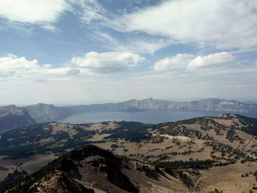
![Crater Lake]() Crater Lake
Crater LakeI was really hoping not to repeat the same problem that I had last year in the lack of summits I did but in some ways the Summer of 2014 was even worse than the summer of 2013. Like last year I only got 7 unique summits before the trip, although this year I was able to repeat for two more summits. I wanted to dedicate this summer to Bulgers but due to lack of partners, financial difficulties (reoccuring theme), and an ever changing schedule that became a major problem for me.
Luckily I had a week off from work for the last weekend in summer and the first week in fall. I had big goals on what I wanted to do in Oregon. Unfortunately like most of my summer I could not find another good partner. Because of that I decided to head off down to Oregon solo. This was going to limit what I wanted to and automatically take Theilson, Broken Top and North Sister off the climbing menu. A storm was also moving in mid week on my trip which was also going to put a damper on my plans. But I was determined to make this work and so I head off to Oregon between September 20th, 2014 and September 27th, 2014.
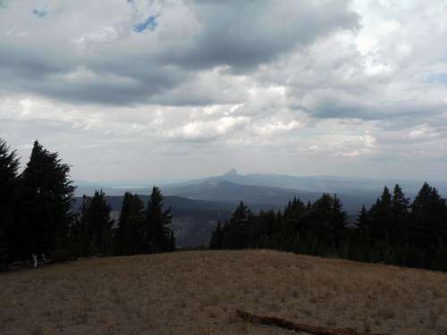
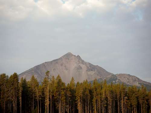
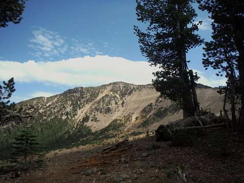
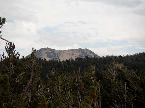
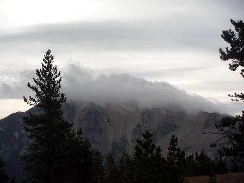
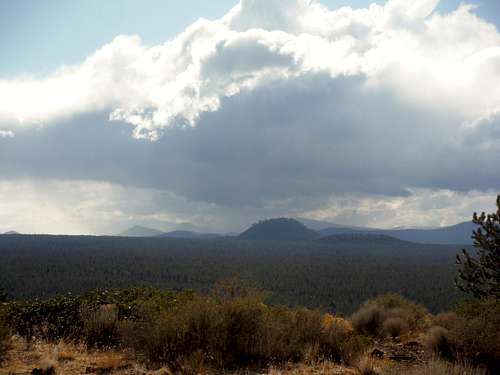
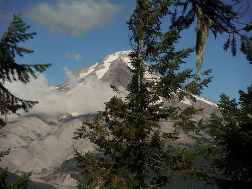
![Mount Theilson]() Next time Mount Theilson
Next time Mount Theilson
It should be noted that despite iffy weather conditions throughout the trip I was able to get 11 summits in 6 days. Many of these summits were not planned due to a major diversion to my trip from the severe rainstorm. Some of these summits are just downright dumpster dives and one was even a dreaded drive up. But still I was able to have a much better 7 day trip than the awful summer that preceded it. With a little luck, better conditioning and maybe a partner I could have summited far more or better. But below is a graph layout of my Oregon Trip compared to my dreadful summer.
| My Summer Summits | Height | Oregon Trip Summits | Height |
| Ruth Mountain | 7115 | Mt McLoughlin | 9495 |
| Old Scab | 6608 | Mount Scott | 8929 |
| Mother Mountain | 6480 | Dutton Cliff | 8147 |
| Tyler Peak | 6364 | Garfield Peak | 8054 |
| Shriner Peak | 5834 | Cloud Cap | 8065 |
| High Rock | 5685 | The Watchmen | 8013 |
| *Kelly Butte | 5409 | Tumalo Mountain | 7775 |
| *Colquhoun Peak | 5173 | Barlow Butte | 5069 |
| Snowshed Head | 3796 | Lava Butte | 5016 |
| *-repeat summit | | Bessie Butte | 4768 |
| | | Pilot Butte | 4138 |
During this trip I was able to summit my second highest peak solo (Mount McLoughlin) and make a serious dent on the Oregon Top 100 list. I was also able to scout out more summits in the region so that I can head back to Oregon in the near future for an even better trip next year. I really hope next year I have a good partner because there were a lot of good peaks in the future I would love to knock off while in southern Oregon.
Day 1: The dreaded drive down
I thought a lot about going for a summit on my way down to Four Mile Lake campground in Oregon. But this clear was summer's last stand and my concern here was by doing even a light peak I could be jeopardizing my first major hike up Mount McLoughlin the next day. The nice cool fog was nice in Washington but as soon as I crossed the state border the heat was on. I was tempted heavily to stop at Eugene and knock off Spencer Butte but decided against it so that I had no excuse not to summit Mount McLoughlin the next day. After making a couple stops along the way most notably in Medford, Oregon I decided to drive out to Four Mile Lake to set camp. I got my pack ready for the next day and then by 8 pm was out cold. The lake itself was nice but you could really see the impact of the drought.
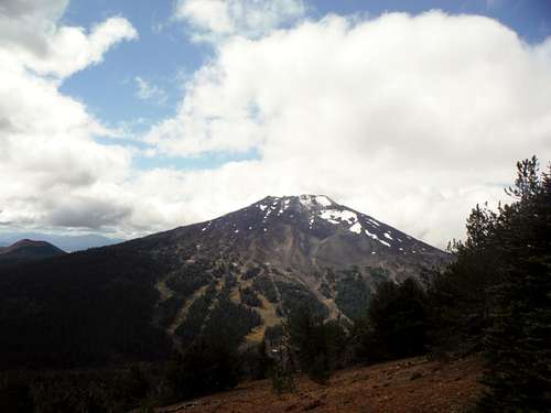
Day 2: Mount McLoughlin
Okay enough driving, camping and resting it was time to get up and take care of business. Mount McLoughlin was going to be the highest mountain I have summited this year and I was going to start this trip in style. No matter what was to happen, if I got this summit alone, the entire trip would be a success. I had two things heavily working against me. The first was the lack of good hiking that I did over the summer and the second was summer heat. I knew this peak was going to be a tough opening act but I knew also that it was very doable for me. I put an extra 2 liters of Gatorade just to make I was in good shape on this hike.
![Sunrise over Mount McLoughlin]() Sunrise over Mount McLoughlin
Sunrise over Mount McLoughlin
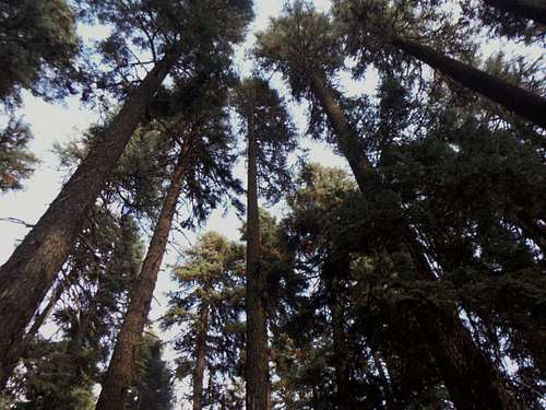
I got to the trailhead around 7:00 am and I started off with my trip up. The first part of the trail is in very good condition and is very easy to follow. I took it slow just to make sure I had a good solid pace and to make sure I did not burn out going up. I was quiet impressed with the forest while heading up the mountain. There are some very large trees on this trail and though it was a hot day the forest really protected me heading up. The tree slowly faded as I got higher on the trail and once I got to the ridge the trail also seemed to start fading. I got a very good view of McLoughin from the trail once it hit the ridge and then from there it was easy to follow the ridge up. The trail seemed to fade away higher up as I continued to rise. I started to get a little tired the higher I went in large part due to the heat of the sun against.
![Looking up at the true summit]() Looking up at the true summit from the trail
Looking up at the true summit from the trail
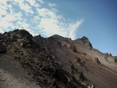
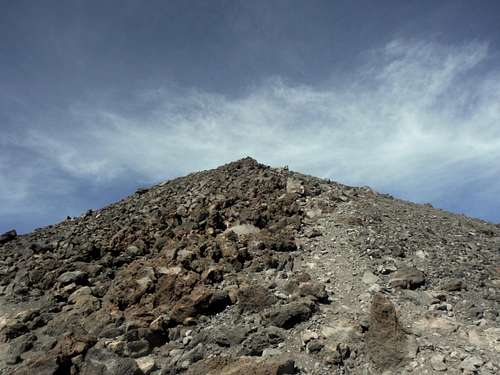
Once I was on the heart of the trail I decided to put my helmet on due to all the loose stuff on the mountain. This is probably heavy overkill but I nearly lost a dear friend recently due to a rockfall and I did not want to be another victim of it. Mentally a helmet on my head also seems to also set my head straight when I am starting to get a little nervous about what is coming up. With the trail here being almost none-existent on part of the final ridge, it was clear I had to find myself the best path to the summit. I could also now really feel the elevation. It had been four months sense I had even done anything 8,000 feet high and now I am 9400' and gasping for air. Five years ago when I was 75 pounds less and in the best shape of my life this would have been done in 3 hours but now that I weigh dramatically more, the hike was breaking me down. The lack of summer hiking was really starting to impact me and I was slowly get more and more tired with each step.
![The final summit ridge to the top]() The final summit ridge to the top
The final summit ridge to the top
Finally at 11:30 am I was on the summit of Mount McLoughlin. This was 30 minutes slower than book time but I did honestly not care. I got the signature peak and though I wasn't feeling all that strong I was happy to make it. The views on the summit were a bit hazy from the California wildfires I was not too disappointed with them. I could still see Crater Lake, Mount Theilson and many of peaks from the summit. I also got to meet a number of cool people on the summit of Mount McLoughlin. Plus the top of Mount McLoughlin was just a really cool place to spend an hour.
![The true summit of Mount McLoughlin]() Looking at the summit of McLoughlin
Looking at the summit of McLoughlin | ![Looking north from the summit]() Looking north from the summit of McLoughlin
Looking north from the summit of McLoughlin |
I did run into a major problem though. I had brought 4 liters of water and Gatorade for this hike but almost all of the water and Gatorade was gone and I was on the summit, only half way done with the hike. There were no running creeks on the way down so I knew that after my rest it was time to head down and try to avoid taking any long breaks. As soon as I left the summit (after spending an hour) I was on my way down the mountain. I tried to get down as fast as I could and tried to hold off drinking too much until I was in the trees. I did get a slight break in that a clouds was overhead on the way down but I feared that it was a mixed blessing and that it may turn into a thunderstorm, which is one of things I fear most in the mountains.
![Big Trees near the trailhead]() Big Trees seen while heading down from Mount McLoughlin
Big Trees seen while heading down from Mount McLoughlin
I finally drank the last drop of water I had just below treeline. This is only the third time in all of my hiking days that I have ever ran out of water before hitting the trailhead and I was three miles away from the car or one hour. I could feel my throat starting to dry out and as I was moving I got more and more fatigued. Though I was in the shade the forest and the heat was starting to heavily beat into me. I knew I really needed to get to my car where another liter of Gatorade was waiting for me. I got more and more tired but I pressed on through the struggle and made it back to the trailhead. Luckily I had another liter of Gatorade and a ton of drinking water waiting for me. Once done with the hike I went straight to my campsite where I sat in the tent for a little bit. The air down here had cooled off and I was able to manage some cool shots of the sunset over Mount McLoughlin and the cool looking thunderstorms off well to the north of me before heading off to sleep.
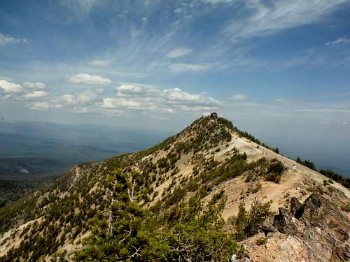
Day 3: Mount Scott and The Watchman
The next day I woke up and I quickly packed up camp and headed to Carter Lake National Park. I was very weak from the hike before but I wanted to check out the national park. On my drive out of the campsite the weakness and the hunger in my body from the day before really took over and I knew I had to get something to eat. Despite getting ten hours of solid sleep the night before I was fatigued beyond anything I knew I had to refresh. I stopped of at the restaurant at the Lake of the Woods resort and ate what I know was one of the best omelets I have ever had in my life. In fact it might be the best omelet ever. With a steak, bacon, diced tomatoes, and onions inside and a layer cheese as well as a cream sauce on the outside my mouth was in heaven and slowly I was enjoying this special treat. Though I was still weak from the day before I slowly was getting my strength back.
I hit Crater Lake National Park a little more than an hour later. Though I felt a little better I did have my doubts on if I was going to do any hiking. I also knew this was a one time trip so I wanted to push it a little if I could. I got a look at the forecast which really looked very poor for the next couple of days. They called for isolated thunderstorms that day and the next day and heavy rain the day after that. I knew I had to push it here if there was any chance on capitalizing on this park.
![Mount Scott]() Mount Scott
Mount Scott
I made up my mind to head up Mount Scott. I was a little discouraged when they said the trail was "strenuous" but I was counting on the fact that this was a well known national park and they would be overstating this trail just to protect themselves. At 5 miles roundtrip and only 1200 feet of elevation gain I gave this hike a try. Honestly I went very slow here. I was still hurting from the day before but I set my pace on what an older couple was doing ahead of me and followed up to this summit at their pace. I did notice that their pace was far faster than others on the trail who seemed to me struggling far worse that I was. After passing a couple of people within an hour I found myself on the summit of Mount Scott feeling no worse for wear. My legs actually did feel stronger on the summit than at the trailhead. The lookout tower shamefully is in poor shape up here and it looks like the park service is not going to keep it in good shape. After spending an hour on both the summit and the southern false summit, enjoying the views I decided to head off the mountain. About 45 minutes later I was back at my car where I had to make some decisions on what to do next.
![EastKing on Mount Scott]() EastKing on Mount Scott
EastKing on Mount Scott | ![Mount Scott true summit]() Mount Scott summit from the false summit
Mount Scott summit from the false summit |
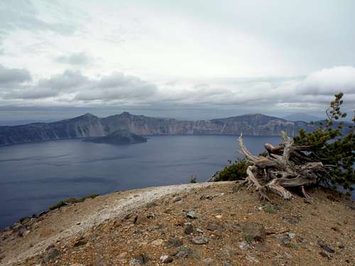
I decided to check out the Cloud Cap overlook on my way back. Cloud Cap was another summit near Mount Scott and you can drive most of the way to it. When I got to the parking area I noticed that the parking area sat in the crater between the eastern and western summits of Cloud Cap. I decided to go up the to western summit of Cloud Cap. The view of fantastic from both on the way up the well beaten path and the western summit of Cloud Cap but I clearly noticed that the western summit of Cloud Cap was clearly the smaller summit of the two. The issue I had with getting the eastern summit on that day was that it was getting very dark where I was due to an ominous cloud that was overhead. This would become a reoccurring theme throughout the trip.
![Crater Lake]() View from Cloud Cap western summit area
View from Cloud Cap western summit area | ![Mount Scott]() Mount Scott hidden behind Cloud Cap's true summit
Mount Scott hidden behind Cloud Cap's true summit |
Seeing that I quickly raced to my car and headed off the mountain and back to my campsite quickly. On the way down outside of a couple rain drops nothing happened. Soon I was back to my campsite where I got something to eat. While down there I read a little more about another shorter peak in the area. The clouds had seemed to clear and so I decided to check out the next mountain, The Watchman.
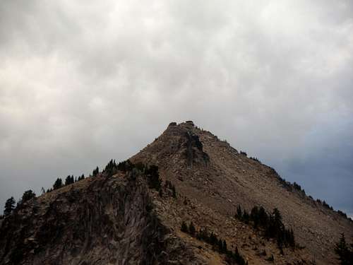
![The summit with building clouds]() The Watchman
The Watchman
I decided to take the drive up to the parking area of The Watchman. I could see Hillman clearly within view but with me being solo and it being late in the evening I did not think it was a good idea for me to head up there. So off to the Watchman I went. I was still sore and tired from the day before but this hike really was very easy to the well kept up lookout tower. The views from the lookout tower area were stunning from the top with Crater Lake and Wizard Island literally right before your very eyes. But there was one thing I noticed more in that it had really started to cool down, I did brave the wind and the now cooler weather to be on the summit and talk to many other hikers and tourist up on top but I now had to break on the jacket which was a far cry from the day before on Mount McLoughlin.
![Wizard Island from heading up the Watchman]() Mount Scott hidden Wizard Island from the Watchman
Mount Scott hidden Wizard Island from the Watchman | ![Inside the lookout tower]() Mount Scott hidden The well conditioned lookout on The Watchman
Mount Scott hidden The well conditioned lookout on The Watchman |
It was now the evening time and now time for me to head off this mountain and get sleep for the next day. Ideally I probably would have done better if I had a little more energy but because I was so fatigued from the day I was just glad to get what I could before calling it a day. After all, it is not a bad thing to knock off two more 8,000 foot summits after knocking off a 9495 foot summit the day before.
Day 4: Cloud Cap, Dutton Cliff, and Garfield Peak
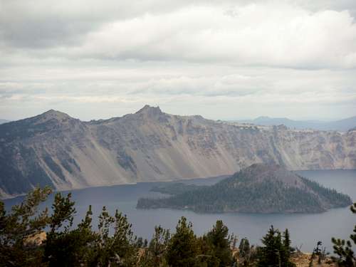
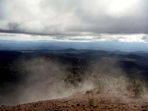
I woke up the next and noticed it was very cloudy. I knew I had to keep an eye to the sky here if I were to do any summit and that everything had to be short. But luckily no rain fell the night before and all my gear was dry. So I got up ate some food and immediately finished what I started off on Cloud Cap. This time when I pulled into the parking area I seemed to be the only one there. This time Mount Scott had a thick cloud covering the top and it looked like I was only going to get one or two summits on this day. From the parking lot I took a nice open field bushwhack to the summit. The entire walk was on open pumice sand and in spite of the fact that it was only 200+ feet of elevation gain, the combination of the sand, my out of shape body and the elevation really made this more of a challenge than I anticipated. Once I got to the true summit I was able to get some excellent shots of the now cloud covered and majestic Mount Scott along with a good shot of distant Mount Theilson which I hope to climb in the near future. I quickly made it down and headed to my second goal Dutton Cliff (Dutton Ridge).
![Mount Scott in the clouds]() Mount Scott in the clouds
Mount Scott in the clouds
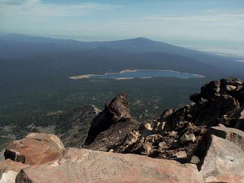
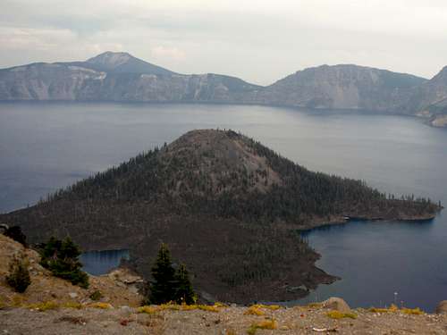
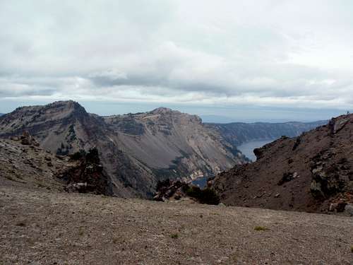
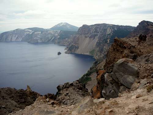
After getting a good look at the terrain the day before I decided to park at the highest location possible for this peak. I made sure to bring my rain jacket and decided to head up the pumice ridge to the true summit. On this trek up I encounter much deeper pumice sand which made the trip up that much harder. At one point the sand was up to my ankle and because I did not wear gaiters, a lot of the sand went into my shoes. I also was racing the clouds which seemed to get thicker by the minute. In about an hour I was on top but tired from dealing with all the sand. There was a cool summit tree that marked the true top. Once I got there I noticed that there was a neat outcrop that stuck out so I quickly headed out to it. I had to watch the edge because there was a lot of slippery sand that lead to a 2000 foot drop-off on Dutton Cliff. I stayed safely away from it and was able to get on the perch and look out over Crater Lake and Wizard Island. The views on this summit are absolutely breathtaking. This is well worth 3 mile off trail walk-up through the pumice sands. The views of Mount Scott and Cloud Cap were mind blowing and of the rest of Crater Lake very good.
![View from the north outcrop of Dutton CLiff]() View from the north outcrop of Dutton Cliff.
View from the north outcrop of Dutton Cliff. | ![Looking at Applegate and Garfield]() Looking at Applegate and Garfield.
Looking at Applegate and Garfield. |
Some dark clouds started to approach Dutton Cliff this time and Garfield and Applegate Peak became completely clouded over. Moreover it began to fog over on the summit I was at. I knew I had to make it of quick because there was feel that a storm of definitely brewing and I did not want to be anywhere near there in case of lightning or thunder. I ran down the pumice sand as fast as I could. Like snow in winter, going downhill was much easier that it normally is on trail. The wind was really picking up which made me even more nervous. Despite having to clear my sand of pumice sand twice I made down very rapidly and decided to wait out the storm back at camp.
![Cloudcap and Mount Scott]() Cloud Cap and Mount Scott.
Cloud Cap and Mount Scott. Once at camp I stopped at the restaurant and decided to eat a burger while I tried to figure out what to do next. I did hear a lot of information about a simple trail up Garfield Peak. The false warning from Dutton Cliff again only materialized in a sprinkle and never even impacted much of the park. Lucky me. Now the sky was somewhat clearing out so I decided to take my shot at Garfield and potentially Applegate Peak. By the time I hit the Garfield Trail it seemed packed with people. A lot of people, mostly from the east coast, were going up this peak. I was again slow and tired from doing all the summits I did earlier. The sky now was a little iffy but not nearly as threatening as it was on Dutton Cliff. I slowly made it up the well designed Garfield Trail all the way to the summit.
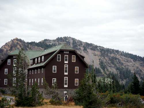
![Crater Lake Lodge]() Crater Lake Lodge and Garfield Peak.
Crater Lake Lodge and Garfield Peak. | ![Looking down at the trail]() The trail to Garfield Peak.
The trail to Garfield Peak. |
Once on the summit I took a look at Applegate Peak, then I took a look at the sky which was starting to darken up again. A part of me wanted to go for Applegate real bad but another part of me was very became very cautious due to the experience I had just a couple hours ago. This time I decided to call it on Garfield a move I later regretted because once I got to the bottom of the trail it cleared up again.
![The view east]() The view towards Scott.
The view towards Scott. | ![Hillman and Watchman]() Hillman, Watchman and Wizard Island
Hillman, Watchman and Wizard Island |
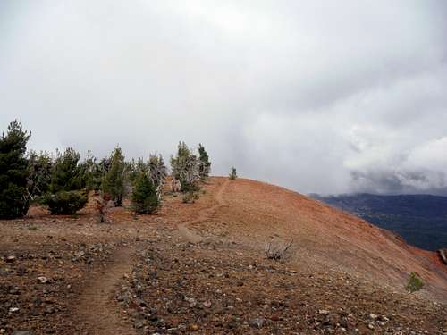
I then decided to head over to Llao Rock. I started my way to the peak when I then ran into a sign saying Llao Rock-Hiking is prohibited in this area. I quickly then turned around and headed back to my car and called it a day over some excellent pot roast back at camp. By 10 pm I was snoring away and ready to go on the next days adventure.
Day 5: Escape from Crater Lake and Saving Face (Pilot Butte)
During that night I had nightmare after nightmare about flooding rains and packing up my tent during the middle of a severe thunderstorm. This horrible thought kept rolling in about packing up all my camp in the middle of the heavy rain. In the national there is no cell phone access or internet access so I was on my own. I woke up from time to time wondering what I should do. I did not hear any rain but my instincts were on fire. So when I woke up around six or so I decided to pack my stuff first and see if I could tag a summit before the rain struck. I was greeted with a red sunrise and the clouds were lit up overhead. I at first thought it was a good thing. So I packed up all of my stuff and put it in my car. No more than one second after I put my sleeping bag in the car the rain started to fall. It started as a drizzle but soon it got harder. At this I decided it was time to escape from Crater Lake and find a place that was drier. As I went north my first thought was to aim for Diamond Lake. Soon though as I went up the Crater Rim Road I was greeted by horrible fog. My gut was telling me that this was not just a shower but a serious rainstorm.
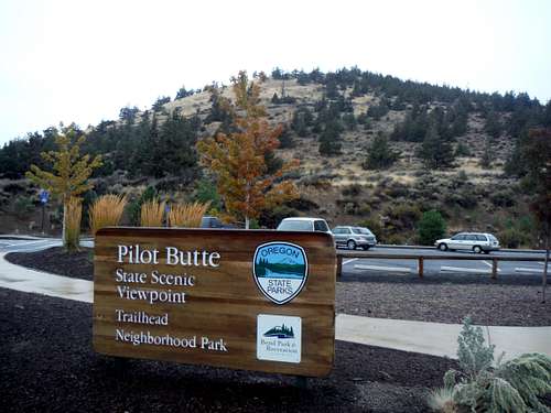
To me that meant it was time head to Plan B, which was Bend, Oregon. I was familiar with Bend, Oregon from my trip down to South Sister back in 2009. I knew Bend had a very dry climate and likely was not going to see a lot of this precipitation that was hitting the mountains hard. When I got to Bend I realized though I was wrong. It was raining very hard in Bend for the first time in a long time and many of the people were actually jumping for joy due to the extremely drought and all of the forest fires. For me though it was time to find a place that I could hibernate as the storm passed on by. Once in town though I did spot a cool little cinder cone on the east end of town called Pilot Butte. After getting some information from the visitor center in the downtown area I decided to find a cheap hotel in town and then head out to the cinder cone.
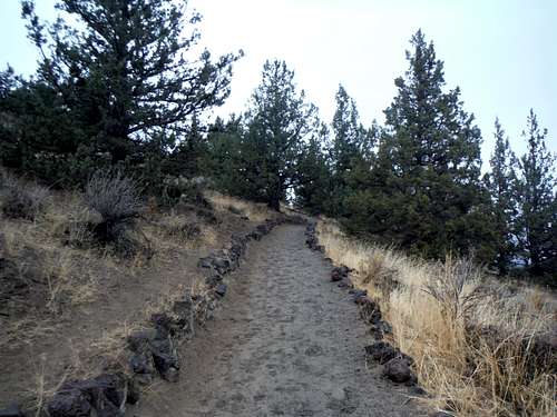
I spent a little time at the television to get an idea of how back the storm was going to be so that I could figure out rather to stay one night or potentially the rest of the trip. It was though obvious that there was a major weather shift and that it would be best if I stayed at the Motel 6 for all three nights. After a couple hours I left the motel and headed for Pilot Butte. I was determined not to drive it if I could. Luckily there was a good park where I could hike to the summit in order truly feel productive on this day of miserable weather. Actually at the trailhead the rain was very light at first and felt similar to a Seattle mist. I did the hike in Crocs in order to avoid wet shoes the next day. This turned out to be a very smart move. As I went up the small cinder cone the rain just got heavier and heavier. By the time I was on top it was a downright downpour and I was miserable. I hurried on down to get back to the car and head back to motel. This would be the only summit I would do on this day.
![Pilot Butte from the parking area]() Pilot Butte Park
Pilot Butte Park | ![Trail heading uphill]() The trail up
The trail up |
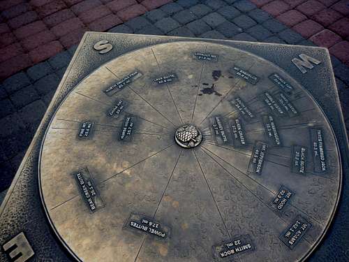
![The summit plaque]() The summit plaque
The summit plaque | ![Views of Bend through the rain]() The city of Bend through the rain
The city of Bend through the rain |
Thankfully I was going back to a motel and not back to a campground. That night outside of the train that passed by the motel at 2 am I was able to get good sleep at the motel. More importantly I was able to quickly dry off and keep up with news about the ongoing rainstorm.
Day 6: Bessie Butte and Lava Butte while dodging storms
I woke up at 6 am only to look outside and see more rain. At least for Bend, this storm was determined to put an end to the drought. So I went back to bed and woke back up at 10 am to now only cloudy skies and no rain. I decided to head south of town to check out Lava Butte. Once I got to Lava Butte I realized that the only way up this peak was the paved visitors road. This was probably the first summit I drove up in four years. There is a steep paved path from the parking area to the summit lookout tower but this is no more than 80 feet maximum in elevation gain. I would laugh to say though that I was the only person out of everyone in the parking lot not to be heavily breathing. To make my own self feel better I took the 1/4 mile loop trail around the crater of Lava Butte to the top. I took a couple of picture and then went to the visitors center for some more information on local peaks in the area. With the iffy weather I was looking at only going for small. On the map in the visitors center I spotted Bessie Butte which now was to be my next destination.
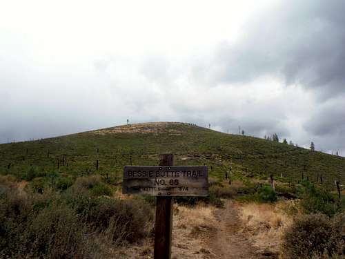
![The trailhead of Bessie Butte as a storm approached]() The trailhead of Bessie Butte as a storm approached
The trailhead of Bessie Butte as a storm approached
I made the quick drive over to Bessie Butte to tackle the small summit. Unfortunately a nasty thunderstorm decided to follow me Bessie Butte. I could tell this was not going to be a false alarm like the clouds at Crater Lake. So left the trailhead went back into town to get something to east. After the hour long rain and hailstorm the sun looked like it was about to come out so I headed this time back to Bessie Butte. This time with the clouds clearing I decided to make my way up the cinder cone to the summit. Along the way I could hear close gunshots which kind of made me nervous. But a part of me figured that "if this is my way to go then at least I had fun while do it". I continued on the trail to the rounded summit of Bessie Butte where I was greeted with excellent views of the entire area. I could see a lot of the mountains from this summit. I could also see another storm brewing in the Cascades that was heading my way. So after only spending fifteen minutes on the summit I ran off the cinder cone and made it to my car roughly five minutes before the hail and rainstorm hit.
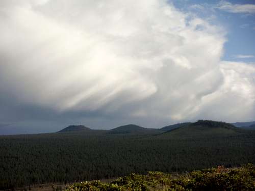
![Thunderstorms on Newbury Crater]() Thunderstorms in the distance as seen from the summit
Thunderstorms in the distance as seen from the summit | ![Pilot Butte from Bessie Butte]() Looking back at Bend, Oregon
Looking back at Bend, Oregon |
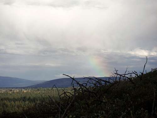
![Rainbow over the eastern mountain]() Rainbow east of Bessie Butte
Rainbow east of Bessie Butte | ![New storm developing to the west]() Storm approaching again from the west
Storm approaching again from the west |
I headed back into town, enjoyed a nice meal and watched a boring football game before spending a good night asleep. This time I was not greeted by trains in the middle of the night and was able to get great rest for the next day.
Day 7: Tumalo Mountain and the Surprising Showers
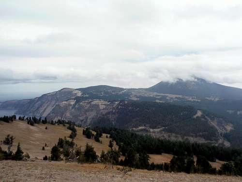
![Mount Bachelor from Tumalo Mountain]() Mount Bachelor from Tumalo Mountain
Mount Bachelor from Tumalo Mountain
The next day I woke up to see that the sun was shining. South Sister was full of fresh snow and even Mount Bachelor had a fresh dusting of snow when it showed through the clouds. I had high hopes that the fog would burn off these summits and that I would be greeted with a stunning view. I was now very used to hiking and hiked up 2.5 mile 1500 elevation gain Tumalo Mountain Trail in a little more than an hour. Unfortunately for me the fog did not lift when I up there. Me and a guy from town sat up there on the summit for more than an hour in what was temperatures in the 40's and a shift wind waiting for the excellent view to open up. It never happened toward Broken Top or South Sister though it did briefly open up towards Bend, Oregon and south towards neighboring South Sister. After well over an hour I said goodbye to the guy and headed on down the mountain. Sure enough the weather decided to turn but this time for the worse. Instead of the sunshine coming out like we were hoping a strong shower moved in. Luckily I was almost off the mountain when it hit but this was enough to call it a day. By this time I was getting tired of dodging showers and with not much research I really did not know where to go from here so I did the safe thing and headed back to the hotel where I got my gear ready to head on home.
![Mist rising from the surface]() Mist rising from the surface on Tumalo
Mist rising from the surface on Tumalo | ![The trail to the summit of Tumalo]() The trail to the summit of Tumalo
The trail to the summit of Tumalo |
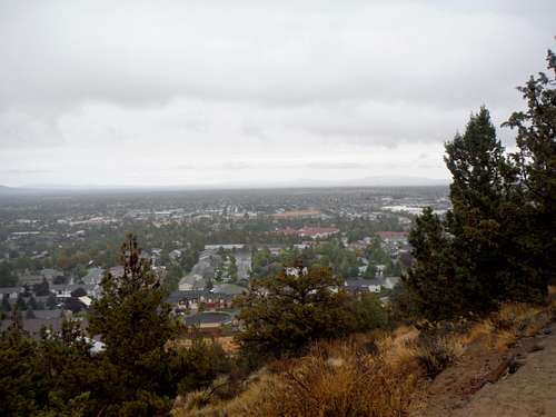
I decided to drive up to the top of Pilot Butte to enjoy the sunset that night. The whole town of Bend, Oregon had the same idea. I got to summit parking area just in time to pick the last spot up there. There was a Native American Dance Ceremony for what I am assuming was there to either symbol the change of the seasons or to celebrate all the rain that Bend had received the previous two days. It was great to listen to the music while I got to enjoy watching the sun go below the mountains and another storm that seemed to be hitting them. The temperature had clearly dropped in Bend and I was a little chilly on Pilot Butte. That all being said I was really able to reflect on this wonderful vacation. Because the next day was the last day and most of it was just the return trip home.
![Nighttime arrives over Bend]() The end of the day on Pilot Butte
The end of the day on Pilot ButteDay 8: Barlow Butte and the trip home
Well it was time for the return trip home. I was thinking of doing one more summit in the Bend area but I wanted to get home and I did not want to be fatigued while driving home. So instead I decided just to drive home or that was at least the plan until I saw a cool map at a gas station right in Governors Camp. After looking at the cool map, I spotted a potential summit on the map that seemed at least on the map to look really cool. the name of the peak was Barlow Butte. It looked like it was going to be steep but at what looked like 3 miles round-trip and 1200 feet of elevation gain this peak seemed to fit the bill. The big bonus is that is one only a mile off course from where I was going and it was all paved road to get there.
![Mount Hood through the trees]() Mount Hood through the trees
Mount Hood through the trees
I pulled into the Barlow Pass trailhead and quickly got out my map and put on my gear for this summit. The map of a little hard to figure out but quickly I knew I was going the right way. I was really looking forward to seeing an awesome view of Mount Hood from this summit. The trail seemed to first drop 200 feet before it then rose back up at first gradually the trail though became though very steep as it approached the summit of Barlow Butte. Once near the top of Barlow Butte the trail veered to the left to the summit, whereas another trail to the right headed right to Barlow Ridge. I headed left and got to the summit rock of Barlow Butte. The last leg on the way up had a decent view east towards some of the smaller summits in the region. Once I got on the summit rock there was fading view west towards Government Camp. Unfortunately I was at first disappointed because I could not find a view of Hood. But I decided to completely check around the mountain until I finally spotted a boot path leading to an excellent view of the massive summit of Mount Hood. This is where I told one of my best pictures of the entire trip. Hooray! I got the shot I want. Now it was time to head down the steep path back to the car. Outside of getting a nasty spider bite on the way down the steep trail there really wasn't anything to talk about on this trail within an hour I was back to the car.
![The summit rocks (no view from Hood here)]() The summit rocks
The summit rocks | ![Looking over the eastern ledge]() Looking east from near the summit of Barlow Butte
Looking east from near the summit of Barlow Butte |
On the way down my wife wanted more time for her cleaning project so I decided to entertain one of my other hobbies; roller coaster riding. I decided to go through Portland to check out a small traditional amusement park to ride their loop coaster. After 60 seconds of fun on the Looping Thunder (Roller Coaster Number 122 for me) and left the small park and headed back home. Though I had a great trip I was glad to finally get home and restart my life again.
Conclusion
Honestly this trip was probably not the greatest Oregon trip I could have done. There could have been so many other ways that I could had this trip work out, but the good thing is that a least I really got out and changed the way this hiking season was looking. I am hoping for a similar style trip in Oregon next year but only focusing on higher and tougher summits. With a couple of partners maybe I can make this a reality. But for now I am very happy to get what I did from Oregon and plan for a better trip next year.


Comments
Post a Comment