Circuit Hikes in Shenandoah National Park
| Page Type | Gear Review |
|---|---|
| Object Title | Circuit Hikes in Shenandoah National Park |
| Manufacturer | Potomac Appalachian Trail Club |
| Page By | taxinvestor |
| Page Type | Feb 27, 2008 / Nov 30, 2009 |
| Object ID | 4895 |
| Hits | 16591 |
| Vote |
30 Loops in Shenandoah NP
Summary100 page paperback with 30 day hikes. Most descend from Skyline Drive, finish uphill, and gain 1500 - 3000 feet. Each hike contains map, length, time, directions, and elevation (sum of the ascents).
 Good spot to chill along Bluff Trail
Best resource available of its type. Get it at REI, local bookstores, and in the park.
Hike List with Mileage, Total Ascent, Comments
Northern District - From Front Royal Entrance to Thornton Gap Entrance - Milepost 0 - 32Fox Farm; 5 miles; 1000ft
Easy loop which sticks close to Skyline Drive and the Visitor's Center.
Bluff Trail; 13.8 miles; 2100ft
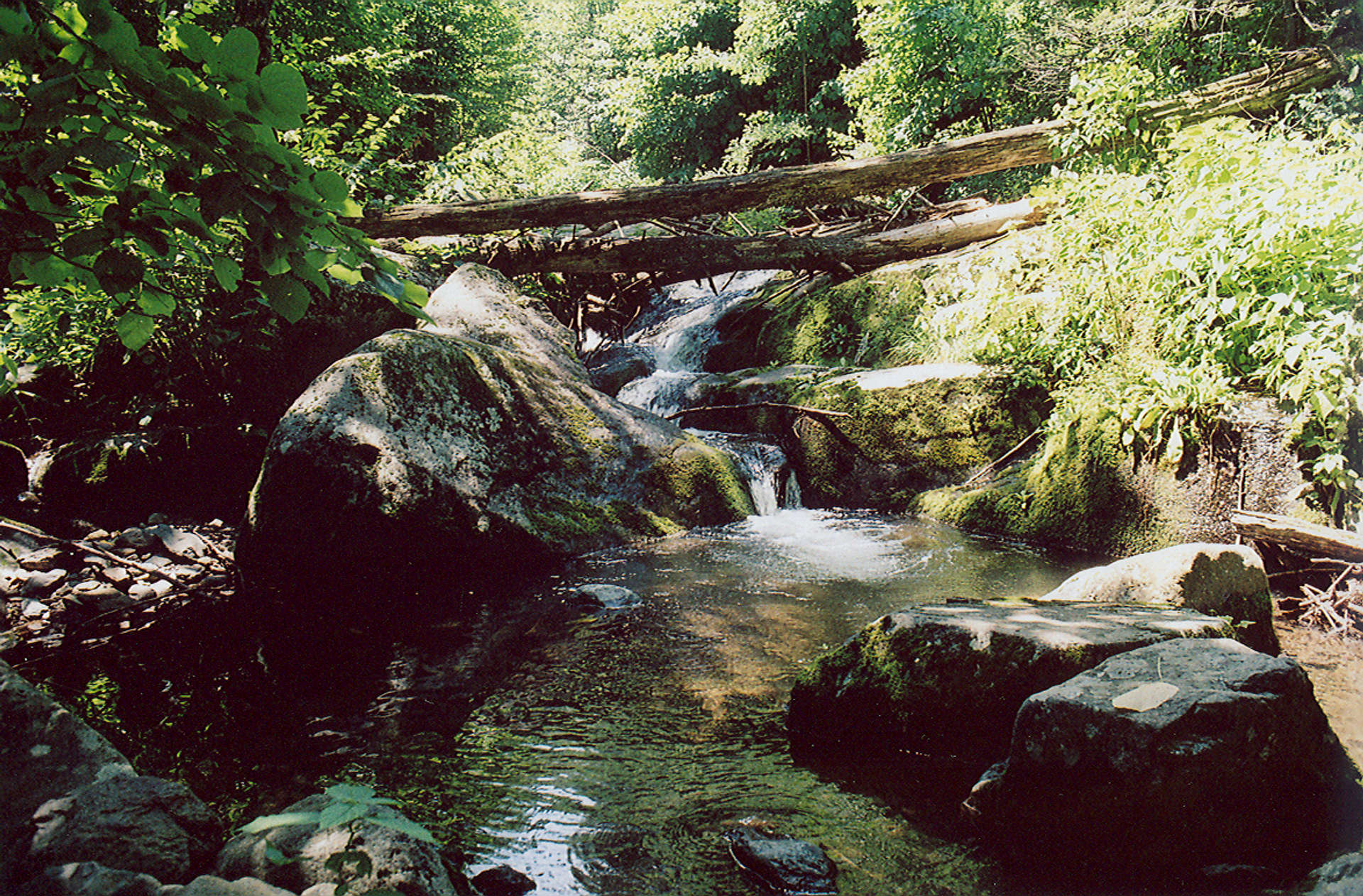
Climbs immediately, then two nice rocky viewpoints on outward leg. On return, go down, then back up Big Devils Stairs if you like ravines and cliffs (adds 1 mile and 500 feet). Several stream crossings and small waterfalls complete the loop.
Sugarloaf; 10 miles; 1600ft
Pretty hike around the Piney River and its feeder creeks.
Piney Ridge; 10 miles; 2500ft
Follows Piney River down the mountain, then ascends Little Devils Stairs. 5 star hike interrupted by 1 mile on a fire road :(
Overall Run; 12 miles; 2900ft
Beautiful stone pools kept clean by the flow of water; awesome view from the head of a ravine near end of hike.
 Bathtub off Overall Run Trail
Knob Mountain/Jeremys Run; 14 miles; 2600ft
Outward leg climbs Knob Mountain; return leg follows Jeremys Run - 6 miles of re-crossing the stream. The length seems mitigated by the constant presence of water. Good chance to see a bear.
Elkwallow Wayside; 6 miles; 800ft
Links campgrounds of Mathews Arm and Elkwallow Wayside. Food/camp stores here.
Byrds Nest #4; 3 miles; 800ft
Family hike to open faced shelter for a picnic.
Thornton Hollow; 11 miles; 2100ft
Constantly ascending and descending - final 2 mile stretch climbs 1000ft straight up the north fork of Thornton River.
Central District - From Thornton Gap Entrance to Swift Run Gap Entrance - Milepost 32 - 66
Hazel Country; 8 miles; 2400ft
Many loops possible here, all are some variation of hiking up or around foothills for lots of elevation swing. Stone fences; chimneys; foundations; and other ruins combine with numerous creeks and rivers. Good views of surrounding peaks and hills.
Stony Man; 3 miles; 370ft
Popular easy hike near Skyland (cabins, camping, restaurant with fresh trout, beer, and live music!) Add 4 miles and combine this hike with Little Stony Man for a longer day.
Nicholson Hollow; 4 miles; 1100ft
Easy down, stiff on the return. Corbin Cabin along the Hughes River is available to rent.
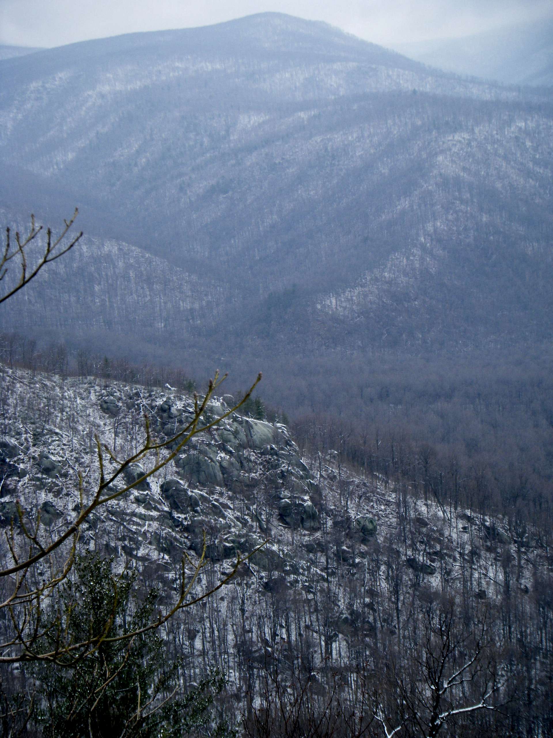 View from Old Rag
Old Rag Mountain; 9 miles; 2200ft
Fun mix of hiking and bouldering. Great views. Try it with snow for a challenge. Couple of shelters west of peak. Arrive early, drive up the fire road, and park in the small lot - otherwise you are adding a boring mile and 300ft.
Hawksbill; 3 miles; 800ft
Family hike to open faced shelter for a picnic.
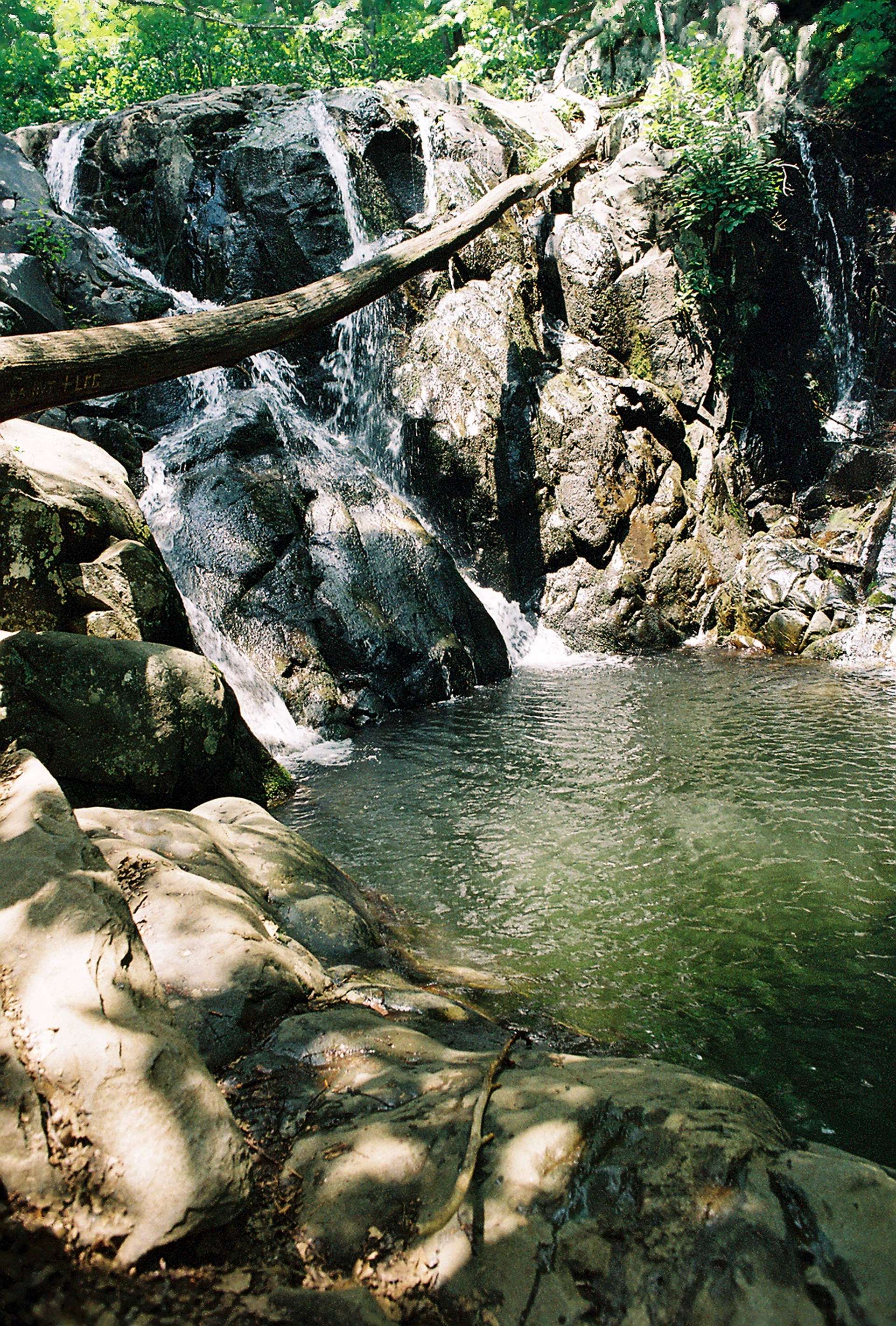
Cedar Run/Whiteoak Canyon; 8 miles; 2800ft
One of the premier loops in the park. Outward leg follows Cedar Run down-mountain with a constant parade of small waterfalls and trout. The return is one long staircase with big, pretty waterfalls. You will be whipped after this hike.
Rose River; 10 miles; 1900ft
Descend fire road, then bushwack up left side of Rose River. Absolutely gorgeous - waterfalls, ravine, trout. Tread gently and please release the fish so I can catch them again. Trip Report
 Upper Rose River
Dark Hollow Falls; 4 miles; 900ft
Popular with kids. Beautiful waterfall at Dark Hollow, then again on return on upper Rose.
Rapidan Camp; 10 miles; 1200ft
Area was precursor to Camp David, established by Herbert Hoover. Descent is long, boring, fire road slog. Better option to hit the highlights (river, waterfall, camp) is down, then back up Mill Prong trail.
Lewis Falls/Blackrock; 4 miles; 1200ft
Near Big Meadows campground. 80 foot waterfall and nice views from the cliffs of Blackrock.
South River Falls; 4 miles; 800ft
Double waterfall. Take spur trail to bottom of falls for a nice, quiet place to picnic.
South District - From Swift Run Gap Entrance to Rockfish Gap Entrance - Milepost 66 - 105
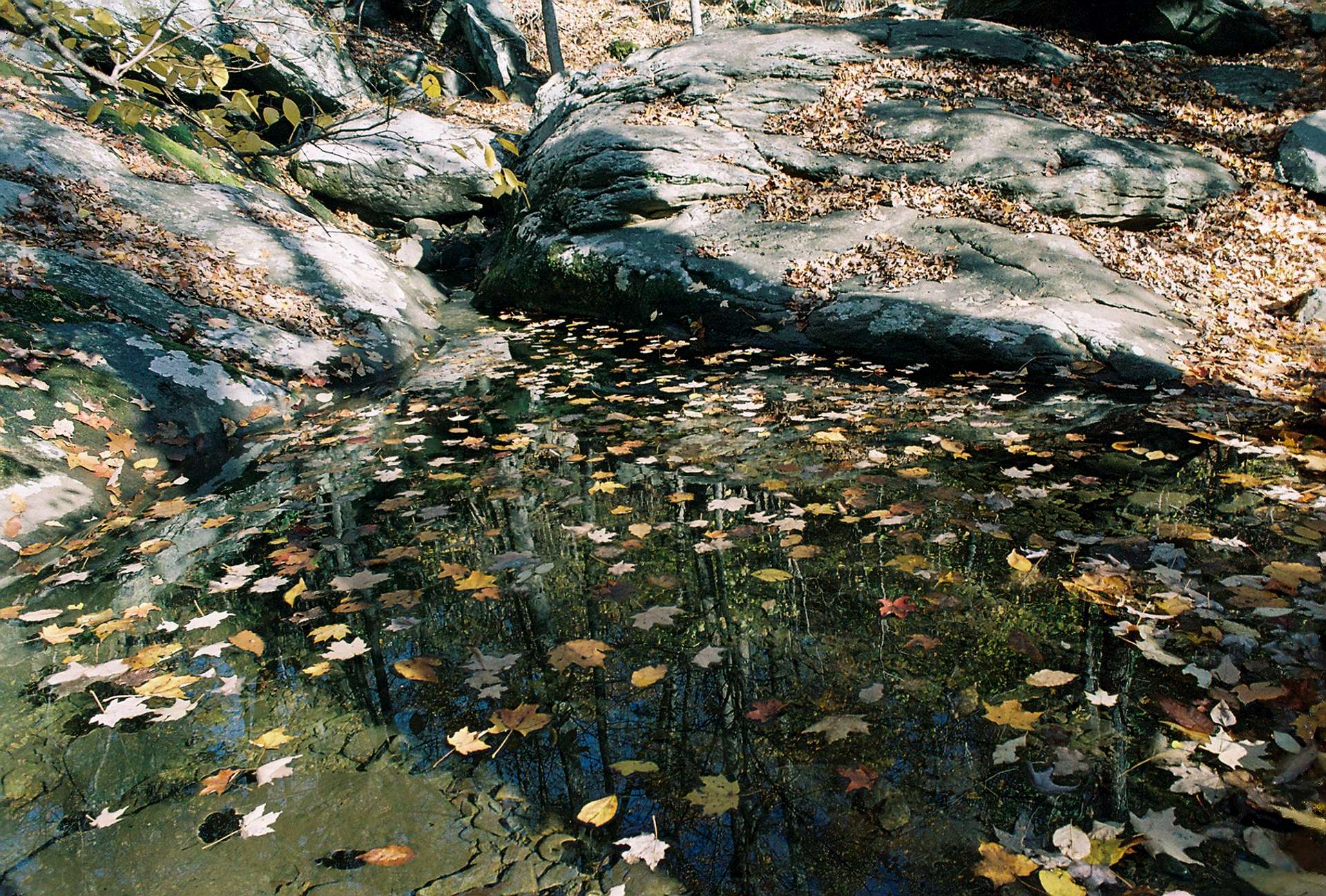 Leafy pool in Whiteoak Canyon
Rocky Mount; 10 miles; 2600ft
Sweet views from Rocky Mount and along ridge on outward leg.
Rocky Mountain/Brown Mountain; 10 miles; 2100ft
Stony and rugged area of the park. Big Run and Rocky Mountain Run have high water levels and fat trout in the spring. Be prepared for wading.
Big Run Loop; 7 miles; 1600ft
Some steep climbing out of a ravine mid-hike.
Rockytop; 14 miles; 2500ft
Traverses some of the same area as Rocky Mountain hike, but sticks with Big Run longer and has more elevation swing. Tough hike.
Jones Run; 7 miles; 1400ft
Sweet waterfall and ravine hiking with Civil War history and a rentable cabin a mile north of the falls and half a mile downhill of the drive.
Austin Mountain; 13 miles; 2800ft
Up, down, up, down - and repeat. Not a lot of water, but plenty of views.
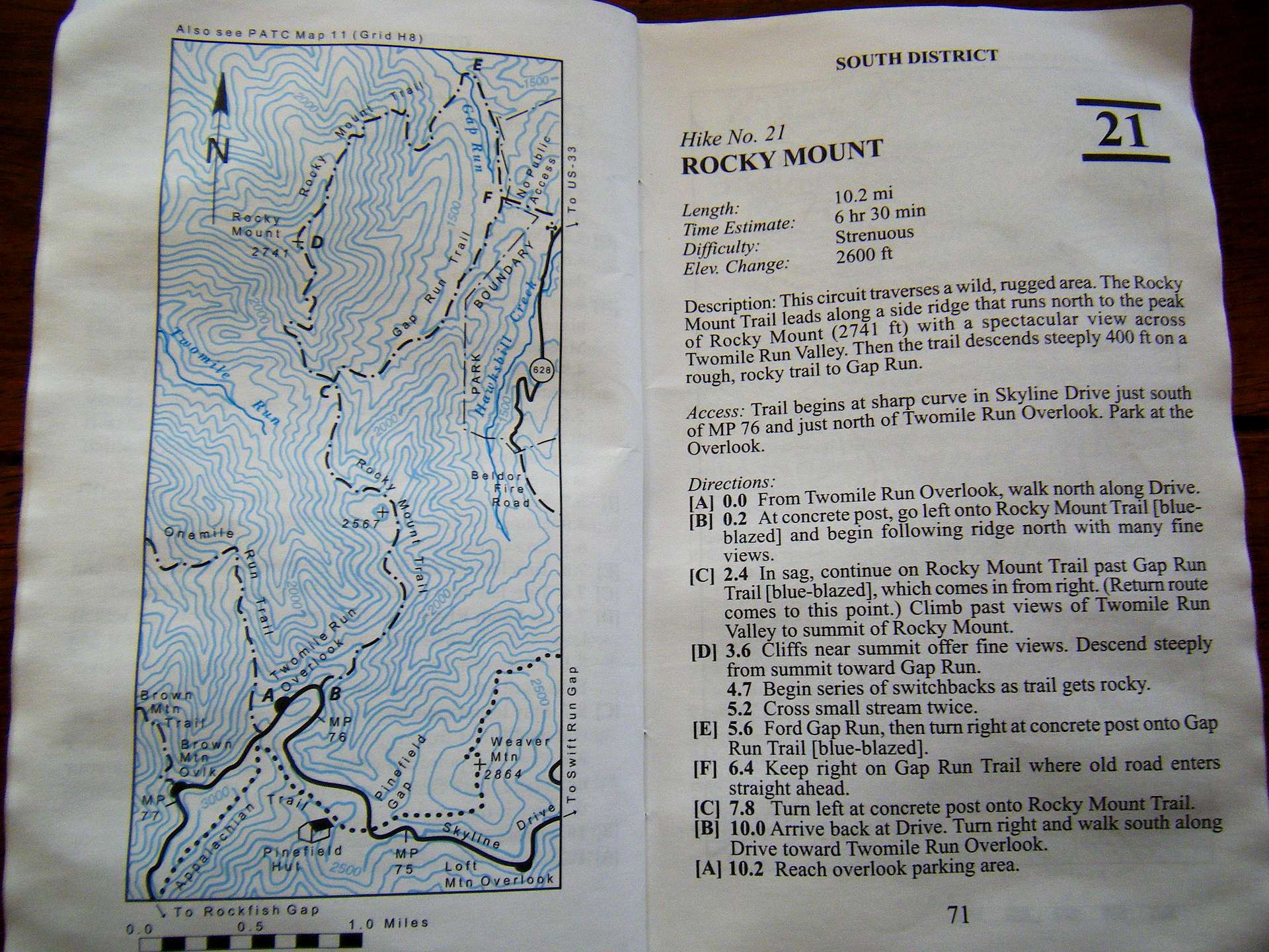 Sample hike of Rocky Mount
Blackrock; 2 miles; 300ft
Quick hike with easy scrambles and nice views.
Trayfoot Mountain/Paine Run; 10 miles; 2200ft
Good views on the 1st third of hike, later Paine Run and its feeder creeks dominate the final 3rd leg.
Riprap Hollow; 10 miles; 2300ft
Best hike in the park. Great views from rocky cliffs; stream descent in pretty hollow; waterfall and pool that looks like it belongs in Hawaii; butt-kicker return climb along Wildcat Ridge.
Turk Branch/Moormans River; 10 miles; 2700ft
First third is on AT next to the drive, 2nd third drops down, final third steady climb along Moormans River.
Conclusion
* Wonderful, pocket-sized book which puts you in the best areas of Shenandoah National Park.* No need for map or compass.
* Accurate description of the routes.
* Handy map of entire park with roads, highways, and park entrances inside back cover.
* Highly recommended!
Images
 |  |  |  |  |  |
 |  |
taxinvestor - Oct 24, 2009 6:13 pm - Voted 5/5
NoteThere are partial closures of the drive roughly on the following dates: from Nov. 1 to Jan. 1 between MP 0-31 and MP 65-105 during the hours of 5pm and 8am.
The entire drive is closed between 5pm and 8am Dec. 1 to Jan 1.
Info Line: 540-999-3500