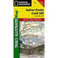
Indian Peaks/Gold Hill Trails Illustratd Map #102
| Page Type | Gear Review |
|---|---|
| Object Title | Indian Peaks/Gold Hill Trails Illustratd Map #102 |
| Manufacturer | National Geographic Maps |
| Page By | redsplashman23 |
| Page Type | Dec 8, 2011 / Dec 8, 2011 |
| Object ID | 8014 |
| Hits | 3114 |
| Vote |
Product Description
"Coverage includes Roosevelt and Arapaho national forests, Indian Peaks Wilderness, Arapaho National Recreation Area, Tabernash, Fraser, Nederland, Eldora, Ward, Peaceful Valley, Lake Granby, Barker and Beaver reservoirs, Pawnee, Arapaho and Rollins passes. Devils Thumb cross-country ski area. Includes UTM grids for use with your GPS unit."Features
Map: 2 pagesPublisher: Natl Geographic Society Maps; 4 edition (September 1, 2006)
Language: English
ISBN-10: 1566953227
ISBN-13: 978-1566953221
Product Dimensions: 7.4 x 3.9 x 0.4 inches
Images
 |