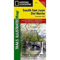
South San Juan & Del Norte, Colorado - Trails Illustrated Map #142
| Page Type | Gear Review |
|---|---|
| Object Title | South San Juan & Del Norte, Colorado - Trails Illustrated Map #142 |
| Manufacturer | National Geographic Maps |
| Page By | redsplashman23 |
| Page Type | Nov 10, 2011 / Nov 10, 2011 |
| Object ID | 7887 |
| Hits | 3042 |
| Vote |
Product Description
"ISBN-10: 1566953413 | ISBN-13: 978-1566953412 | Publication Date: April 1, 2008Coverage includes Rio Grande and San Juan national forests; South San Juan Wilderness; Dipping Lakes and Spiler Lakes; Lost Lake; Platoro and Fuchs Reservoirs; South Fork and Conejos rivers; the cities of Del Norte, South Fork, Wagon Wheel Gap, Summitville, Jasper, Cumbres, Platoro; and the mountain passes of La Manga, Wolf Creek, Gunsight, Blowout, Silver, and Summit. Also includes portions of the Continental Divide Trail. Includes UTM grids for use with your GPS unit."
Features
Map: 2 pagesPublisher: Natl Geographic Society Maps (April 1, 2008)
Language: English
ISBN-10: 1566953413
ISBN-13: 978-1566953412
Product Dimensions: 7.2 x 3.8 x 0.5 inches
Images
 |