Long Overdue Idaho Visit
I had wanted to check out the Sawtooth Mountains in Idaho for a couple years, but it wasn’t until this summer that everyone’s schedules lined up to make it a possibility. My main goal was to hike to the top of Thompson Peak with my brother (my Dad didn’t want to do it because of the length and also the scrambling required), but I was also excited to catch a glimpse of some of the scenic lakes in the area on some easy family hikes.
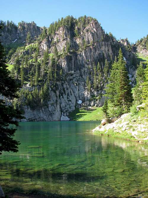
![Bloomington Lake]() Bloomington Lake
Bloomington LakeMy only previous Idaho hike had been to Bloomington Lake near Bear Lake just north of the Utah-Idaho border, but it convinced me that there was some top-notch scenery in the state rivaling that found in some of the famous western national parks if you knew where to look. Most of my outdoor experience in Idaho had been limited to ATV’ing near my grandpa’s farm in Bancroft (give yourself a gold star if you know the location of that little town) and boating/tubing around Preston (Napolean Dynamite country), so I was excited to finally see Idaho’s prize mountains for the first time.
Day 1 - Out of the Frying Pan ...
It had been quite hot in Utah (this July ended up being the hottest month on record in the state’s history), so I was excited to be heading north into the mountains of Idaho. Despite the fact that the same large high pressure system we were experiencing had just moved north to where we’d be going in Central Idaho, I was hopeful that the temperatures wouldn’t be too bad up at the higher elevations. My brother Johnny flew in from California the night before, and the next morning we set off on our drive. To see some different scenery on the trip, I wanted to drive from Salt Lake City to the town of Stanley (where we’d be staying) along the Lost River Mountains around Mackay on the way up, and back along the Sawtooths and down through Ketchum on the way back. You know you’re a mountain geek when you schedule drives around mountains according to when the lighting will be best for taking pictures (Lost River Mountains to the east would look nicer in the afternoon with the sun to the west), which is what I always do when planning road trips to different mountain locations.
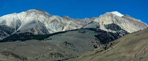
![No Regret & Mt. Breitenbach]()
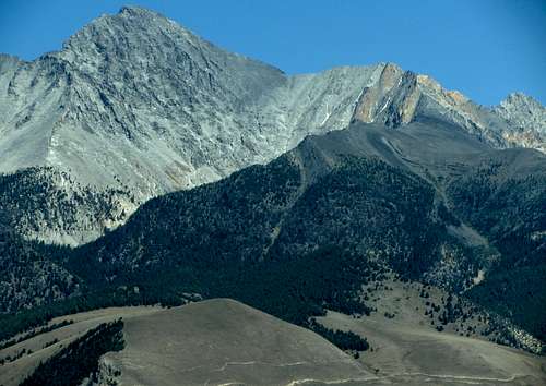
Point 11,967 and White Cap Peak
![Mount McCaleb]() Mount McCaleb
Mount McCaleb
![Mount Breitenbach]()
White Cap Peak
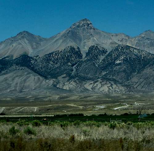
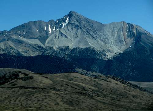
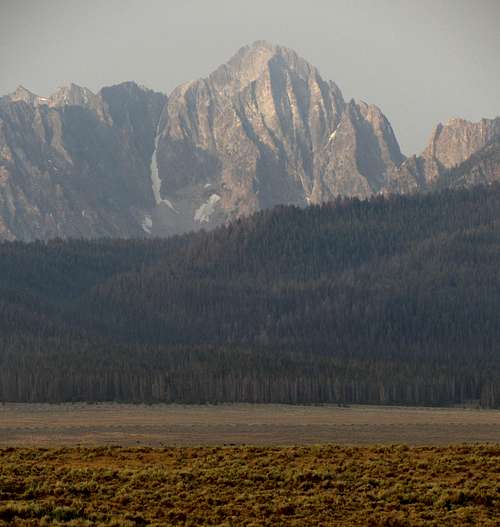
Approaching the mountains north of Arco, the sky began to get very hazy, which made me wonder which fire/fires the smoke could possibly have been coming from, since the news/weather forecasts I had looked at just two days earlier had shown completely clear skies. It must have been from something that started just recently, but I was optimistic the air would clear up as we got farther north. Although they appeared quite dry and barren (more so than the Wasatch, at least), the rugged peaks to the east were impressive (the only ones I recognized were Leatherman Peak and Borah Peak, though). At one point Borah Peak had been on my list, but since the area didn’t seem to have as many nearby family hikes and other activities to keep the rest of the family occupied I ended up taking it off (ran into this same problem when contemplating Crestone Needle and Mount Whitney on separate trips to Colorado and California, as well).
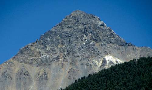
![Borah Peak west aspect]()
Borah Peak
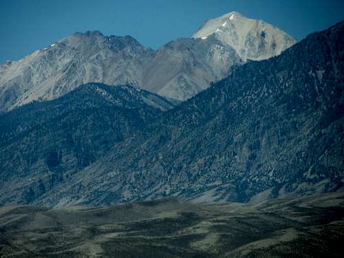
![Leatherman Peak]() Leatherman Peak
Leatherman Peak
![Sacagawea Peak]() Sacagawea Peak
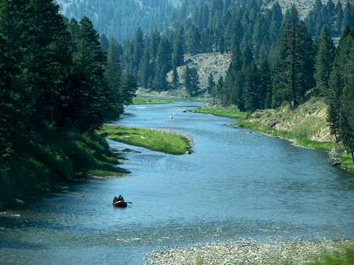
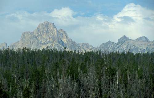
Sacagawea PeakBefore the turnoff onto the ID-75 road which would take us through a scenic canyon leading to Stanley, we saw a faint column of smoke rising just in front of us to the north near Challis. It wasn’t close enough to shut down the road (still a few miles away), but would offer an unfortunate preview of things to come. The road winding along the Salmon River was quite scenic, and seeing the many rafters out enjoying themselves on the water reminded me a lot of the Snake River winding south of Jackson, Wyoming. We finally came out of the canyon just outside of Stanley, and instead of seeing the famous view of the Sawtooth Mountains I’d expected, we were greeted with the worst smoke and haze we’d seen yet. If you concentrated hard you could kind of see the rugged profiles of Mount Heyburn, Horstmann Peak, Thompson Peak, and Williams Peak, but the haze was so thick that it made discerning these otherwise impressive peaks almost impossible, even though they were only a few miles away to the south.
![Salmon River rafting]()
Salmon River
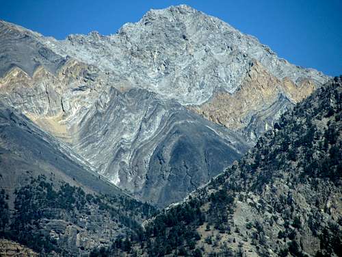
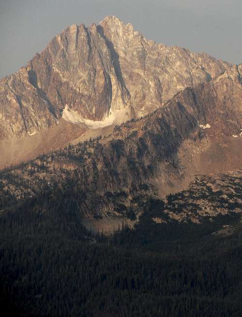
![Borah Peak north aspect]() Borah Peak north aspect
Borah Peak north aspect
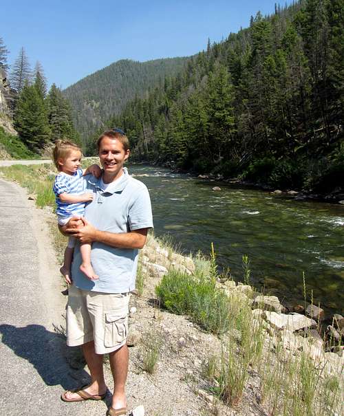
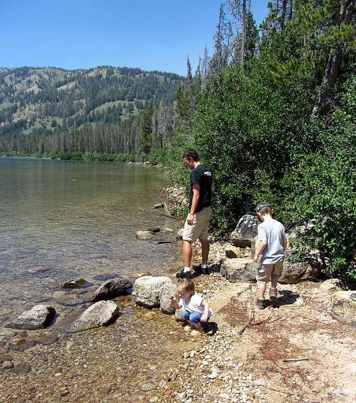
![Ivy at Salmon River]() Pit stop for Ivy
Pit stop for IvyFortunately, the rooms we had booked for three nights with Stanley Vacation Rentals were quite nice, but my first order of business was checking out the forecast for the coming days using the available Wi-Fi. I quickly learned that in the last two days, three different wildfires had sprung up about a hundred miles west of Stanley, causing the majority of the smoke. After researching predictions for wind direction on www.intellicast.com and comparing those results with the locations of the fires from local forest service reports, I figured that barring any new fires, we’d have a small window in the morning where the winds should flush the smoke out of the valley, giving us clear skies at least until the afternoon. After failing to summit Capitol Peak last summer in part due to a wildfire causing my friends to not be able to start the hike until way later than I would have preferred, I was hoping something similar wouldn’t happen on this trip as well. My initial plan was to do some fun stuff with the family around Redfish Lake during our first day there (hiking, boating, horseback riding) and do Thompson Peak the next day, but since Mother Nature was in charge and it was very possible there would be more fires to come, Johnny and I decided it would be better to try it when the odds were more in our favor.
Day 2 - Thompson Peak
![Redfish Lake]() Redfish Lake at dawn
Redfish Lake at dawn
We woke up around 5 am the next day, got dressed, filled our packs, ate breakfast, and drove down to the Redfish Lake trailhead, which was only about ten minutes from where we were staying. It was difficult to tell how clear the skies were since it was still dark, but as the sky got lighter it looked like most all of the smoke from the previous afternoon was gone.
![Grand Mogul]() Grand Mogul
Grand Mogul
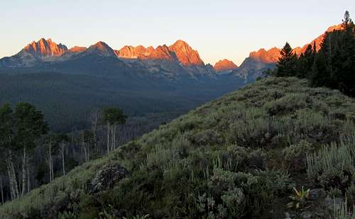
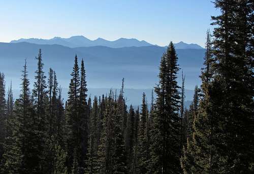
![Sawtooth sunrise]() Sawtooth sunrise
Sawtooth sunrise
![Un-named 10,200 foot peaks]() Un-named 10,200 foot peak
Un-named 10,200 foot peak
![Un-named 9,800 foot peak]() Fishhook Creek peak
Fishhook Creek peakAfter parking in the large trailhead parking lot (which was well-marked with signs so we knew where to go), we made our way back to the northeast for a couple hundred feet, crossed a different paved road, and then the trail wound back to the north and then west eventually. Even though the forecast had shown it would get to almost 90 degrees later in the day, right now it was only barely above freezing, and the nice brisk morning air helped snap us out of whatever lingering sleepiness we may have still had. There were a couple times where the trail forked, but in both cases we stayed straight or to the right, following the signs to Marshall Lake. After a little less than a mile, the trail branched off to the right (north) up a steeper hillside with aspen trees. Once on the ridge overlooking Fishhook Creek below, we would pretty much be heading straight west on a well-maintained trail for the next two or three miles.
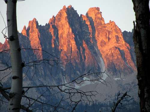
![Mount Heyburn through trees]() Heyburn Mountain alpenglow through the trees
Heyburn Mountain alpenglow through the trees
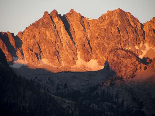
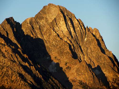
![Horstmann Peak]() Horstmann Peak
Horstmann Peak
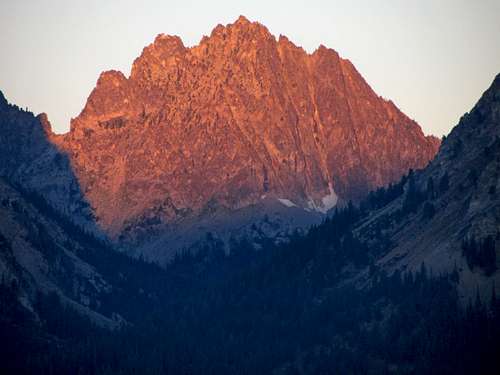
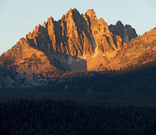
![Heyburn Mountain]() Heyburn Mountain
Heyburn Mountain
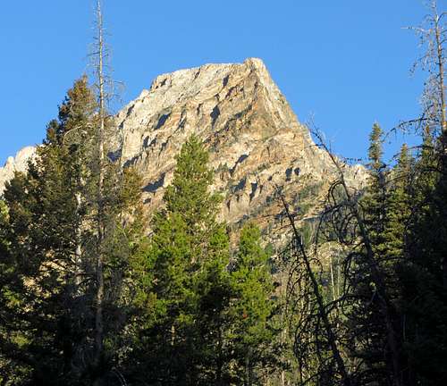
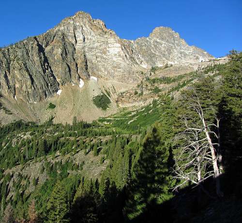
![Williams Peak]() Williams Peak
Williams PeakI’d checked out www.sunrisesunset.com to figure out when the best time to catch the alpenglow on the rugged peaks to the southwest would be, and timed it so that we were treated to some nice views from the start of the ridge trail right around 6:15. These were the same views seen in photographs that had originally sparked my interest in visiting the Sawtooths. Mount Heyburn and Horstmann Peak were on full display just over three miles away, with lesser-known peaks such as Mount Iowa, Mount Bruce, and an un-named peak at the back of the Fishhook Creek drainage also looking impressive.
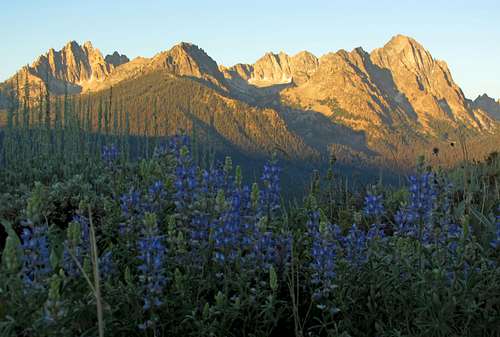
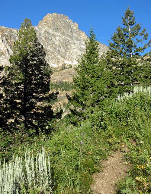
![Sawtooth alpenglow & wildflowers]() Awesome views along the Thompson Peak Trail
Awesome views along the Thompson Peak Trail
![Ridge below Thompson Peak]() Ridge above steep trail
Ridge above steep trail![Hazy Valley]() Rising above the trees
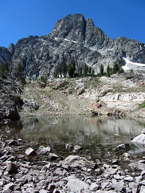
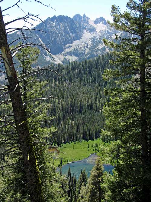
Rising above the treesIt gradually got warmer as the sunlight from behind us filtered through the trees along the trail, but we were shaded, which was nice. Near the base of Williams Peak at 8,000 feet we encountered another split in the trail, and this time we turned left (going right would have taken us to Marshall Lake), up towards the basin between Thompson Peak and Williams Peak. Up until now, the trail had been very flat and gradual, but this is where it became steep. As the trail traversed around the southeast side of Williams Peak, we saw how abruptly Thompson Peak and its jagged sawtooth-shaped east ridge rose above the terrain below. We decided to eat second breakfast in a shaded spot on the trail around 8,300 feet, with nice views of a lake and meadow about 700 feet below us to the south. Looking up towards Thompson Peak from here, we could see several cascades in the distance coming down from the un-named lake at 9,000 feet, which I was excited to see. A little pika stopped by to investigate as we were eating, which surprisingly ended up being our only wildlife encounter of the day.
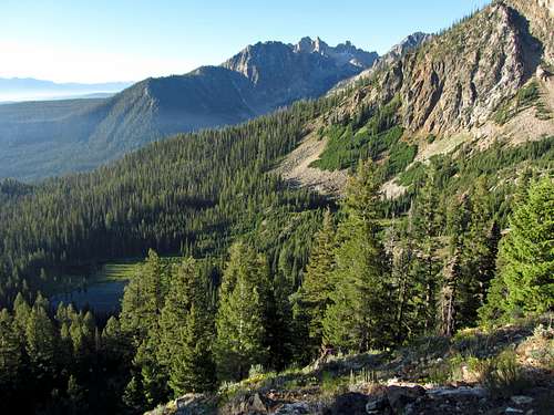
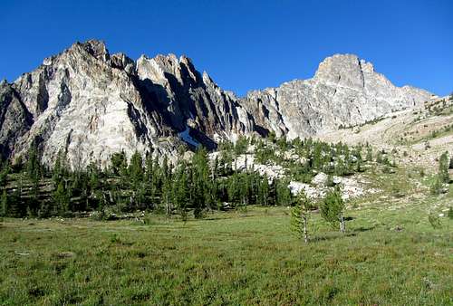
![Thompson Peak Trail views]() Sawtooths rising above valley
Sawtooths rising above valley![Thompson and ridge east aspect]() Thompson Peak (right) and its east ridge (left)
Thompson Peak (right) and its east ridge (left)
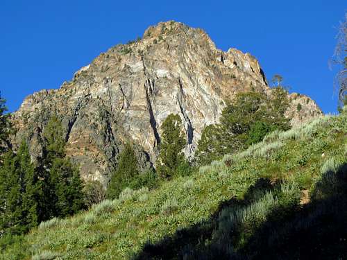
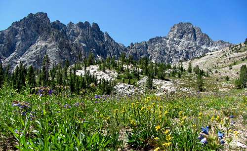
![Thompson Peak first glimpse]() Thompson Peak revealed
Thompson Peak revealedAfter boulder hopping in between some patches of wildflowers and the last stretch of well-maintained trail on the way up, we came to a meadow at 8,700 feet. From this point it’s all off-trail hiking with a little scrambling thrown in to get to the top. We went southwest from here, in hopes of getting to the base of the big lake.
![Thompson Peak meadow in morning]() Meadow below Thompson Peak in the morning ...
Meadow below Thompson Peak in the morning ...![Thompson Peak meadow in afternoon]() ... and later in the afternoon
... and later in the afternoon
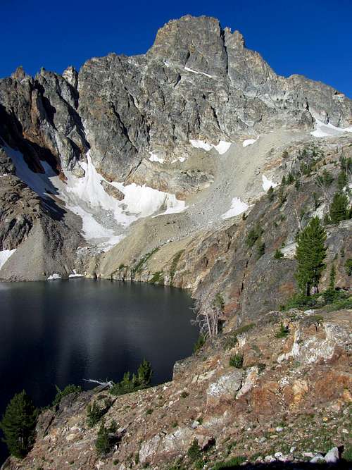
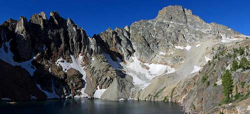
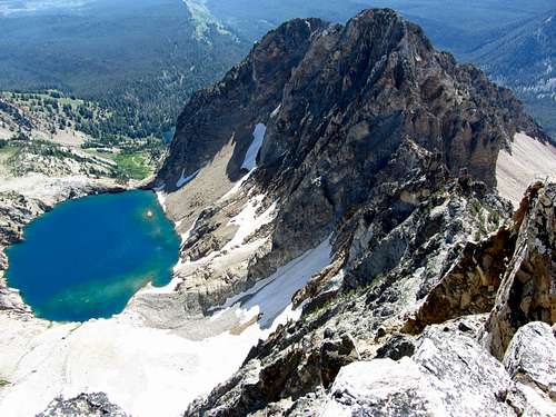
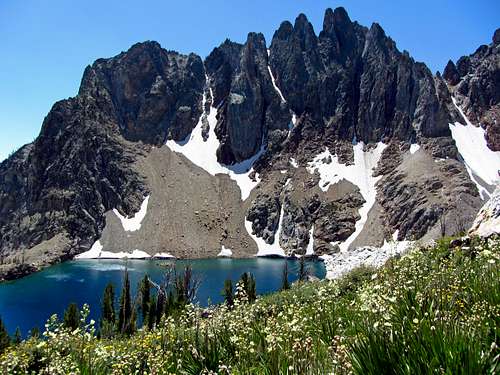
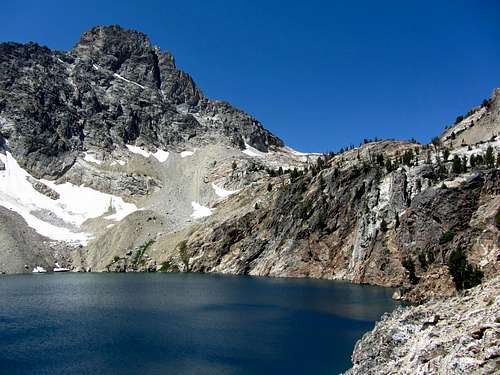
![Ridge over 9,000 foot lake]() Bright blue water
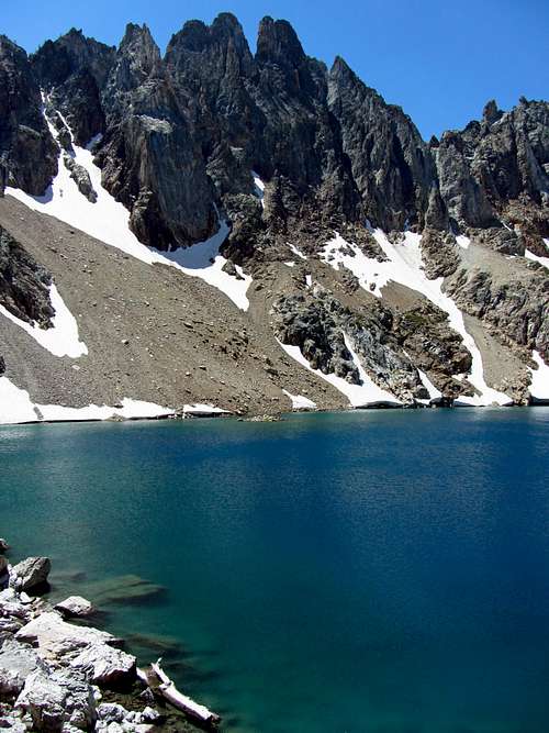
Bright blue water
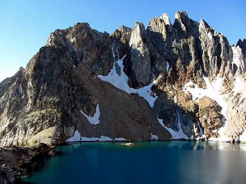
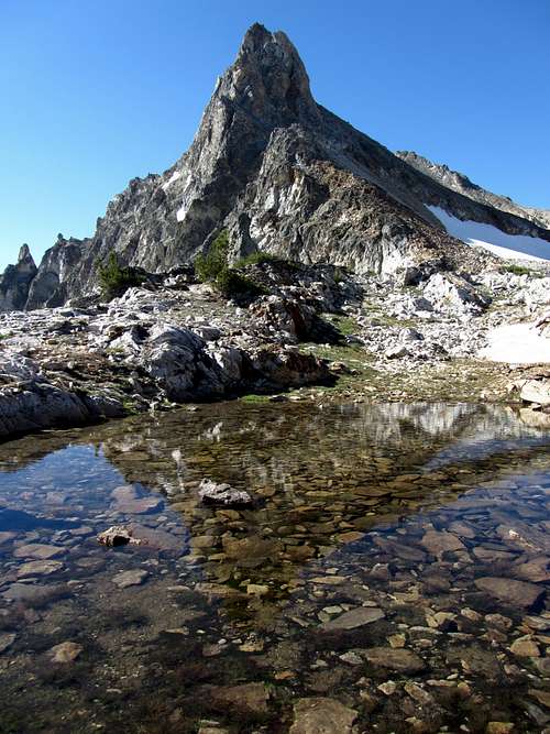
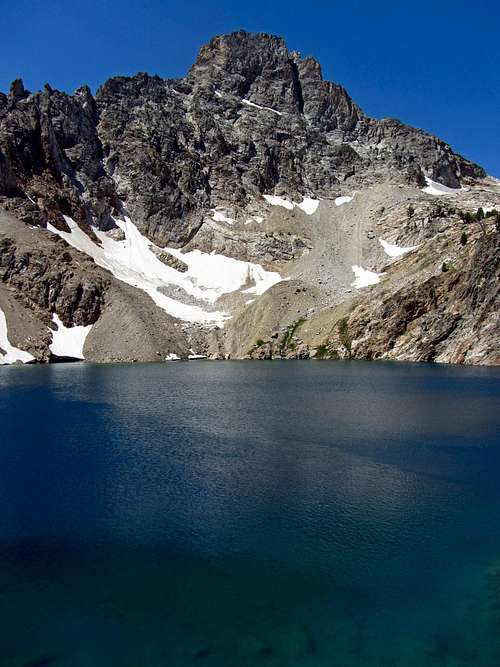
![Thompson Peak over 9,000 foot lake]() Thompson Peak over lake
Thompson Peak over lakeWe should have stayed a bit more to the left (south) going up, since we actually didn’t get to the lake until its northernmost point (staying further to the left brings you to the lake sooner near its northeast shore, with a nice view of Thompson behind). Regardless, the views from above the lake were phenomenal. Of all the alpine lakes I’ve seen in the Rockies, this was probably my favorite. The water was a deep bright blue, and was so clear that you could see the bottom along the north shore we were standing above. The lake is actually ringed by a steep rock wall all the way around, so instead of trying to climb down we just admired it from above. The ridge directly over the lake to the south was particularly impressive.
![Un-named 9,000 foot lake]() Un-named scenic lake at 9,000 feet
Un-named scenic lake at 9,000 feet
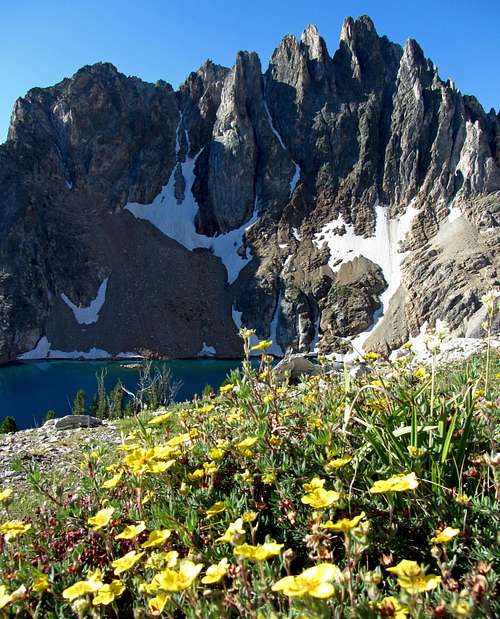
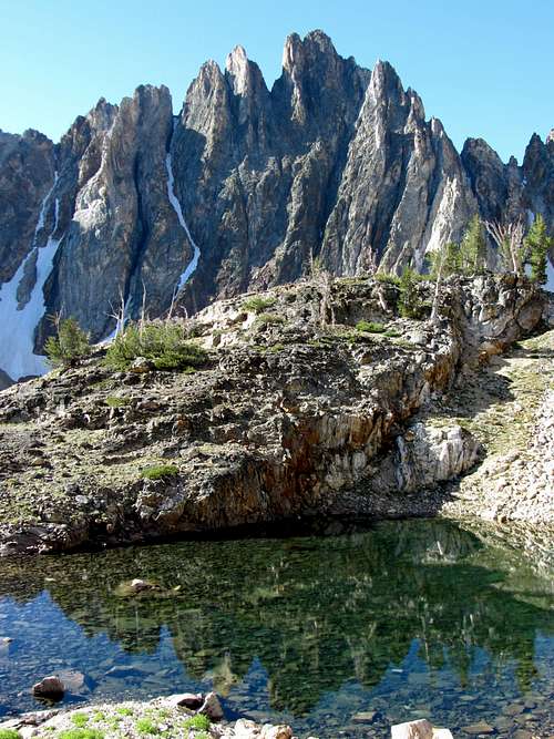
![Ridge, lake, & wildflowers]() East ridge over lake at 9,000 feet
East ridge over lake at 9,000 feet![Ridge reflection]() East ridge over pond at 9,300 feet
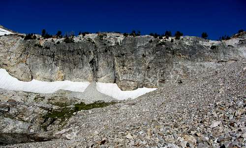
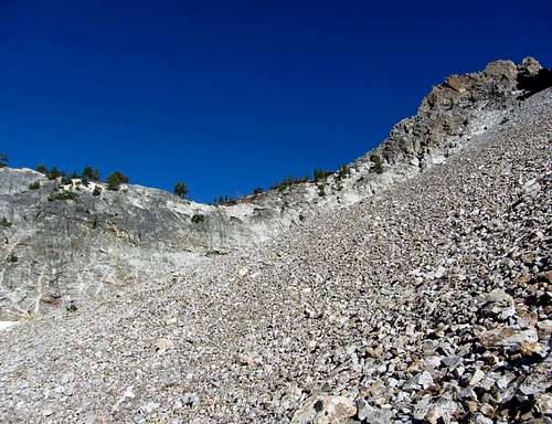
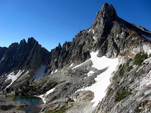
East ridge over pond at 9,300 feetNext up were some boulder fields which would lead us farther west, bypassing a couple smaller ponds to the south. Thompson Peak became even more impressive and needle-shaped from this angle, making me more excited to get to the top. The boulder fields were a little monotonous since the boulders were on the smaller side and especially loose, so we took our time going up to avoid any sprained ankles. We had to gain, lose, and regain elevation quite a few times because the rockfall coming down from the south slopes of Williams Peak seemed to have created a series of chutes we had to climb up and over as we made our way west.
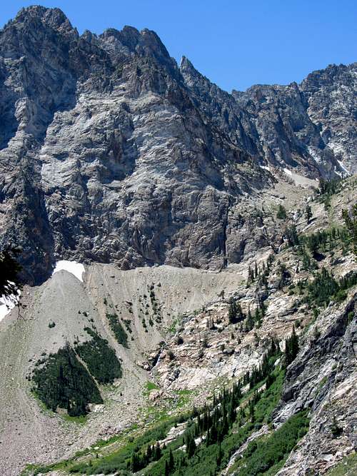
![Thompson Peak headwall]() The walls of Moria (headwall between Thompson Peak and Williams Peak) ...
The walls of Moria (headwall between Thompson Peak and Williams Peak) ...
![Talus field of death]() ... prompted us to traverse this loose talus field (went up north end of headwall in middle of picture)
... prompted us to traverse this loose talus field (went up north end of headwall in middle of picture)
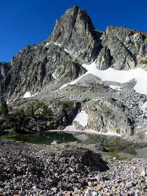
![Thompson over pond]() Thompson Peak over pond at 9,500 feet
Thompson Peak over pond at 9,500 feet
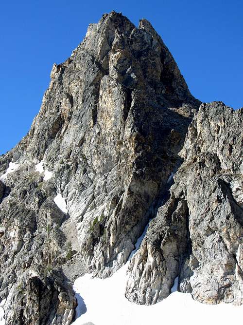
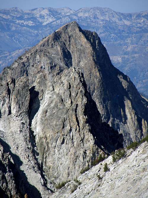
![Thompson Peak north aspect]() Thompson Peak north face close-up
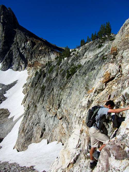
Thompson Peak north face close-upWe probably could have stayed more to the south (closer to the ponds) for a route with less loose boulders, but since I was planning on us scrambling up the north end of the headwall (the south end of the headwall still had some steep snow which didn’t look like a good idea for us since we didn’t have ice axes) I wanted to stay higher to the north. Eventually we got to the base of the headwall, which stretched quite far from end to end (over a thousand feet), and was quite steep. We could have gone even higher to the north to get above the headwall for some easy class 3 scrambling, but since we were sick of the loose rocks and boulders we decided to start up the headwall earlier for some fun class 4 scrambling.
![Thompson Peak over basin]() Thompson Peak's impressive north face over scenic basin below
Thompson Peak's impressive north face over scenic basin below
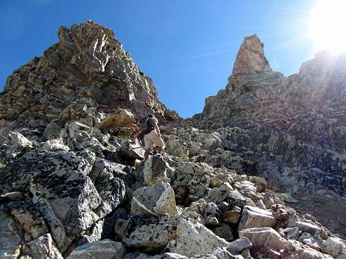
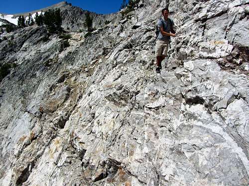
![Johnny climbing headwall]() Johnny scrambling ...
Johnny scrambling ...
![Johnny scrambling]() ... up the headwall
... up the headwallJohnny did quite well, and didn’t have any issues at all with the steeper scrambling. In a couple spots I showed him where the best holds were, and he went up without any problems. He’s only done a few scrambles with me, but has shown marked improvement and confidence each time. On top of the headwall were great views in every direction. Back to the east we could see smoke from nearby fires creeping into the valley, but up here it was still totally clear. To the south was Thompson Peak’s impressive summit spire, and after walking that direction past some more little ponds we could see Goat Lake off in the distance down the drainage to the north.
![Thompson pond reflection]() Thompson Peak scraping the sky
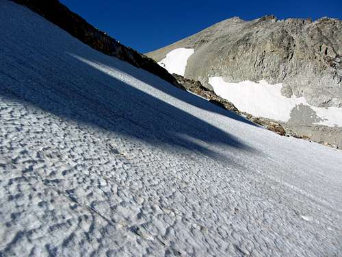
Thompson Peak scraping the skyWe soon came to a couple snowfields as we wound our way around Thompson Peak’s west slopes. The first one we crossed wasn’t too steep, but where we stepped onto the second one was a little too steep and slippery for my liking, so we hopped back down some boulders to the west to cross the snow where the slope wasn’t quite as steep (just be sure to loop around in a circle away from the summit of Thompson’s summit on the west side to avoid this issue, which is what we did on the way down).
![Snow crossing]() Big snowfield
Big snowfield
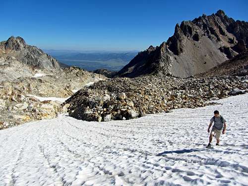
![Johnny crossing snow]() Crossing the snow
Crossing the snow
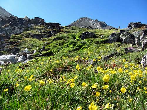
After crossing the biggest patch of snow we came across an isolated patch of bright green grass/moss and yellow wildfowers, which was pretty cool. After that we could then see the saddle between Thompson Peak and Mickey’s Spire to the southwest, which was our next waypoint.
![Sawtooth oasis]() Oasis above tree line
Oasis above tree line
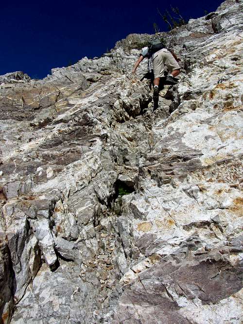
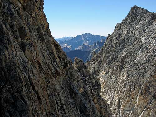
![Thompson South Couloir]() South couloir entrance
South couloir entrance
![South Couloir]() Johnny ascending couloir
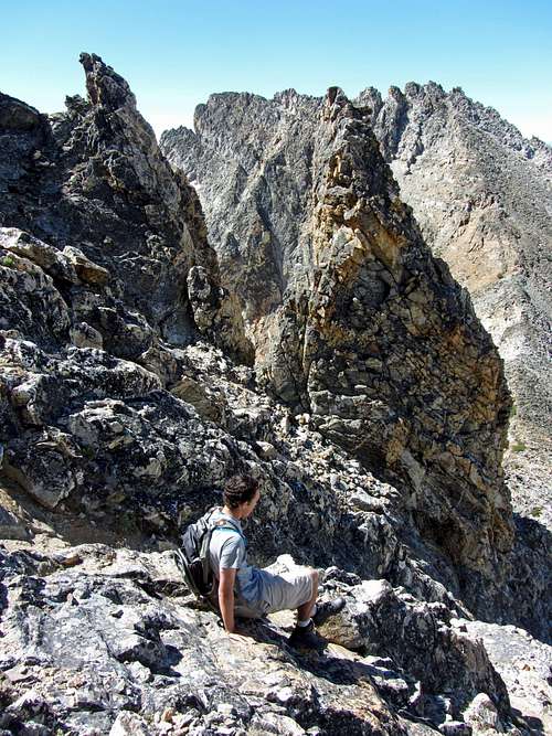
Johnny ascending couloirThe boulders along this stretch were pretty loose, but easier to hop up since they were bigger than what we’d seen below the headwall. The higher we got, the more impressive the views of the peaks above other basins to the south and north became. Soon we were near the saddle to the south of the summit, with impressive views of nearby peaks all around. We went straight up along the southwest ridge (admiring the steep southeast cliffs of Thompson Peak on the way up) until arriving at the base of the south couloir, with several false summit spires directly above us to the north and northeast.
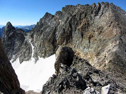
![Decker Peak past cliffs]() Decker Peak beyond cliffs
Decker Peak beyond cliffs
![Mickeys Spire]() Mickey's Spire
Mickey's Spire
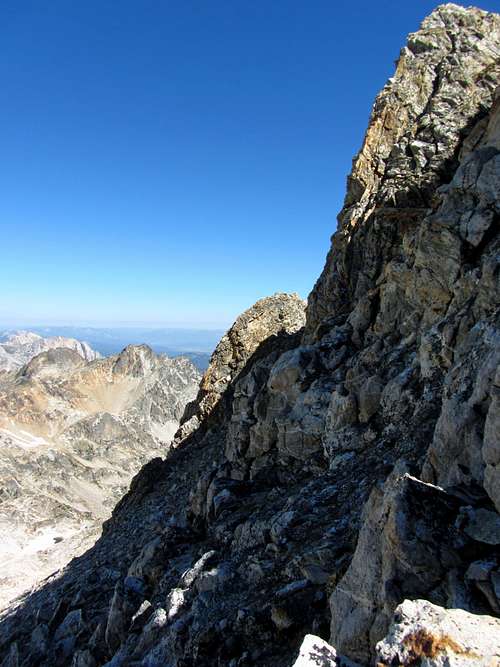
![Thompson Peak west face]() Thompson west face
Thompson west face
![Baron Peak]() Baron Peak
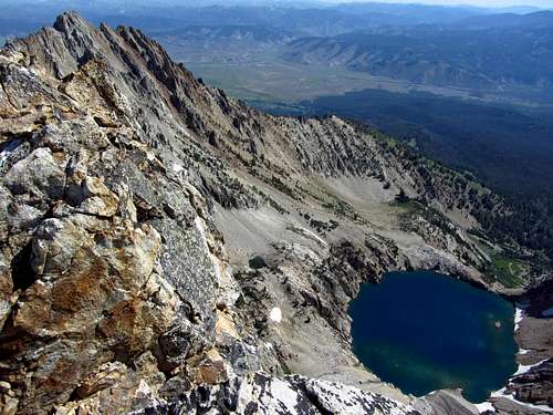
Baron PeakThere was some easy scrambling starting a couple hundred feet below the summit, and the rock here was solid for the most part as long as we stayed on either side of the couloir. Before we knew it we were overlooking Thompson Lake (what I’ll call the un-named 9,000 foot lake since no one else has named it), and only a couple dozen feet later we were at the top. Looking to the south from up here we saw countless razor-shaped ridges, and off to the northeast were impressive views of Williams Peak and the little town of Stanley where we were staying.
![Williams Peak over lake]() Williams Peak over lake, with town of Stanley in background
Williams Peak over lake, with town of Stanley in background![Thompson east ridge & lake]() Thompson east ridge over lake
Thompson east ridge over lake
![Johnny summit shot]() Johnny on summit
Johnny on summit
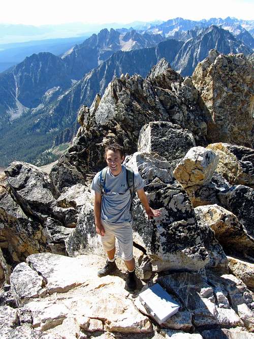
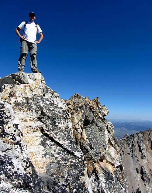
![Brandon on summit]() Brandon on summit
Brandon on summitFrom our car to the summit we had not seen a single other person, which was mindboggling to me considering how scenic this hike had been the entire way. I now knew why local rock climbers would want to keep the Sawtooths a secret. If not for the lack of wildlife, I wasn’t sure why the surrounding area wasn’t already a national park, but in a way I was glad it wasn’t, since it had allowed us an awesome summit in complete solitude. We took a nice 30-minute break on top, signed the register, had lunch, and then started back down.
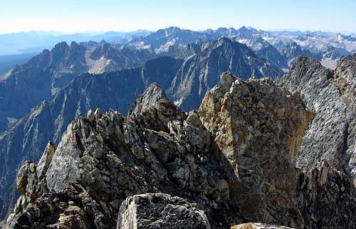
![Thompson summit south view]() Summit view looking south
Summit view looking south
![Back down south couloir]() Going back down couloir ...
Going back down couloir ...![Headwall downclimb]() ... and headwall
... and headwallCircling back down around the west side of Thompson Peak seemed easier on the way down, and we were able to spot a faint climber’s trail below the Mickey’s Spire / Thompson saddle that we had missed on the way up. In a short time we were back to the headwall, and after another fun dose of class 4 down climbing we were back in the loose boulder fields of death. I got a minor ankle sprain at one point and Johnny had an upper leg cramp as well, but route-finding was easier on the way down and this time we stayed closer to the ponds.
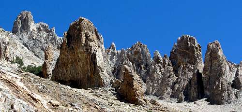
![Williams Peak spires]() Spires on Williams Peak south slopes
Spires on Williams Peak south slopes
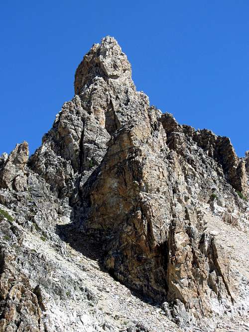
![Williams Peak spire]() Spire on Williams Peak southwest ridge
Spire on Williams Peak southwest ridge
![Thompson over pond]() We climbed that!
We climbed that!This time we contoured along the northeast shore of the 9,000-foot lake on the way down, to get a closer look at the bright blue water. We saw one person lounging on the rocks above the lake, completely oblivious to us, and since it looked like he was taking a nap we just went by without disturbing him. It was starting to get warm enough that a dive into the lake would have seemed quite refreshing, but since it would have required some scrambling to get down to the lake we refrained.
![Gorgeous Thompson Lake]() Last look at gorgeous alpine lake
Last look at gorgeous alpine lake
![Idyllic alpine lake]() Water so blue...
Water so blue...
![Thompson Peak over blue lake]() ... we felt like jumping in
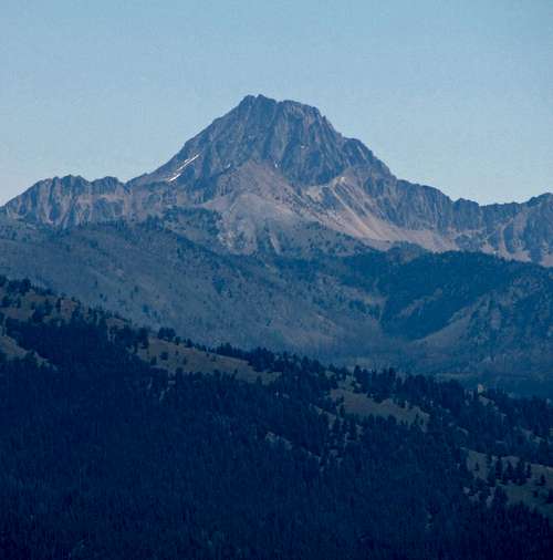
... we felt like jumping inAfter making it to the tall trees in the meadow at around 8,700 feet we were back on the trail. We saw a couple other people on the steep trail asking if it was much farther to the lake, so we told them it was just about half a mile ahead and that the views were awesome. That was all the people we’d see until we got to the Fishhook Creek Trail near our car. Looking back to the east we could see Castle Peak, the highest mountain in the White Cloud Range, which was actually over a thousand feet higher in elevation than Thompson Peak. In the event of a return trip, that’s one I might be interested in trying.
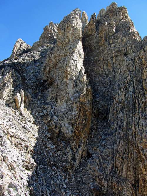
![Thompson Peak northeast aspect]() Steep cliffs below Thompson east ridge
Steep cliffs below Thompson east ridge
![Castle Peak]() Castle Peak
Castle Peak
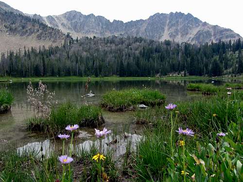
![Heyburn Mountain over lake]() Another un-named lake to the south
Another un-named lake to the southIt was now getting hotter and the views were getting smokier, which made me glad we had done the hike today instead of waiting. We got back to the car eventually, where a nice cold bottle of water was waiting for each of us (I stuck them in the freezer at the hotel the night before). We got back to the rental units at 3 pm, recounting to everyone what an awesome hike we’d been on.
![Thompson Peak Trail wildflowers]() Wildflowers along the trail ...
Wildflowers along the trail ...
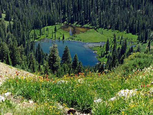
![Looking down on 7,650 foot lake]() ... above another un-named lake
... above another un-named lake
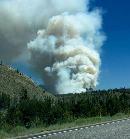
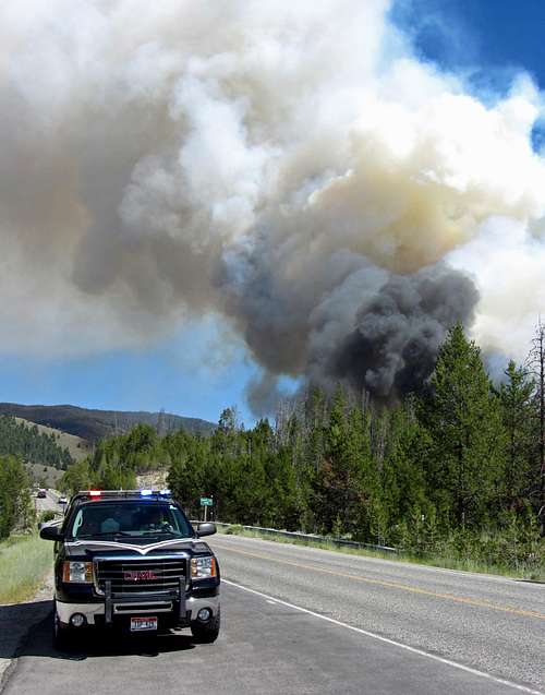
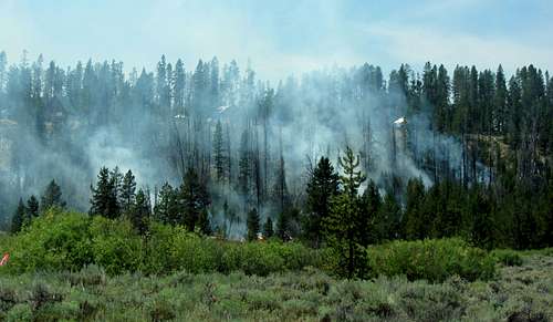
I had expected the rest of the family to visit Redfish Lake while we were gone, but due to some miscommunication they went to Stanley Lake instead. So we decided that we’d all go visit Redfish Lake to hang out at the beach and rent some paddleboats for the afternoon, but upon going out to the cars we discovered a large column of smoke now rising from where Johnny and I had just been a few miles to the south. Hoping to still somehow make it past the fire to the lake, we drove down towards Redfish Lake, the smoke getting ever closer. At the turn off of ID-75 for the Redfish Lake area, there were several drivers pulled over staring at the rising smoke, with a policeman and construction worker turning people around. They said that the Redfish Lake area was closed indefinitely, and you could only drive in to pick up your things if you were staying there (Johnny and I were at the trailhead near the lake just an hour earlier, which made me glad that we were able to squeeze in the Thompson Peak hike before the fire started).
![210 Road Fire]() This new fire would put a damper on our plans to visit Redfish Lake
This new fire would put a damper on our plans to visit Redfish Lake
![Access denied]() No Redfish Lake for you!
No Redfish Lake for you!Unfortunately, that meant no lounging at the lake, horseback riding around it, or taking the boat across to hike up along Redfish Creek. Also, the family hike I wanted to do the second most after Redfish Creek was Fourth of July Lake in the White Cloud Mountains, which was past the fire to the south. Since the smoke was coming up just a mile to the south of where we were, it was very likely that it could jump the main road, and if that happened after we went south for the Fourth of July Lake hike and the road ended up being closed, then we’d have to drive all the way back around the White Clouds down through Ketchum, Hailey, and back over to Mackay to make it back to Stanley. Rather than risk it, we just decided to go back to Stanley Lake, where the others had already spent the morning.
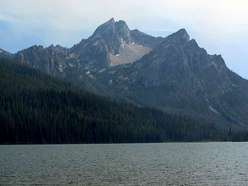
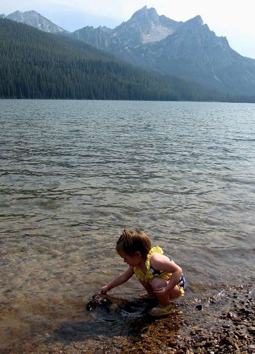
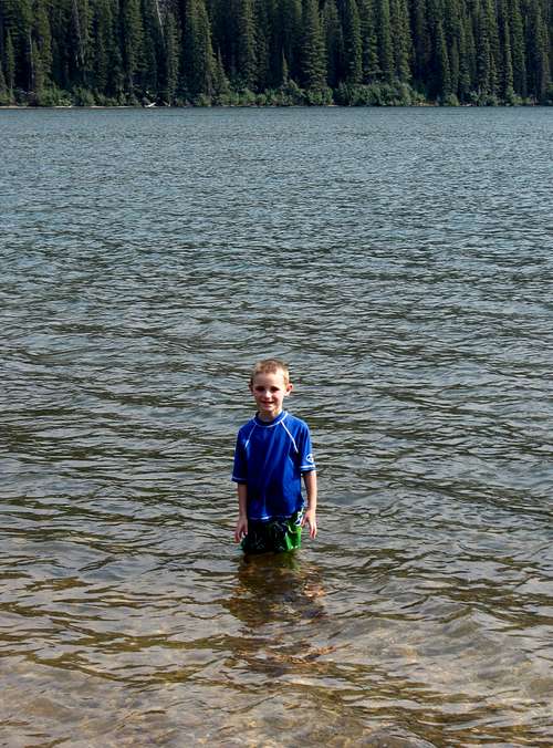
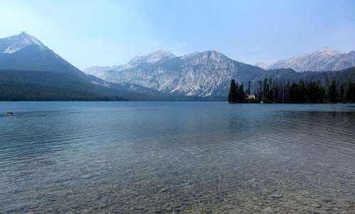
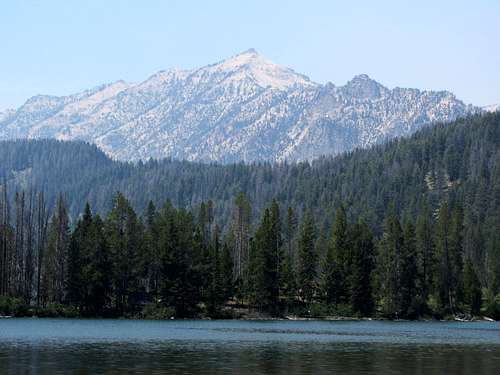
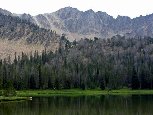
![McGown Peak]() McGown Peak over Stanley Lake
McGown Peak over Stanley LakeMcGown Peak was impressive from Stanley Lake, but the smoke from another nearby fire made the view hazy, and it was thick enough that we didn’t really want to start hiking to Lady Face Falls, another hike we’d thought about doing. We had brought swimsuits though, so the kids had fun splashing around in the surprisingly warm water and playing ladder ball, at least. We turned in for the night earlier than I would have liked, but there were enough channels on the satellite TV to keep us occupied (watched lots of American Ninja Warrior, which has several rock climber contestants).
Thompson Peak Stats
DISTANCE: 13 miles roundtrip
REDFISH LAKE TRAILHEAD: 6,560 feet
SUMMIT ELEVATION: 10,751 feet
ELEVATION GAIN: 4,250 feet
DIFFICULTY (SOUTH COULOIR): Class 3
TIME: 9 hours
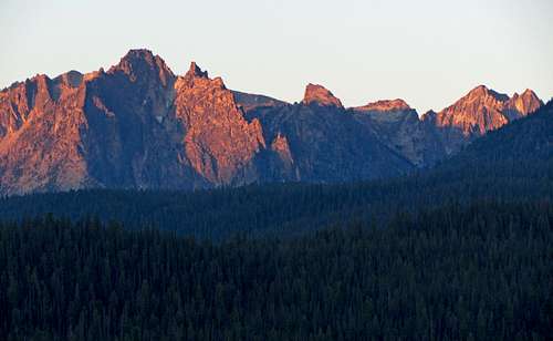
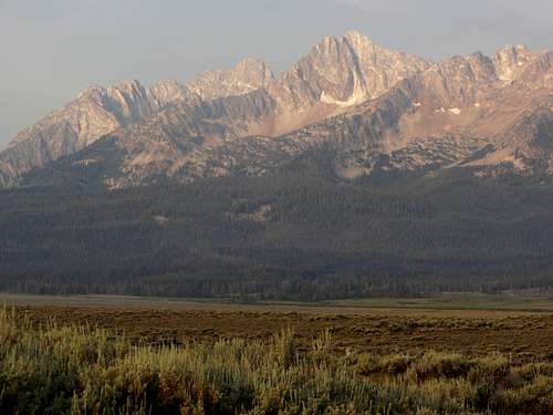
![Sawtooths from ID-75]() Mickey's Spire, Thompson Peak, and Williams Peak to the northwest
Mickey's Spire, Thompson Peak, and Williams Peak to the northwest
![Thompson & Williams from Stanley]() Thompson Peak and Williams Peak from Stanley
Thompson Peak and Williams Peak from Stanley
Day 3 - Smoked Out of Redfish Lake
The next morning we cooked up a nice big breakfast (thanks to the kitchenettes in our rooms) before heading out. It was quite hazy, but it looked like the 210 Road Fire (what they were calling the fire near Redfish Lake) was under control, so we decided to drive down south to try again. The road was still blocked off though, and the same construction worker told us this (with Boromir-style embellishment):
“One does not simply walk into the Redfish Lake Marina. Its gates are guarded by more than just police officers. There are fire fighters there that do not sleep … It is a barren wasteland, riddled with fire, ash, and dust. The very air you breathe is a poisonous fume …”
![210 Road Fire Dwindling]() 210 Road Fire still smoldering
210 Road Fire still smolderingWith that in mind, and the air still smoky enough that we didn’t feel like hiking in the immediate area, we instead kept going south along ID-75 to check out Alturas Lake and Pettit Lake instead. Shortly after leaving the road closure, we saw part of the burned remains of a hillside where the 210 Road Fire had swept through, and there were a few cabins on the hill that amazingly had remained intact. Props to the fire crews that had been working on it (we saw a bunch of them gassing up their trucks at the station across from our hotel before heading back to fight it some more).
![Ivy at Alturas Lake]() We decided to check out Alturas Lake ...
We decided to check out Alturas Lake ...
![Pettit Lake]() ... and Pettit Lake.
... and Pettit Lake.
![Looking for skipping rocks]() Looking for rocks to skip
Looking for rocks to skip
![Imogene Peak]() Imogene Peak
Imogene PeakWe stopped along the east shore of Alturas Lake for a while to let the kids play, ate some sandwiches at some picnic benches there, and then backtracked and took a different dirt road north of there to check out Pettit Lake. Both lakes were nice, but not quite as cool as what I’m sure Redfish Lake would have been like. At Pettit Lake there was a youth group having kayak races near the east shore, so we walked a little farther north along the shore to skip some rocks. I think my Dad, Johnny, and I each had a few rocks skip somewhere in the range of the late teens (# of skips on the water), but it was too close to call a winner.
![Family at Pettit Lake]() Family hanging out at Pettit Lake ...
Family hanging out at Pettit Lake ...
![Stanley Vacation Rentals]() ... and outside our Stanley Vacation Rentals rooms
... and outside our Stanley Vacation Rentals rooms
On the way back up to Stanley, we saw a big chopper fly overhead and drop a container of water on the 210 fire, which was exciting to watch. The air was giving my Mom problems, so yet again we were unfortunately forced to turn in early for the day. That night we tried eating at the BackCountry Bistro, but the waiting time to be seated was over an hour, so we instead went to Papa Brunee’s. I wasn’t expecting it, but the pizza there was amazing and is the best I can remember having in a long time (we had one with lots of meat called the Texan I think, as well as a Hawaiian). The rest of our time was spent playing the board game Sequence, which is a family favorite.
Day 4 - Fourth of July Lake
![Horstmann Peak from Stanley]() Horstmann Peak
Horstmann Peak
![Williams Peak from Stanley]() Williams Peak
Williams PeakOn the way back to Salt Lake City the next day we’d have one last chance to get a family hike in. Johnny was feeling a little under the weather, so he and my parents just decided to drive back to Salt Lake City (he had to pick some stuff up at their house before flying back to California that night, anyway). The skies were a little clearer this day, but with the Redfish Lake area still closed, we would try doing the Fourth of July Lake hike in the White Cloud Mountains instead.
![Grand Mogul from ID-75]() Grand Mogul to the west
Grand Mogul to the west
![Bent tree]() Holding up a tree
Holding up a tree
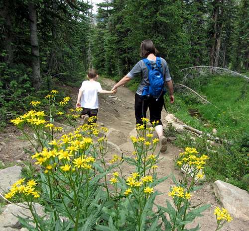
![Hiking buddies]() Hiking buddies
Hiking buddiesIt took about half an hour to drive up the 10-mile dirt road to get to the trailhead. Most of the trees in the area were burnt from a fire, but there was enough undergrowth at the bottom of the trees to make us think that it had been at least a couple years since the fire. We only saw one other car on the way up, but there were several others parked at the trailhead. A large group started out ahead of us as Matthew was using the toilet there, and with them they were taking what looked like a couple giant goats (I don’t think they were llamas, but maybe they were).
![Matthew's Log]() Matthew ...
Matthew ...
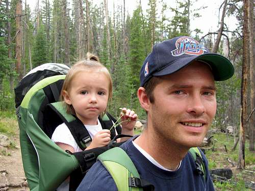
![Ivy in Kelty Pack]() ... and Ivy on our hike
... and Ivy on our hike
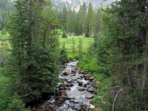
![Scenic Fourth of July Creek]() Fourth of July Creek
Fourth of July Creek
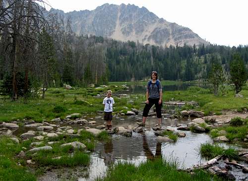
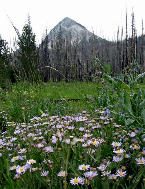
![Patterson Peak]() Patterson Peak
Patterson PeakThe area surrounding the trail was actually quite green, so the fire must have somehow missed this part. There were quite a few barren trees though, which must have been due to beetles. We walked over several stream crossings on the way up to the lake, which the kids liked, especially Ivy, who takes after what her brother Matthew did in that once she spots a stream she repeats “wawa” over and over again excitedly. About 2/3 of the way up to the lake we passed the group with the goats, who were resting for a breather (when he puts his mind to it, Matthew can hike pretty quickly), and soon after that we arrived at our destination.
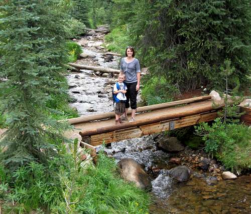
![Matthew & Liz at Fourth of July Creek]() There were several scenic crossings ...
There were several scenic crossings ...
![Crossing at Fourth of July Lake]() ... along Fourth of July Creek
... along Fourth of July Creek
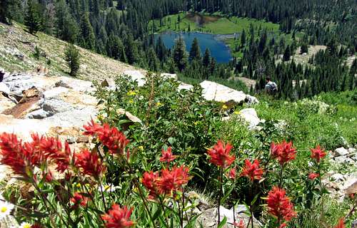
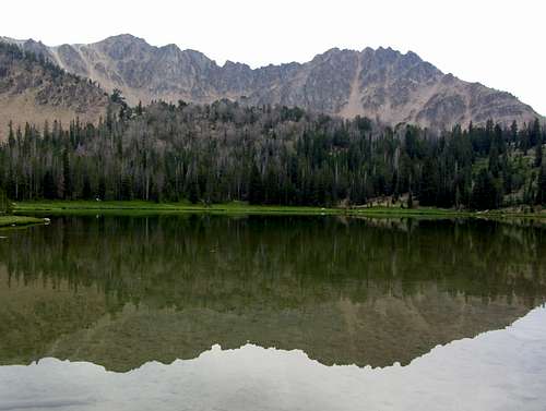
![Fourth of July Lake]() Fourth of July Lake reflection
Fourth of July Lake reflection
![Ivy climbing]() Little climber
Little climberFourth of July Lake was quite scenic, so we figured we could hang out on the grassy west shore of the lake for a while and let the kids throw some rocks in the water. Looking to the east were nice views of Patterson Peak on the left and another un-named peak over 10,800 feet (both just barely higher than Thompson Peak was) on the right, with the still higher Castle Peak hiding somewhere behind. We had just busted open the lunch snacks though, when we were assaulted by a variety of bugs. Among them were mosquitoes and some giant horse flies, and since I had forgotten to bring the repellent our stay was short. Hiking mostly in the Wasatch where there are no pesky bugs to speak of, I underestimated how many there would be here in the White Clouds, especially since we had been fine when walking down to the water of the various Sawtooth lakes on the previous days.
![Fourth of July Lake family pic 2]() Enjoying the surroundings ...
Enjoying the surroundings ...
![Fourth of July Lake Scenery]() ... at Fourth of July Lake
... at Fourth of July Lake
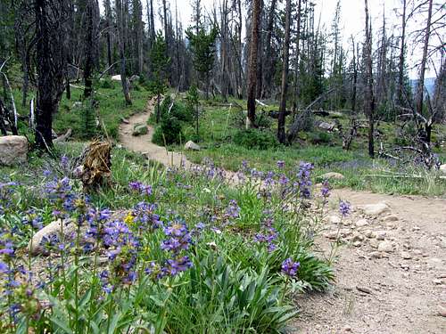
![White Cloud trail]() Wildflowers ...
Wildflowers ...
![Un-named peak & wildflowers]() ... in the White Cloud Mountains
... in the White Cloud MountainsSince we wanted to get back to SLC to say bye to Johnny at the airport before he took off anyway, we decided to forego the remaining hike to Washington Lake. After hiking back down, we started our drive south, which would take us along a different route than the one we had taken to Stanley. Along the way we caught some nice views of the Boulder Mountains to the east. We only drove through, but the scenery in and around Ketchum was nice too. It reminded me of some of the ritzier ski towns in the Rockies like Park City and Aspen. After the town of Hailey the mountains started petering out, so with nothing else to distract me from driving (Liz doesn’t agree, but I think I’ve gotten pretty good at gawking at and even taking pictures of mountains while driving without swerving around too much), I lead-footed it for the rest of the drive back.
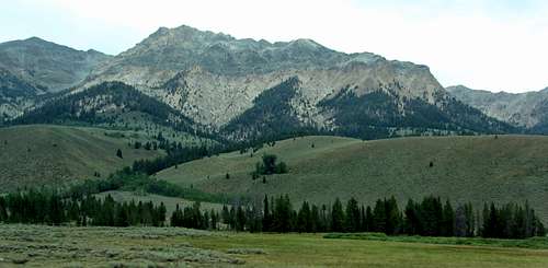
![Lorenzo Peak]() Boulder Mountains
Boulder MountainsSummary
The Sawtooth Mountains were really cool, and I’d recommend a visit to anyone looking for some scenic, rugged mountains. They aren’t as well-known as some of the other sub-ranges of the Rocky Mountains, but from the little taste I had of them doing Thompson Peak, I think they definitely hold their own when making comparisons. Since we didn’t even get to do any other hikes in the range, I’m sure we would have been just as impressed if we had been able to make it up to places like the canyon along Redfish Lake Creek or Sawtooth Lake, which I’ve heard is also a must-do hike. I was very impressed with the little that we did see though, and fortunately the smoke cleared just enough for us to summit Thompson Peak. It was more strenuous than some of the hikes and scrambles I’ve done in the Wasatch like Pfeifferhorn and Mount Timpanogos, but not as hard as others like Lone Peak, which was perfect since I didn’t feel like I really had to exert myself too hard to get some awesome scenery (that lake at 9,000 feet in particular, was incredible).
![Cliffs around lake]() Thompson Peak: One of the most scenic hikes I've been on
Thompson Peak: One of the most scenic hikes I've been on
Also, if you’re a wuss like me who prefers to sleep on a bed at night instead of in a tent, I’d highly recommend staying at the Stanley Vacation Rentals (we booked the Valley View and Heritage rooms, which were probably the nicest we could have gotten around Stanley, and still very affordable). With having to change a lot of our plans due to the fires and spending more time indoors, it meant a much more enjoyable time for the rest of the family.


Comments
Post a Comment