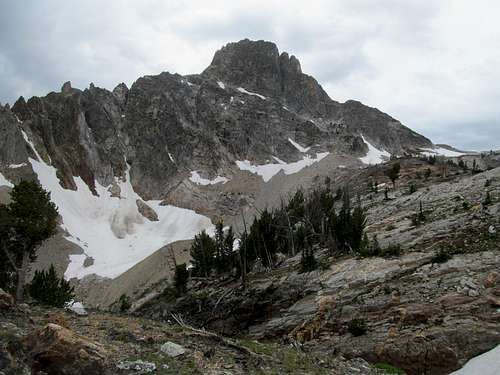
White Mountain West - July 26th, 2014
Christmas of 2013 I went home to Boston for a little over a month. I missed home, I missed the simple life, I missed friends and family, and I didn’t want to go back to Utah. I seriously considered not returning, and I accordingly weighed whether I could leave aside the mountains for good. During this time, my one nagging thought was Thompson Peak. It sat atop the forefront of my mind, beckoning me, taunting me, and I knew that I had to go back for it.
I did return for one more year back west. Thompson still remained a priority in my mind, and I waited for the right, optimal moment to go for it. As August approached my time for climbing was winding down. I had a fateful trip to Savannah Georgia awaiting me the first weekend of August, and afterwards my last week of work, which would subsequently free me for a few months of travelling and wrapping up what I could with unfinished business out west before moving back.
But first on deck was one more trip to Idaho to close out July, which would hopefully culminate with a successful ascent of Thompson. That would be Monday if the weather held out. Before that, a foray deep into the heart of the Salmon River Mountains.
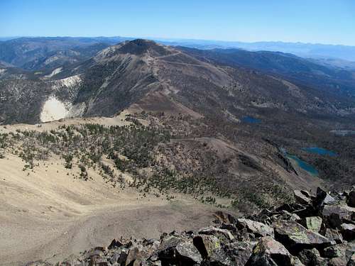
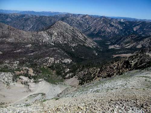
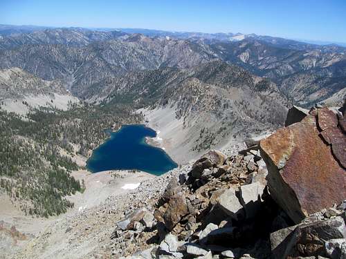
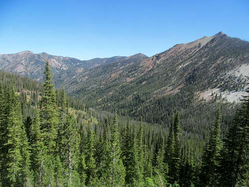
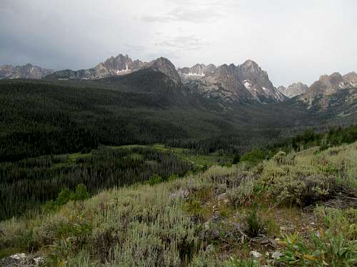
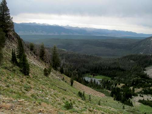
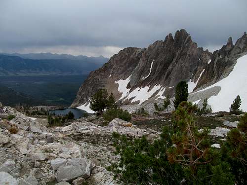
I met up with Greg and Kadee in Challis Saturday morning, and from there we started down the road to the South Twin Lookout. It’s ironic that the highest peak of Salmon River Range, one of the wildest mountain systems in the lower 48, is so close to the beaten path and easily accessible if you had just the mildest tolerance for a rocky gravel road, some easy scrambling and, a sandy 400 foot descent to start the hike.
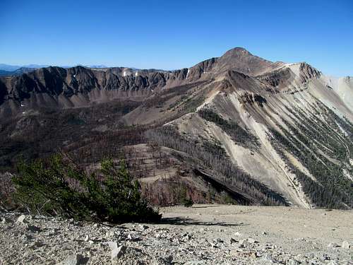
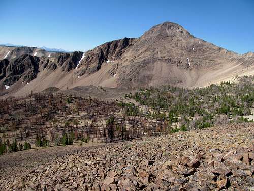
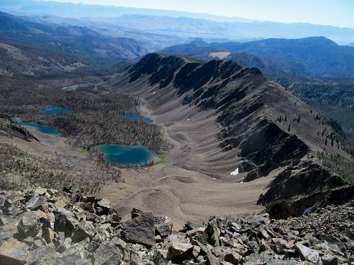
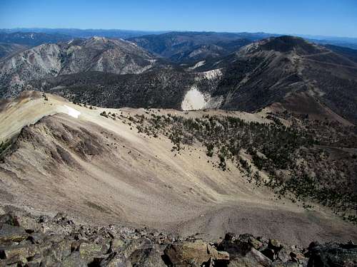
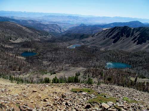
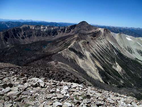
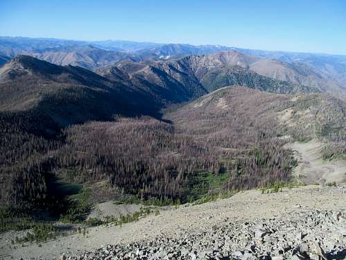
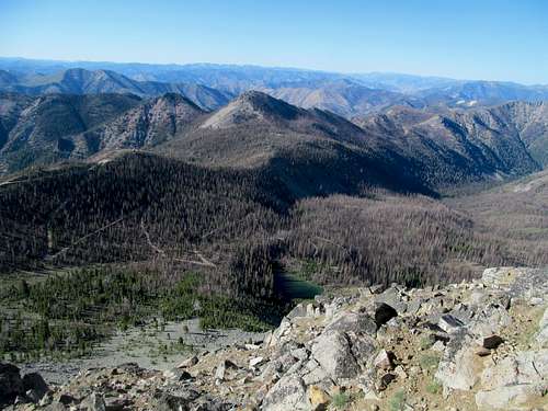
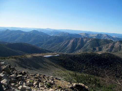
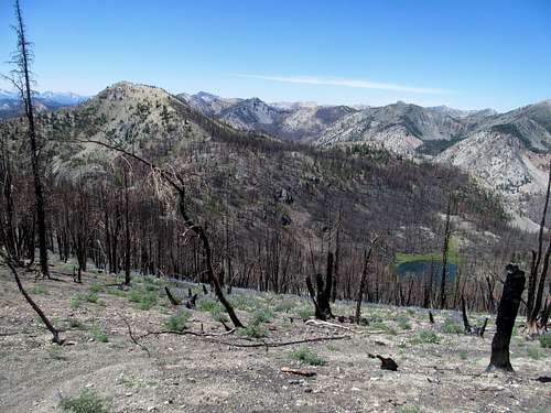
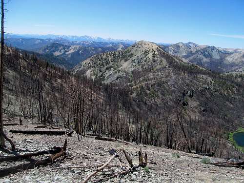
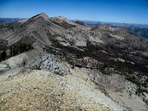
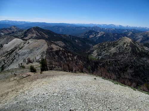
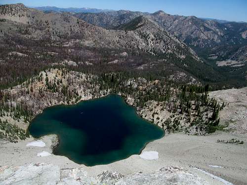
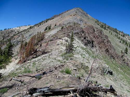
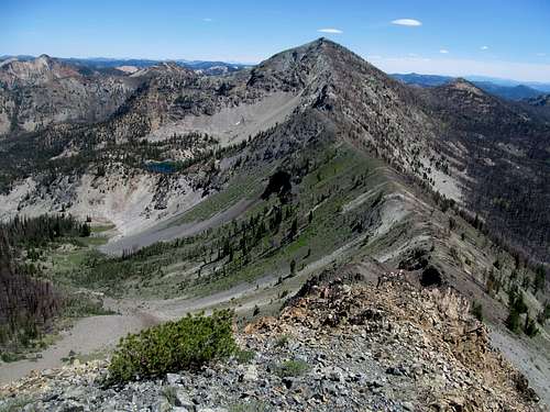
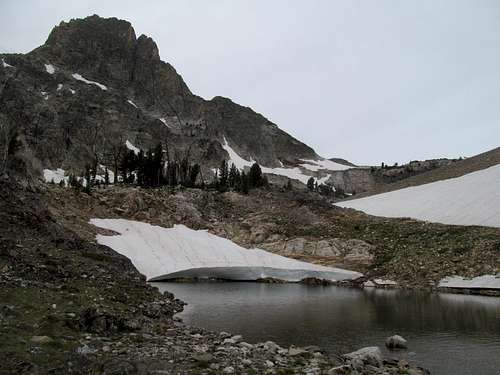
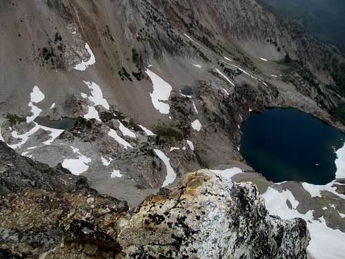
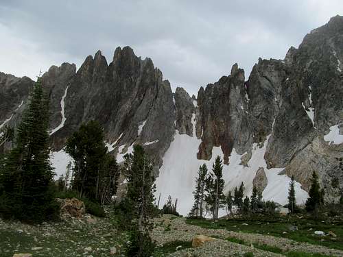
Evidence of recent fires peppered the landscape, from the Twin Creek Lakes drainage below us to the charred, empty forest we traversed through at the saddle between South Twin and White Mountain West.
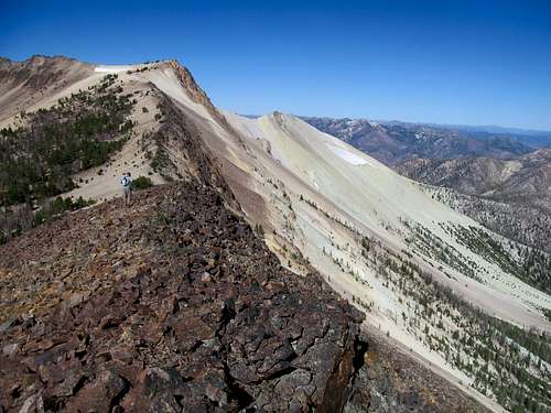
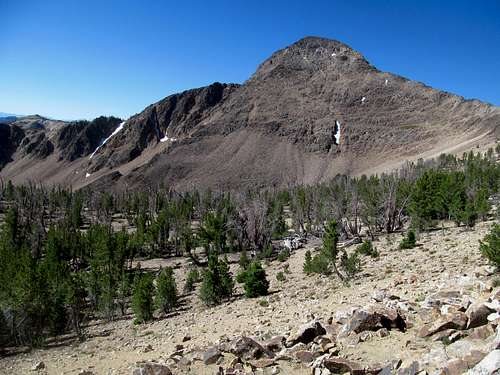
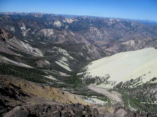
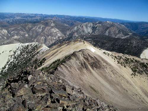
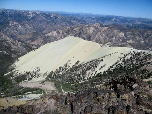
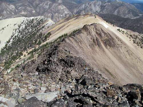
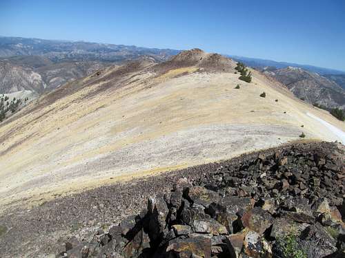
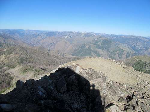
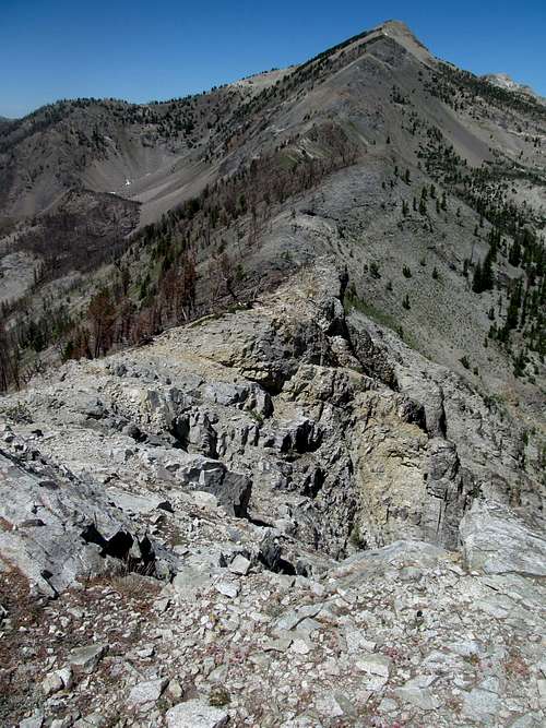
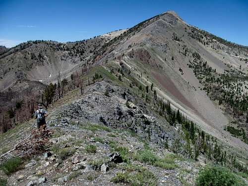
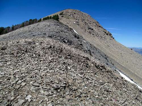
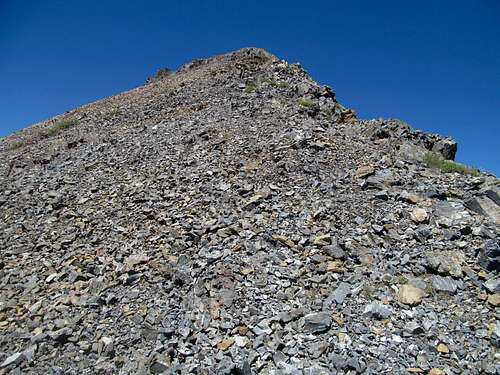
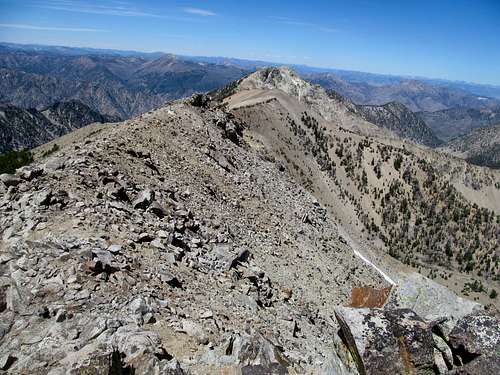
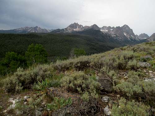
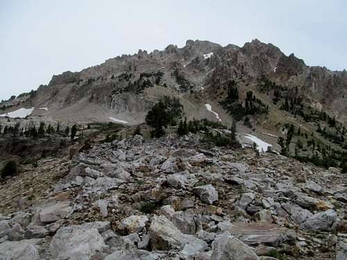
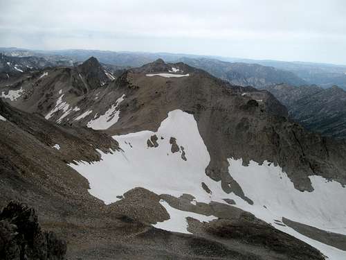
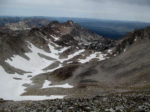
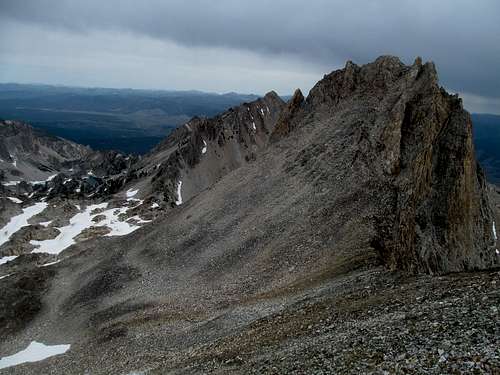
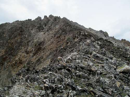
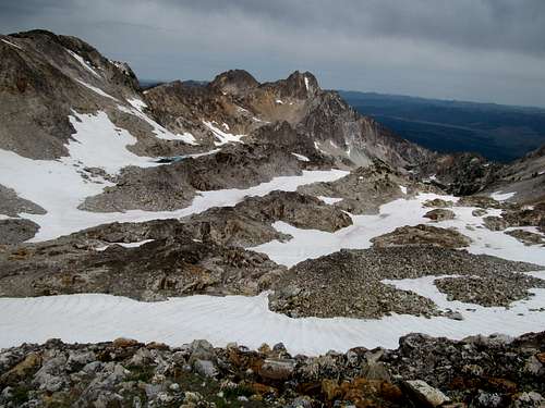
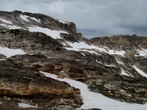
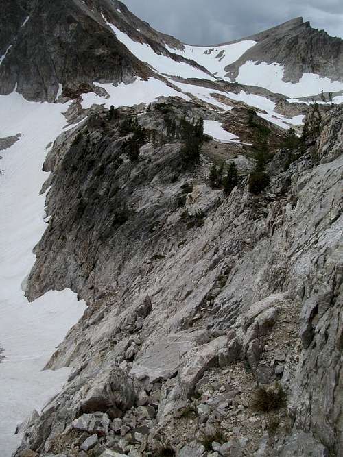
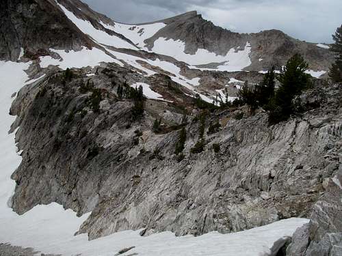
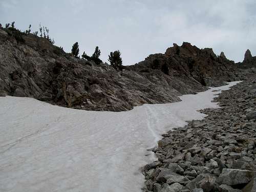
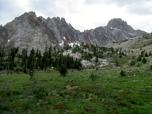
The initial ascent proceeded directly up the ridge, through some light talus to a small bump. From there, a gentle traverse up and around some lingering snowfields to the top of the namesake white sandy ridge.
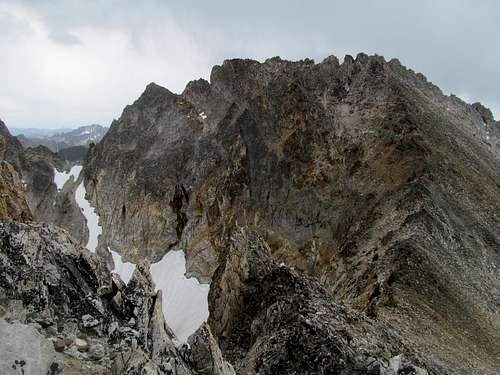
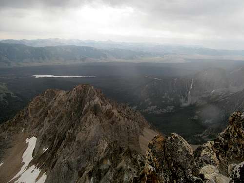
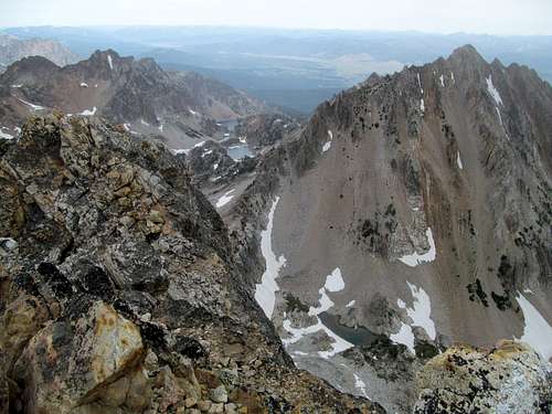
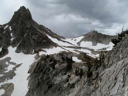
From here, we had a good view to the summit, just a few hundred feet above us. The northeast face was pretty impressive, but our north ridge route provided a perfect path to the top, easy scrambling along relatively stable rocks along the ridge crest with minimal exposure.
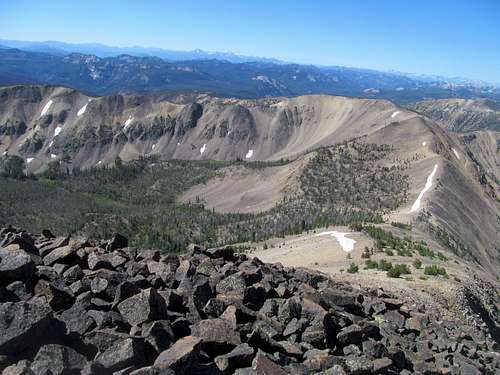
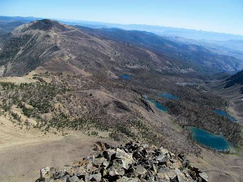
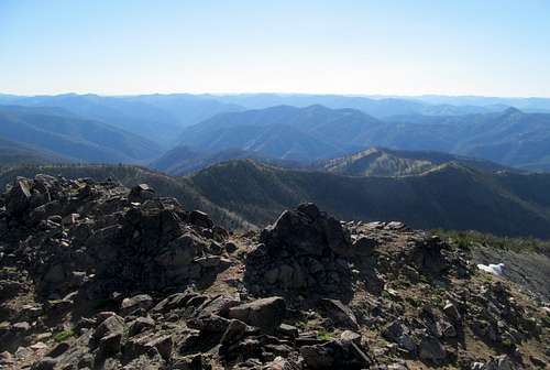
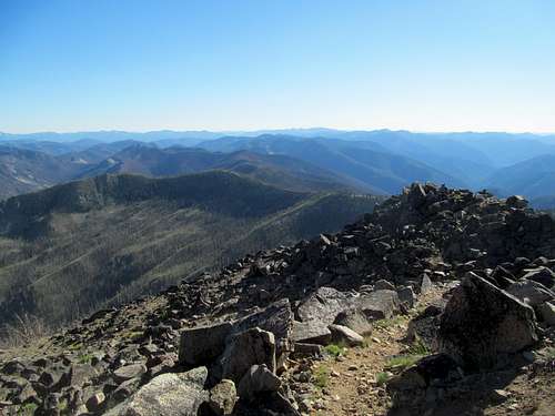
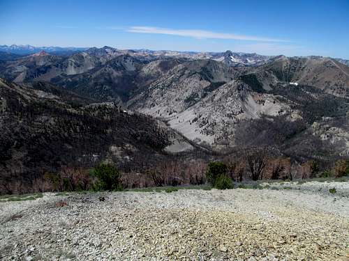
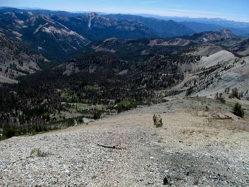
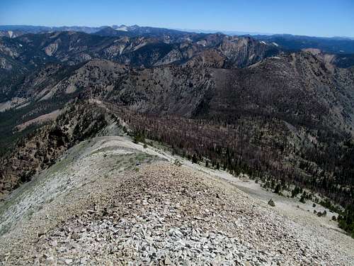
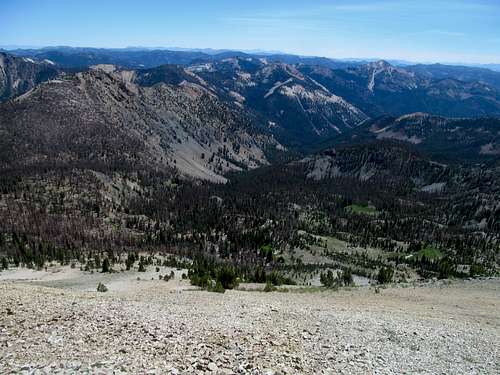
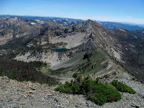
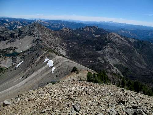
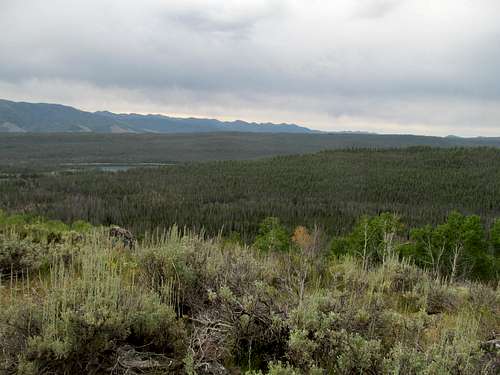
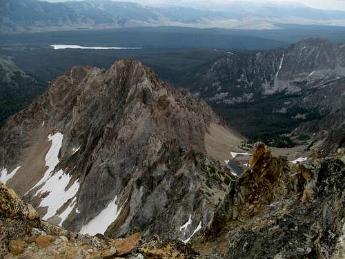
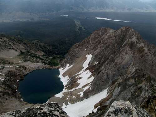
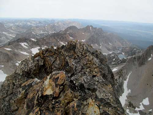
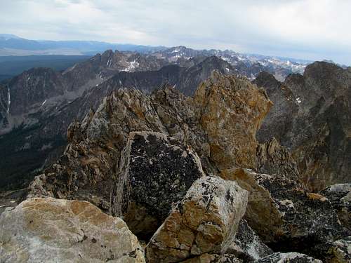
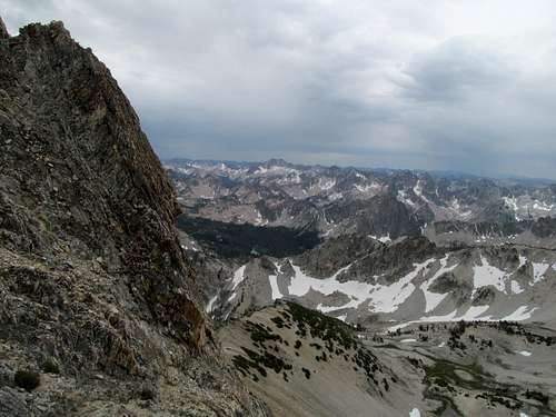
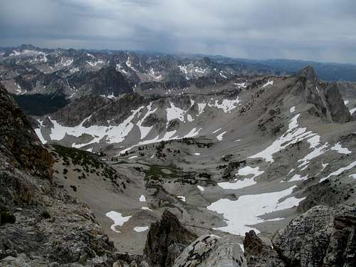
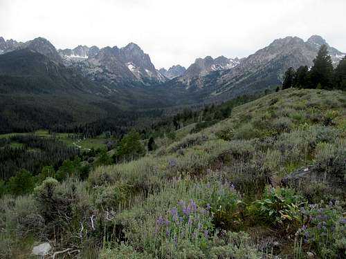
We enjoyed the vast views from the summit, from the long ridges of the Lost Rivers and Lemhi’s still hidden by the glare of the rising sun, to the myriad of colors and ridges dotting the nearby terrain into the inscrutable interior of the Salmon River Mountains.
We descended, and I didn’t enjoy the sandy ascent back to the trailhead, ie a couple convenient turnoffs along the side of the South Twin road.
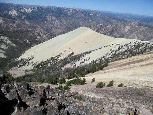
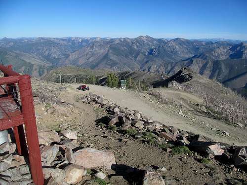
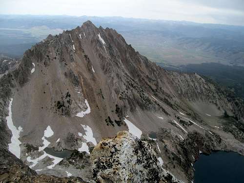
The profile of White Mountain West just from this wide road is a startling juxtaposition of one of the more unique, obscure and colorful vantages of the Rocky Mountain West alongside a wide and well beaten (if rocky) road.
Of course, we had to travel the length of the road to the South Twin Lookout. Kadee had already hiked the rest of the road and chatted with the lookout ranger, a younger kid. She introduced me and Greg and we enjoyed the views, similar to those of White Mountain from the road but better perspectives of the Lemhi’s, and exchanged thoughts on the more obscure summits around us.
Fade to Pinyon - July 26th, 2014
We didn’t have much time to dally around. Our goal, technically the third peak of the day, was Pinyon Peak, a relatively obscure P2K deeper in the Salmon River interior, yet ironically another lookout tower and drive up.
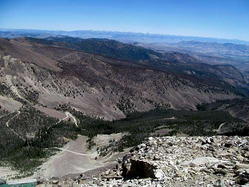
To get there, we backtracked the highway to Sunbeam, halfway between Challis and Stanley. It was a good smooth road to the popular Sunbeam Mine and up the switchbacks to Loon Creek Summit (pass). The switchbacks down were a little more slippery and rocky, but the road was good for passenger cars all the way to the Loon Creek guard station and camps, as evidenced by the multitude of sedans parked there.
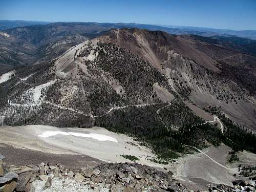
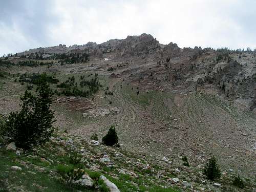
A few miles later the Pinyon Peak lookout road branched left, immediately up a steep and rocky hill, and further deteriorated miles and miles deeper into the heart of the Frank. Occasional smooth portions were interspersed with slow rocky streambeds, deep gorged washouts buttressed for better but probably worse by wooden beams, and all sorts of such ilk, and I despaired of even reaching the summit before a slowly approaching sunset.
Nearer and within sight of the lookout tower the road travelled up the cut in the hillside. Shortly before one last switchback in the direction of the summit a large and significant snowbank blocked our progress. Less than a week from August, no less!
We had no option but to back the car up maybe a quarter mile down to the last curve, all with respect to the dropoff on the right. I decided to defer the inevitable while Greg and Kadee backed up first. Greg would start lower, cross country it up a shorter track to the summit, while I walked the length of the road from further but higher.
Greg beat me to the top and was well into chatting with the lookout ranger by the time I sauntered up. The sun was setting but it took us awhile before we could walk away from the views, from twilight over the Tango Peaks, to the Sawtooths and the White Clouds shining in the waning moments to the evening, to Big Baldy standing solo and sticking out despite the glare along the western horizon.
We drove back but only as far as the Lost Packer Mine, still neck deep in the middle of nowhere.
As if that wasn’t nerve wracking enough Greg and Kadee wanted to explore the cluster of old cabins on the other side of the road. Seriously expected ghosts and all cause abandoned mines, we were surprised by fairly modern décor in one of the buildings, a pool table, and a framed shamrock print.
Outflanking the General - July 27th, 2014
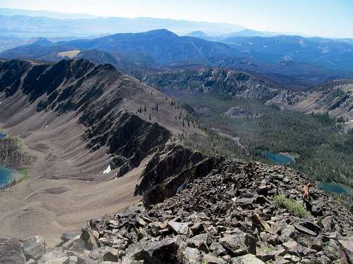
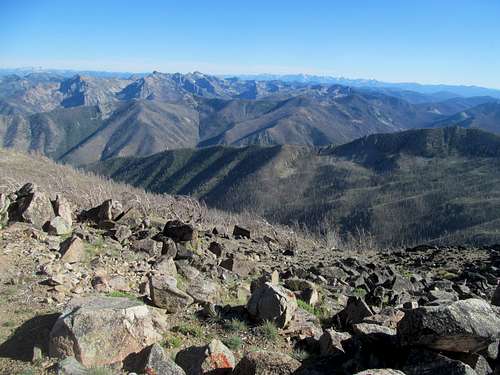
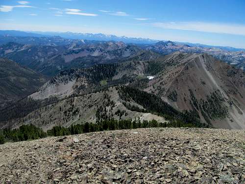
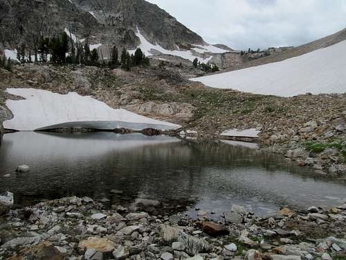
Wake up to face still miles of highly unpleasant driving before we arrived back at the main road. A few switchbacks down from Loon Creek Summit I parked and hopped into Greg and Kadee’s 4Runner, then hung on for dear life as Greg inched the car up to the terminus of the road in a small bowl below Jordan. I got a head start while Greg got ready and made it to the ridge, where views of the other side revealed Lightning Lake sitting amidst a charred apocalyptic landscape.
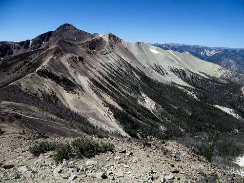
Greg caught up to me before the summit of Jordan, crowded by flying gnatty bugs. We surveyed the route to The General, a 600 foot drop and then a 900 foot or so rise.
I was still surprised that I had convinced Greg to go after a P1K; the peak had gotten on my radar after I discovered its height and isolation as the monarch of this central portion of the Salmon Rivers.
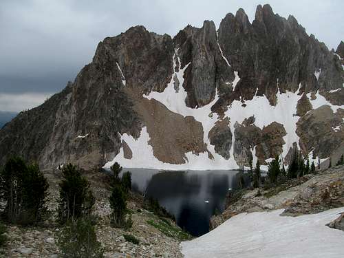
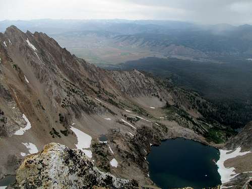
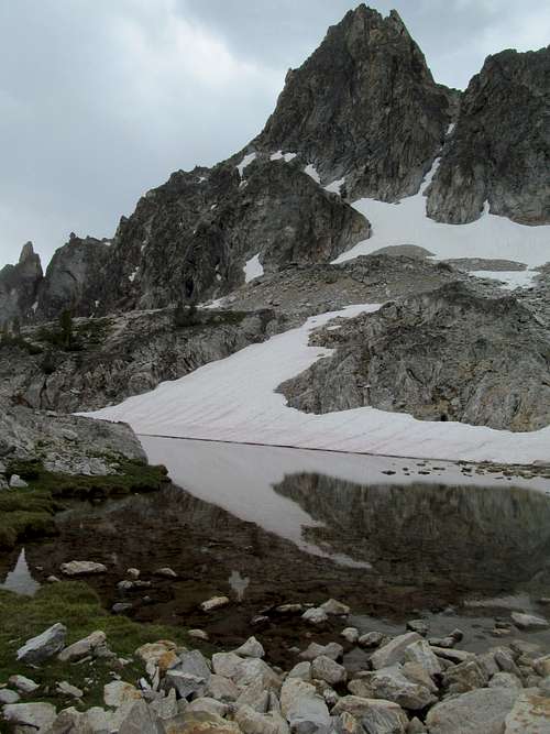
Standing here in the wilderness below the poised countenance of The General, separated from us by a startling pretty and unnamed lake on the right, it was hard not to be convinced of its merit, though grabbing an extra P2K the day before certainly helped its case.
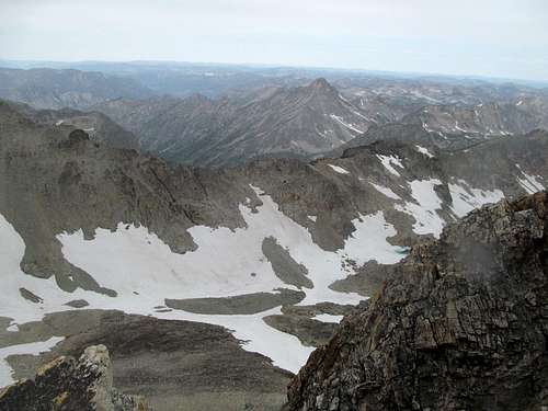
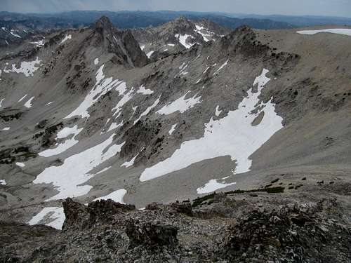
Aside from the constant views of the deep Salmon Rivers, Loening and the Tango Peaks to the left, the turquoise lake and vast miles of wilderness stretching to White West and the Twins to the east, the Jordan-General traverse wasn’t too much to write home about. Easy class 2 up dirt slopes, and upon nearing the summit we glimpsed the larger and even more surreal Mystery Lake.
I had originally thought about ascending via the lake and the sandy slopes east of the summit before Greg informed me of the shorter route via the jeep track. The lake would have still been cool to see at its level, but the view from above wasn’t bad either.
We took in the views then traversed back to glimpses of the White Clouds and Sawtooths bathed in a startling mid afternoon color.
Thoughts of climbing the latter the next day made me a little nervous, but the thought of finally emerging back to civilization and cell reception helped me breathe a little easier. Greg and Kadee took the Yankee Fork fork of the road on the way back, and I had the rest of Sunday to kill.
First, washing off two days’ worth of sweat and grime at the Sunbeam Hot Springs, crowded on a summer weekend to the extent that I had a tough time finding a good spot, relegated to a pool that was either way too hot or too cold.
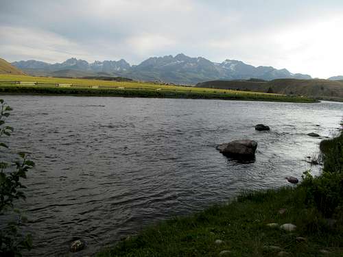
Then off to Stanley on a hot and muggy afternoon, where I ate dinner and backtracked to the Salmon River a few miles east of town, admiring the views of the towering mountains that I would hope to stand atop the next morning.
No Topping Thompson - July 28th, 2014
It’s hard for me to describe with words (cause I dum dum no write) that Sunday night before Thompson Peak. I eventually ended up at the Redfish Lake Lodge, a place dwells in my mind as a refuge of interminable peace and tranquility. The scene seemed to have been plucked straight out of a camp scene from a 90’s movie that I had long forgotten: a bustling general store, people of all ages, shapes and sizes, sauntering lackadaisically astride a band playing a lakeside lawn. Beyond, small waves pulsated across the surface of the lake below the impassively sharp edges of the Sawtooths and a waning sunset that, well after 9 PM, stubbornly refused to die. The scene defined the word chill, well before the goddamned hipsters hijacked the concept into a caricature of itself along with facial hair, bacon, and any beer with a modicum of flavor.
I drank every bit of it in, along with a few beers in at the small quaint hunting lodge style bar, then retreated back to the backpacker’s trailhead a few miles back along the road for a restful night in the 4Runner.
Morning came, I took what was probably my fifth bathroom break past the 8 or so odd hours of the night, then packed up for what I never realized for many reasons, would be my penultimate hike of the year.
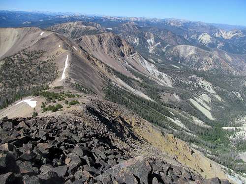
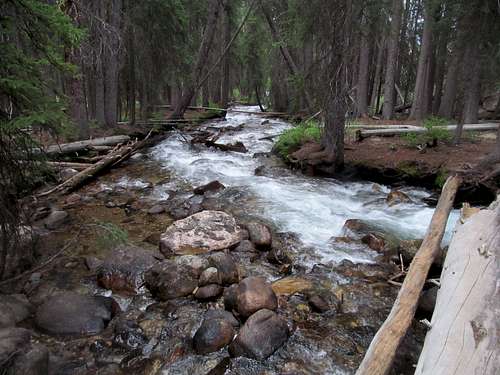
Fishhook Creek was a spectacular crossing early on in the morning, bullrushing through the woods this late into the summer. The first sections of the trails were wide and seemed geared for recreational hikers, and a good trail continued up some meadows onto the often open ridge leading to the Sawtooths, impressively visible through much of the approach.
Weather for Monday had initial been favorable, 20% thunderstorms, but deteriorated through the weekend. By Sunday night I saw 40% and much of the actual day was cloudy. Despite that, things worked out. You can’t see Castle Peak, or really any of the major White Cloud summits, from the Sawtooth Valley. From the trail however along the Fishhook ridge, the massif stood impressively and impassively above a wave of smaller peaks ebbing and flowing like a rising tide towards their leader. Above them, wisps of light rain drizzled, echoing my concerns about the weather.
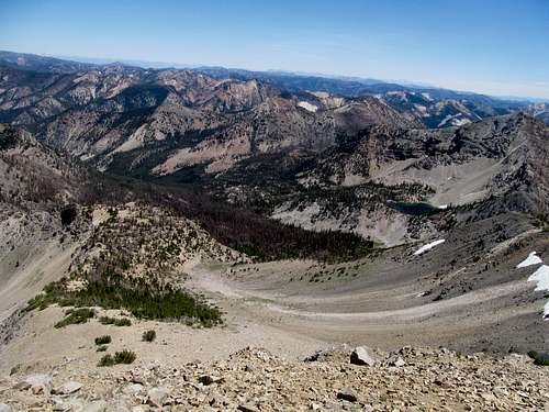
I continued down the trail, occasionally stepping left on the ridge not only for the views of the two mountain ranges, but also of the lush marshy valley down to my left. Several miles in, as I approached the Sawtooths proper, the landscape rose through hanging basins connected by undulating cascades, making the views better as the trail transitioned from a hiker’s to a climber’s trail, which cut across an open loose dirt section where I guess some people occasionally lose the trail.
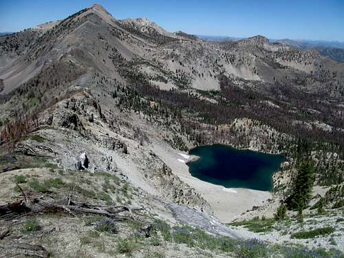
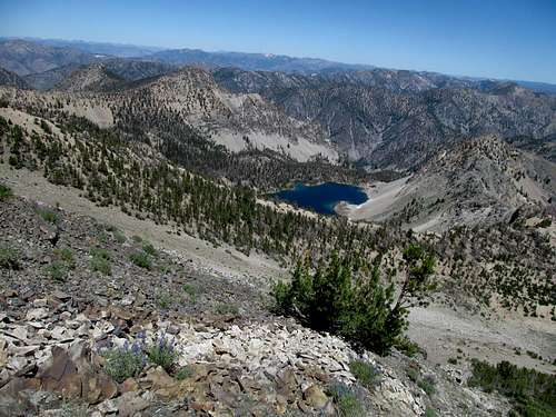
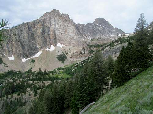
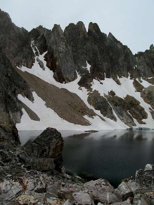
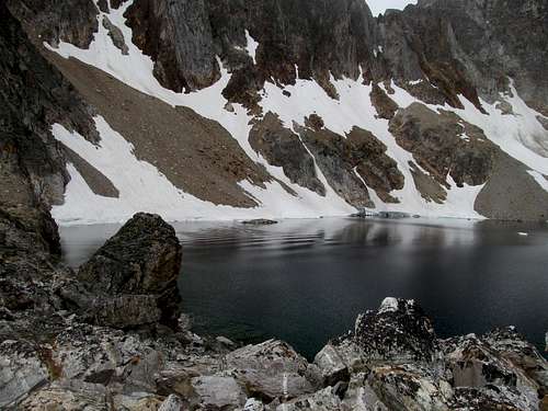
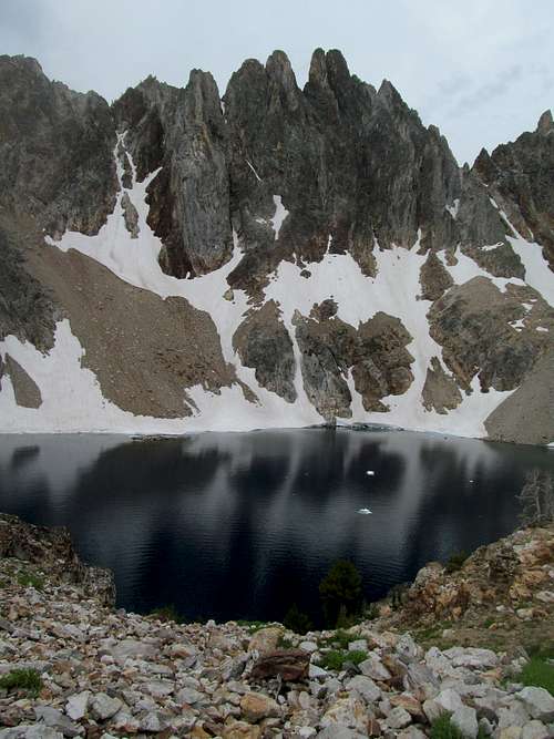
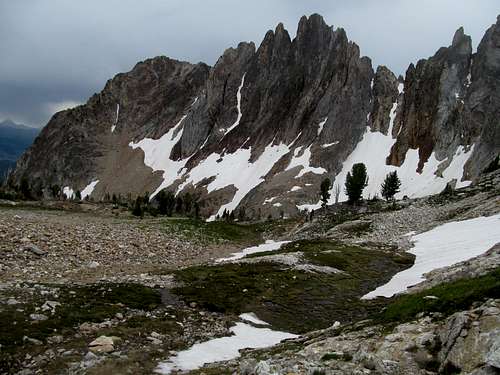
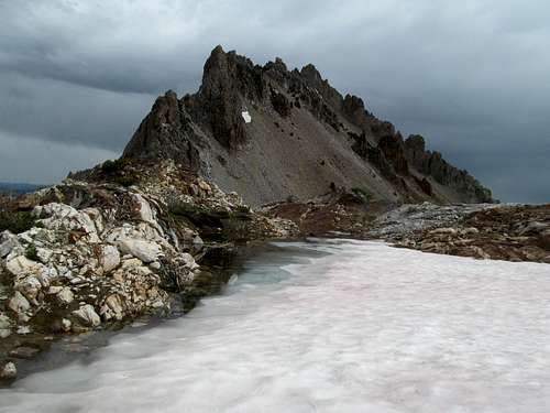
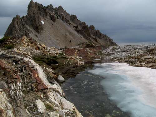
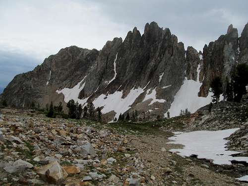
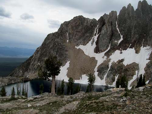
I entered a small grassy meadow into the first of several escalating basins between the jagged talus gendarmes of Williams Peak right and the big time gnarly ridge of Thompson left, rising like a callused knuckle over the unnamed lake at 9,000’.
Greg had gushed plenty about this lake, from how the peak looks unclimbable from this vantage point and how from the top it looks like you can practically jump into the lake over a thousand feet directly below.
I saw firsthand his first observation now and hoped to prove right the second as well. Having browsed through pictures of the lake before, I personally was surprised how steep the cirque surrounding the lake was; there didn't appear to be a shore, just cliffs and deep navy blue and presumable ice cold water.
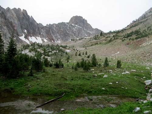
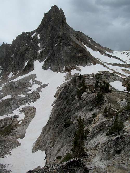
Moving on, the view continued improve hiking towards the headwall as I passed a few more tarns worth looking back on, especially contrasted against with the rippling White Clouds on the horizon. I was a little nervous about the headwall, as Greg had indicated that it was the only tough spot on the climb. It certainly looked intimidating up close, but less challenging the further up you ascended towards Williams Peak. The drawback was that any elevation you gained in the name of a technically easier route were extra feet that you’d immediately have to downclimb upon reaching the ridge.
My inner fatass did battle with my inner coward here; ascending up the talus I ran into a coupre who no speak engrish rear good, so I couldn’t tell where where/what they were crimbing. They had helmets so I assumed I’d see them later on Thompson but I’m not sure what they did with the headwall if anything. They were the first people I had seen thus far, and as for myself, I picked a spot not too far up that seemed to offer a reasonable route through the gully. It featured a tough first step, then traversing then climbing around some narrower ledges, but none of the moves were tougher than the first one, which was low and had no exposure, though the exit off the snow onto the slippery chute between it and the headwall proper was a bit tricky.
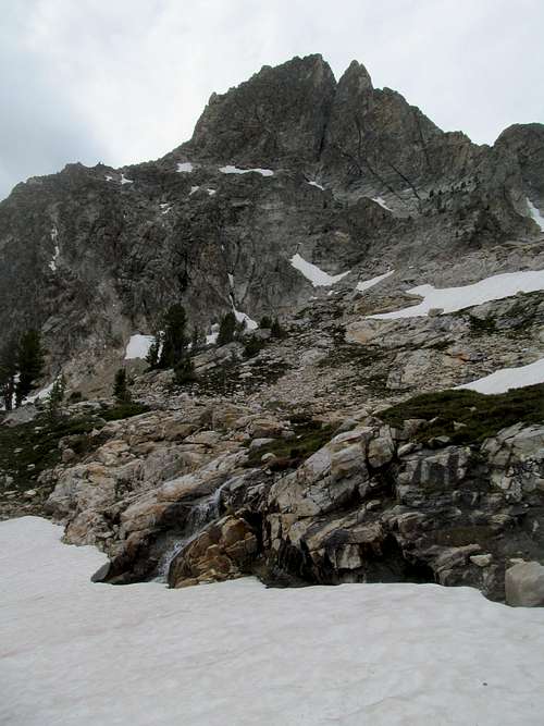
Though I had yet to glimpse the views of the Sawtooths from the summit, I had figured that Thompson the peak itself at this point couldn’t impress me any more than it already had. Wrong. The peak transformed from the sheer canvas of a cliff face to a sheerer blade trying its best to carve out a chunk of the cloud blotted morning sky.
To the north, my first glimpse at the glacier tarns dotting the granite landscape one indescribable cirque down to the next.
I wandered past several reflecting pools to make the traverse around the west side of Thompson to access the south couloir…some snow, some boulders of the wide, gappy kind, but overall stable. The snow was soft, firm, pleasant going overall. Keeping an eye on the topo I gradually gained elevation along the ascent and ultimately followed the peakbagger.org trax to identify the correct couloir, left of a skinny, sharp gendarme, to make the final ascent.
There was a climber’s trail for some of the couloir, and the terrain was easy for the most part despite a slight dropoff above the aforementioned gendarme. A few easy rocky blocks and I was at the first, southerly summit.
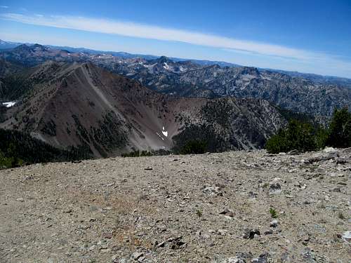
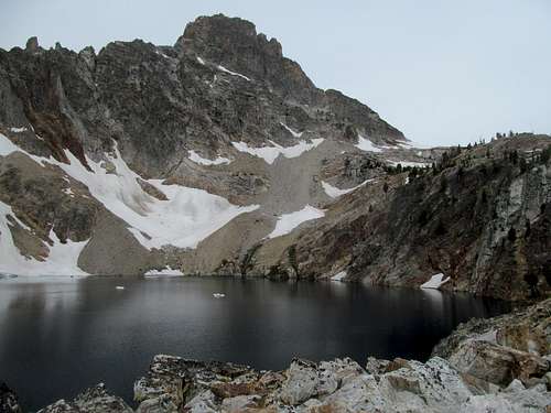
I took in the indescribable views, only to find to my frustration the inhibited views north and south. Fine, I had to make the north, true summit anyway. The brief move was indeed a little exposed, and I hugged the rock going up to the northerly summit, where the sharp dropoff to the lake below really hits you. Good views of Williams as well, and far away the rain parted just enough for a glimpse into the Salmon Rivers.
I carefully made my way back to the southern summit. On my part I barely felt a few drops of light rain all day, but all my views from the summit had been bathed with a light misty quality that cleared in the thirty, forty or so odd minutes I had spent immersing myself in the views. The Sawtooths proper to the south now took on a crystal clarity unique perhaps only to post rain conditions, so I had a to linger a little more to see the mountains from a new light.
But I couldn’t see it all. Mickey’s Spire blocked most of my views into the southwest Sawtooths, and I debated doing something about that. I had been lucky with the weather thus far, but surely it could get worse as noon approached…but I couldn’t come so far up my top priority peak and not get all the views I wanted.
I descended down the south couloir and found myself steadily staying steadfast along the saddle losing as little elevation as possible, studying the various lines of assault on Mickey’s Spire. The summit looked jumbled as hell and possibly technical, but all I wanted to do was to gain a spot on its northwesterly ridge, a vantage point for views currently blocked.
My legs felt surprisingly sprite and light as I hopped up the easy rock ledges and indeed, a few hundred feet short of the summit I crested the ridge and got the views I was looking for.
It was worth every minute and ounce of effort, and turning back I enjoyed the perfect vantage point to the standard weakness to Thompson as well. Knowing now that the peak is a class 3, I should have hopped the last couple hundred feet to the top, but wary of both weather and terrain I was satisfied with the views and started my return trip.
The Sawtooths possess a unique contrast in that they offer grand vistas from afar but a cozy, intimate atmosphere within.
Its cliffs and gendarmes are small and blocky, the tarns seemingly not too large to hop across, and its ledges impressive but, north face of Thompson notwithstanding, often of reasonable scope.
Or so I hoped as I approached the return trip down the headwall.
Once more I thought about going higher towards Williams for a technically easier descent, and once more the first reasonable crack in the rocks spurred my lazy ass to bolt for lower ground. The descent wasn’t much of a hassle, and I reached the bottom of the headwall perhaps a bit higher up from where I left it.
Each tarn, each cascade, each meadow seemed to merit yet another picture coming back down.
I ran into a few solitary hikers upon hitting the climber’s trail, but had the mountain to myself for the most part on a Monday afternoon.
Normally on the way back to a trailhead after a successful ascent I’m content with the achievement and more impatient to get back to creature comforts. Thompson was different though, and I really basked in the satisfaction of having gotten to enjoy a perfect day on my most desired peak for years now. I thought to myself that, if I never got to climb another mountain again, if lightning struck me where I stood now, I could die happy.
Little did I know how prescient that thought would be. Lightning would hold, but a car would have less restraint the following weekend at a bachelor party in Savannah, Georgia. I didn’t know at the time that Thompson Peak would be an end of an era, and I couldn’t think of a better peak to fit that purpose. And as for the next, the Crippled Peakbagging era…well, to quote fellow SummitPoster Dean here, stay tuned.


Comments
Post a Comment