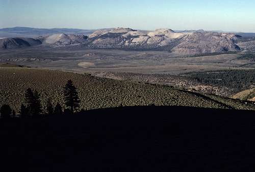
I used to enjoy studying topo maps of the Sierra Nevada for the purpose of weekend peak bagging trips. I was especially interested in the more easily reached trailheads of eastern Yosemite- only about 3 or 4 hours from where I lived in San Jose. Sometimes these trips would be done as dayhikes, but more often than not, I would do them as 'over-nighters' with a lightweight pack. The idea was to keep things as simple as possible in order to have as much flexibility as possible.
One summer in late July, four peaks on the western edge of the Mono Craters quad caught my attention: Kuna Peak, Koip Peak, Parker Peak and Mount Wood. A nice collection of peaks that ranged from between 12,500 and 13,000 feet in elevation. All were connected by a wide east-west trending ridge that had an overall length of about three miles. Traveling from peak to peak looked easy with very little elevation loss and gain. Easy money- but, how was I to access this interesting ridge? Therein lay the rub.
According to the map, there were a few different route choices- most of which I rejected right off the bat due to their lengthy approaches. It looked, to me, like the most interesting (and elegant) approach was from the Parker Lake trailhead. A maintained trail went as far as Parker Lake and from there, it would be all cross country: Up Parker Creek Canyon past the Parker Pass Trail to a point where the western end of my ridge could be gained near Kuna Peak. Then a long traverse eastward along the crest of the ridge tagging all those peaks followed by a steep drop down the eastern face of Mount Wood to some ranch roads that would, hopefully, connect with the Parker Lake Trail and the trailhead. All in all, an interesting looking loop.
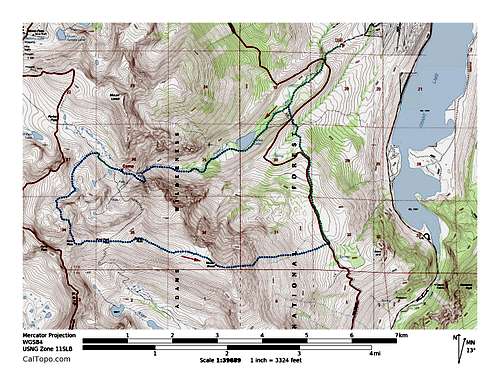
![Parker Loop Map]() Parker Loop Map
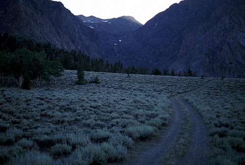
Parker Loop MapCould this be done? ...this canyon, I mean. Maybe, but I forgot to mention what appeared to be a significant impasse: At about the 10,000 foot level, a dark cliff adorned with a scenic waterfall in the middle of it, spanned the entire breadth of the canyon. It didn't look easy and would likely be the crux of the whole adventure. But I realized that it would be hella fun to try, so one night after work, I drove across California and arrived at the Parker Lake trailhead a short time after sunrise.
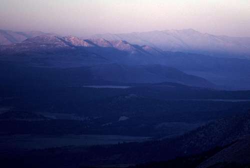
The easy hike up the trail to Parker Lake was pure delight. The weather was perfect. The morning air was warm, clean and rich with the aromas of both desert flora and conifers. As I got closer to the lake, more and more of the mysterious canyon beyond to the west started coming into view. It was an extremely impressive sight and I knew that this trip was going to be epic. (Okay, 'epic' was not a term that I would have used back then, but it sure seems to fit, so I use it now.)
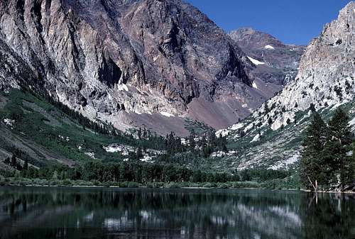
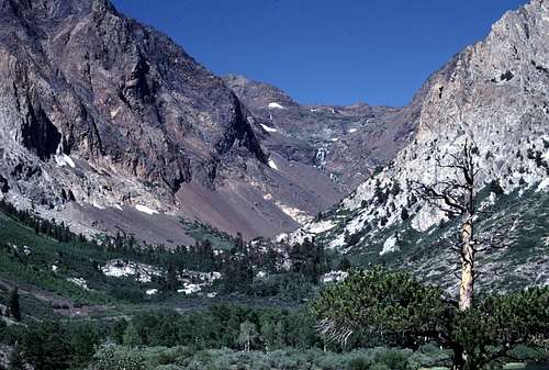
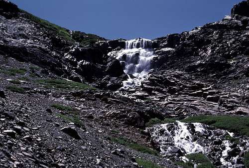
![Parker Lake and Canyon]() Looking up past Parker Lake to Parker Creek Canyon.
Looking up past Parker Lake to Parker Creek Canyon.
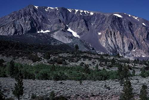
| ![Mount Wood]() North face of Mount Wood from the Parker Lake Trail.
North face of Mount Wood from the Parker Lake Trail.
|
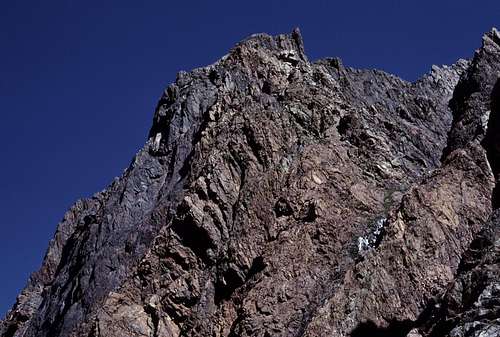
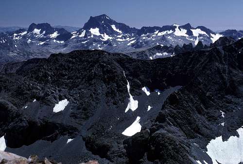
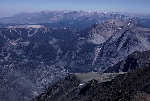
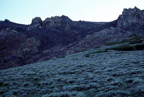
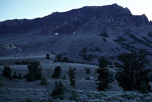
As I hiked, I gazed repeatedly up at the massive ridge of peaks that I would be traversing the next day- if I could get up this canyon, that is. The central section was dominated by huge colorful cliffs on the north side of Parker Peak. They rose dramatically above the steep talus and scree slopes south of the 'waterfall cliff'. Immediately above me and to the south was massive Mount Wood- the eastern most of the four summits that I would be attempting. The following day, if I made it up there, I planned to drop down the steep-looking east slope. In his climber's guide, Roper mentions it as a long, but easy route, but it didn't look very easy to me from where I was viewing it. Maybe it was because of my perspective from near Parker Creek. The north slope of the mountain, which faced me, seemed to end in some sketchy looking cliffs near the bottom. I made a mental note not to try to descend this way.
In less than an hour, I reached beautiful Parker Lake and the end of the maintained trail. I found a use trail that followed the lake's south shore around to the inlet side of the lake. There were a few groups of people scattered along the shore fishing at various spots. Tents were set up in a distant grove of trees across the calm surface of the lake- an idyllic spot for fishing enthusiasts.
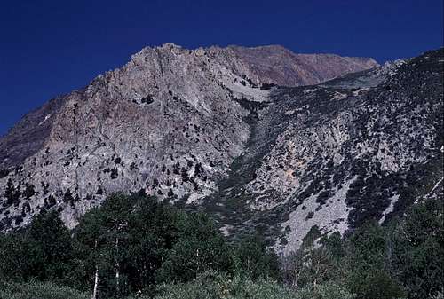
![Mount Lewis]() The southeast slopes of Mount Lewis from the Parker Lake Trail.
The southeast slopes of Mount Lewis from the Parker Lake Trail.
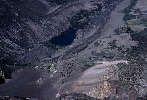
| ![Parker Creek Canyon]() View from beyond Parker Lake (and the trail) looking up Parker Creek Canyon. A nice collection of bushwhacking, tedious talus, and forbidding cliffs.
View from beyond Parker Lake (and the trail) looking up Parker Creek Canyon. A nice collection of bushwhacking, tedious talus, and forbidding cliffs.
|
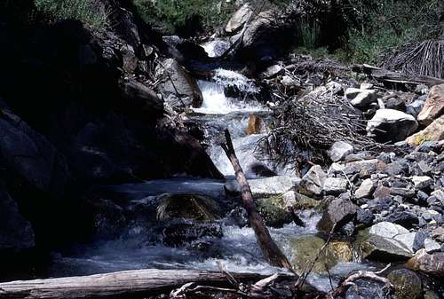
I left the use trail on the west end of the lake and continued up the canyon along some flats that consisted of a mixture of trees and brush. Luckily, the brush was thin enough so that there was no real bushwhacking. Soon Parker Creek was reached at the foot of a narrow channel between some short steep cliffs. The brush seemed to be much thicker along the tops of the cliffs, so I followed the boulders next to (and sometimes in) the creek. I found a nice spot to stop for a snack break near some pleasant cascades. I happened to look up from the pool I was sitting next to and saw, to my delight a medium sized bird sitting on a nearby rock bobbing up and down. A 'dipper'! Also known as a Water Ouzel. This was only the second or third time I'd ever seen one in the Sierra. I began to take my camera out of it's case, but it flew off upstream not to be seen by me again.
![Parker Creek]() A rest stop along Parker Creek.
A rest stop along Parker Creek.
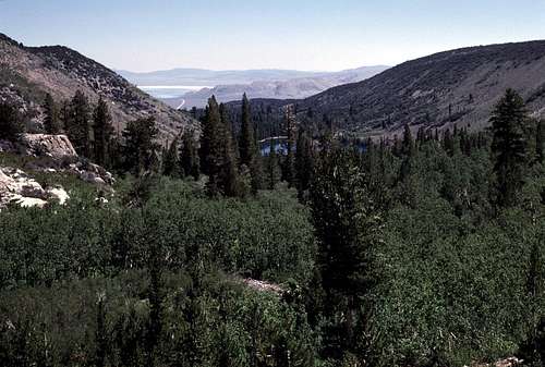
| ![Down Parker Creek Canyon]() A view looking down lower Parker Creek Canyon. Parker Lake is just visible through the trees. In the distance on the left is Mono Lake.
A view looking down lower Parker Creek Canyon. Parker Lake is just visible through the trees. In the distance on the left is Mono Lake. |
After my break, I reached an area where an easy looking breach in the cliffs and the brush led upwards away from the creek and toward what may have been some clearings. I followed this up and reached a rocky area surrounded by thick brush that turned out to be very difficult to travel through. After a lot of unpleasant work, I eventually found Parker Creek once again- now well upstream from its deep channel where I saw the Water Ouzel. I followed it by boulder-hopping along the shore and sometimes even wading through the creek itself to bypass the brush choked shores. This sucked. At one point a view opened up and I could see that just one or two hundred feet above the creek to the south were open talus and scree slopes. I decided to leave the creek and fight my way up to those slopes.
![Parker Creek Canyon]() I climbed up the south slopes of the canyon to escape the brush found along the floor of the canyon.
I climbed up the south slopes of the canyon to escape the brush found along the floor of the canyon.
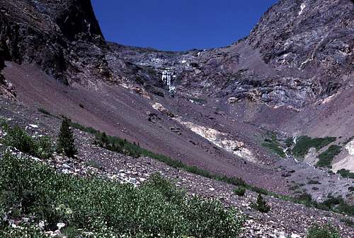
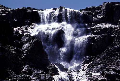
| ![Parker Creek Falls]() Approaching closer to the waterfall.
Approaching closer to the waterfall. |
This turned out to be a good decision. Once I reached the talus, my route was free and clear all the way to the waterfall cliff up ahead. The talus wasn't even steep and was very stable so I made pretty good progress for the next mile or so to the base of the waterfall. All along this part of the route, I studied the waterfall cliffs for weaknesses where I could possibly climb up to the hanging part of the canyon above the falls, but I didn't see anything that looked at all promising. My only choice seemed to be to bypass the cliff on the climber's left side of the canyon where there seemed to be a breach in the barrier at the extreme southern end.
After spending several minutes at the foot of the waterfall enjoying the sight and sound of the cascade, I began the long unpleasant climb up the steep slope toward the base of the cliffs on the north side of Parker Peak. The slope consisted of steep unstable talus and scree that caused me to slip backwards a foot for every two feet I gained. The climb was slow, tedious and exhausting.
![Parker Creek Waterfall]() Looking up from the base of the falls.
Looking up from the base of the falls.
| ![The Scree Slopes]() Scree and talus leading to a bypass of the 'waterfall cliff'. The impressive north cliffs of Parker Peak beyond.
Scree and talus leading to a bypass of the 'waterfall cliff'. The impressive north cliffs of Parker Peak beyond. |
Eventually, I reached the point that I'd seen from below where I could bypass the cliff and begin the long ascending traverse back to the center of the canyon just above the waterfall. I thought the worst was over, but I was wrong. Instead of steep talus, the traverse turned out to be along steep scree-covered slabs. Almost every step had to be carefully executed to avoid stepping on the unstable rocks that covered this slope. Imagine crossing a slope of solid rock covered with marbles and golf-balls and you'll know what I mean. The whole time I was crossing this slope, I was keenly aware of the cliff just below and I wondered if I could stop a fall if I should slip. I was using my ice ax as a trekking pole for extra stability along the way. If I slipped would my instincts take over? That is, would I try to self arrest on the steep rocky slope? What would be the consequences of that? “Just don't slip!” was all I kept thinking like a mantra as I slowly picked my way across.
![Scree Traverse]() A thin layer of scree covers a slab making this one of the most unpleasant segments of the trip.
A thin layer of scree covers a slab making this one of the most unpleasant segments of the trip.
| ![Parker Peak Crags]() Impressive crags on the north side of Parker Peak.
Impressive crags on the north side of Parker Peak. |
![Parker Creek Canyon Traverse]() Looking back at the unpleasant traverse above the waterfall cliff. Parker Peak's crags are beyond.
Looking back at the unpleasant traverse above the waterfall cliff. Parker Peak's crags are beyond. | ![Upper Parker Creek Canyon]() Easier climbing up ahead.
Easier climbing up ahead. |
Gradually, the slope eased and the going got easier. Finally, I reached the creek above the waterfall- actually creeks since two separate branches of Parker Creek meet at the very brink of the falls. I breathed a sigh of relief, and began climbing the slopes of yet another hanging valley for several hundred feet. Another waterfall was passed and I eventually reached the lip of the bench near the Parker Pass Trail very late in the afternoon. Time to look for a place to camp.
![Down Parker Creek Canyon]() Looking back down Parker Creek Canyon from above all the major difficulties. The waterfall is near the lower left where the two creeks meet. Parker Lake is far below.
Looking back down Parker Creek Canyon from above all the major difficulties. The waterfall is near the lower left where the two creeks meet. Parker Lake is far below.
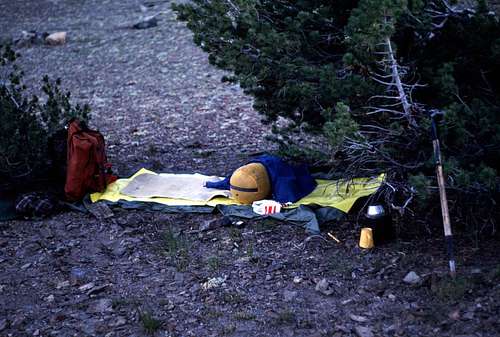
| ![My Camp]() My camp (actually more of a planned bivouac).
My camp (actually more of a planned bivouac). |
Well, actually what I had in mind was a 'planned bivouac'. My gear was very basic: sleeping bag, tube tent, poncho, sleeping pad, a few extra layers and a small cooking kit. All I needed was a water source and a view- not necessarily in that order. Luckily, there was an abundance of both, so I found a flat spot in the shelter of some scrub pines and enjoyed an evening meal of some macaroni and cheese with a couple of sliced precooked hotdogs thrown into the mix. Mmmmm. Very satisfying.
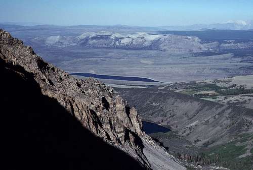
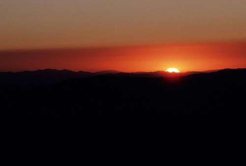
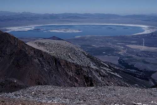
I spent the rest of the evening watching and photographing the wonderful views that surrounded my camp. The colorful rock and the impressive cliffs of the nearby Sierra peaks put on quite a show as the unseen sun slowly sank in the distant west. Far below, Mono Basin, dominated by the otherworldly array of the Mono Craters, presented itself as vast and as varied as it was beautiful. Deep forests, moonscapes, rivers, lakes, hot springs and volcanic features all bounded by alpine peaks, glaciers, and deep canyons. Who could ask for more? In the distance stood the mighty White Mountains changing colors rather quickly from, well- white, to orange and finally to deep red as it caught the last rays of the setting sun. It was the end of a fine, albeit difficult day in the High Sierra. Time for bed.
I was up before sunrise and ate a simple breakfast. My usual: A packet of Granola with freeze-dried blueberries and powdered milk. Just tear it open, pour in a cup of cold water and stir. Delicious and the best part was that it met my requirements for camping food: ridiculously simple to prepare, good to eat, and easy to clean up after. I ate, packed up and started hiking just as the sun cleared the eastern horizon.
![Sunrise]() Sunrise from my camp in Parker Creek Canyon.
Sunrise from my camp in Parker Creek Canyon.Less than 5 minutes later, I reached the Parker Pass Trail which was just above my campsite. From there, the easiest route to the top of my first goal- Koip Peak- would have been to turn south and follow the trail to Koip Peak Pass and head west from there to tag Koip and Kuna. But I wasn't in the mood for 'easiest' on that glorious morning. I wanted to spice things up a little, so I turned right and headed north along the trail toward Parker Pass. I was looking for the entrance to a trail-less hanging canyon to the west that would lead up towards the Kuna Glacier and, ultimately, the high saddle that lies between Kuna and Koip Peaks.
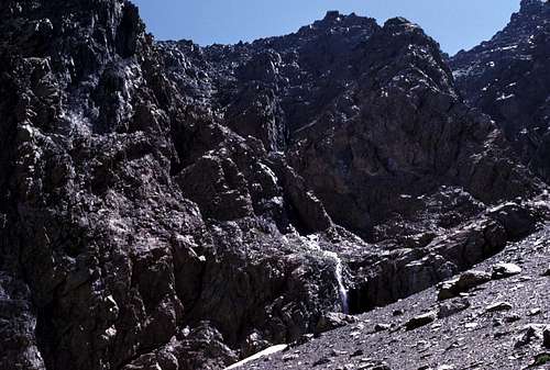
![Alpine Canyon]() A trail-less canyon heading up for Koip and Kuna Peaks.
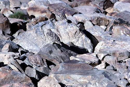
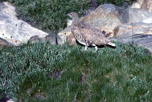
A trail-less canyon heading up for Koip and Kuna Peaks.I was only on the trail for less than about 10 minutes before I left it at a stream crossing that I knew would lead westward up into the alpine valley I wanted to explore. Cross country travel was easy with a moderate amount of loose talus and a small amount of unpleasant boulder hopping. I was startled by a small flock of nearly invisible grouse that suddenly took off noisily right in front of me. They landed only about 20 feet away so I slowly approached them for a few photographs- setting them off into short flights again and again.
![Gaggle of Grouse]() Several grouse encountered in the canyon above the Parker Pass Trail.
Several grouse encountered in the canyon above the Parker Pass Trail.
| ![Dusky Grouse]() A High Sierra Dusky Grouse.
A High Sierra Dusky Grouse. |
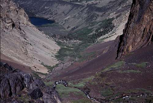
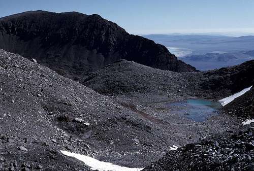
I passed a couple of small tarns and was surprised to find a rather large body of water that was not shown on the topo map (the old 15 minute map, that is). It was the color of turquoise from the glacial silt coming down from the Kuna Glacier just upstream. Cool! Finding an uncharted lake really enhanced my self illusion of exploring new territory. (This lake is shown on the newer 7.5 minute maps.)
![Uncharted Lake]() Newly 'discovered' lake.
Newly 'discovered' lake.
| ![Mount Lewis]() Dark mass of Mount Lewis is on the left. Below is the 'new' lake I discovered. This was taken from the terminal moraines of the Kuna Glacier.
Dark mass of Mount Lewis is on the left. Below is the 'new' lake I discovered. This was taken from the terminal moraines of the Kuna Glacier. |
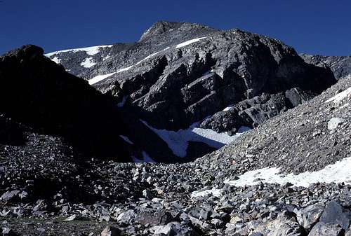
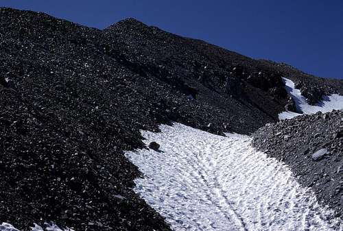
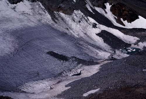
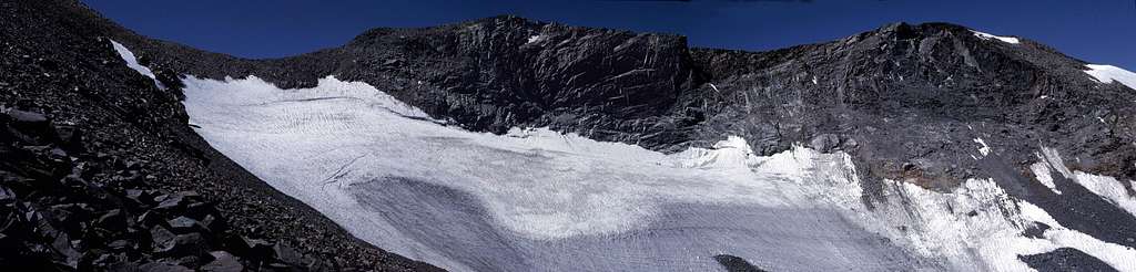
The canyon veered west from the 'lost' lake and began climbing in earnest up some morainal material. The rocks were surprisingly stable for a fresh moraine, but I was feeling the altitude and traveled rather slowly up the several hundred feet to the toe of the Kuna Glacier at about 12,200 feet above sea level. I was kind of surprised. I had no idea that this little glacier would turn out to be so impressive looking. Above the glacier loomed the dark northeast face of Kuna Peak. Judging by all the debris on the glacier, there must be a lot of rockfall coming down that crumbly face, though I didn't hear any on that day.
![Climbing Koip Peak]() Talus slopes on the northwest side of Koip Peak near the terminus of the Kuna Glacier.
Talus slopes on the northwest side of Koip Peak near the terminus of the Kuna Glacier.
| ![Kuna Glacier]() Looking down of the Kuna Glacier from Koip Peak.
Looking down of the Kuna Glacier from Koip Peak. |
![Kuna Peak and Glacier]() View of Kuna Peak and its glacier from the slopes of Koip Peak.
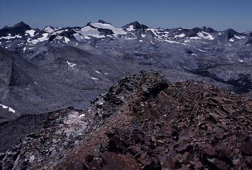
View of Kuna Peak and its glacier from the slopes of Koip Peak.I hiked a short distance up a rocky moat near the toe of the glacier and then turned east to climb the talus slopes to the top of the north ridge of Koip Peak. Soon I was at the summit enjoying magnificent views all around. I was particularly impressed with the views toward the Lyell group of peaks and the Ritter Range.
![Mount Lyell Group]() View of Mount Lyell and the peaks of southeastern Yosemite National Park from Koip Peak.
View of Mount Lyell and the peaks of southeastern Yosemite National Park from Koip Peak.
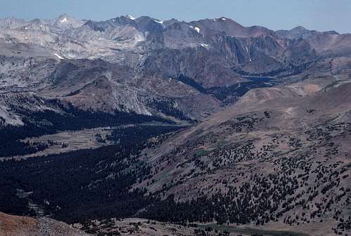
| ![View North from Koip Peak]() Dana Meadows and Tioga Pass is near the lower left of this photo. In the distance are the peaks of northeastern Yosemite National Park.
Dana Meadows and Tioga Pass is near the lower left of this photo. In the distance are the peaks of northeastern Yosemite National Park. |
![Mono Lake]() Mono Lake from the summit of Koip Peak.
Mono Lake from the summit of Koip Peak.I had arrived on the summit of Koip a bit later in the day than I was hoping to and so decided to skip a side trip that I'd planned to the top of Kuna Peak. I would save it for a later trip.
Eventually, I left the summit heading east and downhill toward Koip Peak Pass. I passed a small group of backpackers that had left their packs at the summit of the pass to pursue the summit of Koip. We exchanged greetings before continuing in opposite directions. They seemed to be a happy lot, but then who wouldn't be in this fine alpine setting on such a gorgeous day.
![Parker Peak]() Looking east at my intended route toward Parker Peak and Mount Wood. Koip Peak Pass is below.
Looking east at my intended route toward Parker Peak and Mount Wood. Koip Peak Pass is below.I crossed Koip Peak Pass 'against the grain', as it were, and continued up about 6 or 7 hundred feet to the top of Parker Peak. Another wonderful view was enjoyed as I rested and even napped for quite a while to recover from the effects of altitude which were causing me to travel very slowly in spite of the easy terrain along the crest of this ridge. I ate some 'gorp' and jerky and soon I was up on my feet refreshed and ready to continue.
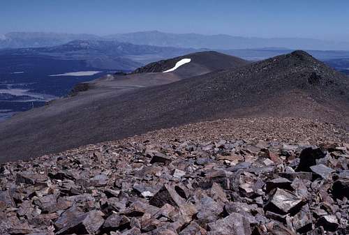
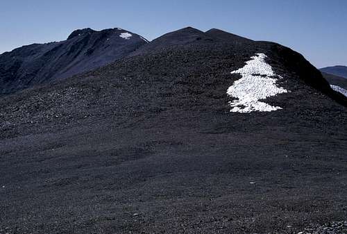
![Koip Peak]() Looking back at Koip Peak from Parker Peak.
Looking back at Koip Peak from Parker Peak.
| ![Mount Wood]() Looking ahead to Mount Wood from Parker Peak.
Looking ahead to Mount Wood from Parker Peak. |
![The Ritter Range]() Ritter Range from Parker Peak
Ritter Range from Parker Peak | ![Parker Peak]() East slopes of Parker Peak from a subsidiary summit to the east.
East slopes of Parker Peak from a subsidiary summit to the east. |
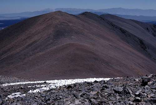
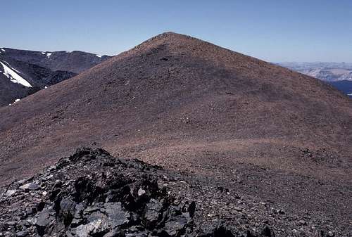
The segment between Parker Peak and Mount Wood was very easy. Just a stroll across a gently undulating plateau- all at about 12,500 feet or higher. I thoroughly enjoyed this part of the trip and would have enjoyed it even more if I wasn't so tired and if it hadn't been so late in the day. I was also getting concerned about what descending the east face of Mount Wood would be like. The contours on the map made it look quite steep. I was wishing that I had taken the time to photograph and study the face from below prior to this trip.
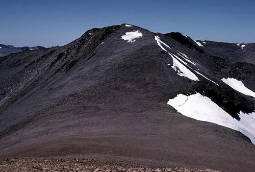
![Mount Wood]() Looking at the easy approach to Mount Wood from east of Parker Peak.
Looking at the easy approach to Mount Wood from east of Parker Peak.
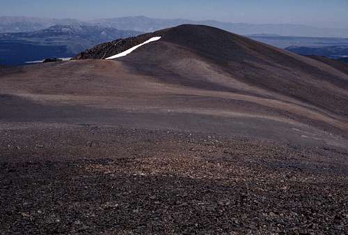
| ![West from Mount Wood]() Looking west from Mount Wood at Koip Peak (left) and Parker Peak (center).
Looking west from Mount Wood at Koip Peak (left) and Parker Peak (center). |
Finally, I reached the summit of Mount Wood and stopped to enjoy another fine view. This eastern-most peak along the ridge I'd been following juts way out over the Mono Basin and the views of this vast region and beyond were unforgettable. If only I could have sat down and taken the time to absorb it all, but my internal clock (I almost never carried a watch in those days) and the angle of the sun was telling me to keep moving.
![South from Mount Wood]() Looking south from Mount Wood. June Lake ski area is on the left. To the right are Carson Peak and San Joaquin Mountain.
Looking south from Mount Wood. June Lake ski area is on the left. To the right are Carson Peak and San Joaquin Mountain.
| ![Parker Lake]() Looking down at Parker Lake from Mount Wood.
Looking down at Parker Lake from Mount Wood. |
Soon I arrived at the brink of the east face and looked down. It was indeed steep, but not fearfully so. What concerned me was the abundance of loose rock lying on the slope. It reminded me of the steep loose traverse I did the day before to bypass the waterfall cliff. I had been hoping to be able to 'boot ski' down sand and rubble to the bottom of the face, but apparently, I was going to have to carefully pick my way down inch by inch. Drat!
The east face just below the top consisted of two broad chutes separated by a shallow rib. I ruled out the rib since it appeared too 'craggy'. Both chutes 'funneled' steeply down into rocky gullies that couldn't be seen from above due to the increased steepness. I decided to take my chances with the chute on the skier's left since it was closer to the car.
![Mount Wood East Slope]() Looking down the chute I chose to descend on Mount Wood.
Looking down the chute I chose to descend on Mount Wood.Picking my way down that steep funnel was just as unpleasant as I thought it would be. Just like the traverse near the waterfall, it was steep solid rock with plenty of footholds but with randomly scattered marble and golf-ball sized rocks covering much of the slope. Staying focused was obligatory. I hoped that the gully below the funnel would be easier, but it turned out to be more of the same- only steeper.
![Descending Mount Wood]() In the gully below the funnel on the east face of Mount Wood.
In the gully below the funnel on the east face of Mount Wood.The sun was gone now- too far to the west to provide any warmth to the chilly air in that gully. There was an endless series of short steep dry waterfalls to down-climb. Much of it was class 3 and couldn't be seen from above due to the steepness. I worried that I might get 'cliffed-out'. Then what? The thought of having to climb several hundred feet back up to the top to try a different chute seemed unthinkable.
Eventually, I came to somewhat easier ground and I began to angle down toward the skier's left in order to exit from the rocks at the top a a steep brush covered alluvial slope. What a relief that my chosen route did not end in a cliff. Later I saw that the other chute- the one further south- did end in a cliff. That would have really sucked.
![Mount Wood East Face]() From the alluvial slopes looking back up the east face of Mount Wood.
From the alluvial slopes looking back up the east face of Mount Wood.
| ![Mount Wood Alluvial Slopes]() Looking across the alluvial slopes below the east face of Mount Wood.
Looking across the alluvial slopes below the east face of Mount Wood. |
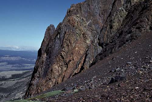
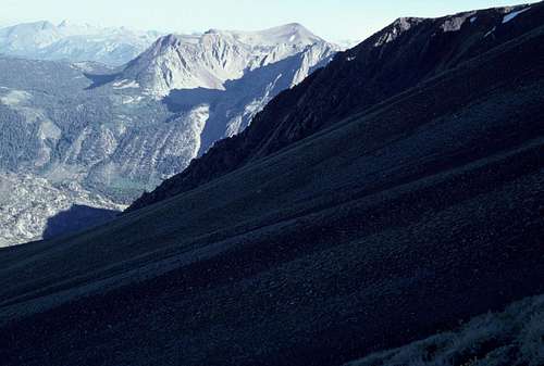
The knee deep brush on the alluvial slope was tedious, but easy to travel through and at long last, I reached a north-south trending dirt road at the base of the slope. I had descended about 3500 feet below the top of Mount Wood. Fifteen hundred feet of that descent was in that miserable rock gully- two thousand feet was on the alluvial slope. Looking back up at the mountain, I was surprised at how difficult it looked. If I had taken the time to study the route before the trip, I just might have abandoned the idea of descending it which probably would have made me seriously reconsider the plausibility this entire trip.
![Mount Wood East Face]() Mount Wood East Face
Mount Wood East Face
| ![Dirt Road Below Mount Wood]() Looking south along the dirt road I reached at the foot of Mount Wood.
Looking south along the dirt road I reached at the foot of Mount Wood. |
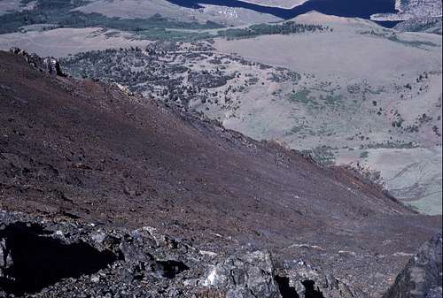
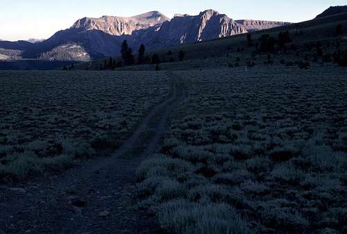
After a much needed snack break, I turned north and started following the road toward Parker Creek and my car. The sun was already down behind the Sierra to the west. A quick glance at the map confirmed that I still had more than four miles to go. There was no way I would make it back before dark, so I set a nice relaxed pace and enjoyed the view as I hiked.
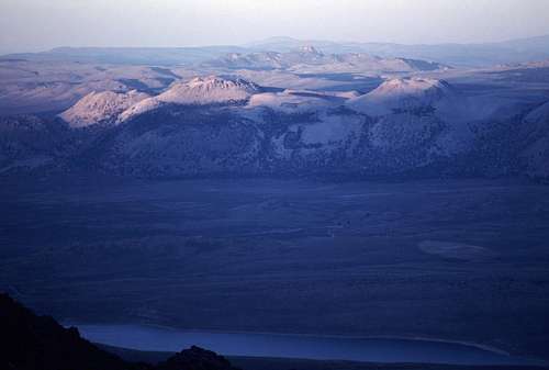
![Mono Craters]() Looking at the Mono Craters from the dirt road I was hiking at the foot of Mount Wood.
Looking at the Mono Craters from the dirt road I was hiking at the foot of Mount Wood.
| ![Parker Creek Canyon]() A last view back up Parker Creek Canyon as the day was ending.
A last view back up Parker Creek Canyon as the day was ending. |
After a couple of miles, I came to the high lateral moraines of the prehistoric Parker Glacier. Beyond the moraines was the Parker Lake Trail which would lead me back to the trailhead. I found what looked like the start of a cutoff trail that, according to the map, crossed over the moraines and ended at the Parker Lake Trail. The junction was near a muddy creek bed. The area was thick with brush and it was apparent that cattle- a lot of them- had overrun everything as far up and down the creek as I could see. All signs of a trail were pretty much obliterated by countless hoof prints in the mud and the dirt.
I hunted around for a significant amount of time for any sign of a trail beginning beyond the mud, but didn't have any luck. I was quickly overcome by darkness as I searched, so I got out my headlamp and started using it. It was getting late and I was desperate to get back to the car. I realized that I had no choice but to 'plop' my way across the slippery mixture of mud and cow poop and start climbing straight up the side of the moraine. It was only about 250 to 300 feet high, but it was kind of steep and covered in waist high brush. It was exhausting work and I began to sweat in spite of the chilly night air. When I was about half way up I suddenly burst out of the brush and onto a hoof print covered trail that diagonally ascended the slope. Gratefully, I followed this up to the narrow crest of the moraine.
Just beyond the crest of the moraine was a wall of vegetation higher than my head. I desperately hiked first west and then east along the crest looking for the continuation of the trail or some kind of breach in the wall or brush. There were a lot of hoof prints up there, but I couldn't find anything that headed in the direction that I needed to go. I was shivering from the sweat that I'd worked up while climbing the south side. This really sucked!
Finally, I resigned myself to fate and began the exhausting work of shoving my way through the brush on the north side of the moraine. Luckily, after only about 50 feet of misery, the brush thinned enough to make travel much easier. I made it down the remaining 300 feet or so without too much trouble and arrived at the foot of the moraine- amid several surprised cows. They didn't seem very happy with my sudden arrival and- to be honest- I wasn't very happy to see them either. A couple of them stamped and lowed quietly as I passed by.
I hiked north through dark bushes and trees until- finally- I stepped onto the Parker Lake Trail. Mentally, I got down on my hands and knees and kissed it. The night was moonless and dark, so I continued to use my headlamp for the rest of the way back to the trailhead. Not surprisingly, mine was the only vehicle still left in the lot. As I started the engine, I noted the time on the dashboard clock: 10:30pm. Holy s**t! What a long long day! Now for the 325 mile drive back to San Jose so I could go to work tomorrow. Ugh!
As I often did, I pulled off to the side of Tioga Pass Road near the foot of the long steep eastern grade to check my oil level. When I opened the rear engine cover on the back of my VW van, I heard some very strange noises coming from the engine. What the... I shined my flashlight around the inside of the engine compartment, but I couldn't see anything that would be making such noises- weird squeaking sounds. Maybe there was a vacuum leak in one of the engine components. Great! Just what I needed, but wait...
I continued to search and finally discovered the source down in the bottom of the well just below the main belt pulley. I carefully reached in and pulled them out one at a time: four tiny newborn rodents. Three were already dead- probably they succumbed from the terror of being confined in such a noisy toxic environment. The survivor continued to emit squeaks and to weakly wriggle around in the palm of my hand. I threw the deceased siblings into the bushes next to the road and put 'Mono'- as I called him- into a wad of tissues and paper towels that I had stuffed into my hat. I put the hat on the floor in front of a heater vent.
“Your mama sure made some poor decisions, Mono.” I shuddered at the thought of a rat or a field mouse using my engine as a maternity ward and possibly nibbling on a hose or a cable. His squeaking stopped not long after I resumed my drive home and I wondered if he'd passed on.
He was still alive when I got home. I transferred him to a bowl filled with paper towels and found an eyedropper that I thoroughly cleaned and filled with milk. He readily drank drop after drop of milk. Wow! I've got a pet! What a conversation piece this guy was going to be! I wondered what he was going to turn out to be when he grew up. I was hoping for a marmot, but I knew that that wasn't very likely.
![Mono]() Mono
MonoI kept him in the bowl near a lamp for warmth and fed him regularly. He survived for about 3 days and then finally succumbed. My heart was sad. What a short terrifying life. I guess I was a poor substitute for his mouse mama. I threw his tiny remains in the dumpster at the apartment complex- such is the miracle of life. Later, I spread my topo maps on my living room floor and began looking for my next trip.
Once again, the mountains were calling...


Comments
Post a Comment