
|
|
Mountain/Rock |
|---|---|
|
|
38.05267°N / 119.28921°W |
|
|
Mono |
|
|
Hiking |
|
|
Summer, Fall |
|
|
11568 ft / 3526 m |
|
|
Overview
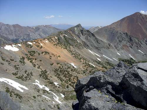 Peak 11,568 from Black Cat Peak
Peak 11,568 is located in the Hoover Wilderness just outside of the eastern border of Yosemite National Park. The summit is easily reached from Highway 395 from the Virginia Lakes Trailhead in less than 2 hours via a straightforward route. Despite its accessibility and incredible beauty, it remains unnamed. There is no summit register and no USGS marker.
Views from the summit are outstanding. There are dozens of high Sierra summits in the distance. This includes one of its closest neighbors, Dunderberg Peak.
The peak has a prominence of approximately 430', sharing a pass with nearby Excelsior Mountain.
The mountain can be climbed all year round with snow shoes needed in winter and spring, but the best time of year to hike it is late-June through early October.
Getting There
The trailhead starts at the end of Virginia Lakes Road. To get there, head 13 miles south from Bridgeport, California on Hwy. 395 to Conway Summit, 8,143'. At Conway Summit take a right on Virginia Lakes Road, and head 6 miles (west) to the trailhead at roads end. There is a bathroom at the trailhead and a good number of parking spots. Additional parking is available on the side of the road.
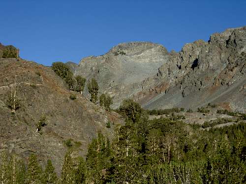 Peak 11568 from just above the trailhead
The trailhead starts on the right side of the road. The trail heads up a meadow, and then back into the forest. The trail stays mostly level for the first 1/4 miles, and then gets steeper as it passes Blue Lake. The trail levels out at the top of the hill, passes a small wooden structure, then gains elevation to Cooney Lake and Frog Lakes. At one point past Cooney Lake, the trail curbs back east. Do not take the trail. It actually continues on the other side of a river crossing.
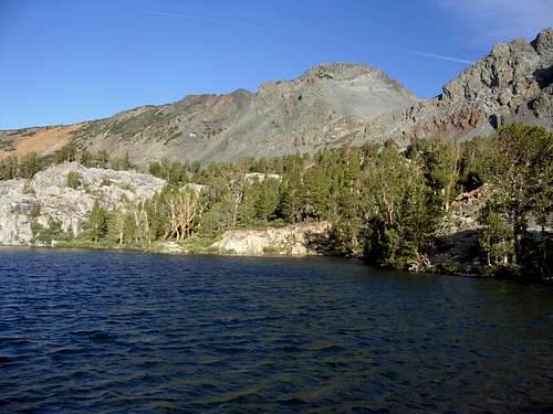 Peak 11568 above Cooney Lake
After the trail passes Frog Lakes, it gains elevation up to a pass. Peak 11568 rises on your right as you head up to the pass. Once you get to the top of the pass after 2.8 miles from the trailhead you are at about 11,126’. Take a right, and then head back east up to the summit; gaining about 442 feet in a little less than a mile.
The total round trip hiking distance from the Virginia Lakes Trailhead is about 7.5 miles, with a one-way elevation gain of about 1750 feet. There is some minor class 2/3 moves required in the last 30 feet, but nothing too difficult or dangerous.
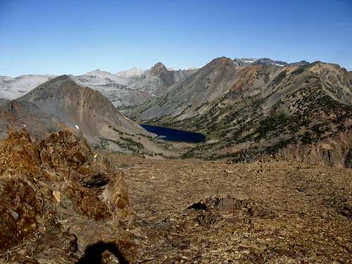 Summit view northwest looking towards Summit Lake
Red Tape
No permits are required for a day hike. We have slept in our cars overnight at the trailhead without any issue. Tent camping at the trailhead isn't allowed. Typically, overnight trips require a permit if choosing to camp in the Hoover Wilderness. These can be picked up at the Toiyabe NF Ranger Station 3 miles south of Bridgeport on US 395.