
|
|
Mountain/Rock |
|---|---|
|
|
33.56210°N / 112.0073°W |
|
|
Maricopa |
|
|
Hiking, Scrambling |
|
|
Spring, Summer, Fall, Winter |
|
|
1955 ft / 596 m |
|
|
Overview
 Peak 1955 from the north
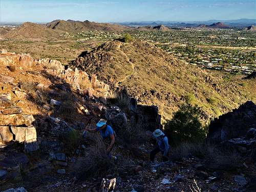
Situated 1.3 miles northeast of Piestewa Peak is a little mountain without a formal name. The summit is 1,955’, making it seem unimpressive. However, what makes this summit noteworthy is how impressive it actually looks. It has impressive rock spires and features, and is visually stunning. The mountain is made up of a half-mile long ridge. There are actually two summits separated by a saddle. The summit to the west is the lower one. However, both are worth a visit.Peak 1955 is easily accessible from the 40th Street Trailhead, south of Shea Blvd. It isn’t nearly as popular as its neighbors, Piestewa Peak and Dixie (aka Two Bit) Peak. However, it offers an opportunity for a rare chance at solitude in one of the most popular hiking areas in the city.
The shortest route to the summit is about a mile. However, there are plenty of ways to get more distance. There are multiple trails to the mountain, and other trails and mountains nearby.Hiking Peak 1955 is enjoyable and can be done year-round. Although it is recommended to hike it very early in the morning in the summer. The best time to hike in this area is between November and March.
Getting There
 Hiking up the summit block
The primary starting point is the 40th Street Trailhead at 9200 N 40th St, Phoenix, AZ 85028. When the parking lot is full, cars can park on the side of the road before the trailhead. Peak 1955 is located to the west of the trailhead. There are multiple ways to approach. You can approach from the north, south, or west sides. There is no direct route from the east, although a trail heads east behind the summit, and then another trail goes up the north side. These options involve between 470' and 530' of elevation gain.
A second option is to start at the popular Dreamy Draw Trailhead at 2421 E Northern Ave, Phoenix, AZ 85020. The trailhead can be reached from right off of Highway 51.
From Dreamy Draw, the summit can be reached in about 1 ¾ miles requiring about 750’ of elevation gain. A map is helpful, since there are many trails. However, as long as you are heading east from Dreamy Draw, you will reach the mountain.Finally, a third option is to park at the main Squaw Peak trailhead reached off of Lincoln via E. Squaw Peak Drive. Park on the north side of the parking area. Hike north up and over a pass, and then down towards Peak 1955. The summit can be reached in about 2 miles, gaining only about 700’.