
-
 5552 Hits
-
 0% Score
-
 0 Votes
|
|
Route |
|---|---|
|
|
44.11280°N / 115.0969°W |
|
|
Scramble |
|
|
Most of a day |
|
|
Class 3 |
|
|
Approach
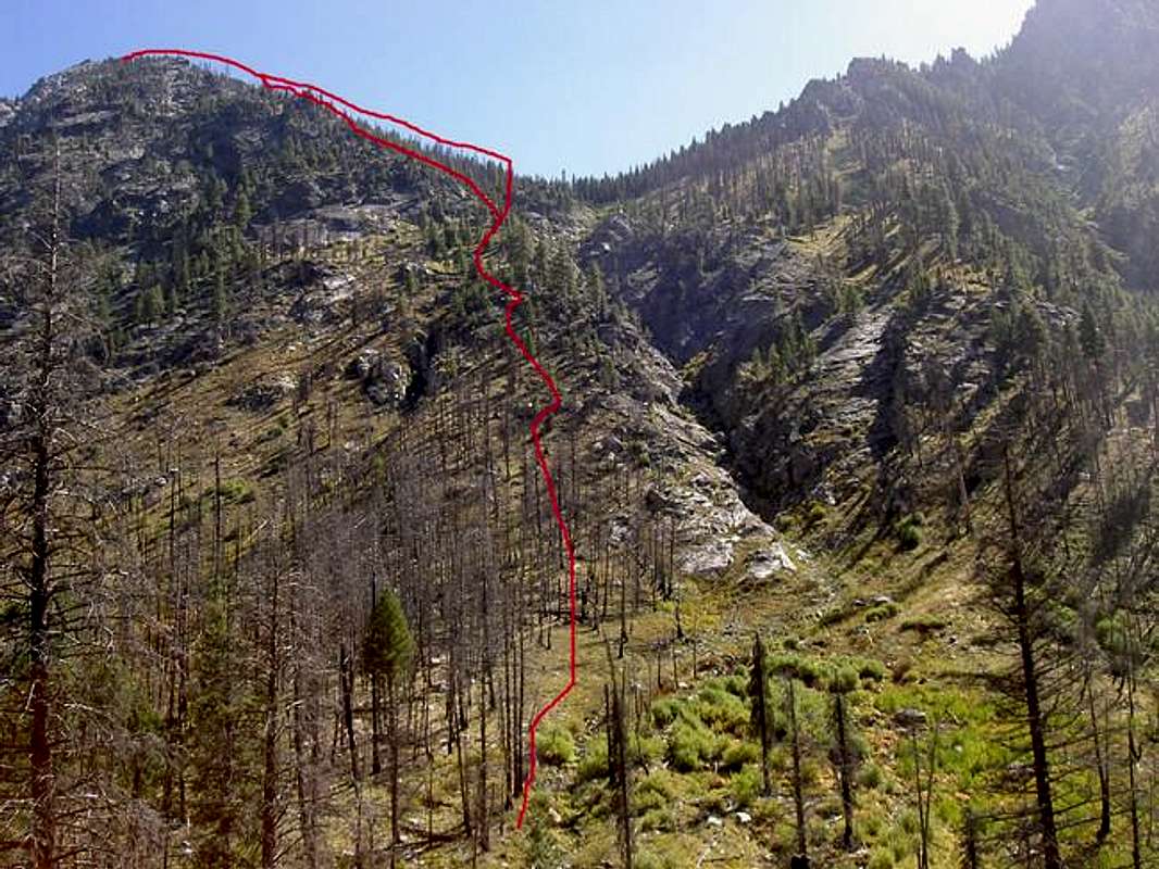
From the trailhead hike South along the Grandjean trail for 1 1/2 miles until it reaches the South Fork of the Payette River. Take the Baron Creek fork to the East (left) and continue up the trail for approximately 1 mile for the 9105 scramble. Look for the avalanched hillside with a path coming down from up and to the left (east). Cross Baron Creek where you can- can be very difficult in high water. You should be crossing the creek near the 5450 contour
Route Description
Scramble up a steep rock and grass covered slope angling slightly to the left (east) and avoid getting into any gulleys or onto any side ridges. Your aiming for the tree line that sweeps down from the ridge. Near the 8000 contour scramble more toward the east and into the prominent avalanche path that cleared away the trees. Follow this clearing as high as it will go and exit the trees just 500 feet below the summit. Another option is to go straight up to the ridgeline (don't veer left as much) between Point 7888 and Point 9105 and follow the ridgeline. The terrain doesn't become any steeper than what is experienced on the lower slopes.
Total Mileage / Elevation Gain (One-Way): 4.2 miles / 4178 feet

Essential Gear
Hiking Gear
Miscellaneous Info
If you have information about this route that doesn't pertain to any of the other sections, please add it here.