
|
|
Route |
|---|---|
|
|
32.32763°N / 111.13075°W |
|
|
Hiking |
|
|
Spring, Fall |
|
|
Most of a day |
|
|
Hike |
|
|
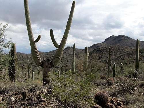
Overview
Picture Rocks is one of a number of dry washes that sits among the hills in the northeastern part of the western district of Saguaro National park. A network of local trails go up and down the hills and into some of the small “canyons” created by the dry washes providing great views of the cactus forest and the nearby mountains. The total length of the trails (as shown in the map below) is 13.6 miles. This allows the hiker to do a leisurely stroll, a long day hike or anything in between.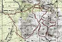 Map |
Getting There
From Exit 248 on I-10 in Tucson, turn west onto Ina Rd. Drive less than 3 miles and turn south onto Wade Rd. In less than a mile, the road turns west to become Picture Rock Rd. You will see the road going up to Contzen Pass, a saddle between two high points. Right after the saddle, there is a hairpin loop with a paved pull-off on the north side of the road. I saw no sign here but this is the trailhead.Route Description
The 10.7 mile complex loop described here will take you on most of the area trails.Although most of the trails were well-signed, I noted that some trails were missing signs. Carry a map and study it well.
From the paved pull-off, cross to the south side of the road and enter a dry wash. You will see a sign here. Follow the Cam-Boh Trail 0.4 miles west to the intersection with Ironwood Forest trail.
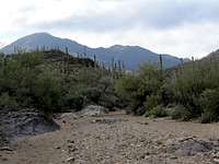
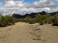
Ironwood Forest Trail 1.4 miles
Ironwood Forest Trail takes you mostly over a plain. You can look back to see the slopes of Safford and Panther Peaks.
 |  |
 |
Brittlebush Trail 1.0 miles
Ironwood Forest Trail eventually drops into a small canyon created by Picture Rocks Wash. Head south. After a short distance, the canyon splits. The left branch is Brittlebush Trail and follows the bottom of the canyon.
 |  |  Wasson Peak |
The trail eventually exits the canyon and goes up a slope to reach a saddle.
 |
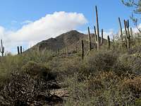
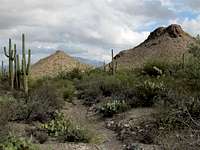
Thunderbird Trail 0.7 miles
The saddle sits to the north of Point 3037 ft. The trail descends into a valley and heads north.
 Point 3037 | |
 |  |
Cactus Canyon Trail 0.7 miles
You will then reach a junction. Right goes to Gila Monster Trail. Turn left onto Cactus Canyon trail and go up to a saddle and then down into a valley to reach Coyote Pass Trail and eventually Picture Rocks Canyon.
 |
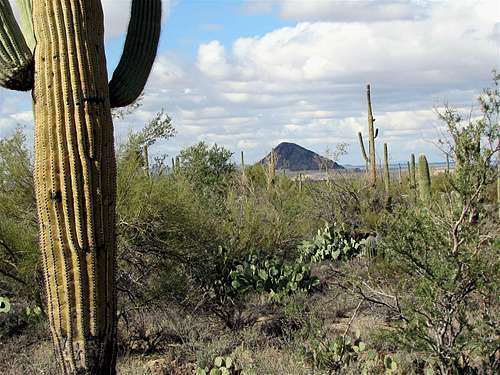
Picture Rocks Wash Trail 1.5 miles
Get into Picture Rocks Canyon and follow it south to reach the spot you were earlier.
 Wasson Peak | 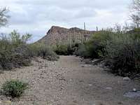 |
Take the right branch and continue up Picture Rocks Canyon.
 |  |  |
The trail eventually gets out of the canyon and goes up a slope to a 2900 ft saddle on the north side of Point 3263 ft.
 Point 3263 ft |  |
 2900 ft Saddle | |
Prophecy Wash Trail 2.1 miles
The trail descends on the west side of the saddle.
 |
It then gets onto the surface of a dry wash and continues northwest. You will have good views of Safford and Panther Peaks. The trail crosses Golden Gate Road (dirt) and continues another 0.6 miles.
 |  |  Safford & Panther Peaks |
 Safford & Panther Peaks | ||
Cam-Boh Trail 2.0 miles
Turn right and head east on Cam-Boh Trail toward the trailhead. You will cross Golden Gate Road again.
 | |
 |  Contzen Pass |
Weather Forecast & When to Hike
See the forecast for the nearby city of Tucson.Fall and spring are the best time to hike. Summer can become extremely hot.