
|
|
Route |
|---|---|
|
|
32.21757°N / 111.10297°W |
|
|
Hiking |
|
|
Spring, Fall, Winter |
|
|
Most of a day |
|
|
Hike |
|
|
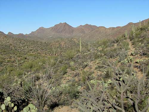
Overview
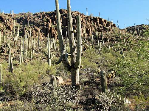
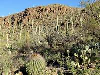
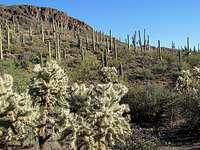
Yetman Trail is a 6 mile long trail in Tucson Mountain Park near the city of Tucson, AZ. The trail connects a spot on Gates Pass Rd to Camino de Oeste in Tucson. It takes you through a number of valleys providing you with great views of the mountains and the beautiful cactus forest that covers them.One mile from Camino de Oeste Trailhead, you will see the remains of a stone house known as Bowen Ranch. This house was built in the 1930s by a newspaper editor who lived in the area for a few years.
 Yetman Trail |
Getting There
Directions to Gates Pass Rd Trailhead:Take exit 99 on I-19 and head west on Route 86 (Ajo Highway). After 5 mile, you will reach the junction with Kinney Rd. Turn right (north) and drive 5 miles to reach Gates Pass Rd. Turn right (east) onto Gates Pass Rd and drive 2 miles. Just before Gates Pass, you will see a parking area on the right side of the road.
Route Description
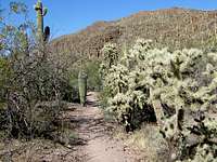
This description takes you from Gates Pass Rd to Camino de Oeste.All distances are per my GPS. The trail is generally well signed. In a few places, however, I did come across unsigned intersections. If you study your map, the path will be obvious.
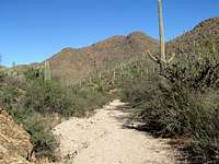
Starting at Gates Pass Rd Trailhead, follow the trail uphill to the 3182 ft Golden Gate Pass. Just before the pass, you will reach the signed junction with Golden Gate Trail.
 Near Gates Pass TH |
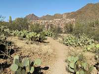
At Golden Gate Pass, you can look southeast to see a suburb of Tucson known as Tucson Estates. The 3852 ft Cat Mountain is also well visible.
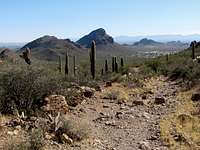 Cat Mountain |
Golden gate Pass sits between the 4288 ft Golden Gate Mountain to the south and unnamed Peak 3988 ft to the north. Follow the trail downhill heading southeast to reach a low point where you cross a dry wash and reach the junction of a few other trails that exit the park and go to Tucson estates.
 Peak 3988 ft | |
 Slopes of Golden Gate Mtn |  Slopes of Peak 3988 ft |
You can now look back to get a good view of Golden Gate Pass.
 Golden Gate Pass |
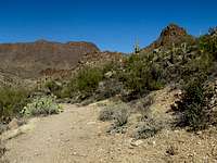
The trail goes uphill to reach a high point where you enter a tight valley between two mountains. It then goes to the bottom of a dry wash and continues to head southeast going downhill.
 | ||
 |  |  |
 |  |  |
 | ||
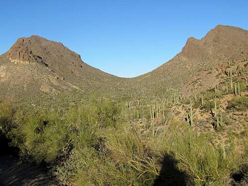
The valley then opens up and you reach a plain at the junction of the Starr Pass Trail. Yetman Trail makes a 90 degree turn and heads north going uphill again. You can look back east to get glimpses of Golden Gate Mountain and Peak 3988 ft.
 Peak 3988 ft |  |  Golden Gate Mountain |
Cat Mountain will be well visible to the south.
 Cat Mountain |
You will then reach another junction where Yetman Trail heads northwest and goes up to reach a 2950 ft saddle to the north of Point 3060 ft.
 Point 3060 ft |
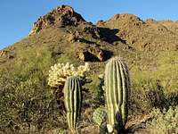
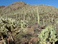
You will see two trails at this pass. You must follow the one that descends into the valley. The trail eventually gets into another dry wash and continues northwest. The 4140 ft Bushmaster Peak will be in good view.
 Bushmaster Peak | ||
 |  |  |
You will then reach the remains of the stone house.
 Stone House |  Stone House |
The trail gets into a tight valley among the mountains and turns northeast to end at Camino de Oeste Trailhead.
 | ||
 |  |  |
 | ||
Essential Gear, Red Tape & Weather
Hiking equipment.No permits or fees for day hikes. See the site for Tucson Mountain Park for all rules and regulations.
See the forecast for the nearby city of Tucson.
Fall and spring are the best time to climb. Summer can become extremely hot.
External Links
http://hikearizona.com/decoder.php?ZTN=1267http://sunnyarizona-walksandhikes.blogspot.com/2009/11/david-yetman-trail-tucson-hike-on.html
http://www.localhikes.com/Hikes/YetmanTrail_8520.asp