
-
 4014 Hits
-
 76.66% Score
-
 7 Votes
|
|
Trip Report |
|---|---|
|
|
49.17901°N / 20.08846°E |
|
|
Oct 2, 2011 |
|
|
Hiking, Scrambling |
|
|
Fall |
The plan
Initially, I wasn't planning at all to be in Tatry this weekend. Originally, the plan was to drive to Amsterdam, participate in a anarchist demonstration there, get drunk and stoned, and drive back to Kraków for work on Monday...It didn't all work out. Probably for the better, because 64 people got arrested in Amsterdam that Saturday, and my plans did not include spending time in a Dutch jail and having to explain that to my boss. Thursday my car broke down, two hours before scheduled departure. My boss called me thursday evening, told me I had to get back to work because some reports that were supposed to be filed never happened, and I ended up being at work until 23:30. Friday I had taken off, expecting to be smoking some of the good stuff, instead I had to ensure that everything was sorted at work because one of my colleagues effed up. I was not very happy...
During a smoking break, Katalin, my Hungarian colleague asked me whether I wouldn't feel like hiking in Tatry that weekend. Having my original plans for the weekend not working out anymore, and without a vehicle, this was a welcome diversion from what I was thinking my weekend would turn out to be.
Saturday, the first of October we left Kraków, first to the spa in Białka Tatrzańska, later to spend the night in Jurgów for an early morning start to Slowakia... At 7:15 am we left Jurgów for the Popradske Pleso car park, where we arrived at 8 in the morning.
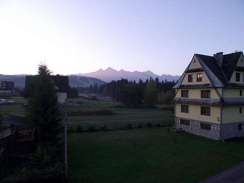 Tatry from Jurgów
Beer 1&2, Popradske Pleso, 9:00 am, 1515 metres
The first hour we walked the road from the car park to the actual hostel at Popradske Pleso. The road climbs from 1246 metres to 1515 metres over about 2.8 kilometres, and is generally off-limits to people without a permit. We still saw some people driving there which obviously didn't belong there (Czech and Polish plates) but we did it legally. Me and Katalin arrived at the hut the earliest, and considering my breakfast only consisted of coffee and a fag, it was time for some real food (I'm not a big eater the first two hours after waking up) I had Slowakian goulash (my Hungarian friend wants to stress the "Slowakian" part) and some beer. Then the rest arrived and I had some Śliwowica with Arek. At around 10, we were on our way again, through the upper part of Mengusowska Dolina, to Żabie Plesa Popradske Pleso
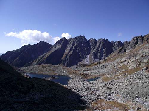
Beer 3, Żabie Plesa, 11:20 am, 1919 metres
 Low Tatras from above Popradske Pleso
At around 1600 metres we climbed above tree line into the krummholz zone, consisting mainly of Scots Pine, with pine bushes getting shorter and shorter up to about 1850 metres where we entered the Alpine tundra. Although it's name would suggest otherwise, the lakes at Żabie Plesa are way too cold for frogs, or any cold-blooded animal, for that matters, to survive in.
 Żabie Plesa and Satan
It was a nice place to crack open another beer and have some more food though. I annoyed Katalin with lighting another cigarette. It was little after 11 in the morning and already quite warm, around 12C/54F. Żabie Plesa lies in a cirque down the bottom of Rysy and Vysoka, and it also marks the end of the "walk-up" part of the trail, up from here there is (mild) scrambling involved, in the somewhat more difficult parts made easier with chains bolted in place. After a 25 minute stop we continued our way up to the famous Chata pod Rysami.
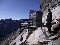
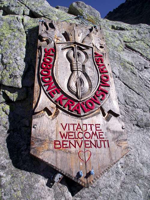 Welcome to Chata pod Rysami
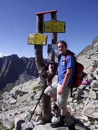 Posing with the Grim Reapers' scythe
Beer 4 & 5, Chata pod Rysami, 12:30 pm, 2253 metres
Chata pod Rysami lies on a bit of relatively flat ground looking over the cirque in which the lakes of Żabie Plesa are located. The approach is littered with all kinds of funny signs once one passes the arch of Tibetan prayer flags, one can pose with the Grim Reaper's scythe, or in front of a sign that says you're entering Al-Qaeda territory... Chata pod Rysmi is the highest hut in Central Europe outside the Alps, and the trail from there to the summit of Rysy holds this distinction for the highest non-technical trail. The place is also famous for it's outhouse, which discharges down a corrie... Kegs are being brought up by hikers with a special sort of backpack that holds one keg. It explains why the beer there is twice the price of the beer down at Popradske Pleso. 700 metres of climbing with a >30 kilo backpack will do that...Thankfully, they also sold cigarettes here, as I was almost running out.
At the time of writing, there is a massive renovation taking place at the hut, and they're doing a fundraiser for that. 17000 euro will secure the hut's future, they're up to close to 13000 now, but buying an extra beer or any of their souvenirs will help.
 The outhouse...
 Looking at the Polish summit of Rysy
From Chata pod Rysami we walked up to the col, called Sedlo Vaha, at 2340 metres between Rysy and Vysoka. 20 minutes to the top from here. This is the head of Bielowodska Dolina, looking in to Łysa Polana. While waiting for the rest of the group to arrive, I noticed that looking towards Łomnicza and Gierlach, there was no snow in the High Tatry, not even the supposedly perennial fields in north-facing corries. As far as I know, this hasn't happened before in recorded history, but the late summer has been particulalry dry and warm. I was standing here in 13 degrees C / 55 degrees F, in the first weekend of October in brilliant sunshine. From the col at Valka, it's a 20 minute hike up to the summit of Rysy, at 2503 metres. We reached it around 1:30 pm.
Beer 6, summit of Rysy, 1:30 pm, 2503 metres.
The summit of Rysy, at 2503 metres, is the highest place in the Tatry one can reach legally without the use of a guide or without any technical climbing. At the summit, we lingered for about an hour, until around 2:30. The weather was great, around 11C/52F and sunny. The Polish summit (2499,6 metres) and the Slowakian summit (2502,8 metres) are connected by a col at around 2491 metres. Makes for easy border crossings, and until 2008, this was an actual port of entry for both countries.The Polish summit, although more than 3 metres lower, is actually much more crowded than the Slowakian summit, this because the Polish summit is the country highpoint. We visited both summits, although I saved my beer for the Polish summit. We stayed over an hour all together, enjoying the views and the weather. Like mentioned before, there was no snow to be seen anywhere in Tatry, which, as far as I know, is unique. At around 2:45 pm, we started our descent back down.
 Looking in to Podhale from the summit
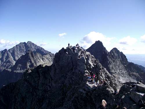 Some of the tallest mountains in Slowakia
Beer 7 & 8, Chata pod Rysami
 Around the Alpine tree line...
Sometime before 3:30, we got back to Chata pod Rysami. Everyone needed to use the loo, so, we stayed here for a while. Here was also where we met up with two girls from Kraków, which had decided to climb up from Łysa Polana and Morskie Oko, and now wanted to go down the easier, Slowakian side. Katalin actually wanted to do it the other way around, but I wasn't entirely for that, knowing that trail, and knowing that descending it down to Morskie Oko after a few beers is almost like asking for a rescue or worse... Neither did the rest of the group though, because from Morskie Oko it's a long way to Popradske Pleso, which necessitates splitting the group so one half can fetch the cars.
The way back down went quite fast, and we reached Żabie Plesa within half an hour, and another half an hour to the hostel at Popradske Pleso. Here we ran out of beer, so I went down to get more.
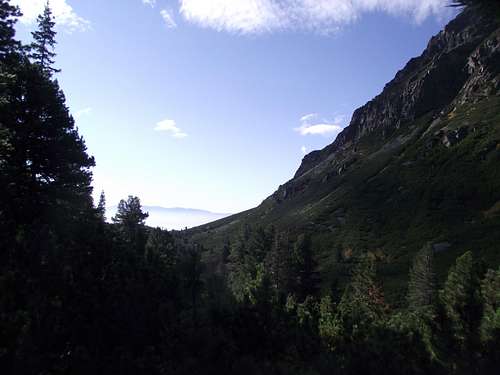
In the 1000 metre descent from the summit of Rysy down to the hostel at Popradske Pleso one travels through 4 distinct climate zones, first down to around 2200 metres there's mainly lichen and mosses growing. Average temperatures are here always below freezing, except for maybe 2-3 months during the summer, but still frost and snow can be expected any time during the year. This is remniscent of the climate of the colder low-elevation parts of Svalbard at 81N, 32 degrees in latitude further north from the Tatry.
Once one reaches Chata pod Rysami, grasses start to appear. Most noticably in the corrie down the discharge of the outhouse, obviously humanure has it's qualities, considering that corrie looked at least three shades greener than the others, but in general, at around 2200 metres one enters the Alpine tundra. More vascular plants appear, frosts start to become increasingly uncommon here during the summer season. Snow may still linger well in to June or in some cases, even July though, and the growing season is still short, roughly around 40-60 days around 2200 metres, 20 days more around 1900 metres, but in summer daytime temperatures regularly top 10C/50F and stay above freezing at night. This is remniscent of the climate of Bjornoya at 74N, or the Longyearbyen valley, the warmest part of Svalbard at 78N
 Krivan (2495m)
At around 1850-1900 metres, dwarf Scots Pine starts apprearing. First in some patches, but forming a blanket downwards of 1800 metres. The Krummholz zone marks the beginning of where woody plants can grow. This region is generally frost-free for about 2 months in the upper reaches, down to about 3-4 months in the lower reaches. The height of the dwarf Scots pine tells one about high high the snow usually lies during winter, as in a non-tropical climate trees need a summer average of about 10C to grow. Trees can grow at lower summer averages, but in this case the winter averages can not be far below freezing. This is why one can see forests on Tierra del Fuego where the summer averages often don't go north of 8-9C, but the winters barely drop below the freezing mark, or in some high-insolation (sub)tropical, low- to non-seasonality climates, where tree lines have been observed as high as the 6C maximum average isotherm.
What these dwarf pines actually do, is trap the snow as a isolating blanket, allowing the winter minimums around them to not fall far below freezing, which in turn allows them to grow at these spots. The opposite works as well, in Siberia and parts of Canada, tree lines have been observed as far south/low as the 12C isotherm because of the brutal winters there... The lower bit of the Krummholz zone, at around 1600-1650 metres, is comparable in climate to the coldest, low-elevation parts of Lappland at around 70-71N.
 Satan
SatanFinally, at around 1650 metres, the first isolated willows and birches start growing above the dwarf pines, followed at around 1550-1600 metres by a dense spreuce forest. This marks the beginning of the actual tree line. Summer averages here are solidly above 10C for at least 1 month, and there is no frost for at least 4 months. Climatologically speaking, we have crossed from the ET zone in to the Dfc zone here, although, as noted above, the ET zone is diverse enough to be divided in to at least three different (sub)zones. Popradske Pleso, at 1515 metres, has on average two months above 10C, 6-7 months of snow cover and 4 months frost-free. This climate is remniscent of the taiga of Norrbotten or Vasterbotten in Sweden, near the Arctic Circle
Beer 9, Popradske Pleso
At 5 in the afternoon, we arrived at the beginning of the road at Popradske Pleso. The group had already split in two here, one car immediately wanting to go back to Kraków, another three cars wanting to enjoy one more beer in the mountains before heading out.Walking down the road to 1246 metres where the car was parked, there is one more change in the environment; below 1350-1400 metres, the height of the trees start going up from 15-20 metres to more than 30 metres. Also, Spruces start to dominate here, with incidentally a tall Scots Pine inbetween. The car park at 1246 metres is as such comparable to Central Sweden at about 63N. We got to the car at around 6 pm, this is where I had my tenth and last beer. Obviously, I wasn't driving today. The drive back to Kraków took over four hours, thanks to traffic on Zakopianka. Apparently we weren't the only ones wishing to enjoy the last beautiful weekend in the mountains...
[img:751276:aligncenter:medium:Satan]
The beers enjoyed on this trip were mainly Saris, although I had taken Warka up, which I enjoyed at Żabie Plesa, and a Żubr which I enjoyed on the Polish summit of Rysy.


Comments
Post a Comment