
|
|
Mountain/Rock |
|---|---|
|
|
39.36622°N / 119.8894°W |
|
|
Washoe |
|
|
Hiking, Scrambling |
|
|
Spring, Summer, Fall, Winter |
|
|
8364 ft / 2549 m |
|
|
Overview
Church's Knob is located in the Mount Rose Wilderness. It is a rounded, brush-covered summit with open 360 degree views. It rests just to the north of Church's Pond, a small pond below Mount Rose. For that reason, I am referring to it as "Church's Knob" although it does not have an official name. It is marked as 8364 on topographic maps. Church's Knob is also basically the summit of the Jones Creek/White Creek loop; a popular hike from Galena Creek Park in Reno, Nevada.The Jones Creek/White Creek loop is quite a pretty hike. It is well-marked, gradually steep, and has open views of the mountains for nearly all the way up. To reach the summit takes little more than an hour via the quickest route. There is plenty to see along the way up and along the loop hike. It is even possible to reach Mount Rose along this route in about a 10 miles round trip.
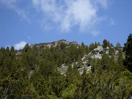
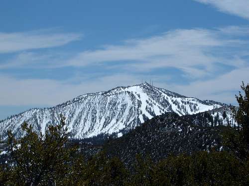
First view of Church's Knob from the trail
Since it isn't an actual peak, having minimal prominence (55'), you may be asking yourself why this deserves its own page. Well, there are a couple primary reasons.
1) It is a notable landmark on a very popular trail, very accessible from Reno and Carson City; and
2) It is the high point above that very popular Jones Creek/Whites Creek/Church's Pond trail, and a worthy destination for hikers who want to reach a summit, but don't have the extra time or desire to reach any of the major peaks nearby.
Getting There
From Reno, take 395 South to the Mount Rose Highway (rt. 431). Once on 431, take it to the west for 6 miles to the north entrance of Galena Creek County Park. There are new trails and trailheads as of the summer of 2011, but the original trailhead is still in tact.Two routes to take up Church's Knob
1) Start at the Jones Creek Trailhead and follow signs. Don't take the lower trailhead. Park at the further trailhead up and find the dirt road towards Jones Creek/White's Creek. After about 1/2 a mile on the trail the trail reaches a junction. Take a left. After another 1/2 mile you will see a Mount Rose Wilderness trail sign. From here you have about 2 miles to go. Head up the trail which has several switchbacks. You eventually reach a ridge where you will see a sign for Church's Pond. You already have the knob right in front of you. Take the trail to Church's Pond for about a tenth of a mile until you see a boulder field on the right. Climb this boulder field the remaining ~250' up to the summit. Descend via the same trail.
Total round trip hiking distance: 6 miles
Total elevation gain: ~2100 feet
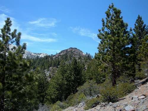
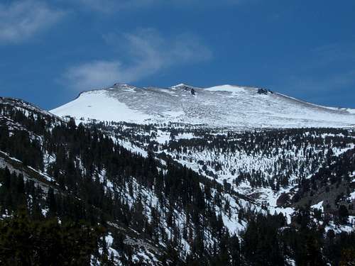
View to Church's Knob from about 1/2 mile away
2) Ascend the same as route#1, but instead of coming back the way you came, you take Whites Creek trail back to the trailhead. This is part of a loop hike where you get even more great views of the Mount Rose Wilderness and the Carson Range. The loop is about 9.5 miles, but if you summit Church's Knob, it is about 9.8 miles. The elevation gain for the loop is probably closer to 2,500 feet due to some ups and downs. For this, start at the lower trailhead, which is well-marked as the trailhead.
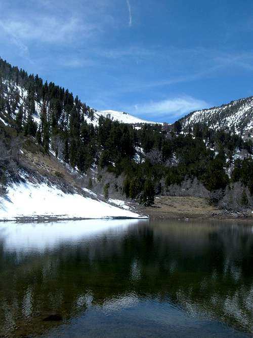
Church's Pond
Regardless of the route, you should take the time to stop by Church's Pond at 8290'. Church's Pond is about 0.3 miles past Church's Knob and has some great views just under Chocolate Peak and Mount Rose. This is a nice place to stop for lunch, depending what time of year. I was there in early May and the bugs were pretty severe, so I stayed little more than a minute. If you take the entire Jones Creek/Whites Creek loop, climb Point 8364 and visit Church's Pond, the total hiking is about 10.5 miles and the elevation gain is about the same. If you just go out and back to Point 8364 and visit Church's Pond, the total hiking distance is about 6.8 miles.
As noted above it is possible to hike Mount Rose via this route. You can start the ascent from Church's Pond. There is no trail, but you can find your way up the boulder field if you are prepared for snow climbing. In summer the route should be free of snow. It would be a tough climb, since you are totaling nearly 4700' in 4.5 miles - with nearly 2,600 feet gained the final 2 miles. However, it is a good challenge if you wish to take it.
To reach Mount Rose, go straight over the ridge and up the where the snow slope begins
Trail Views
Chocolate Peak (9402')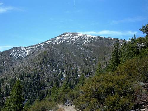
Slide Mountain (9698')
Mount Rose (10776')
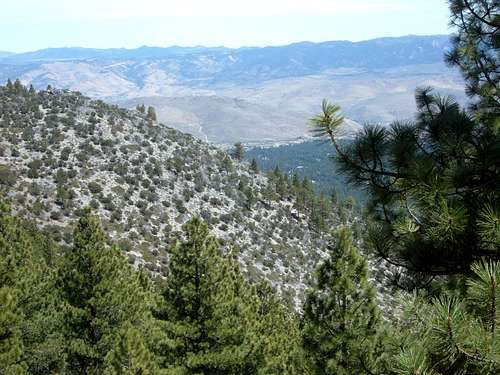
View back down towards the valley
Red Tape
There is no red tape. The trail is in National Forest land with no parking fees. Snow may limit parking during winter months after a big storm.External Links
Trail review #1Trail review #2
Hike to Mount Rose via this the Jones Creek/Church's Pond route