
|
|
Area/Range |
|---|---|
|
|
39.34390°N / 119.9161°W |
|
|
Hiking, Bouldering, Scrambling |
|
|
Spring, Summer, Fall, Winter |
|
|
10776 ft / 3285 m |
|
|
Overview
The Mount Rose Wilderness is one of the most accessible mountain wilderness with alpine territory in the United States. It is situated just northwest of Nevada's capital city, Carson City, and immediately west of Reno, Nevada.
The Mount Rose Wilderness is part of the larger Carson Range which stretches from Luther Pass southeast of Lake Tahoe to the Truckee River northwest of Reno, Nevada. However, only specific parts of the Carson Range are within the designated Wilderness Area.
The Carson Range is far drier than the mountains to the west, particular mountains west of Lake Tahoe. Typically the Carson Range receives half the rainfall as its western counterparts, and loses its snow much earlier in the summer season.
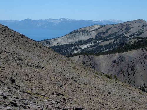 Relay Peak (right) and Lake Tahoe from the slopes of Mount Rose
The Mount Rose Wilderness encompasses a total of 31,310 acres, and the area was designated the Mount Rose Wilderness in 1989 by the U.S. Congress.
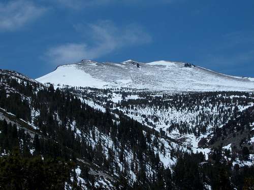
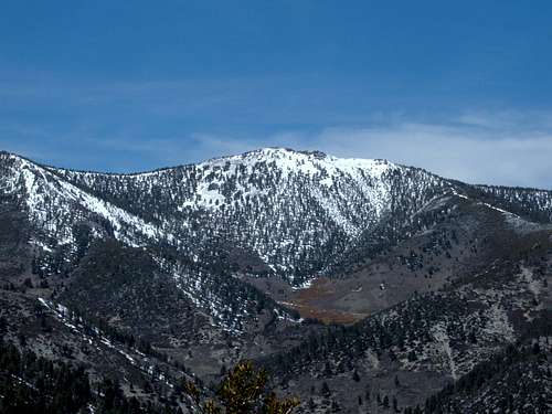
The highest mountain in the range is Mount Rose at 10,776', stands 286 feet higher than the 2nd highest mountain in the range, Mount Houghton at 10,490'. Mount Rose has a named summit on its shoulder, Church Peak at 10,601', although Church Peak rises less than 200' above the saddle between the two summits. Mount Rose is the only mountain in the wilderness that can be considered "alpine" or "above tree line" but only by about 100 feet.
 Mount Rose from Point 8364
Entrance to the wilderness can be made from within Reno city limits. All of the wilderness is in Nevada and is managed by the U.S. Forest Service. Primary trailheads into the wilderness are located between 10 minutes to 45 minutes drive from downtown Reno. Efforts are underway to build out the trail system to better connect Reno to the Tahoe Rim Trail from these primary trailheads like the Hunter Creek Trail and Thomas Creek Trail.
There are several trailheads close to the City of Reno where you can access the primary wilderness trails. To climb the loftier peaks in the wilderness (including Mount Rose, Mount Houghton, Relay Peak, Tamarack Peak, and Slide Mountain) the best trailhead is a well-developed parking area called the Mount Rose Summit. It can be accessed by taking the aptly titled Mount Rose Highway (Rt 431), which winds through the wilderness with access to several ski areas. It should take no more than 35-40 minutes to reach this parking area from downtown Reno.
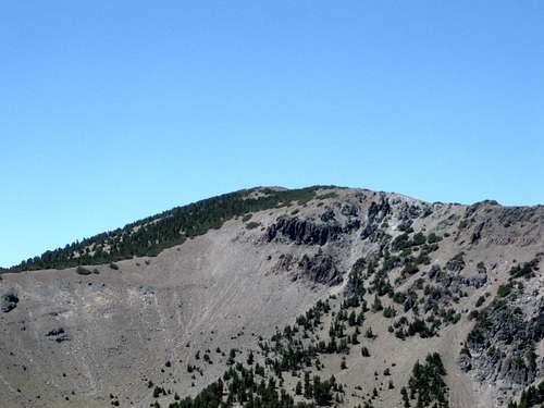 Zoom shot of Mount Houghton
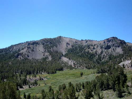 Looking back at Tamarack Peak from high up on the Mount Rose Trail
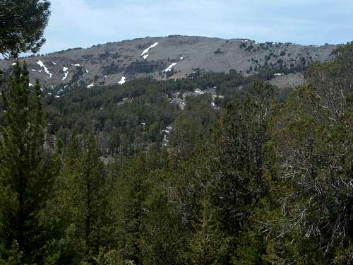 Relay Peak from the Relay Peak Service Road
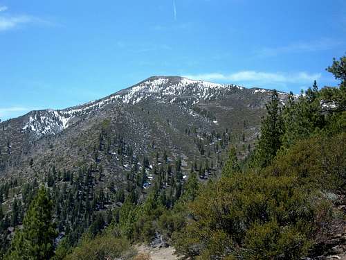 Chocolate Peak from the Jones Creek-White's Creek trail
Galena Creek County Park is an entry way into the lower slopes of the Mount Rose Wilderness. The park sits at an elevation of about 6,200 feet, and is host to several trails including the very popular the Jones Creek/White Creek loop that was recently upgraded. This is only about 15-20 minutes from downtown Reno.
About the same distance from downtown is the Thomas Creek Trail, which takes hikers up over 9,700 feet where Point 9896 and Snowflower Mountain can be reached. The Thomas Creek Trail is reached by taking the Mount Rose Highway to Timberline Drive. The trail can be accessed from the trailhead up on Timberline Drive, with better access to the higher peaks reached by taking FS Road 049 for 2.5 miles up to 6950 feet.
The White's Creek Trailhead is also reached from Timberline Drive, and is the best access point for Alpine Walk Peak, and can be used for the Whites Creek-Jones Creek loop.
 Snowflower Mountain (10,243')
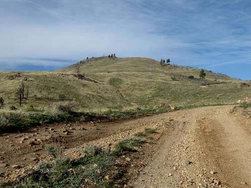
The northern extension of the Wilderness can be reached from Northwest Reno via the Pine Bluff Trail below the Mount Rose Substation off of Caughlin Parkway. The end of Pine Bluff Trail is the start of Hunter Lake Road. There are numerous minor summits along the road that offer excellent views of the wilderness.
 Approaching Point 6312 from Hunter Lake Road.
 View towards Point 7236 above Hunter Lake Road
The Hunter Creek Trail off of Woodchuck, also reached off of Caughlin Parkway. There are several opportunities for boulder climbing off of that trail in particular. These trailheads are about 10 minutes away from downtown Reno. The primary one is the recently constructed "Michael D. Thompson Trailhead Project". The new trailhead is connected to the Steamboat Ditch Trail below, and a new series of trails have been laid down. It connects to the main Hunter Creek trail, which is also been upgraded.
From the trailhead, one can head up the Hunter Creek Trail through a canyon, or to reach higher slopes, the trail can be avoided by hiking up a jeep road that follows power lines and then heads up the ridge up the lower mostly treeless hills in the Northeastern Carson Range, topping out at the pyramid shaped Point 6610 before descending down 115' and ascending back up to the higher, mostly tree-covered slopes to the south.
 View on the way down the Hunter Creek Trail.
 Large rock tower seen further down the Hunter Creek Trail
There are a number of other trailheads located West of the Mount Rose Summit parking area towards Incline Village. Finding trailheads to these mountains is a little less clear as some rise above neighborhoods in Incline Village, although the Tahoe Rim Trail heads directly towards each of them. Getting to the Tahoe Rim Trail to access these peaks requires some scrambling via the shorter routes. Starting points are at the southern edge of the Tahoe Meadows and from the road to Incline Lake. From these it is possible to hike up Rose Knob, Rose Knob Peak, and Rifle Peak.
Brockway Summit to Tahoe Meadows is the only segment of the Tahoe Rim Trail that covers areas in the Mount Rose Wilderness. See the External Links section below to see a map of this trail segment. Brockway Summit is located north of Lake Tahoe near Kings Beach. It is described in more detail on the Carson Range
When to Climb
Hiking can be done all year round in the Mount Rose Wilderness. The Hunter Creek Trail accesses the wilderness at an elevation of about 5,000 feet, so the trail doesn't usually get significant snowfall. By April the rock ledges along this trail may have rattlesnakes, and it is recommended you do not hike here when temperatures in the valley are above 80 degrees.
Galena Creek County Park trails start about 6,200 feet, and are usually free of snow starting in April and continuing through early-mid December. Jones Creek-Whites Creek trails which head up over 8,000 feet are generally clear by late April. Bear season starts by the summer, and that should be considered before hiking in the forest alone.
Higher elevation trails, like the Mount Rose Trail, generally lose most of their snow by early June. Trails are generally clear from mid-June through early November. Except in very dry years, snowstorms will start in November and these trails will be covered in snow.
Here is a rule of thumb for hiking different mountains or trails:
Mount Rose/Church Peak: June-October
Mount Houghton/Relay Peak: June-November
Snowflower Mountain: June-November
Rose Knob Peak/Rose Knob: June-November
Chocolate Peak: May-November
Thomas Creek Trail (6,000-9,800 feet): March-December
Jones Creek-Whites Creek loop (6,200-8,200 feet): April-December
Hunter Creek Trail (5,200-6,200 feet): October-April
Red Tape
There is no Red Tape in particular, but keep in mind that roads may be closed due to fire danger. Parking at the trailheads is free.
Camping
For information on camping, see here and here.
External Links
Lake Tahoe Basin Management Unit
Wilderness.net
Tahoe Rim Trail website
Brockway Summit to Tahoe Meadows