-
 11902 Hits
-
 86.37% Score
-
 22 Votes
|
|
Mountain/Rock |
|---|---|
|
|
46.46120°N / 114.321°W |
|
|
Ravali |
|
|
Hiking, Mountaineering, Scrambling |
|
|
Spring, Summer, Fall, Winter |
|
|
8618 ft / 2627 m |
|
|
Overview
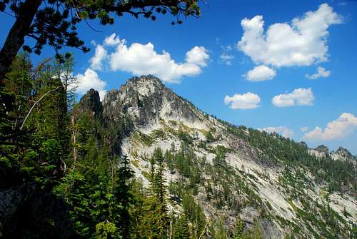
Point 8618 (Hidden Lake Peak) is located in the official wilderness of the Bitterroot Mountains west-northwest of Glen Lake. Its cone shape, quite different from all other peaks in the area, definitely attracts attention when viewed from several of the nearby summits, especially Gash Point.
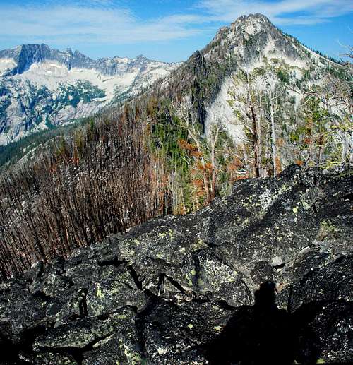
Not only are the views from the summit area of Point 8618 good (including an astounding vista of Ranger Peak), but those along the route offer perspectives of many well-known peaks not often experienced.
Reaching Point 8618 is a fairly serious undertaking – not just a hike. Granted, it requires only a "hike" to reach the summit area of Glen Lake NE (Point 8608), but the excursion then changes character and becomes a true "wilderness experience." The remainder of the route is a mixture of bushwhacking, route finding, rock hopping, and scrambling.
2006 – The Gash Creek Fire
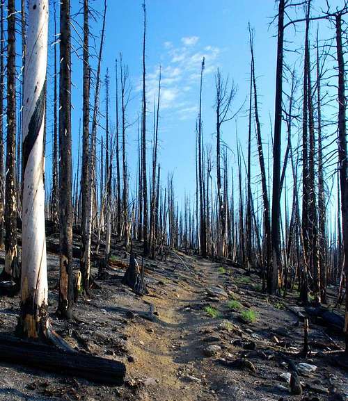
On July 24, 2006 at 4:01 pm, a fire in the Gash Creek area was reported to the Forest Service. The fire eventually grew to cover more than 8,500 acres.
The fire was easily visible from many points in the Bitterroot Valley and at times was rather spectacular. This was especially true one evening when a huge abandoned slash pile near the Glen Lake Trailhead ignited. Because this happened in a shallow cirque, after dark, the mountain looked like a spewing volcano.
Many trees and other plants were killed or damaged, but more survived and will likely flourish with the lessening of competition. The "look" of the area has certainly changed, but to state categorically that "things are worse" would be to take a short-term view. Things always "change".
When I visited on July 27, 2007, animals had returned to the area. I saw several Three-Toed Woodpeckers working on the many fire-killed trees. Of course, plenty of Clarks Nutcrackers were about, too. I observed deer tracks along the trails. Chipmunks were in evidence, especially in the areas most hard hit by the fire.
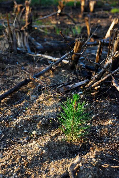
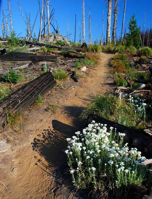
Plant growth was beginning to show, even in areas of the forest which were absolutely scorched by very hot wind-driven fires. Along with the ever-present Beargrass, other plants were beginning to sprout.
Side Note(a diatribe, if you will):
Glen Lake is very popular, in fact, one of the most-popular hiking destinations in the Bitterroots, and the Forest Service has made a serious effort to restore easy-access after last year's fire.
I mentioned on the page for Point 8608, that when I visited on June 16, 2007, I expected the Forest Service to make an effort to keep the path clear. Well, they've done just that during the little more than a month which has passed.
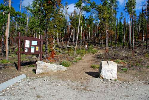
The Forest Service Road to the trailhead is now in the best shape ever, better than any other access road into the forest. The trailhead area has been replanted with tree seedlings and the trail signs fixed.
The deadfall has been cleared from the trail all the way to Glen Lake. Furthermore, a trail (which I had not known to existed) has been opened to the unnamed lakes above Glen Lake. Besides removing the deadfall, both trails have been repaired and short sections rerouted to better terrain.
Now, a cynic would say this "effort" is simply Forest Service window dressing, designed to show the general public what a great management job they are doing; however I disagree. I believe the "effort" was sincere in nature and forced upon the Forest Service by our micro-managing Congress.
Congress, in its wisdom(?), no longer sees fit to place funds in a "general" fund which the Forest Service can use as required. That Congress should do such a thing should be expected, given that Congressional members (each of whom desire reelection) feel forced to "buy" blocks of votes by catering to special interest groups, many of which have vastly differing views on what goals the Forest Service should be striving to reach.
I find it rather sad that politicians have control of our national forests instead of those who are experts (or who at least work on the front lines). Not being able to perform upkeep on something as simple as a popular road or trail without cheating a bit and calling the work "restoration from fire damage" in order to access funds, is pathetic and disheartening. If the current trend followed by our elected officials (of catering to special interests in exchange for votes) continues much longer, I fear we will not have forests and wilderness for much longer.
Getting There
From Hwy 93, about 2 miles north of Victor, MT, turn west at Bell Crossing. The intersection has a blinking yellow light, and is marked with a Forest Service sign for the Big Creek Trailhead.
In less than a half mile the road turns 90 degrees to the right (north), quickly followed by another 90 degree turn, this time to the left (west). In about a mile, you will reach FR 738 which turns slightly to the right in a northwesterly direction.
As you proceed uphill, you will pass through the area of the old Curlew Mine before reaching an intersection. The right (northwest) fork goes downhill to the Big Creek Trailhead.
Take the left (south) fork onto FR 1321. Approximately 6 miles later you will reach the Glen Lake Trailhead, marked with a Forest Service sign. Make sure you stay on the main road. There are several spur roads which will take you to dead-ends.
There are no restroom facilities at the trailhead.
Area Restrictions (Red tape)
Point 8618 is in an official Wilderness Area. Wilderness rules apply.
Camping
Though much of the route is in official wilderness, camping is allowed. I didn't see any good site on Point 8618. There are some great camp sites near either of the upper two lakes and in some of the meadows just past them. The closest area to Point 8618, fit for camping, would be just after passing the summit of Point 8608 in one of the open areas. Of course no water would be available.
One could always make a side trip and drop down to Hidden Lake to camp, but that would add additional elevation gain and miles to the outing.
The Route
Route Type - Scramble
Elevation – 8,618'
Class Level – Class 2 and 3
Elevation Gain - 4,154'
Distance - 10.1 miles
Length of time required to complete route – one day
Approach – Glen Lake Trailhead to Hidden Lake Cutoff
From the trailhead, the trail goes gently uphill as it proceeds north-northeast along the side of a ridge on which sits a saddle between the trailhead and Glen Lake. It's not long before you enter an area of forest which received serious damage from the 2006 fire.
The trail turns northwest just as it reaches the saddle about 1.3 miles from the trailhead. Notice the many rock piles along the crest of this ridge, granite remnants of old volcanic intrusions. The boundary of the official Wilderness area follows this north-south ridge. Looking west-northwest from the saddle, you can see Point 8608 in the distance. West-southwest offers a view of Gash Point.
As the trail traverses along the side of a ridge from the saddle to Glen Lake, it passes through an area of the forest which suffered some of the most severe damage. The ground seems to be composed entirely of ash, However, the trail is has recently been cleared of all fire- and wind-downed trees and is quite easy to follow.
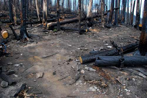
When the trail reaches a point about 2.1 mile from the trailhead (46.45521 N/ 114.27526 W, elevation 7,465') there is a fork in the trail. The left fork, marked with a small cairn is the trail to Glen Lake. The right fork leads to the two unnamed lakes above Glen Lake.
During ascent, I took the right fork and followed the trail as it meanders along the ridge-crest toward the unnamed lakes. (If you desire solitude, this trail will keep you away from Glen Lake which receives plenty of visitors on most weekends.)
Note: As I hiked along toward the unnamed lakes, it was obvious the trail had been in existence for some time. However, it had been allowed to fall into disrepair and was previously all but invisible. I have never seen this trail mentioned in guide books or talked to anyone who was aware of its existence. It's nice it has been re-established.
Once the trail reaches the first of the unnamed lakes, you may want to pause long enough to wash the ash residue from your hands as you admire the gendarmes along the ridge-crest over the lake's west shore.
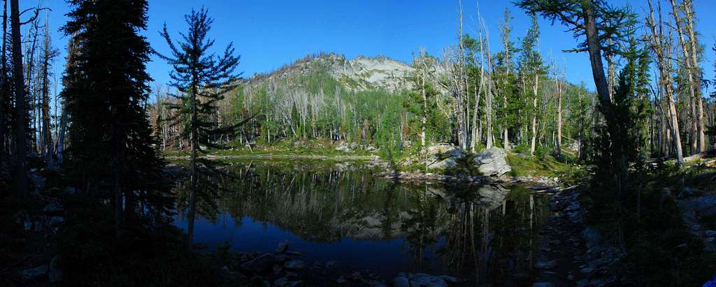
The trail swings around the northeast corner of the lake and turns west-northwest. After passing up a small rise, you reach the second unnamed lake. (Topo maps show this lake and the first unnamed lake as a single lake. That is incorrect. This second lake is several tens-of-feet higher and only connected to the first and lower unnamed lake by a small stream and falls.) Slightly larger than the first unnamed lake, the views are even more spectacular and the seclusion superior.
Leaving the area of the lakes, the trail proceeds northwest toward the ridge leading to Point 8608. At this point the steepness of the trail begins to increase rather substantially.
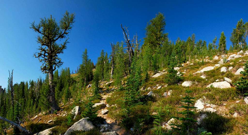
Once the base of ridge is reached, the trail turns west-southwest as it traverses toward the crest. Point 8608 is at the point where the crests of two ridge-lines meet, the back sides of which fall off sharply. Straight-down just about describes it. The ridge-line coming from the south (passing along the west sides of the three lakes) is covered with gendarmes, many of which look climbable.
As you hike through the meadows on the broad top of Point 8608, on your left (south) are several rock outcroppings, one of which is the actual summit of this peak.

The trail to Hidden Lake continues west and downhill, staying close to the ridge-crest. At times you may lose the trail (it gets braided and indistinct in a few places) but should be able to find it again with minimal effort.
Climbers' Trail – Hidden Lake Cutoff to Summit

Continuing to descend, you will reach a couple of cairns (46.30702 N / 114.30742 W, elevation 8,270'), the second of which is quite distinctive. It has a small stick integrated into its structure pointing to the right (north) along the trail to Hidden Lake. This is the point at which you leave the defined trail and begin bushwhacking.
From the cairn, turn left (directly south) and cross to the south side of the ridge-crest. You will see a large talus field covering the side of the ridge.
Climb onto the talus and work your way westward along the side of the ridge. Do not descend too far down the side, just far enough to avoid having to climb over the rock outcroppings which populate the actual crest.

Note: I made the mistake of staying on the north side of the ridge for part of the time while descending toward the saddle. Big mistake! That side of the ridge is covered with thick brush and required time-consuming bushwhacking.
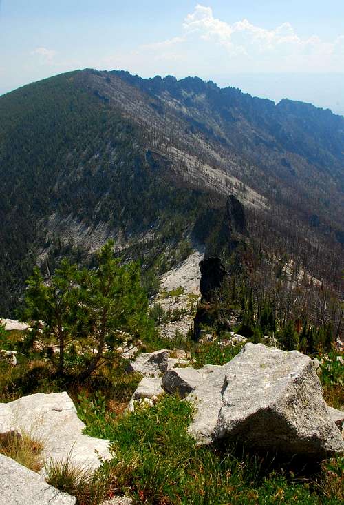
As you near the saddle, you will begin to enter sections of forest which were heavily burned during the 2006 fire. No matter how hard you try, you are likely to get plenty of ash on your clothes and hands.
The ridge near the saddle is comparatively narrow (though not enough for exposure) and allows some nice views to the north of Hidden Lake and the surrounding wilderness.
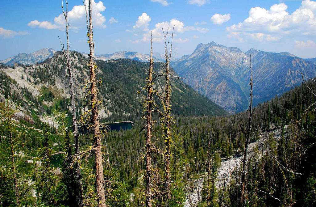
While continuing from the saddle up the ridge toward Point 8618, stay south of the ridge-crest. Again, this helps avoid a couple of magnificent rock outcroppings.
There is some serious deadfall along this section of the route, but with careful route finding, it's possible to avoid most of it. As you near the summit, you enter an area of talus interspersed with grass. Head though this toward what appears to be a notch between two large summit blocks.
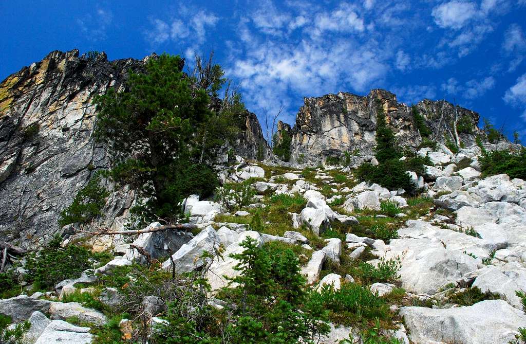
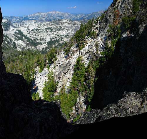
Climbing up into this notch affords some terrific views of Ranger Peak to the west.

The actual highpoint on Point 8618 is on the north summit block. I'll leave you to discover your own path to the highpoint. I found a way which I consider to be upper Class 3 and saw several others which exceed that rating.
Descend by retracing your path, first to the saddle between Points 8618 and 8608, then over the top of Point 8608 along the path from the unnamed lakes above Glen Lake toward Hidden Lake. Once you reach the unnamed lakes, you can either stay away from Glen Lake and use the higher route or (do as I did and) follow the trail from the unnamed lakes to Glen Lake and back to the trailhead. The trail past Glen Lake is longer, but not by much.
When to Go
This summit could be visited any time of year. If visiting under heavy snow conditions, an ice axe would be a necessity (crampons may be required) to navigate the portion of the route going up the ridge of Point 8618. There is a lot of deadfall on this ridge, so the presence of deep snow could actually make the route a bit easier to navigate.
I saw no signs of avalanche activity anywhere along this route (much of it is on or near ridge-crests), but one should always be fully alert when traveling over any snow when avalanche conditions are present anywhere in the area.
Essential gear
I recommend sturdy footwear for this route. In addition to plenty of rock hopping, the abundant deadfall along the ridge of Point 8618 will test your ability to keep your footing and the sturdiness of your ankles.
After passing a small stream just past the unnamed lakes above Glen Lake, no water is available for the remainder of the climb. Be sure to carry plenty.
Route Statistics

Topo of round-trip routes
Summit – 8,618'
Gain – 4,154'
(round trip)
Distance – 10.1 miles
(round trip)

Profile of ascent route

Profile of descent route
Album of Additional Pictures
