

-
 5270 Hits
-
 84.82% Score
-
 19 Votes
|
|
Route |
|---|---|
|
|
46.21950°N / 10.66420°E |
|
|
Mountaineering |
|
|
Summer |
|
|
Most of a day |
|
|
PD - Alpine Scale |
|
|
Overview
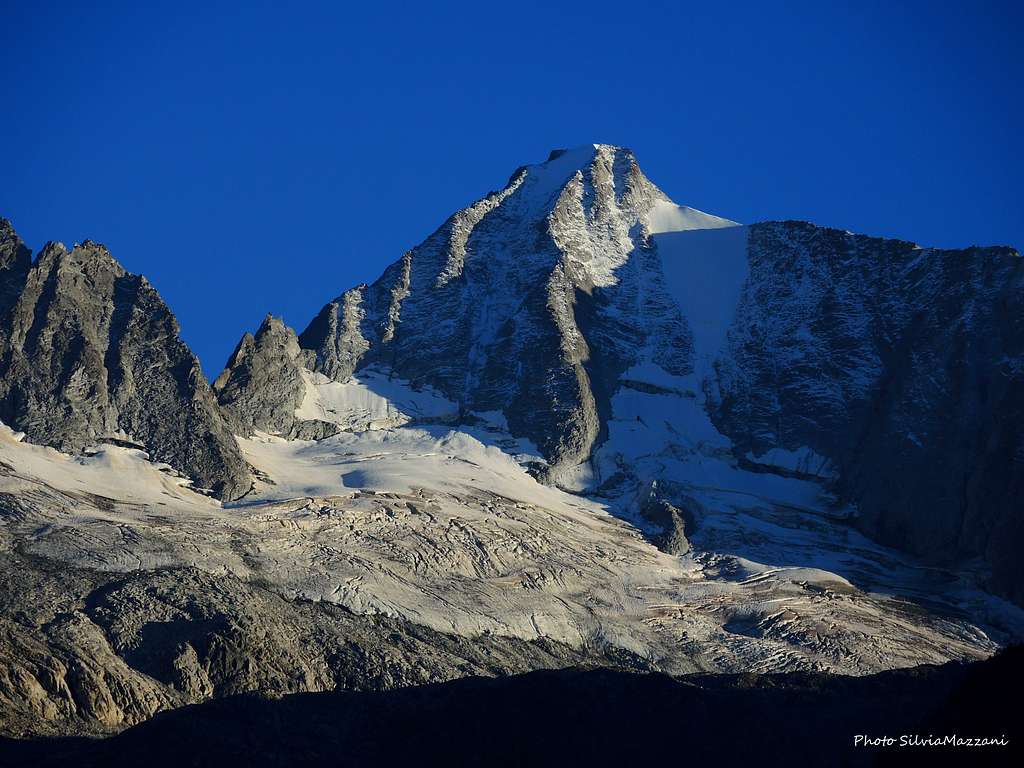
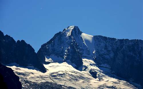
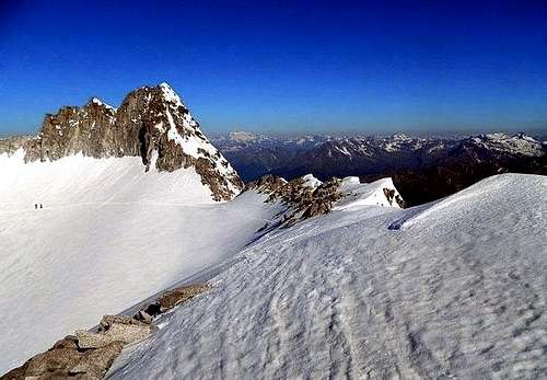
Presanella Normal Route from North-West
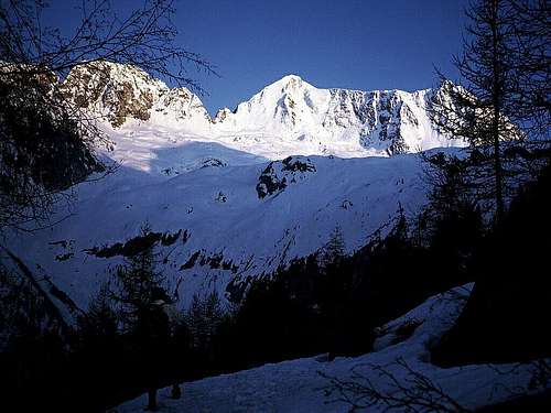
Presanella m 3558 is a highly coveted summit in reason of its remarkable importance and its sweeping views to the nearby Adamello and the most distant Ortles-Cevedale and Bernina groups, as well as the Brenta Dolomites, but mostly because it is the highest mountain located entirely in the Trentino region. For all these reasons Presanella is one of the most famous and popular mountains of the Rhaetian Alps, with various routes, from the most challenging ice-climbs and on rock and mixed ground to its Normal routes, opposing quite moderate difficulty.
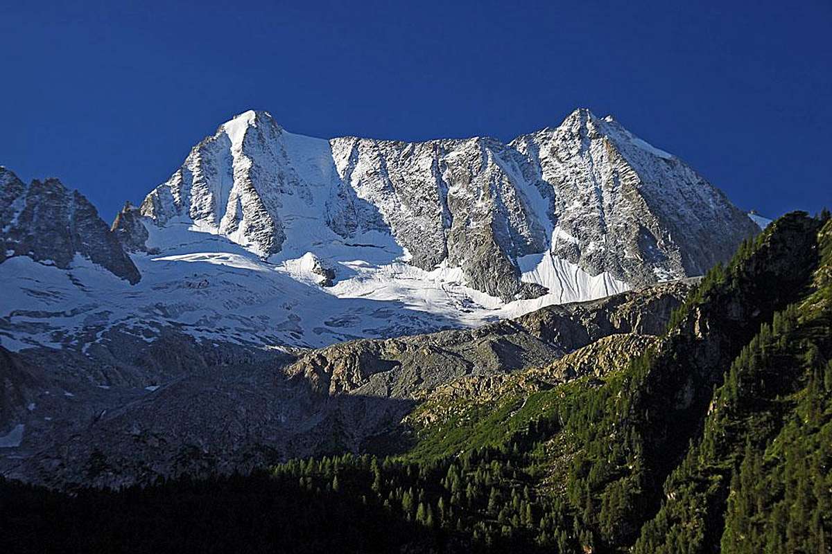
Amongst the Normal routes to the top the most spectacular is the Normal route starting from the Val Stavel through the Cercen Pass, the Col Freshfield and the West side. In addition to a view of the famous icy North face, this route has become a classic in reason of its spectacular setting and the stunning views over the surrounding ranges. The itinerary doesn't oppose any particular difficulty, but it involves the crossing of a glacier, which without opposing major difficulties is crevassed and requires the proper glacier gear.
Getting There
Road Access
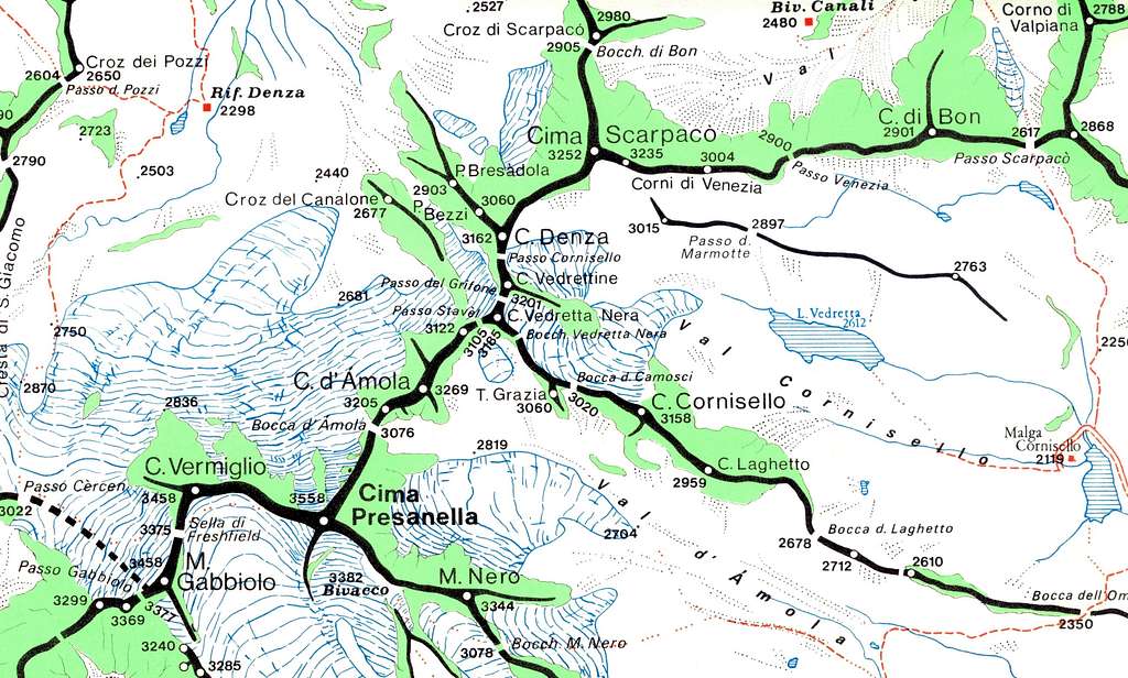
The road access is from Val di Sole.
The climbing route to the summit can be reached starting from Val di Sole on the North side of the mountain. From the road, about halfway between the village of Vermiglio and Passo del Tonale, turn to left following the signposts to Baita Velon. Drive along the gravel road to the parking lot located near the former Forte Pozzi Alti 1836 m. (about 6 km). Who doesn’t like to travel by car up this road, can leave the car lower and walk up to the former Forte Pozzi Alti following the SAT trail n. 233, that goes to the Forte Pozzi Alti by cutting the winding road. In this case it takes about one hour and a half more by walk.

|

|
Approach to Refuge Denza
From the car park you can reach the refuge in about 1.15 hour following the SAT trail n. 233 (400 vertical gain from the car park). The third possibility is to start from Stavel, taking the SAT trail n. 206, which then rejoins n. 233. In this case the travel time is about 3.30 h.
The trail starting from Forte Pozzi Alti goes through a short tunnel excavated in the rock and then continue to the left through the woods along the northern slope of Croz Stavel, then entering Val Stavel. Out of the wood, continue on grassy slopes, always on a well worn path, up to the junction connecting the path 233 with 206 coming from Stavel. Continue now to the right with some hairpins and with regular tilt slope reaching Rifugio Stavel-Denza m. 2298 (1,15/1,30 hour if starting from the upper parking near Forte Pozzi Alti).
Route Description
Presanella Normal Route from Refuge Denza
Difficulty: PD (Alpine scale)
Difference in level: 1260 m from Rifugio Denza
An absolutely worthwhile route up the highest peak entirely located in the Trentino region. The ascent doesn't oppose particular technical difficulties, but involves a complete glacier's equipment.
From the Refuge Denza 2298 m follow the path marked (234 and 235) quickly reaching the nearby pond Presanella 2314 m. Do not follow the right path n. 234 to Passo dei Pozzi, but take the left path n. 235 signposted Passo Cercen. Continue following initially back the tributary of the pond until you reach the base of a rock, where you turn to right and climb up the scree valley between the moraine of the Vedretta Presanella to the left and the debris below the crest of San Giacomo to the right. Up along the trail, then on some large rocks and slabs, reaching the beginning of the Vedretta Presanella.

|
")
|
Set foot on the glacier we proceed on slightly inclined slopes, where there is almost always a well worn track, with obvious itinerary getting to the large saddle of Passo Cercen m. 3022. From the pass turn to left on steeper slopes, in view of the Freshfield Pass m. 3375, between Cima Vermiglio and Monte Gabbiolo. From the pass descend briefly on the opposite side reaching another glacier, Vedretta di Nardis (fixed ropes). Once on the glacier, cross it, bypass Cima Vermiglio and then back to the left, in view of the notch known as the Sella Muraccia, located on the NW ridge.
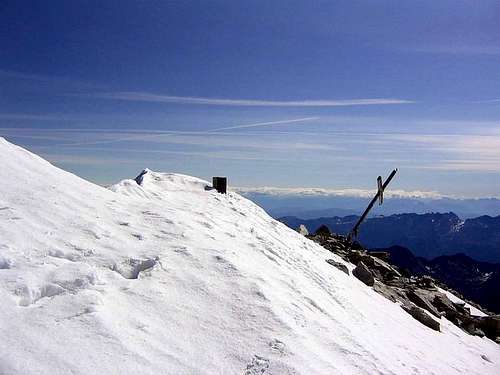
Now following the ridge, the summit metal cross can be reached without particular difficulty. (about 4 hours from the shelter).
Descent: reversing the ascent route
Essential Gear
Rope, one axe, crampons and full glacier equipment.
Red Tape

No fees no permits required. Presanella is situated within Adamello-Brenta Natural Park, the largest protected area in Trentino, established in the year 1967. It's located in Western Trentino and with its 620.51 square kilometers includes the mountain groups of Adamello, Presanella and Brenta Dolomites, separated by Val Rendena. Follow the "leave no trace" approach.
Hut
The hut is located at an altitude of 2298, at the foot of the moraine of the glacier Presanella. It offers 56 beds. Guardian: Fam. Dezulian VERMIGLIO TN Home Phone 0463758585 Mobile 3396233902
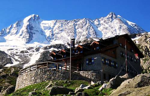
Refuge Denza
When to climb
Mountaineering: best months are June, July, August and September.
Ski-mountaineering: from middle March to the beginning of May
Meteo
Guidebooks and maps

"Presanella" - Dante Ongari - Guida dei Monti d'Italia CAI-TCI
Maps:
Dolomiti di Brenta, Adamello, Presanella - Tabacco Foglio 10 scala 1:50000