
-
 21774 Hits
-
 80.48% Score
-
 12 Votes
|
|
Mountain/Rock |
|---|---|
|
|
33.74643°N / 112.18195°W |
|
|
Hiking, Bouldering, Scrambling |
|
|
Spring, Fall, Winter |
|
|
2260 ft / 689 m |
|
|
Overview
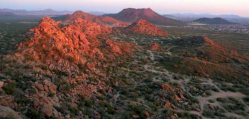
Pyramid Peak is located in North Phoenix and is one of the highest in the immediate area. The area has great single track mountain bike trails and plenty of bouldering opportunities. It is part of the Deem Hills and a City of Phoenix Desert Preserve.Check out some local history here:
DEEM HILLS

There are really no standard routes, the peak can be summitted by any number of class 2, 3, and 4 routes from most sides. The rock is solid and the climbing generally excellent. In addition, one can incorporate the awesome boulder fields to the SE into the approach.
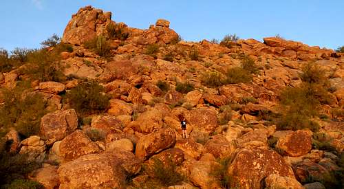
The boulder fields could be a destination all their own. The next shot is looking SE from Pyramid Peak along the approach route.
Getting There
From I - 17, take Happy Valley Road west to 51st Avenue. Head north on 51st Avenue to the end of the road at the CAP canal. Park here, cross the canal, and start heading through the desert and boulders to the northwest to Pyramid Peak.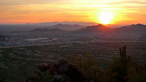
Red Tape
Pyramid Peak is on Arizona Trust Land and is land managed by the State Land Department.Trust Land is not public land.
A recreation permit is required to camp, hike or travel on Trust Land that is designated as open for recreation. A recreation permit is an agreement between you (the responsible casual user) and the Department, to allow limited recreational activities conditional on your continued responsible behavior.
PERMIT INFORMATION
Map
View Larger Map