
|
|
Mountain/Rock |
|---|---|
|
|
35.52315°N / 111.87447°W |
|
|
Coconino |
|
|
Hiking, Mountaineering |
|
|
Spring, Summer, Fall, Winter |
|
|
7965 ft / 2428 m |
|
|
Overview
 Very Cool Interior
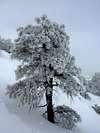
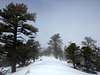
Red Mountain is a spectacular little mountain located about 30 miles north of Flagstaff in the San Francisco Volcanic Field. Like everything in the vicinity of Flagstaff, Red Mountain's geologic features can be credited to the volcanic activities of the area. Maintained by the Coconino National Forest, Red Mountain offers the perfect weekend day trip. There is a very nice trail maintained by the Forest Service that goes to the peak. Not only is the peak cool geologically speaking (see next paragraph for information on why that is so cool), the views are drop dead gorgeous from the summit and all around. From the summit, you have great views of Humphreys Peak, Kendrick peak, Slate Mountain and of much more of the area including glimpses of the Grand Canyon. The views that Red Mountain make it worth the visit. However, the real beauty of the mountain lays in its geological features
Red Mountain is an ancient cinder cone and is among one of the oldest cinder cones in the region (740,000 years old). What makes Red Mountain so interesting? One thing is that its predominant color is red, hence its name Red Mountain. There are a lot more interesting things, however, the first and foremost interesting fact is that the inside of this volcano is exposed- you can see its guts. Visible from Fort Valley Road, the steep escarpment of Northeast face of Red Mountain has been eroded by wind and water (weathering) over time. Most who visit Red Mountain journey to the large amphitheater that this erosion has created. Inside the amphitheater, one is surrounded by ancient hoodoos made of volcanic cinders. If you want to feel small, then you should go inside the amphitheater. It is quite an awe inspiring place to be. In early spring and early summer, there is a little spring that often runs from the amphitheater depending upon the time of year. Most people thing that the amphitheater is the actual crater, which in truth, it isn't. That lays on Red Mountain's SW face. That has seen the typical cinder cone erosion common among the volcanic field.
Route Information
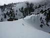
 The Amphitheater from the trail
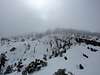
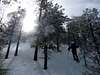
The trail to this peak is very easy. According to the Forest Service, the trail takes around 30 minutes to get to the amphitheater. Its roughly 1.5 miles on a well maintained trail (nothing to exciting, but the views of the surround area are quite cool. What is pretty interesting is that while on the trail, the landscape changes. You begin in juniper-pinyon clad rolling hills and as you gain elevation, the ponderosa ecosystem begins to form. From the trail-head to the amphitheater it is around 300ft of elevation gain- not bad at all. The maintained trail ends in the amphitheater. However, for those that wish to summit, they have a few options.
From the amphitheater, you could head NW towards a little saddle on the ridge. This is mainly 2nd class scrambling with maybe some 3rd class scrambling depending upon your route. After reaching the saddle, the ridge does get pretty steep, but that is about it. This route gives you some amazing views of the amphitheater and of the sheer NE Face. An option to that for just a walk up is to just take the ridge up before you even reach the ladder (which signals the entrance to the amphitheater). That route is very very easy.

If you head up east towards that ridge, you could follow that to the summit. Getting to the ridge is straightforward. Once on the ridge, you can see where the ridge connects into the mountain. It is fairly rocky and steep, but nothing impossible. This ridge is 2nd class scrambling. The crux is a fairly steep head-wall that will take a few 3rd class to surpass it.
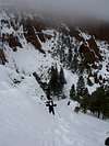


The summit of Red Mountain is very broad. There are at least three, small false summits. The true summit lays at the south end of the ridge. I didn't see any outstanding summit features when I was there due to snow, but it is marked by very big, dead ponderosa pine, which looms over it. The views from the top are pretty baller if you ask me.


Red Tape
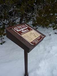 Trail Register
 Trail Sign
There really is no red tape in this area. All of it is open to hiking and camping. For winter, there is no need for a Bacountry Permit like in the Kachina Peaks Wilderness Area.
Camping
 Feeling Small
There are really no established campgrounds around Red Mountain. However, it is surrounded by the vast Coconino National Forest. Primitive camping can be done anywhere in the area. For more information about primitive camping in the Coconino National Forest, visit their
Dispersed Camping Page. For established Coconino National forest campgrounds in the Flagstaff Area, visit their Campground Page.
Getting There
 The Ladder before the Amphitheater
From Flagstaff- Head out North on Fort Valley Road/AZ 180. A good way to find the road is by following the signs for the Snowbowl. Follow this road for about 30 miles. Right around thirty miles you will see a sign for the "Red Mountain Trailhead". Turn left onto a short forest road (like maybe .20 miles) and then you will be at the trailhead. This road isn't plowed in the winter, but as said before, it is only .20 miles so its not really a big deal.
Make sure you get the to trail-head early on weekends (not really in winter) because this is a popular attraction and it could be fairly crowded.
External Links
Coconino National ForestNational Forest website with lots of information regarding the area, including current conditions.
Current Weather Conditions
The weather conditions for Red Mountain as predicted by NOAA.
Geological Information
Geology information on Red Mountain by the USGS
Misc
If you have any more additional information or photos, please contact me or add them to this page. Thank you!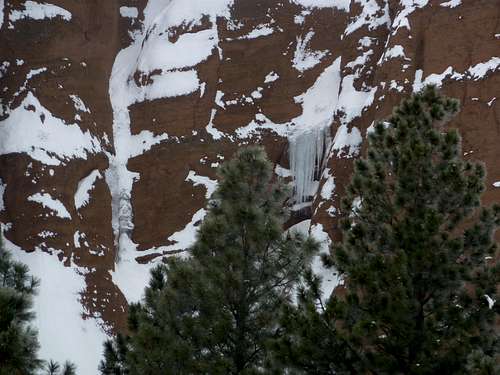 Ice in the NE Face
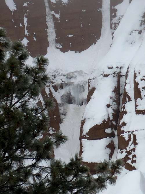 Lots More Ice..in Arizona?
 Outcropping
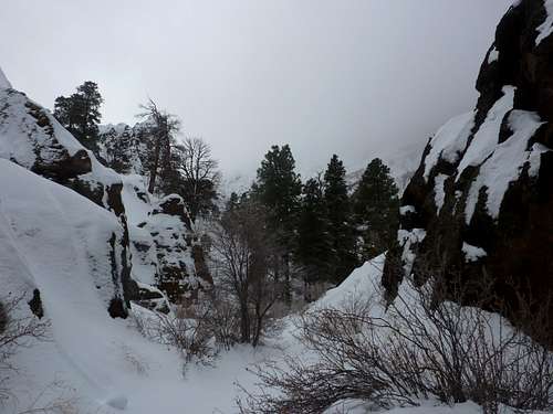 Amphitheater