
-
 10943 Hits
-
 86.37% Score
-
 22 Votes
|
|
Area/Range |
|---|---|
|
|
42.21340°N / 9.00514°E |
|
|
Hiking, Mountaineering, Trad Climbing, Sport Climbing, Toprope, Scrambling |
|
|
Spring, Summer, Fall |
|
|
8602 ft / 2622 m |
|
|
What's new on this page?
PAGINA COMPLETA DI TRADUZIONE IN LINGUA ITALIANA - THE ITALIAN TRANSLATION ADDED TO THE PAGE (2023, January)
Overview
Restonica
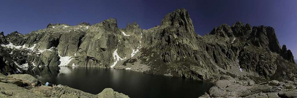
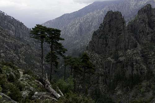
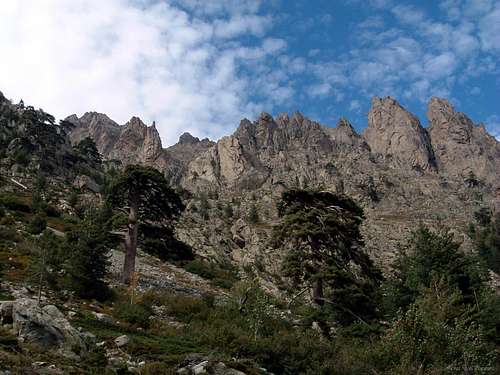
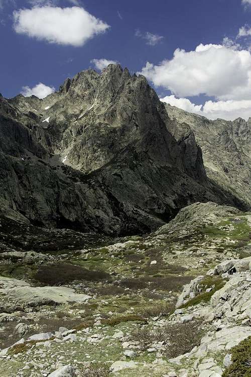
The island of Corsica is covered, mostly in its Northern part, with luxuriant pine forests and is plenty of little lakes, unlike Sardinia, the other large island located in the middle Tyrrenian sea. Due to this peculiarity, which contributes to give to the landscape a stunning alpine look, with peaks overcoming 2.000 m. that suddenly fall away into the sea, Corsica is also called the “Green Island”. The Restonica Valley, located in the Northern of the island (Haute Corse), is one of the most beautiful places of Corsica; surrounded by stunning granite peaks and charming mountain lakes, and cut through by the thundering Restonica river, which flows with crystal clear and icy waters through the granite cliffs and gorges and gives the name to the valley, it’s the most famous place of Corsican hiking and climbing.

Taking its origin from the town of Corte, the former capital of the island, the valley penetrates into the heart of Corsican mountains, running a long time towards SW. A very narrow 15 km long road, overcoming about 1.000 m of difference in level, gets to the “Bergeries de Grottelle” m. 1370. It's a magic place with some small lakes, surrounded by the highest peaks of the Restonica Group: Monte Rotondo m. 2622, the second highest peak on the island after Monte Cinto, Punta alle Porta m. 2313, Pointe des Sept Lacs m. 2266, Lombarduccio m. 2261, Punta Capitello m. 2245, Pain de Sucre m. 2100. Another impressive valley in this area is the Tavignano, running side by side NW to Restonica, also starting from Corte. This is cut through by another thundering river, the Tavignano river, which has its source from the superb Lac de Nino.
")

La Corsica è coperta, principalmente nella parte settentrionale, da rigogliose pinete ed è ricca di piccoli laghi, a differenza della Sardegna, l'altra grande isola situata nel medio Tirreno. Grazie a questa peculiarità, che contribuisce a conferire al paesaggio un aspetto alpino, con montagne di oltre 2.000 m. affacciate sul mare, la Corsica è anche chiamata "Isola Verde". La Valle Restonica, situata nel nord dell'isola (Corsica settentrionale), è uno dei luoghi più belli della Corsica. Circondata da splendide cime di granito e incantevoli laghi di montagna e attraversato dallo spumeggiante fiume Restonica, che scorre con acque cristalline e ghiacciate attraverso le pareti di granito e le gole e dà il nome alla valle, è il luogo più famoso per escursioni e arrampicate. La valle ha origine dalla città di Corte, l'antica capitale dell'isola, e penetra nel cuore delle montagne corse, dirigendosi a lungo verso SW. Una stretta strada lunga 15 km raggiunge le "Bergeries de Grottelle" m. 1370 superando circa 1000 metri di dislivello da Corte.È un luogo magico con alcuni piccoli laghi, circondati dalle vette più alte del gruppo: Monte Rotondo m. 2622, la seconda vetta più alta dell'isola dopo il Monte Cinto, Punta alle Porta m. 2313, Pointe des Sept Lacs m. 2266, Lombarduccio m. 2261, Punta Capitello m. 2245, Pain de Sucre m. 2100. Un'altra valle impressionante in questa zona è la Valle del Tavignano, che corre fianco a fianco a nord-ovest della Restonica, sempre partendo da Corte. Questa seconda valle è attraversato da un altro fiume, il Tavignano, che ha origine dal superbo Lago di Nino.
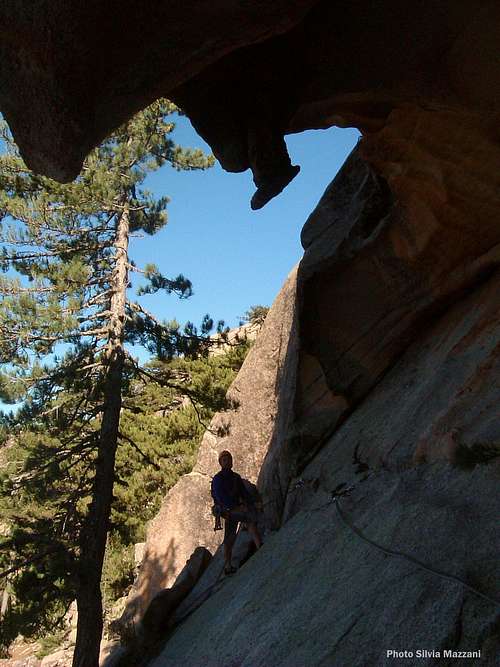
Huge roof inside a tafone |
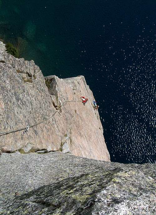
Fine slab on Pointe des 7 Lacs |
Restonica creek |
Getting There
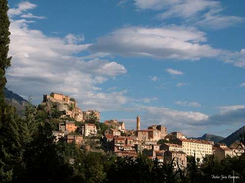
Town of Corte
Access to the island
Corsica can be easily approached:
- by ferry-boat from the French ports of Marseille, Nice and Toulon or from the Italian ports of Livorno, Genova and Savona (main Corsican ports are Ajaccio, Bastia and Calvi). The shortest trip by ferry is from Livorno port on Italy Western coast to Bastia port on Corsica Eastern coast.
- by plane; main Corsica airports are Bastia, Ajaccio, Calvi and Figari.
Road approach
The most convenient destinations to visit the Restonica area are Bastia and Ajaccio. The closest town to the Restonica Valley is Corte, the former capital of Corsica during the brief period of its independence, located in the heart of the island. Besides to be a charming town, it's the starting point of several dayly climbs and hikes - Corte Tourisme Roads in Corsica are infamous for being winding and narrow. Pay particular care when cars come from the opposite direction, and remember that the local inhabitants often do not use the horn.
- from Bastia (Corsica East coast) take the road N193 (70 km)
- from Ajaccio (Corsica West coast) take the road N193 (80 km.)
Road approach to Restonica
From Corte follow the Restonica signposts. Drive to South-West on the narrow and impressive road D623 onto the Restonica valley. After about 15 kms you will reach the car-park at the “Bergeries de Grottelle” m. 1370 (paying park: car 5€ - motor bike 2€ for the day from june 1st to September 30th) The trip takes about 30 minutes.
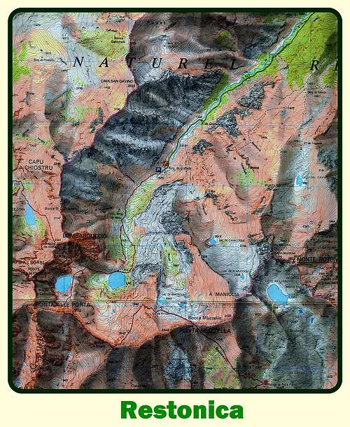
Click here for Corsica map: Corsica map on Arcipelagoverde
La Corsica può essere facilmente raggiunta:
- in traghetto dai porti francesi di Marsiglia, Nizza e Tolone o dai porti italiani di Livorno, Genova e Savona (i principali porti corsi sono Ajaccio, Bastia e Calvi). Il viaggio più breve in traghetto è dal porto di Livorno sulla costa occidentale dell'Italia al porto di Bastia sulla costa orientale della Corsica.
- in aereo; i principali aeroporti della Corsica sono Bastia, Ajaccio, Calvi e Figari.
Accesso stradale
Le destinazioni più convenienti per visitare la Restonica sono Bastia e Ajaccio. La città più vicina alla Valle della Restonica è Corte, l'antica capitale della Corsica durante il breve periodo della sua indipendenza, situata nel cuore dell'isola. Oltre ad essere una città affascinante, è il punto di partenza di numerose salite ed escursioni giornaliere: le strade di Corte Tourisme in Corsica sono famose per essere tortuose e strette. Presta particolare attenzione quando le auto provengono dalla direzione opposta e ricorda che gli abitanti del luogo spesso non usano il clacson.
- da Bastia (costa orientale della Corsica) prendere la strada N193 (70 km)
- da Ajaccio (costa occidentale della Corsica) prendere la strada N193 (80 km.)
Accesso stradale alla Val Restonica
Da Corte seguire le indicazioni per Restonica. Guidare verso sud-ovest sulla strada stretta e impressionante D623 sulla valle della Restonica. Dopo circa 15 km si raggiunge il parcheggio delle “Bergeries de Grottelle” m. 1370 (parcheggio a pagamento: auto 5€ - moto 2€ per la giornata dal 1 giugno al 30 settembre) Il tragitto dura circa 30 minuti. Clicca qui per la mappa della Corsica: Corsica map on Arcipelagoverde
History
Corte was the stronghold of the Corsican independence from 1755 to 1769, restated by the Corsican Pasquale Paoli as capital of a free Corsica. Therefore many Corsican inhabitants still regards Corte, which embodies the independence of their culture, as the secret capital of the island.
Corte fu la roccaforte dell'indipendenza della Corsica dal 1755 al 1769, dichiarata dal corso Pasquale Paoli come capitale della Corsica libera. Pertanto molti abitanti della Corsica considerano ancora Corte, che incarna l'indipendenza della loro cultura, come la capitale segreta dell'isola.
Red Tape
The Restonica area is located inside the Parc Naturel Régional de Corse P.N.R.C. (Natural Regional Park of Corsica) and since the year 1985 it has been acknowledged as “Great National Site”. Its 33,000 hectares' extension includes 143 communes and fills beyond 1/3 of the island’s territory. Wild camping is strictly prohibited in Corsica At Bergerie Grotello there is a parking area paying from June to September. Parking is very limited throughout the valley itself and also the parking area at the Bergerie is not too large. During the weekends the road can be closed temporarily, due to the traffic or complete parking areas. From july 16th to august 15th the road is closed and a mini-bus service is available.
L'area della Restonica si trova all'interno del Parc Naturel Régional de Corse P.N.R.C. (Parco Naturale Regionale della Corsica), dall'anno 1985 riconosciuto come "Grande Sito Nazionale". I suoi 33.000 ettari di estensione comprendono 143 comuni e occupano oltre 1/3 del territorio dell'isola. Il campeggio selvaggio è severamente vietato in Corsica. Alle Bergerie Grotello è disponibile un parcheggio a pagamento da giugno a settembre. Il parcheggio è molto limitato in tutta la valle e anche il parcheggio della Bergerie non è troppo grande. Durante i fine settimana la strada può essere temporaneamente chiusa, a causa del traffico o delle aree di parcheggio complete. Dal 16 luglio al 15 agosto la strada è chiusa ed è disponibile un servizio di minibus.
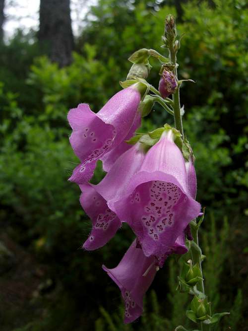
Digitalis Purpurea |
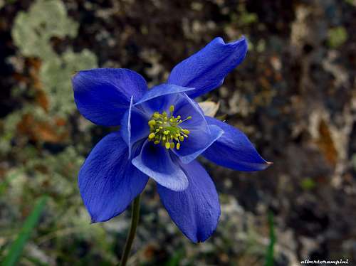
Alpine columbine 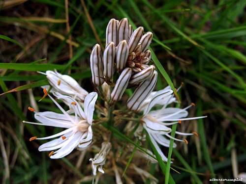
Asphodel |
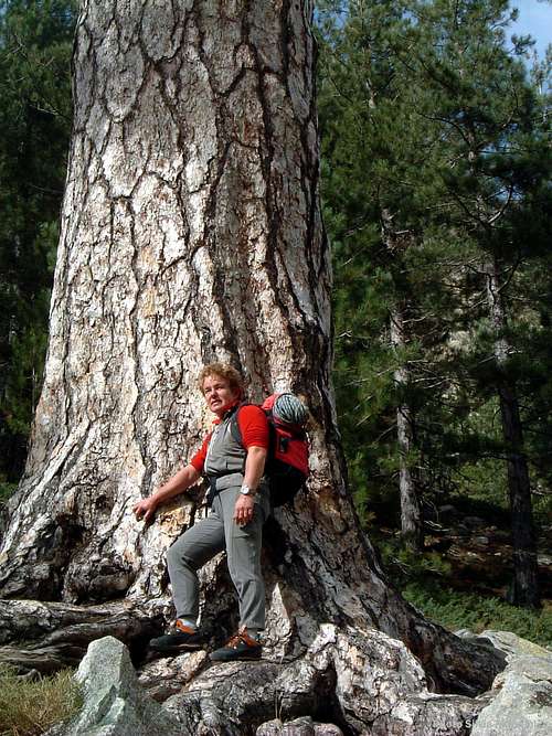
Huge Pino Laricio near Grottelle |
Trekking, hiking and other interests
The Restonica area is crossed by two long trails accross the island: the GR20, the “Grande Randonnée n. 20” a 15 days trail, the most famous one of all the Mediterranean area, starting from Calenzana and getting to Conca, and “Mare a Mare Nord”, a 14 days trail, the longest one amongst the East-West crossing of Corsica. Besides, Corte is the starting point of different interesting day-walks and short hikes.
Main long trails
- GR20 - The 6th and the 7th legs of the GR20 pass through Restonica. Coming from Col de Vergio the GR20 head to South-East, getting the amazing Lac du Nino m. 1743, the Refuge de Manganu m. 1601 and after reaching the hearth of the highest mountains of Restonica, with surprising views over Lac de Capitellu and Lac de Melu. The trail crosses just 150 m. below the summit of Punta alle Porta m. 2313 (it’s easy to climb from here the second highest summit of the group), then head to Colle Rinoso, Bocca Muzzella and the Refuge de Petra Piana m. 1842.
-Mare a Mare Nord - The 4th leg of this 14 days trail descends through the Tavignano Valley, running side by side West to Restonica. From Bocca de l’Arinella the trail gets to Refuge de la Sega m. 1166, then enters the Gorges du Tavignano, reaching Corte.
L'area della Restonica è attraversata da due lunghi sentieri che attraversano l'isola: il GR20, il “Grande Randonnée n. 20 ”un trekking di 15 giorni, il più famoso di tutto il Mediterraneo, che parte da Calenzana e arriva a Conca, e “ Mare a Mare Nord ”, un trekking di 14 giorni, il più lungo tra le traversate est-ovest della Corsica. Inoltre Corte è il punto di partenza di diverse interessanti passeggiate giornaliere e brevi escursioni.
Principali trekking lunghi
- GR20 - La 6a e la 7a tappa del GR20 passano per Restonica. Provenendo dal Col de Vergio il GR20 si dirige verso Sud-Est, arrivando al meraviglioso Lac du Nino m. 1743, il Rifugio de Manganu m. 1601 e dopo aver raggiunto il cuore delle montagne più alte della Restonica, con viste sorprendenti sul Lago di Capitellu e sul Lago di Melu. Il sentiero attraversa solo 150 m. sotto la vetta di Punta alle Porta m. 2313 (da qui è facile salire la seconda vetta più alta del gruppo), quindi dirigersi verso Colle Rinoso, Bocca Muzzella e Rifugio de Petra Piana m. 1842.
-Mare a Mare Nord - La 4a tappa di questo percorso di 14 giorni scende attraverso la Valle del Tavignano, correndo fianco a fianco verso Ovest fino alla Restonica. Da Bocca de l'Arinella si arriva al Rifugio de la Sega m. 1166, quindi entra nelle Gorges du Tavignano, raggiungendo Corte.


Day hikes
- Monte Rotondo
Difference in level: 1600 m. Starting point: Pont de Timozzo
One of the best walks, even if very long, is through the black pine forests to Monte Rotondo, the highest summit of Restonica. From Corte turn into D623 which immediately enters the valley. 11 km behind Corte the trailhead starts the bridge Pont de Timozzo.
- Arcu di u Scandulaghja (The Arch of Corte)
Difference in level: 1000 m. Starting point: Parking lot near Corte citadel (Orange Marks)
Starting from a small parking lot near the citadel of Corte. The ark is signposted with a sign and is located a few meters above the start of the worn path along the Tavignano Valley. The path is well marked by orange marks, so just follow it. Don't follow the Tavignanu path, but rise up, passing a house and getting a small stones' shelter. Head to North and follow a crest, then enter a chestnut-wood and after a pine-wood at about 1000 m. of altitude. Head to SW, getting a col at 1145 m. (cross on a summit on the left). Carry on towards North, pass a rocky summit (m. 1293), then rise towards right on a scree getting a small notch. From the notch take on the right, at first towards NW, then towards W, getting to the Arch.
Short walks
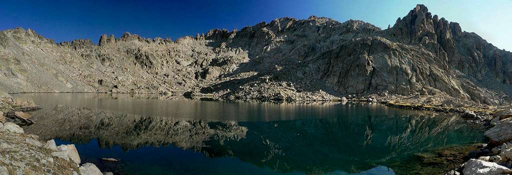
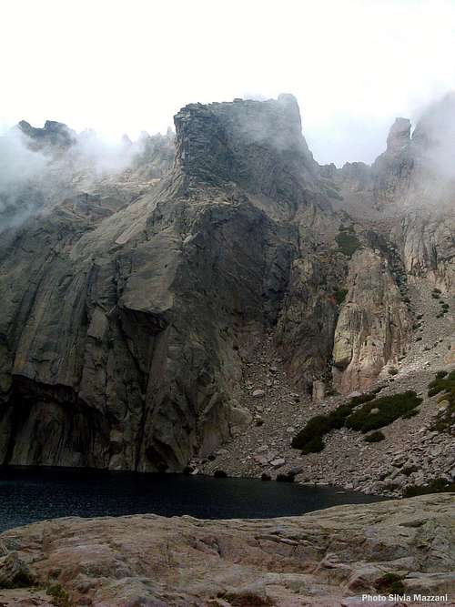
- Lac de Melu and Lac de Capitellu
A strongly recommended short walk to the two most famous mountain lakes of Restonica, having both a glacial origin: Lac de Melu ( 1711 m) an hour hike, and Lac de Capitellu ( 1930 m) 1 and 3/4 hours hike. The trailhead is from the “Bergerie de Grottelle” m. 1370. The view is magnificent.
Escursioni giornaliere
- Monte Rotondo
Dislivello: 1600 m. Punto di partenza: Pont de Timozzo
Una delle migliori escursioni giornaliere, anche se molto lunga, è attraverso le pinete nere fino al Monte Rotondo, la vetta più alta della Restonica. Da Corte si imbocca la D623 che entra subito nella valle. 11 km dopo Corte il sentiero è al ponte Pont de Timozzo.
- Arcu di u Scandulaghja (L'Arco di Corte)
Dislivello: 1000 m. Punto di partenza: parcheggio vicino alla cittadella di Corte (segni arancio)
Partenza da un piccolo parcheggio nei pressi della cittadella di Corte. L'arco è segnalata con un cartello e si trova pochi metri sopra l'inizio del sentiero ben tracciato lungo la Valle del Tavignano. Il sentiero è ben segnalato da segni arancioni, quindi non è difficile da seguire. Non seguire il sentiero Tavignanu, ma salire, superare una casa e trovare un piccolo ricovero di pietre. Si prosegue verso Nord e si segue una cresta, quindi si entra in un castagneto e in seguito in una pineta a circa 1000 m. di altitudine. Dirigersi a SW, raggiungendo un colle a 1145 m. (croce in vetta a sinistra). Si prosegue verso Nord, si supera una sommità rocciosa (m. 1293), quindi si sale verso destra per un ghiaione raggiungendo una piccola sella. Dalla sella prendere a destra, prima in direzione NW, poi W, arrivando all'Arco.
Brevi camminate.
- Lac de Melu e Lac de Capitellu
Una breve camminata assolutamente consigliata per i due laghi di montagna più famosi della Restonica, entrambi di origine glaciale: Lac de Melu (1711 m), un'ora di cammino, e Lac de Capitellu (1930 m), 1 e 3/4 ore di escursione. L'inizio del sentiero è dalla “Bergerie de Grottelle” m. 1370. La vista è magnifica.
Kayaking
The Restonica river shows one of the steepest gradients of Corsica and it’s an excellent place for kayaking.
Il fiume Restonica possiede una delle discese più ripide della Corsica ed è un luogo eccellente per il kayak.
Climbing
Climbing
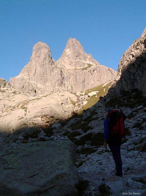
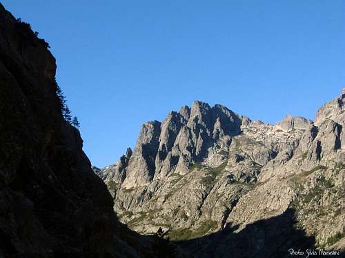
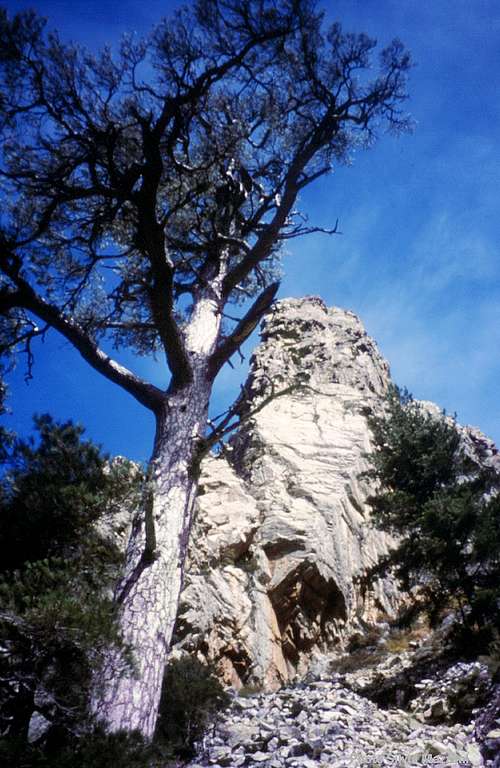
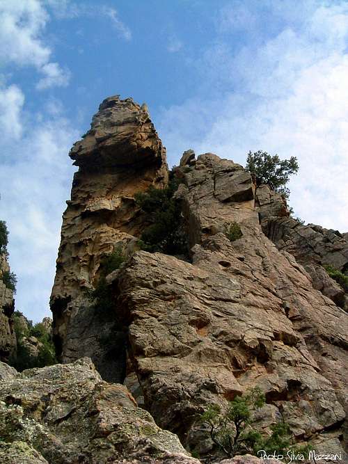
Like the Bavella Massif, the Restonica area is a great drawn for climbers, due to the amazing granite, the beauty of the landscape, the local hospitality, the climate. Corsica is claimed to have more unclimbed walls than anywhere else in Europe! Some of these are located just in Restonica, but here there are also hundreds of confirmed routes. The Restonica granite offers a wide choice of every kind of routes: from the low lying bolted single pitches to the multi-pitch routes, both trad and modern, located high up in the mountains, beyond the 2000 m., above amazing deep blue lakes. Besides, an excellent mixture of different climbing styles can be found: technical steep walls, smooth slabs, corners and cracks, roofs and overhangs. The environment of Restonica, if compared with the Bavella Massif, is less wild and more alpine and the approaches less complex. The most spectacular route in Restonica is the world classic rock climb “Symphonie d'automne” on the Pointe of Sept Lacs, just above the amazing Lac de Capitellu. Another beautiful multipitch route is “Ombre et Lumiere” on Rossolino, Gorges du Tavignano.


Arrampicata
Come il Massiccio della Bavella (Bavella Massif), la Restonica è una grande attrazione per gli alpinisti, per il sorprendente granito, la bellezza del paesaggio, l'ospitalità locale, il clima. Si dice che la Corsica abbia più pareti non ancora scalate che qualsiasi altra parte d'Europa! Alcuni di queste pareti si trovano proprio a Restonica, ma qui si trovano anche centinaia di vie già salite. Il granito della Restonica offre un'ampia scelta di vie di ogni genere: dai monotiri spittati in bassa valle alle vie di più tiri, sia trad che moderne, situate in alta montagna, oltre i 2000 m., sopra incredibili laghi di colore blu intenso. Inoltre, si può trovare un'eccellente scelta di diversi stili di arrampicata: pareti verticali tecniche, placche lisce, diedri e fessure, tetti e strapiombi. L'ambiente della Restonica, rispetto al Massiccio della Bavella, è meno selvaggio e più alpino e gli avvicinamenti sono meno complessi. La via più spettacolare della Restonica è la classica via di fama mondiale “Symphonie d'automne” sulla Pointe of Sept Lacs, appena sopra lo straordinario Lac de Capitellu. Un altro bellissimo percorso multipitch è “Ombre et Lumiere” su Rossolino, nelle Gorges du Tavignano.
Climbing grades
The French scale is the grading system used in Restonica.
Climbing Grades:
| Rock Climbing Rating Systems | ||||||||
|---|---|---|---|---|---|---|---|---|
| French | YDS (USA) | UIAA | French | YDS (USA) | UIAA | French | YDS (USA) | UIAA |
| 1 | 5.2 | I | 6b | 5.10c | VII- | 7c+ | 5.12d | IX |
| 2 | 5.3 | II | 6b+ | 5.10d | VII | 8a | 5.13a/5.13b | IX+/X- |
| 3 | 5.4 | III | 6c | 5.11a | VII+ | 8a+ | 5.13c | X- |
| 4 | 5.5 | IV | 6c+ | 5.11b | VII+/VIII- | 8b | 5.13d | X |
| 5a | 5.6 | V- | 7a | 5.11c | VIII- | 8b+ | 5.14a | X+ |
| 5b | 5.7 | V/V+ | 7a+ | 5.11d | VIII | 8c | 5.14b | X+/XI- |
| 5c | 5.8 | VI- | 7b | 5.12a | VIII+ | 8c+ | 5.14c | XI- |
| 6a | 5.9 | VI/VI+ | 7b+ | 5.12b | VIII+/IX- | 9a | 5.14d | XI |
| 6a+ | 5.10a/5.10b | VI+/VII- | 7c | 5.12c | IX- | 9a+ | 5.15a | XI+ |
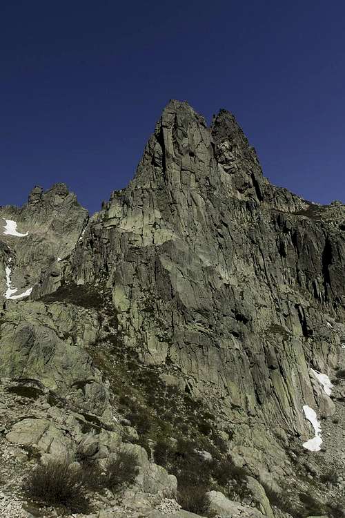
Main summits
Pointe des Sept Lacs and Lac de Capitellu |
Punta Capitello - Ph. Gangolf Haub |
Pain de Sucre and Punta Capitellu |
Monte Rotondo m. 2622, the second highest peak on the island, Punta Alle Porta m. 2313, Pointe des Sept Lacs m. 2266, Lombarduccio m. 2261, Punta Capitello m. 2245, Cima San Gavino m. 2222, Pain de Sucre m. 2100, Punta Finosa m. 1855, Pointe de la Touffe m. 1751, Punta a Meda m. 1735, Punta San Teofalu m. 1720, Pointe 1670, Punta a u Finellu m. 1565, Punta Spenicazzia m. 1506, Monte Leonardo m. 1146, Sorbello, Bravino m. 1090, Rossolino m. 908, Punta di Zurmulu m. 862
Monte Leonardo - Photo Gangolf Haub |
Pointe de la Touffe |
Lombarduccio |
Punta Spenicazzia |
The spire of Rossolino, Gorge of Tavignano |
Pic Lombarduccio - Ph. Gangolf Haub |
Climate
Restonica shows more or less the same climate of the Mediterranean middle-mountain areas situated at these latitudes, but with stronger alpine distinctive features, due to its altitude and location: it may be sometimes hot in summer, but on the highest peaks, overcoming the 2000 m. of height, the climate is pleasant also in full summer. Winter may be often cold and very snowy. In Spring and Fall rainfall sometimes are important and dangerous when joined with the strong winds coming from NW.
La Restonica ha più o meno lo stesso clima delle zone di media montagna mediterranee situate a queste latitudini, ma con tratti distintivi alpini più forti, per la sua altitudine e posizione: può essere a volte caldo in estate, ma sulle vette più alte, superando i 2000 m. di altezza, il clima è gradevole anche in piena estate. L'inverno può essere spesso freddo e molto nevoso. In primavera e in autunno le piogge a volte sono consistenti e pericolose se unite ai forti venti provenienti da NW.
Where to stay

In Corte there is a wide choice of different kinds of accommodations: hotels, appartments, campgrounds and gites d´etape. Camping is allowed only on public campgrounds. There are several campgrounds around Corte:
Camping Tuani, Camping Chez Bartho, Camping Biancardini Marc
Huts
- Réfuge de Manganu m. 1601 and Refuge de Petra Piana m. 1842 are located along the GR20 trail
- Refuge de la Sega m. 1166 is located along the “Mare a Mare Nord “ trail about 10 km west of Corte in the Tavignano valley
A Corte c'è un'ampia scelta di diverse tipologie di alloggio: hotel, appartamenti, campeggi e gites d´etape. Il campeggio è consentito solo nei campeggi pubblici. Ci sono diversi campeggi intorno a Corte:
Camping Tuani, Campeggio Chez Bartho, Campeggio Biancardini Marc
Rifugi
- Réfuge de Manganu m. 1601 e Rifugio de Petra Piana m. 1842 si trovano lungo il sentiero GR20
- Rifugio de la Sega m. 1166 si trova lungo il sentiero “Mare a Mare Nord” a circa 10 km ad ovest di Corte nella valle del Tavignano
When to climb and hike
Best season goes from late April to October
Meteo
Guidebooks
Guidebooks
"Corse paradis de l’escalade" by Martial Lacroix DCL Editions
"Guide d'escalade en Corse - Corse du Nord", Tome I by Jean Paul Quilici and Bernard Vaucher, Ed. de l'Envol, 2000, in French
"Corse, l'ile verticale" by Martial Lacroix e Pierre Sanchou, Ed. Adrénaline, 1999, in French. A selection of 72 beautiful multi-pitches in Corsica
"Sport climbing in Corsica" by Maurizio Oviglia (Italian and English) Ed. Versante Sud
"Le Grand Chemin - Toutes les étapes du GR 20" - Albiana PNRC
"A travers la montagne Corse" Fédération Française de Randonnée Pédestre
 |
 |
 |
 |
 |
Maps

IGN 4251 OT “Monte d’Oro – Monte Rotondo Parc Naturel Régional de la Corse" 1:25.000 Topo Guide Link
External Links
Parc Naturel Régional de Corse
Office du Tourisme de Corte Tél: +33 (0)4 95 46 26 70 Fax: +33 (0)4 95 46 34 05 Email: corte.tourisme@wanadoo.fr