My first visit to the Weisshorn Group had been by myself, back in 2012. It made quite an impression, but it would take two more years before I would go revisit the are. And I'm still far from done with it, I want to go back for more!
OSM map centered on the Weisshorn, the highest peak in the Weisshorn Group. The Turtmanntal is the valley to the north.Click here for a larger map.
On the last day of June, 2014, Jan and I traveled to the Alps. For the first few days we took it relatively easy, with a mix of hiking, scrambling and rock climbing. Then, once we were somewhat acclimatized, we set our eyes on higher and more difficult goals, in particular on the Brunegghorn North face. Despite the somewhat unstable weather, there was the occasional fine day, and in the end we got lucky and got the one day of fine weather that we needed to climb it.
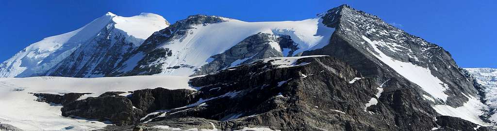
![Panoramic view of Bishorn from the Turtmannhütte]() Panoramic view of Bishorn from the Turtmannhütte
Panoramic view of Bishorn from the TurtmannhütteLinks
![Turtmannhütte]() Turtmannhütte
TurtmannhütteMostly we camped, but a couple of days I stayed at the
Turtmannhütte. There is an enormous choice of bolted sports climbing routes in the vicinity of the hut; we barely scratched the surface on our visit.
Comments
No comments posted yet.