
|
|
Mountain/Rock |
|---|---|
|
|
39.62970°N / 107.8128°W |
|
|
Garfield |
|
|
Hiking, Mountaineering, Trad Climbing, Sport Climbing, Scrambling |
|
|
Spring, Fall |
|
|
6800 ft / 2073 m |
|
|
Overview
In addition to being a natural arch, Rifle Arch is a nice climbing area north of Rifle Colorado. The features and rock here are similar to what you find in the much more crowded and popular Flatirons near Boulder Colorado. The rock here is sandstone, but by sandstone standards is pretty solid, at least on the lower sections of the crag (higher up the rock is said to be sandy). It is a pretty scenic area as well.The slabs are rather massive, are about 500 feet tall, and impressive. They lie on the southwest face of what is known as the Grand Hogback.
The climbs here range from 5.5 single pitch sport routes to 5.11 seven pitch trad routes, so there should be something here for everyone.
From the arch itself, going north the main crags are Piñon Slab, Juniper Slab, Mitten Slab, and Keyhole Slab. South of the arch is Pothole Rock.
I am only familiar with the Piñon Slab, Juniper Slab, and Mitten Slab, so the emphasis on the page will be on those slabs.
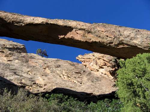
Rifle Arch.
 Kimberly smiles while enjoying the good climbs on the Mitten Slabs.
 Kessler leading P1 of Arm and Hammer.
Getting There
Getting to the Rifle Arch Trailhead is very easy. From Rifle, head north along Highway 13 for about seven miles to a parking lot and trailhead on the east side of the highway. This isn't much farther north than mile marker 7. Slab layout as seen from near the trailhead. Click for full size.
Approach
From the trailhead, follow the trail towards the arch. Once you are near some log benches and fairly close to the rock walls and arch, take the climbers trail which heads left from the main trail and to the base of the slabs.When the climbers trail reaches the cliff, this is the Piñon Slab. It is identified by the piñon tree about 90 feet up.
To get to the Mitten Slab, continue left from the Piñon Slab for another 150 feet or so.
I have not been to Pothole Rock, but it is located across the gully from the arch and to the east of Rifle Arch.
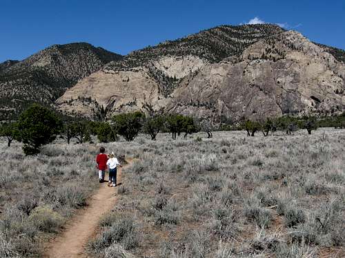
The trail to Rifle Arch.
Routes Overview
Routes are listed from right to left since that's how you approach them.PIÑON SLAB
| ROUTE | DIFFICULTY | LENGTH | PITCHES | GEAR | QUALITY |
| Methane Mic | 5.8 | 80 feet | 1 | 8 draws | Good |
| Jimboliar | 5.8 | 85 feet | 1 | 9 draws | Good |
| Ladies First | 5.10a | 85 feet | 1 | 10 draws | Not Recommended (soft rock and holds breaking) |
| Andy Wants Some Candy | 5.10a | 85 feet | 1 | 9 draws | Fair |
| Sok Rot (optional pitches 2 and 3 from the right hand of slab) | 5.9 | 270 feet | 3 | ?, 70 meter rope | Fair |
| Opcion Dos (slightly better option to the above) | 5.9 | 110 feet | 2 | ?, 70 meter rope | Good |
 Sok Rot.
MITTEN SLAB
| ROUTE | DIFFICULTY | LENGTH | PITCHES | GEAR | QUALITY |
| Icon | 5.10 R | ~500 feet | 5 | Standard rack, long slings, and 70 meter rope | Good |
| Arm and Hammer P1 | 5.5 | 75 feet | 1 | 8 draws | Good |
| Arm and Hammer | 5.10b | ~500 feet | 5 | 12 draws, long slings, extra biners, small rack optional | Good |
| Illusions P1 | 5.6 R | 90 feet | 1 | 5 draws | Good |
| Illusions | 5.11- | ~500 feet | 7 | Medium to large nuts, single set of cams to 3.5 inches, #4 Camalot, 12 draws, 8 long slings, extra biners, 70 meter rope | Good |
| Smitten by the Mitten | 5.10+ R | ~400 feet | 4 | 10 medium to large nuts, single set of cams to 3.5 inches, 12 draws, 8 long slings, extra biners, two ropes | Good |
 The upper part of P1 and the lower part of P2 on Arm and Hammer.
 The left pair of climbers are on Illusions and the right pair are on Arm and Hammer.
KEYHOLE SLAB
| ROUTE | DIFFICULTY | LENGTH | PITCHES | GEAR | QUALITY |
| Primavera II | 5.10 (possibly un-repeated since 1st ascent) | 300 feet? | 3 | Standard rack to 3.5 inches | Good |
Red Tape
Climbing on Rifle Arch itself is forbidden.There is no other red tape here, so please treat the area with respect.
 Please take care of the area.
When to Climb
These slabs tend to be sunny and brutally hot in summer, Spring and Fall are the ideal times to climb here.Summer climbing is not recommended, but might be tolerable in the very early morning hours.
Winter weather can be nice, but the approach trail can be and probably will be very muddy in the winter.
 A nice April day on Arm and Hammer.
Camping
There is no camping in the immediate vicinity, but there are several places with excellent camping only a few miles away. Click on the links for more details.Rifle Gap State Park Camping
Rifle Falls Camping
Rifle Mountain Park Camping
The town of Rifle also has several hotels, motels, and RV Parks.
External Links
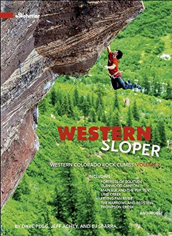
GuidebookThe following book mentions 12 different climbs at Rifle Arch (the book does not mention the climbs at Pothole Rock), but this is the best and most comprehensive climbing source on the area:
Western Sloper
Online Sources
Rifle Arch on Mountain Project
Mountain Conditions
CLICK HERE FOR WEATHER FORECASTWeather and climate data for Rifle is below. *National Weather Service Data 1910-2007. Rifle is only a few miles from Rifle Arch.
| MONTH | AVE HIGH | AVE LOW | REC HIGH | REC LOW | AVE PRECIP (in) |
| JAN | 37 | 9 | 62 | -38 | 0.86 |
| FEB | 44 | 17 | 69 | -34 | 0.77 |
| MAR | 54 | 24 | 81 | -16 | 0.94 |
| APR | 64 | 31 | 92 | 4 | 1.01 |
| MAY | 74 | 39 | 99 | 17 | 1.00 |
| JUN | 84 | 45 | 102 | 22 | 0.73 |
| JUL | 90 | 52 | 104 | 33 | 1.03 |
| AUG | 88 | 50 | 102 | 31 | 1.48 |
| SEP | 79 | 41 | 99 | 21 | 1.14 |
| OCT | 67 | 31 | 88 | 7 | 1.19 |
| NOV | 51 | 21 | 79 | -16 | 0.88 |
| DEC | 39 | 12 | 65 | -27 | 0.93 |