
-
 7406 Hits
-
 87.31% Score
-
 24 Votes
|
|
Mountain/Rock |
|---|---|
|
|
44.51210°N / 6.92238°E |
|
|
Piemonte |
|
|
Trad Climbing, Sport Climbing |
|
|
Spring, Summer, Fall |
|
|
8045 ft / 2452 m |
|
|
Overview
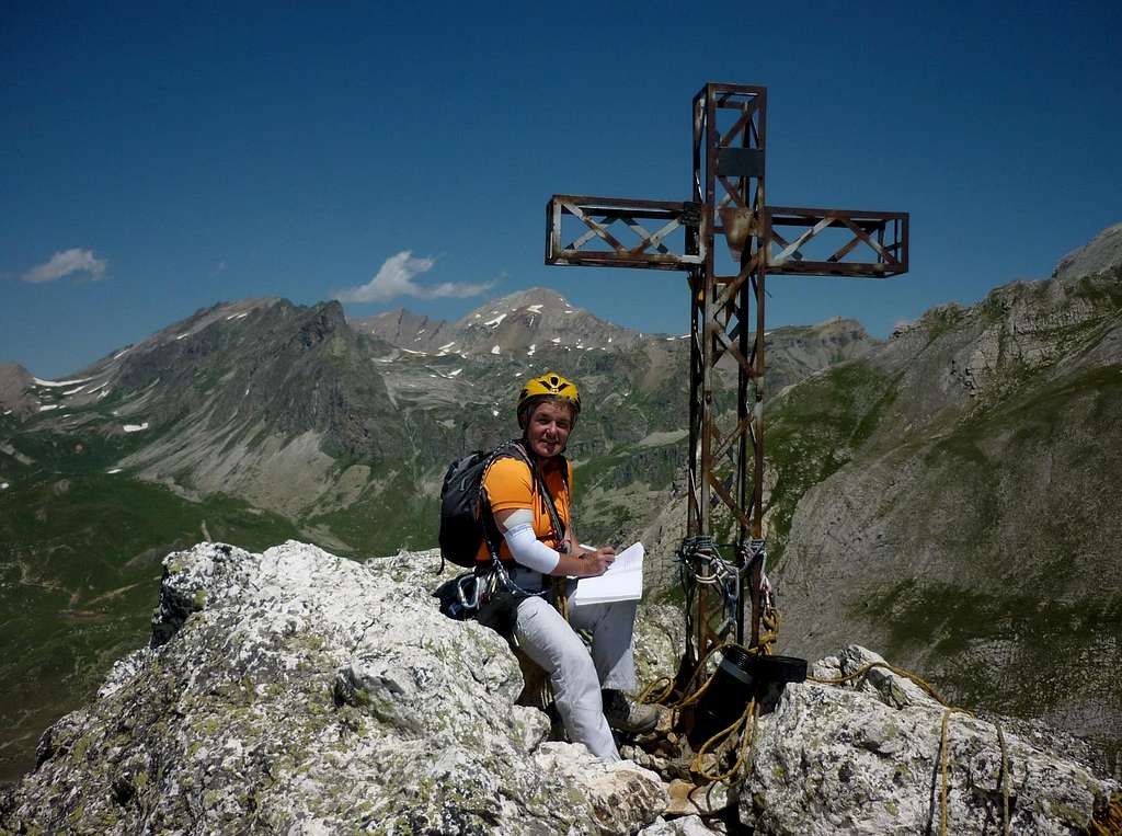
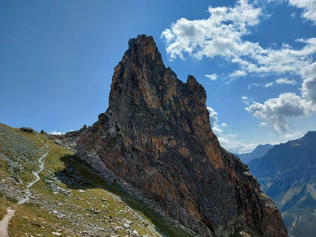
Rocca Castello 2452 m
Rocca Castello is the Northernmost summit of the Castello-Provenzale Group and the highest one, overcoming the nearby Torre Castello for a few meters. This area is consisting of four singular rocky towers - Rocca Castello, Torre Castello, Punta Figari and Croce Provenzale, similar to the Dolomites in reason of their steep shapes. The four peaks are lined up on a line along the N-S direction, running for about 1400 mt. and strongly contrasting with the surrounding gentle sloping mountains and green pastures.
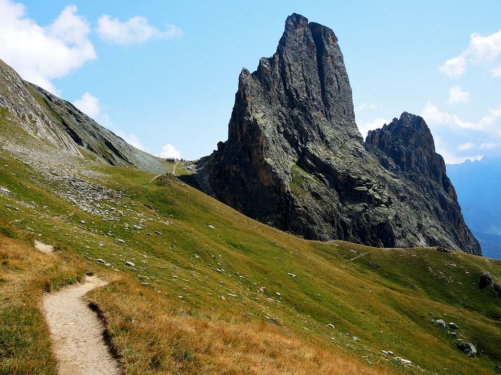
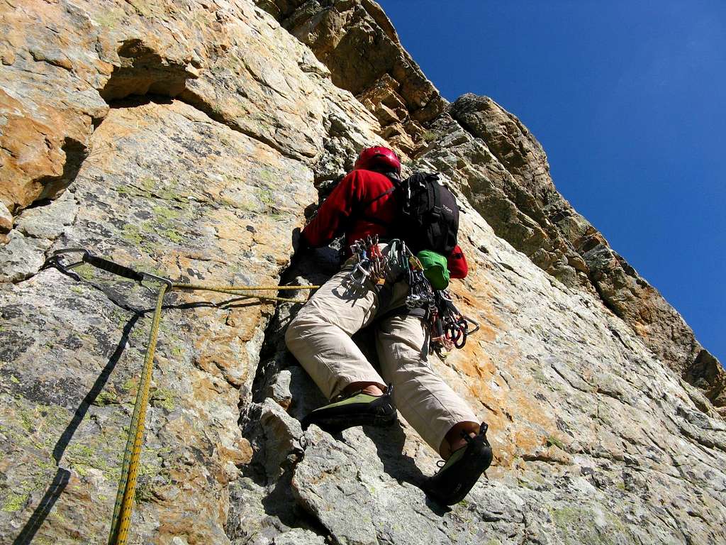
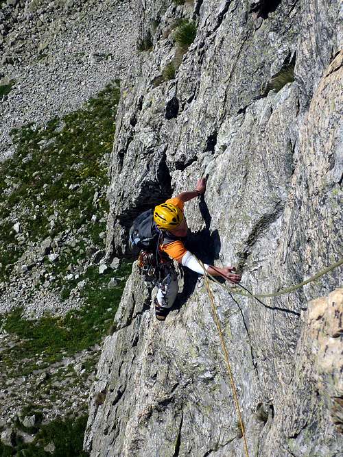
Rocca Castello is a mighty rocky peak, rising between Greguri Pass mt. 2319, a wide grassy saddle in Northern side, and Forcella Castello mt. 2420; this is a narrow and high rocky saddle, cutted on both sides by two deep chimneys (Palestro Chimney on East side and Gedda Chimney on West side), separating Rocca Castello upper part from Torre Castello, which is nearly fastened to Rocca from the foot of the face as far as this saddle. Rocca Castello shows an high-quality orange and grey quartzite with several cracks suited for use natural protections. Current routes are mostly trad climbing, but there are also some sportive routes.
First summiter: Vittorio Sigismondi in 1908

|

|
Getting There
An ancient alp and back Castello-Provenzale West side
Road access
From Dronero mt. 622, a small town 20 km. from Cuneo, which is the main town in this area, follow SS 22 rising along beautiful Maira Valley - or Macra Valley - 45 km. long, where Maira Rivers runs going down towards the plain and Po River. The road reachs San Damiano Macra 743 mt., Ponte Marmora mt. 944, Acceglio mt. 1220, Ponte Maira mt. 1404, Saretto mt. 1533 and Chiappera mt. 1614, last inhabited place, a charming mountain village, typical of this Provencal valley, situated below Croce Provenzale..
East Face Approach
From Chiappera m. 1614 follow the road to Soutan Bridge; at a cross-road turn to right following the road towards Maurin Valley. After the second hairpins you’re reaching a pull-out with a little source on the right-hand side of the road. Parking. From the parking follow the track to Gregouri Pass (GTA and T12 path) going inside Gregury Valley and leading first towards Rocca Provenzale, then to Punta Figari, Torre Castello and finally Rocca Castello East sides. Rocca Castello is the last one in the upper part of Greguri Valley (1 hour and 15 minutes from the parking).

|

|
West face Approach
From Chiappera m. 1614 follow the road to Soutan Bridge; at a cross-road turn to right and follow the road towards Maurin Valley, leading to Grange Collet mt. 2006. Parking. From here follow T14 path reaching Greguri Pass (1 hour from Grange Collet). From the pass go down, skirting below North Ridge and reaching West Face Left edge, the easier way to reach the ledge cutting West Face, from where the climbing routes start.
Faces and Routes overview
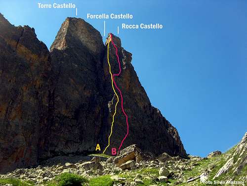
Rocca Castello East Face: A Spigolo Maria Grazia - B Balzola
*East Face
Rocca Castello East Face is a 240 mt. high cliff – in its major point - overlooking upper Greguri Valley. This face, the finest one of the peak, is defined by North Ridge on the right-hand side and Palestro Chimney, situated below Forcella Castello, on the left-hand side.
East Face Routes (from right to left):
- Sigismondi Route AD, III sup., 180 mt.
- East Diagonal Route AD inf., III inf. 150 mt.
- Solo per Bruna D sup., V, 200 mt.
- Buch and Maia Route AD sup., IV+, 180 mt.
- Rinaudo Route D sup., V, 210 mt.
- Il Giglio Farneticante TD inf., V+, 240 mt.
- La vita è tutta un quiz TD inf., VI+, 225 mt.
- Sete d’Oriente TD inf., V+, 230 mt.
- Diedro Calcagno TD inf., V+
- Balzola D sup., V, 240 mt.
- Ulag, gioco selvaggio TD, VI+, 235 mt.
- Spigolo Maria Grazia D, V, 235 mt.
- Panda Route TD, VII, A0, 240 mt.
*West Face
Rocca Castello West Face is a 340 mt high face looking out on Maurin Valley separate from Torre Castello by Gedda Chimney. This face is subdivided in two sectors: a lower 200 mt. skirting board and the true face showing a height of 140 mt. A large middle ledge is running between the two sectors. Rocca Castello shows besides a notched North Ridge ending below Greguri Pass.
Upper W Face Routes (from right to left)
- SW RidgeTD, VI, 140 mt.
- W Direct or Balzola West D, V, 120 mt.
- Apolloni-Manera Route TD, V, A1, 130 mt.
- Rossa RouteTD inf., V+, 130 mt.
- Toast RouteTD, VI+, 135 mt.
- W Face and N Ridge PD, 210 mt.
Lower West face Skirting Board Routes (from left to right)
- Left Route PD inf., II +, 50 mt. The easier way to reach the middle ledge
- Central Route D inf., IV-, 210 mt.
- Right Route PD sup., III, 180 mt.
West Face Integral Routes
- Vecchio Scarpone TD, VI+, 380 mt.
*Other Routes
- Integral N Ridge D inf., V-
- NE Face and N Ridge AD inf., IV
*Routes to Forcella Castello
Forcella Castello is a high and narrow rocky saddle between Rocca Castello and Torre Castello
- Camino Palestro (Palestro Chimney) (East Face) AD, IV+, 200 mt.
- Camoino Gedda (West Face) AD, IV-, 150 mt.
Descent from Rocca Castello - From the top towards East abseil to Forcella Castello (25 mt.). From this rocky saddle climb up to reach the upper Rocca Castello ledge and go along the ledge reaching its Northern edge. A short abseil leads to a rocky gully. From here a sequence of abseils leads to the bottom of the gully. Traverse towards left (North) – iron fixed rope. Last 50 mt. abseil leads to the base. Grades are expressed by the French Scale for the modern routes (letters) and by the UIAA Scale (Roman Numbers) for the trad routes.
Red Tape
No particular restriction in climbing and hiking
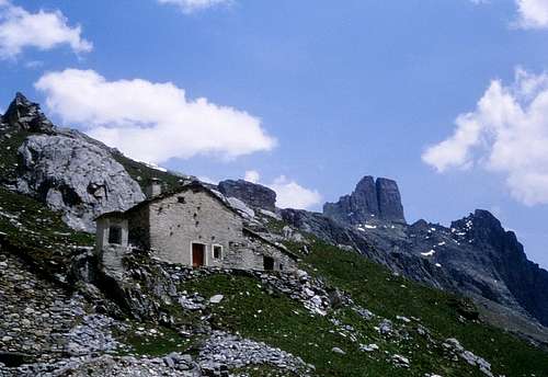
Camping and huts

"Rifugio Campo Base" - Chiappera mail to info@campobaseacceglio.it Phone: +39 334 8416041
“Camping Senza Frontiere” – A short distance after the village of Chiappera Phone: +39 0171 99048 Mobil: +39 348 7391356
“Camping Lou Dahu” in Borgata Marmora
Agriturismo, Hotels and Huts in Acceglio, Saretto, Frere
When to climb
Best season goes from May to the middle of October.
Meteo
Guidebooks and maps
 |
 |
-Guidebooks
"Il Gruppo Castello-Provenzale"
"Monte Viso - Alpi Cozie Meridionali" by Michelangelo Romano - Guide dei Monti d'Italia CAI-TCI