
-
 14298 Hits
-
 90.81% Score
-
 33 Votes
|
|
Area/Range |
|---|---|
|
|
44.50980°N / 6.92020°E |
|
|
Hiking, Trad Climbing, Sport Climbing |
|
|
Spring, Summer, Fall, Winter |
|
|
8044 ft / 2452 m |
|
|
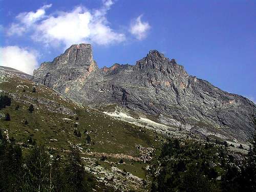
erview ![the small group]()
Castello-Provenzale Group
Castello - Provenzale Group
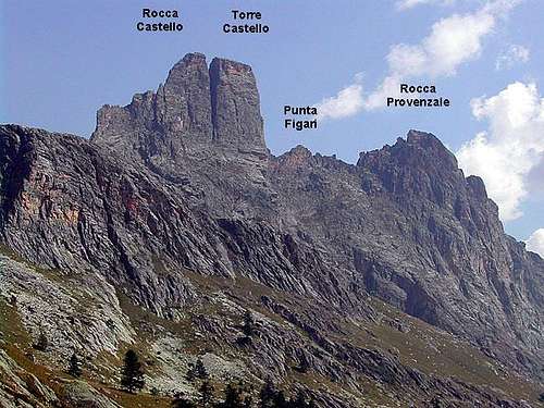
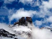
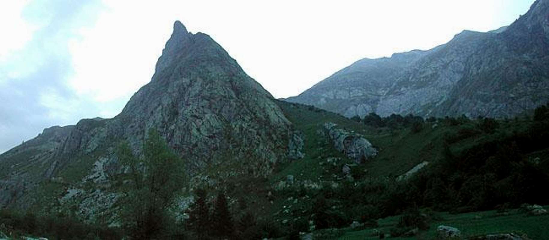
Castello-Provenzale is a small group situated in Southern Cozie Alps, overlooking upper Maira Valley and inclusive of four magnificent and singular rock towers:
- ROCCA CASTELLO, the highest summit
- TORRE CASTELLO, maybe the finest one
- PUNTA FIGARI m. 2345, the minor one, a narrow tricuspidate ridge
- CROCE PROVENZALE or ROCCA PROVENZALE, the only one with an easy route (hard to imagine it looking at it from the valley).
The peaks are perfectly lined up along N-S direction and running for about 1400 meters; they're rising in the orographic left-hand side of Maira Valley between Maurin Valley, a wide valley leading to Maurin Pass, an hiking frontier-crossing on Italy-France border, and Greguri Valley, leading to Greguri Pass.
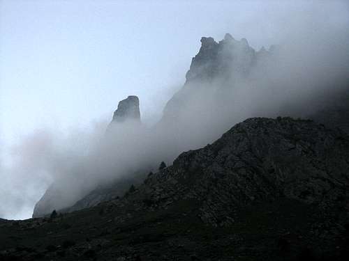
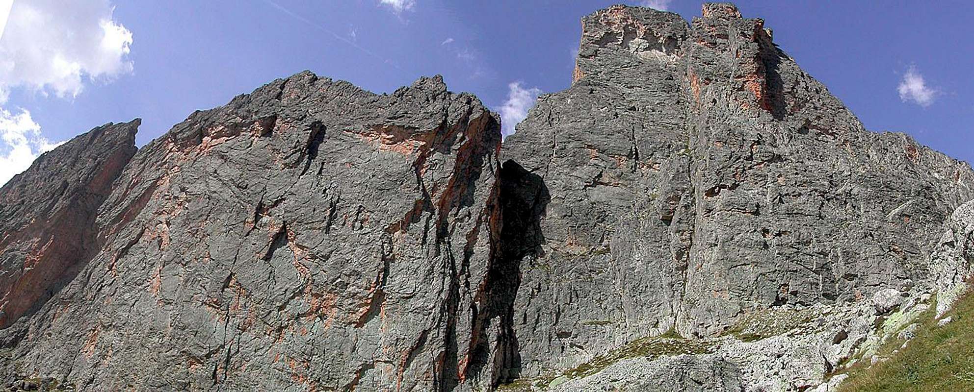
Castello-Provenzale group is truly a unique rocky building, a little natural masterpiece: because of its vertical shapes, its different geological formation and its geographic situation, it's clearly distinguishing itself from the nearby limestone-made summits and it's strongly clashing with their rounded profiles. The towers are built with very high-quality reddish and grey quartzite (Brianzonese Area Permiano), a kind of rock we sometimes can find in the neighbouring Ubaye county (like on Aiguille Pierre Andrè and Aiguille Large de Mary). All the four towers – with the exception of Croce Provenzale South Ridge – are showing steep and impressive faces, overlooking Gregouri Valley on East side and Maurin Valley on West side. Due to their slender and steep shapes, this peaks are often and correctly called “Val Maira Dolomites”, although Castello-Provenzale metamorphic origin is quite different from the sedimentary rocks which constitute the “true” Dolomites.
Also the climbing way is different; quartzite is a very compact and hard kind of rock, but plentiful of cracks fit to receive friends and excentrics, rather then pegs. Several routes had been realized on all the towers, because of the high quality of quartzite; this kind of rock can be very slippery when not perfectly dry, but it offers some very fine, difficult and technical climbing routes. Also the peacefulness and the beauty of this environment makes Castello-Provenzale Group a magnificent place for rock-climbing.
![]()
![]()
![]()
![]()
![]()
![]()
ROAD ACCESS
In SW side of Piemonte a long valley, oriented East to West, grows from the plain rounding Cuneo and arrives to the France border in a wild, low frequented and peaceful environment: that is Val Maira.
It starts from Dronero mt. 622 and ends at the Col de Maurin 2637 mt., on the border between Italy (East) and France (West) and wherefrom one can give a glance to Ubaye county (France).
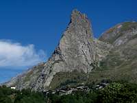
A good and long (more than 45 km) road goes along this valley and, with very fine sceneries, allows to reach a very small village called Chiappera mt. 1614, where a strange pyramid hangs over the road : that is Rocca Provenzale, the first summit of this fine and small group, very interesting for classic and modern rock climbing. Chiappera is Castello-Provenzale best starting point for hikes and climbing in this area (Alta Val Maira).
There are two main starting points to get there
By car :
from Torino (Piemonte) - motorway to Savona (A6), way out for Marene, Fossano, Mondovì.
from Genova (Liguria) - motorway A10 to Savona and motorway A6 for Torino, , way out for Marene, Fossano, Mondovì.
Follow for Busca, Dronero and Acceglio (main built-up area of the valley)
Herefrom follow the good road till Chiappera (1614 mt.), at the end of the tarred road.
By public transportation:
Once you reach Cuneo (from Torino or Savona), starting from the railway station and using the Autolinea Nuova Benese you can reach Dronero and Acceglio, then you have to use the Sherpabus service (useful for the GTA raid).
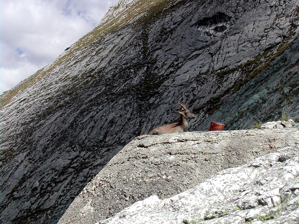
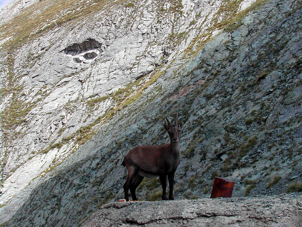
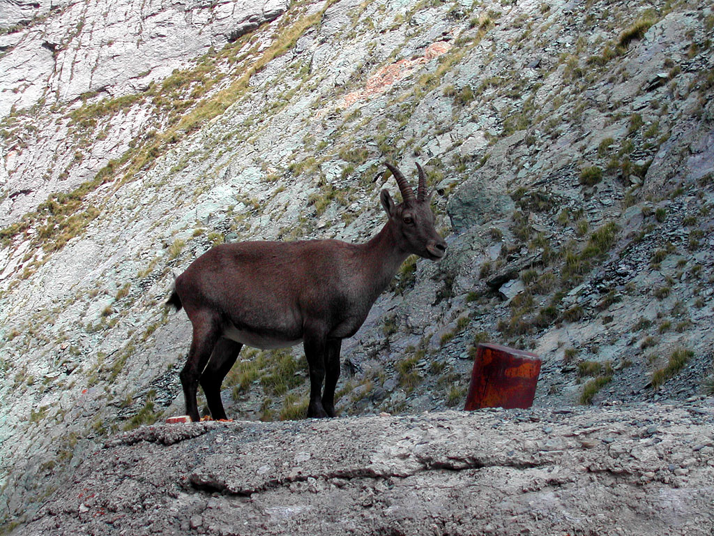
The shortest walk is the trip all around the group starting from Chiappera, getting to Greguri Col mt. 2319, where you can find a war position often crowded with some ibex that look very indifferent...
 ...
...  ...
...  ...
... 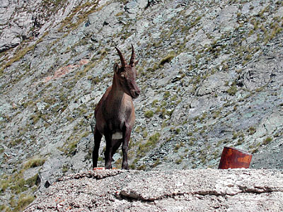
.... and descending on the north side to the Grangia, where a good white road leads you back to Chiappera allowing you to see all the summits surrounding the high part of Val Maira.
Of course this hike is the best way to enjoy the area, before climbing the Rocca Provenzale S ridge.
Many other well marked paths run across the valley (about them you can find free, useful and complete leaflets in Campo Base Refuge)
Rock climbing
A lot of technical climbing routes had been realized over these extraordinary rocky towers, both classic and modern routes. They are all difficult: none is easier than D (4° UIAA - 5.4) and some are really extreme. The unique easy route existing (F+) allows to get Croce Provenzale summit along its S ridge: the route, when seen from below, looks much more difficult than it really is.
![]()
![]()
![]()
![]()
![]()
![]()
![]()
Best season for climbing goes from late Aprile to late October.
best one is Campo Base few km beyond Chiappera (camping area, Refuge and Restaurant)
some "free"areas "Campeggiare senza frontiere" few beyond the further (paths are on the other side of the Maira stream)
A free Camper area in Chiappera
Camping Lou Dahu” in Borgata Marmora
You can find other "standard" accomodations like small hotels, agriturismo and huts in Chiappera, Acceglio, Saretto and Frere.
A "higher" accomodation is the Stroppia bivouac, but is definitely out of the range and only useful for walks and ascent in Chambeyron Group.
At Gregouri Col you could use, as a makeshift shelter or as a base for climbings on E walls, the war position.
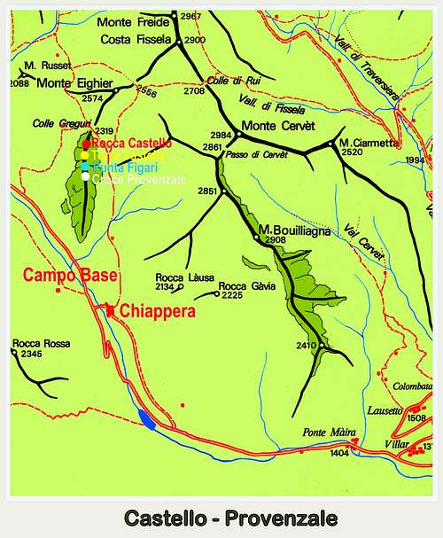
![Castello-Provenzale map]()
METEO REGIONE PIEMONTE
METEO FRANCE
METEO ALPI

“Monte Viso – Alpi Cozie Meridionali” by Michelangelo Bruno – Guide dei Monti d’Italia CAI-TCI
“Il Gruppo Castello-Provenzale” by Michelangelo Bruno - A good guidebook (only in Italian language but with good sketches), which can be found in Campo Base Refuge.
Castello-Provenzale Group
Castello - Provenzale Group
Castello-Provenzale is a small group situated in Southern Cozie Alps, overlooking upper Maira Valley and inclusive of four magnificent and singular rock towers:
- ROCCA CASTELLO, the highest summit
- TORRE CASTELLO, maybe the finest one
- PUNTA FIGARI m. 2345, the minor one, a narrow tricuspidate ridge
- CROCE PROVENZALE or ROCCA PROVENZALE, the only one with an easy route (hard to imagine it looking at it from the valley).
The peaks are perfectly lined up along N-S direction and running for about 1400 meters; they're rising in the orographic left-hand side of Maira Valley between Maurin Valley, a wide valley leading to Maurin Pass, an hiking frontier-crossing on Italy-France border, and Greguri Valley, leading to Greguri Pass.
Castello-Provenzale group is truly a unique rocky building, a little natural masterpiece: because of its vertical shapes, its different geological formation and its geographic situation, it's clearly distinguishing itself from the nearby limestone-made summits and it's strongly clashing with their rounded profiles. The towers are built with very high-quality reddish and grey quartzite (Brianzonese Area Permiano), a kind of rock we sometimes can find in the neighbouring Ubaye county (like on Aiguille Pierre Andrè and Aiguille Large de Mary). All the four towers – with the exception of Croce Provenzale South Ridge – are showing steep and impressive faces, overlooking Gregouri Valley on East side and Maurin Valley on West side. Due to their slender and steep shapes, this peaks are often and correctly called “Val Maira Dolomites”, although Castello-Provenzale metamorphic origin is quite different from the sedimentary rocks which constitute the “true” Dolomites.
Also the climbing way is different; quartzite is a very compact and hard kind of rock, but plentiful of cracks fit to receive friends and excentrics, rather then pegs. Several routes had been realized on all the towers, because of the high quality of quartzite; this kind of rock can be very slippery when not perfectly dry, but it offers some very fine, difficult and technical climbing routes. Also the peacefulness and the beauty of this environment makes Castello-Provenzale Group a magnificent place for rock-climbing.


Getting There
ROAD ACCESS
In SW side of Piemonte a long valley, oriented East to West, grows from the plain rounding Cuneo and arrives to the France border in a wild, low frequented and peaceful environment: that is Val Maira.
It starts from Dronero mt. 622 and ends at the Col de Maurin 2637 mt., on the border between Italy (East) and France (West) and wherefrom one can give a glance to Ubaye county (France).
A good and long (more than 45 km) road goes along this valley and, with very fine sceneries, allows to reach a very small village called Chiappera mt. 1614, where a strange pyramid hangs over the road : that is Rocca Provenzale, the first summit of this fine and small group, very interesting for classic and modern rock climbing. Chiappera is Castello-Provenzale best starting point for hikes and climbing in this area (Alta Val Maira).
There are two main starting points to get there
By car :
Follow for Busca, Dronero and Acceglio (main built-up area of the valley)
Herefrom follow the good road till Chiappera (1614 mt.), at the end of the tarred road.
By public transportation:
Once you reach Cuneo (from Torino or Savona), starting from the railway station and using the Autolinea Nuova Benese you can reach Dronero and Acceglio, then you have to use the Sherpabus service (useful for the GTA raid).
 |  |
Some small info about Hiking and Climbing
HikingThe shortest walk is the trip all around the group starting from Chiappera, getting to Greguri Col mt. 2319, where you can find a war position often crowded with some ibex that look very indifferent...
... ...  ...
... 
.... and descending on the north side to the Grangia, where a good white road leads you back to Chiappera allowing you to see all the summits surrounding the high part of Val Maira.
Of course this hike is the best way to enjoy the area, before climbing the Rocca Provenzale S ridge.
Many other well marked paths run across the valley (about them you can find free, useful and complete leaflets in Campo Base Refuge)
Rock climbing
A lot of technical climbing routes had been realized over these extraordinary rocky towers, both classic and modern routes. They are all difficult: none is easier than D (4° UIAA - 5.4) and some are really extreme. The unique easy route existing (F+) allows to get Croce Provenzale summit along its S ridge: the route, when seen from below, looks much more difficult than it really is.


When to Hike and Climb
All year long for hiking.Best season for climbing goes from late Aprile to late October.
Accomodations
There is a lot of camping areas nearby Chiappera:some "free"areas "Campeggiare senza frontiere" few beyond the further (paths are on the other side of the Maira stream)
 |  |  |
Meteo
METEO REGIONE PIEMONTE
METEO FRANCE
METEO ALPI
Red Tape
No fees, no permits requiredGuidebooks and maps
 |  |
“Il Gruppo Castello-Provenzale” by Michelangelo Bruno - A good guidebook (only in Italian language but with good sketches), which can be found in Campo Base Refuge.