
|
|
Route |
|---|---|
|
|
46.88600°N / 10.87520°E |
|
|
Mountaineering |
|
|
Summer |
|
|
One to two days |
|
|
PD- (UIAA I / 35°) |
|
|
I |
|
|
Overview
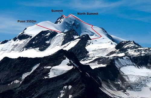 Wildspitze North Face with Rofenkarferner Route Topo |
The well-known German mountain magazine Alpin.de says it best: The Rofenkarferner route to the summit of Wildzpitze is often referred to as the ‘new normal route’. Although it should be said that the real normal route still is the Mitterkarferner Route from the Breslauer Hut, the Rofenkarferner Route is increasingly becoming more popular.
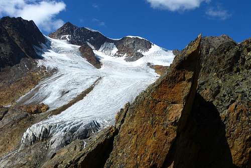
Main reason for this is the difficulty of the climb. The route offers a fairly easy ascent to the summit of Wildspitze. The route is graded PD- being mostly a walk over glaciated terrain. Under the north summit the slope is in my opinion steepest with an angle of about 30/35 degrees. Although no real climbing is involved in the route the greatest danger is the crevassed Rofenkarferner-Glacier. So be sure to rope up and be careful here.
Apart from the fact more and more people head up the Rofenkarferner Route from the Breslauer Hut, it is also great to use the route for a round trip. Go up the normal route from Breslauer Hut over the Mitterkarferner to the summit. Traverse the ridge from the real summit to the north summit. (which actually used to be higher in past days; due to global warming the snowy North summit melted so much the rocky South summit now is the highest point of Wildspitze. The elevation therefore dropped from 3779m to 3768 meters) From the north summit go further down along the Rofenkarferner Route until you get back at the Breslauer Hut again. This route makes for a great day trip.
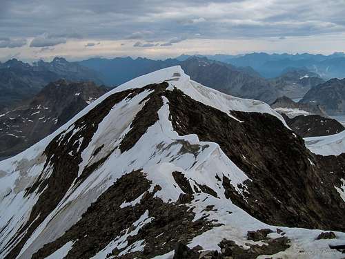 Wildspitze North Summit |  Mittelbergferner & Otztal Alps from point 3552m | 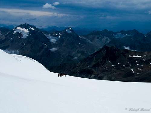 Climbers approaching Point 3552 |
Approach Route
 Approach Route Vent-Breslauer Hut OVERVIEW MAP |
Approach Route to the Breslauer Hut
The route to the Breslauer Hut starts from Vent. To get to this village see the section ‘’How to get there’’ further below.
An easy, well makred trail starts from the village and leads up the mountain to Stablein at 2365 meters. It takes about 1,5 hours to get there. Another option is to use the ‘’Venter Seilbahn’’ cablecar. This chairlift starts in Vent and goes up to Stablein.
Venter Seilbahn GesmbH & CoKG
6458 Vent
Telefon 05254 / 81 54
For more information about the calbecar to Stablein see : Website Stablein Cablecar
From Stablein it is another 1,5 hours walk until you reach the Breslauer Hut at 2850 meters. The trail is easy (T2) and marked very well .
For an overview of the Approach route see the map above
 Schalfkogel from the trail above Stablein | 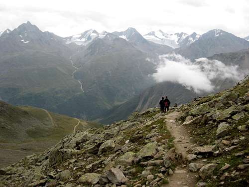 Trail Breslauer Hut - Rofenkarferner | 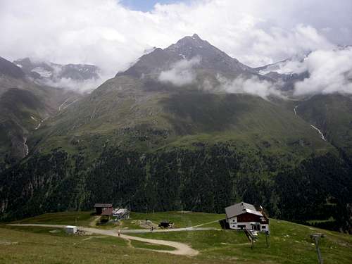 Stablein Alm chairlift |
Route Description
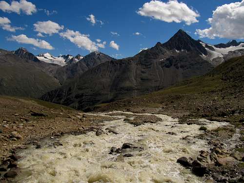
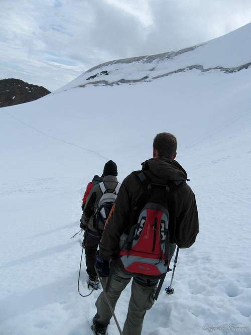
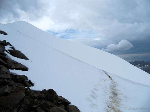
The starting point of this route is the Breslauer Hut. After a short night of sleep leave the hut towards the east-northeast. To be more exact: Follow the signs towards Wildes Mannle. The path is marked well and is easy (T2/T3). In approximately 15 minutes there is junction. If you take a right you will go to the Wildes Mannle, an easy just over 3000-meter summit. Keep left at the junction. The path will lead you further ,in about 45 minutes, to the base of the Rofenkarferner (Glacier). You are now at a small glacial lake. From this point on, put on crampons and rope up.
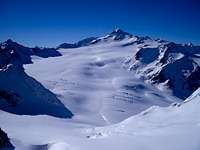
Find your route up the Rofenkarferner and be aware of crevasses. The glacier is not steep at first but gradually becomes somewhat steeper. At the upper-right part of the glacier a rocky ridge is visible which leads to Point 3552m. Cross the glacier to the base of this rocky ridge. When you arrive here, follow up the ridge to the Point 3552m. The climbing is fairly easy and never exceeds the UIAA Grade I.
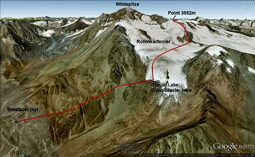 Rofenkarferner ROUTE Part I | 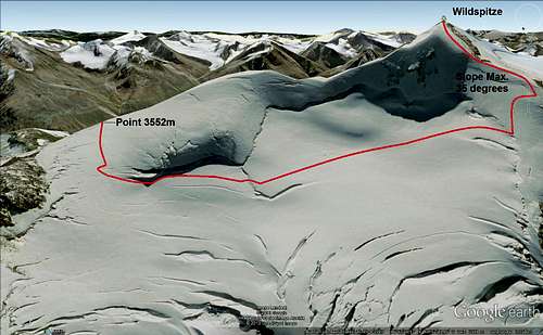 Rofenkarferner ROUTE MAP Part II |
At Point 3552m you can now see the massive glaciated North side of Wildspitze. Enter the Taschachferner and keep heading west. You will pass the whole North Face of Wildspitze and its smaller brother Kreuzerschneide (3677m). In front of you the Northwest ridge is becoming closer and closer. The terrain is getting a bit steeper (max 30-35 degrees) until you will eventually reach the northwest ridge. On the ridge follow it upon the North summit. From the North summit it is only minutes before you will be on top of Tirol: Wildpitze; 3768m.
This description is read best with the two topographic 3D maps above which show the whole route. The first map shows the route from the Breslauer Hut until Point 3552m. The second map shows the route from the Point 3552m to the summit of Wildspitze.
As a side note: I can recommend anyone to look at the Wildspitze in Google Earth. When you zoom in on the mountain you can clearly see the trails in the snow and many people on it heading to or coming down from the summit.
 Crossing underneath the North Wall | 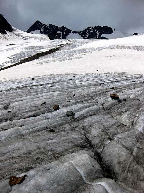 Wildspitze looming above the Rofenkarferner by rgg | 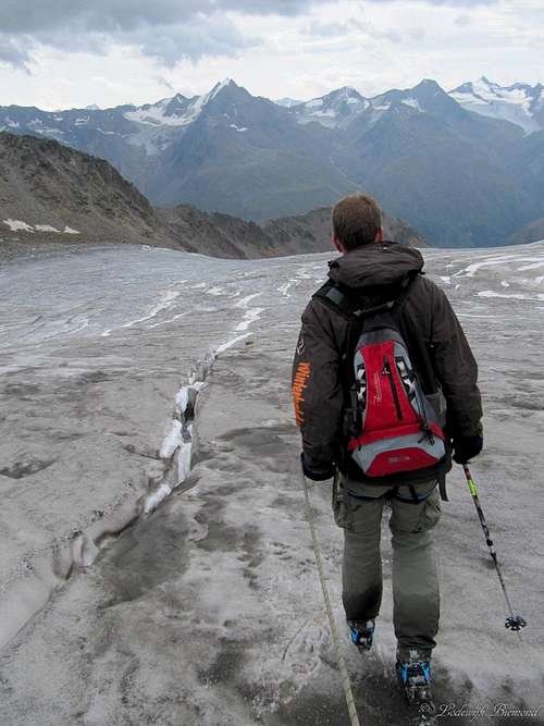 On the Rofenkarferner |
 @ Point 3552m looking towards Wildspitze | 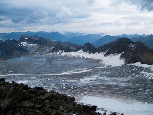 The Giant Mittelbergferner from point 3552m | 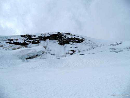 Crossing underneath the Wildspitze North Wall |
Walking/Climbing Times

Base of Rofenkarferner
Vent (1950m) – Stablein (2365m) 1,5 hours
Stablein (2365m) – Breslauer Hut (2850m) 1,5 hours
Breslauer Hut (2850m) – Base of Rofenkarferner Glacier 0:45min / 1 hour
Base of Rofenkarferner – Point 3552m 1 hour and 45 min.
Point 3552m – North Summit (3764m) 1 hour
North Summit (3764m – South (Main) Summit (3768m) 10 minutes
How to get there
Rofenkarferner and Wildspitze by GijsJ
From the West:
Vorarlberg - Tirol via Arlberg Pass or trough Arlberg Tunnel (S 16 Federal Road) - direction Landeck - change to A 12 Autobahn - exit: Ötztal - B 186 Federal Road (35 km) to Vent
From the North:
- Bad Tölz - Achen Pass - B 181 Federal Road - Jenbach - A 12 Autobahn - Innsbruck - exit: Ötztal - B 186 Federal Road (35 km) to Sölden - Pfronten - Reutte - Fernpass - Imst - A 12 Autobahn - exit: Ötztal or B 171 Federal Road to Ötztal (no Vignette toll-sticker required!) - B 186 Federal Road (35 km) to Sölden - Garmisch Partenkirchen - Mittenwald - Scharnitz - Seefeld - Telfs - A 12 Autobahn - exit: Ötztal or B 171 Federal Road to Ötztal (no Vignette toll-sticker required!) - B 186 Federal Road (35 km) to Vent
From the East:
Munich or Salzburg - A 93 Autobahn to Kufstein - A 12 Autobahn direction Innsbruck - Ötztal - B 186 Federal Road (35 km) to Vent
From the South:
Merano/South Tirol - via Timmelsjoch Pass to Vent. High Alpine road leading up to 2.500 m above sea level. The Pass is open only from the beginning of June to the middle/end of October. Toll road!
You can find a RoutePlanner here!
Essential Gear
Basic glacier gear: ice axe, crampons, harness, rope.A helmet
Huts

Views from Breslauer Hut are great!

Breslauer Hut (2850m)
+4352548156 (hut),
+436642141579 (mobile),
+4352548153 (valley)
Camping

North Summit & Connecting Ridge

The village of Solden nearby Wildspitze
There are some beautiful campsites in the main Otztaler valley:
Camping Otztal Langenfeld
NaturCamping Otztal
Maps & External Link
Wildspitze
DAV Alpenvereinskarte 30/6, Ötztaler Alpen, Wildspitze. Scale 1:25 000.
Kompass Karte 43: Otztaler Alpen, Otztal, Pitztal. Scale: 1:50 000.
Good overview of the Rofenkarferner Route on the Alpin.de Website