|
|
Mountain/Rock |
|---|---|
|
|
36.31940°N / 50.74166°E |
|
|
Mountaineering |
|
|
Summer |
|
|
13337 ft / 4065 m |
|
|
Overview
Click for Introduction to the Central Alborz Mountains.Click for a Detailed Map of the Central Alborz Mountains.
Note About Elevation: My GPS measured an elevation of 4080 m. The 4065 m figure is per the Iranian 1:50 000 Map
Note About Name: The name “Saal Barf” appears on the Iranian 1:50 000 Map to the north of this peak. I am otherwise not aware of any names for this peak.
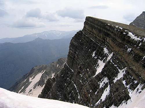
 South Face
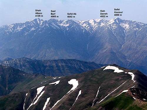 North Face
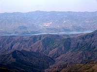
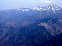
In the western portion of the Central Alborz Mountains of northern Iran, on the crest of the ridgeline that separates the Taleghan Valley to the south from the Alamoot Valley to the north, you will find a series of five 4000 m peaks. East to west, these peaks include:
1) Shah Alborz 4125 m
2) Saal Barf 4065 m
3) Sefid Ab 4042 m
4) Siah Darreh 4022 m
5) Taleghan Peak (Sefid Kootool) 4089 m
 SE Face
 West Face
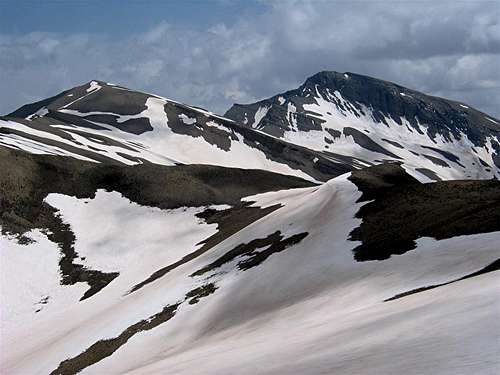
To the east, Saal Barf is separated from the Shah Alborz Peak via a 3960 m saddle and to the west, Saal Barf is connected to the Sefid Ab Peak by a 3980 m saddle. The northern slopes of Saal Barf are rocky/wall-like and drop into a glacially carved valley that eventually drops down to the bottom of the Alamoot River Valley (1800 m). The southern slopes of Saal Barf give rise to the Hasan Joon Stream which joins the Taleghan River near the Taleghan Lake behind the Taleghan Dam.
Saal Barf is best approached via its southern slopes. Much of the route is the same as that for the neighboring Shah Alborz Peak which is a popular climbing destination and has an established trail. The cliffs that form the western slopes of the Shah Alborz Peak make it difficult to access Saal Barf via the summit of Shah Alborz (see the attached “Southern Slopes” Route Page for more details). The starting point is the village of Hasan Joon at an elevation of 1980 m. One way hiking distance is 17.1 Km.
 SW Face, (L) Saal Barf & (R) Shah Alborz
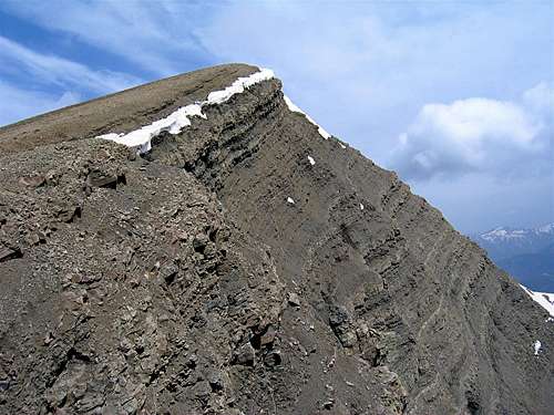 East Face
Below you will see pictures of what you will encounter on your way to the summit of Saal Barf:
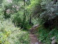
On the Trail, 2000-2300 m:
Just above the Hasan Joon Village, the trail follows the stream at the bottom of a tree-filled valley. You will hike around 7 Km while gaining only 300 vertical meters.
 |  |  |  |
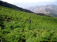
On the Trail, 2300-2600 m:
Here the trail goes up the slopes steeply. In late spring/early summer, the slopes are covered by beautiful mountain flowers.
 |  |  |
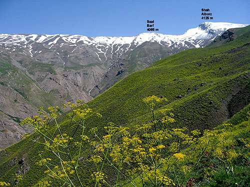
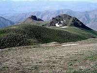
On the Trail, 2600-3200 m:
Here Shah Alborz and Saal Barf Peaks come into full view.
 |  |  |
On the Trail, 3200-3500 m:
Here you will come across two flat spots ideal for camping. The first one is at 3250 m (Camp 1) and the second at 3400 m known as Goosfand Sara (Sheep herding place).
 Camp 1 Camp 1 |  |
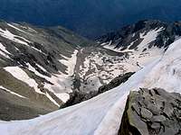
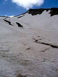
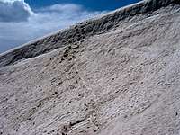
Above 3500 m:
In late spring/early summer, snow still covers much of these slopes.
 |  |  |  |
 From the saddle between Saal Barf & Shah Alborz
Views From the Summit of Saal Barf: