
-
 52701 Hits
-
 93.1% Score
-
 41 Votes
|
|
Route |
|---|---|
|
|
37.98053°N / 119.28508°W |
|
|
Hiking |
|
|
Spring, Summer, Fall |
|
|
Half a day |
|
|
Overview
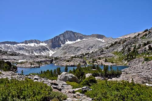
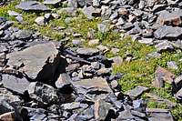
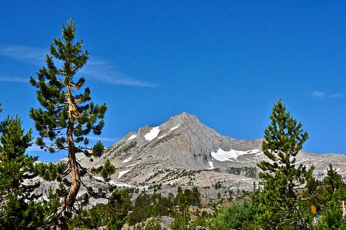
Simply known as "The Loop Trail," Saddlebag Loop Trail" is probably the easiest loop trail I have seen in the Sierras. Although it has a respectable six mile length, the amount of the elevation gain and loss does not exceed a few hundred feet. This trail attracts nature lovers of all ages from small children to folks well into their retirement. The views of North Peak and Mount Conness dominate the entire hike. You also pass by Excelsior Mountain and Saddlebag Crest. The elevation of the loop stays at over 10,000 feet for its entire length and passes by several high altitude lakes and streams.
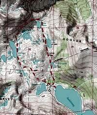
Route Description and Points of Interest
 |
 |
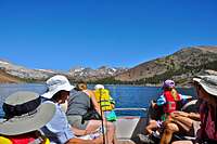 |
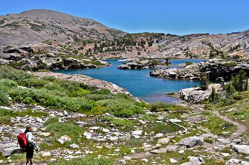
The trailhead for the loop trail starts on the opposite side of Saddlebag Lake from the parking lot. You have the option to walk around the lake to get to the trailhead. This walk is tedious and not very interesting. The second way and much more fun is to take the water taxi that operates from 7:00 a.m. to 7:00 p.m. daily. From the water taxi dock you will see two trailheads. You can take the right one to start the loop and come out of the left one, or visa versa. In this page I will describe taking the right one to start.
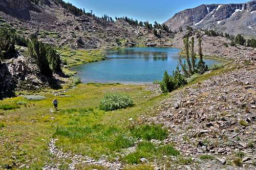
From the water taxi dock on the north end of Saddlebag Lake take the right fork and hike about a mile toward Lundy Pass. A worthwhile side trip is to leave the trail at a small wooden bridge and walk easterly a short distance to see a true gem. This is Hummingbird Lake just behind a small hill and hidden from the trail. From the north end of the lake you can walk up a faint trail to a meadow and an incredible view of North Peak and Mount Conness. You should be able to see the main trail from this meadow.
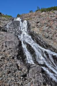
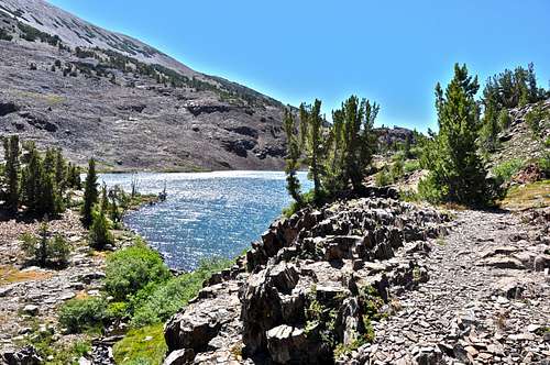
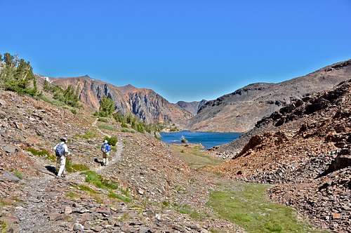
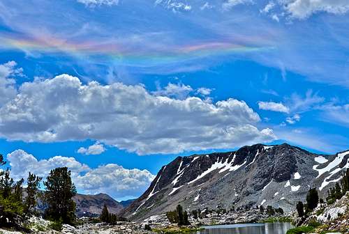
Continuing on the main trail for another mile will bring you to Odell Lake at an elevation of 10, 267 feet located in a canyon. The trail skirts the westside and on top of some rock formation on the west shore of the lake. Another three quarters of a mile on the main trail will bring you to Helen Lake. Another worthy side trip is to walk east from the north end of the lake following a creek to see a huge waterfall cascading down into Lundy Canyon. Skirting around the north shore of Helen Lake, the trail begins to head south to Shamrock Lake. From hereYou will climb up a short hill and drop down the back side to Steelhead Lake heading directly south. At this point you get the best and closest view of North Peak. Continuing south another half a mile will bring you to Wasco Lake and the best view of Saddlebag Crest where the photo of a wispy rainbow on this page was taken. One more mile on the trail you will come back to your starting point and the water taxi pick-up point and back to the parking lot.
How To Get There:
From Highway 395 in California take Highway 120 toward Tioga Pass and Yosemite National Park. Drive some eight miles up the winding road to Tioga Pass Resort/cafe. The road to Saddlebag Lake splits off from 120 just before the resort. There is a parking lot, a campground and a store where you can purchase food, drinks, and water taxi tickets.
Essential Gear
Good fitting pair of boots, rain gear, sun block, mosquito repellent and a water bottle.
 |
 |
External Links
North Peak
Mount Conness
Excelsior Mountain
Saddlebag Crest