
-
 15733 Hits
-
 82.48% Score
-
 15 Votes
|
|
Mountain/Rock |
|---|---|
|
|
44.90073°N / 122.044°W |
|
|
Hiking, Scrambling |
|
|
Spring, Summer, Fall |
|
|
5710 ft / 1740 m |
|
|
Overview
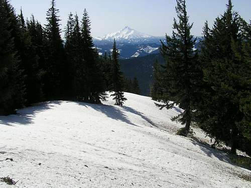
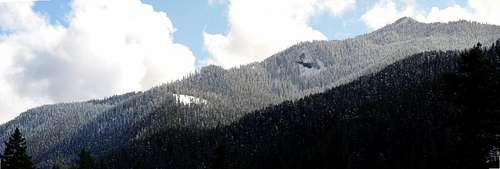
The highest mountain in the Bull of the Woods Wilderness Area at 5710 feet is Schreiner Peak. It is an elusive summit tag as there is no established trail to the summit. The views afforded of the Cascade giants are superb as well as most of the main peaks in the Wilderness Area (well, that goes without saying if you are the highest point for miles). The shortest route from the nearest road goes up steep slopes with rocky ridges and would be best done in Spring when snow softens the steepness and reduces the bushwhacking involved.
There are probably four main routes to be considered to the summit. One would be to take the trail up to Bull of the Woods to the southwest, take the connecting trail to Big Slide Mountain and bushwhack northeast along the ridge connecting that peak with Knob Peak and Schreiner. A second way would be to take the Elk Lake Trail from Road 6380 to the southeast all the way to where it connects with the trail up to Big Slide and then take the same ridge over. A third way would be to take the same Elk Lake Trail for just under a mile and bushwhack up the forested ridge to the northwest. The final route is that which can be found attached to this page, the East Ridge Bushwhack.
Whichever way you go, be prepared and skilled in routefinding. A GPS would be handy. It's steep enough that in winter, you would benefit from either crampons or snowshoes depending on the snow conditions.
Schreiner is named for Fred J. Schreiner who taught Forestry Management in the 1930's at Oregon State University. Schreiner is the German word for "carpenter."
Getting There
To access the East Ridge Bushwhack trailhead, you would take Highway 224 from I-205 in Portland down through Estacada, OR to Road 46 which branches off to the right shortly after you pass the Ripplebrook Ranger Station. You then take Road 46 about 3 and a half miles to Forest Road 63. Turn right onto Forest Road 63. (Actually, you cold access this from the south in the Detroit Area from Road 46 there but this is seasonally closed due to snow and not plowed so make sure before you try that way.) Take Forest Road 63 about 12 and a half miles to Road 6380. Take Road 6380 about 2 and 1/4 miles to where it "T's" just across a small bridge. To get to the East Ridge Bushwhack route, turn right and follow this road about 1.4 miles just after the second hairpin left turn to an open area below an old clearcut. (GPS point N44degrees 54.416' W122degrees 00.959') Park here. (Please note this is a rough unmaintained road from what I can tell. Small branches hang out into the road if you are worried about your paint job. Also, there are some large ruts or erosion control drains in the road and my guess is that a vehicle without high clearance would bottom out. Just somethings to keep in mind.)
To get to the Elk Lake Trailhead, you would take the left turn after the bridge mentioned in the paragraph above and follow it a short distance to its end.
To access the trail to walk the ridge from Bull of the Woods, see directions on the Bull of the Woods page.
Red Tape
There is no requirement/fee/pass needed to park at the East Ridge Bushwhack start. You do need a Northwest Forest Pass to park at the Elk Lake Trailhead and the trailhead for Bull of the Woods.Camping
There are numerous small campsites along the roads in. At Ripplebrook is the Ripplebrook Campground.Link to another nearby site, Raab Campground
Also, nearby Lockaby Campground
As for backwoods camping, there is a flat spot along the East Ridge Bushwhack route with views of the summit that would be suitable for camping. It was at about 4200 feet and is GPS point N 44degrees 54.059' by W 122 degrees 01.453'.
Mountain Conditions
Estacada Ranger District595 NW Industrial Way
Estacada, OR 97023
(503) 630-6861
When To Climb
For the East Ridge and Elk Lake Trailheads, typically May - October is what the snow levels permit.June/July - October for the Bull of the Woods route trailhead.