
-
 13109 Hits
-
 81.18% Score
-
 13 Votes
|
|
Mountain/Rock |
|---|---|
|
|
39.14130°N / 105.1942°W |
|
|
Douglas |
|
|
Hiking, Trad Climbing, Sport Climbing, Toprope, Bouldering, Scrambling |
|
|
Spring, Summer, Fall, Winter |
|
|
8894 ft / 2711 m |
|
|
Overview
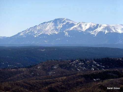
Pikes Peak from Sheep Nose
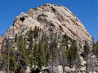
Sitting almost due south of Douglas County highpoint Thunder Butte sits a graceful yet rugged dome of granite named Sheep Nose. This South Platte gem is home to numerous climbing routes and bouldering problems, but also has a couple of scrambling routes up the north side. Also called "Sheeps Nose" or "Sheep’s Nose" by some, every route to the top of this formation is bound to be fun – there is no simple walk-up path.
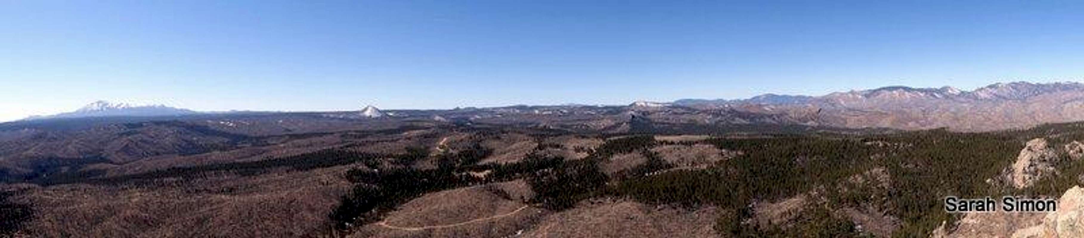
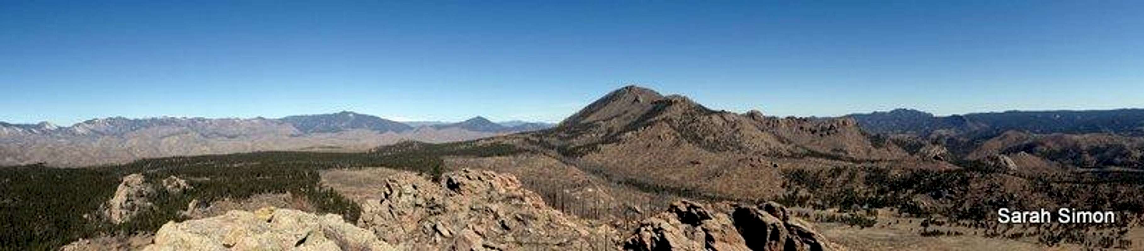
The wide-open views from the rocky granite summit are astounding. Pikes Peak dominates to the south, while directly to the north sits Thunder Butte. Much of the Rampart Range is available to the east while the Lost Creek Wilderness sits on the western horizon.
Rank: 2997th highest peak in ColoradoProminence: 394 feet
USGS Quad: Westcreek
Planning Map: Trails Illustated #135 Deckers | Rampart Range
Peak Stats: Lists of John
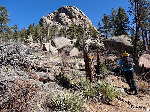
Getting There
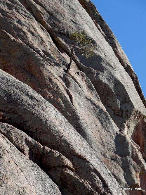
Lone Pine on granite
This peak is approximately 90 minutes driving time from Denver or Colorado Springs.
- Driving from the north | Denver: Travel
south from Deckers on CO 67 toward the town of Westcreek and turn right on
Westcreek Road (CR 78).
- From the south | Colorado Springs: Travel north from Woodland Park on CO 67 toward the town of Westcreek and turn left on Abbey Road, which runs into Westcreek Road. Turn left on Westcreek
Road (CR 78).
Travel southbound on Westcreek Road to CR 68 (Stump Road) and turn right. Stump Road turns into FS 360.
- Southern Approach Access: Drive approximately 1.8 miles west on CR 68 / FS 360 (Stump Road). Park south of the summit in a pullout on the left side of the road. 4x4 is not needed
to reach this parking area. Cross the road and head north, ascending a broad sandy gully and do your best to find and keep the faint climbers trail.
- Northern Approach Access: Continue on CR 68 / FS 360 (Stump Road) to FS 523 and travel north for over a mile (approximately 1.5 miles) to parking northwest of the peak. 4x4 may be necessary.
 North side rap | 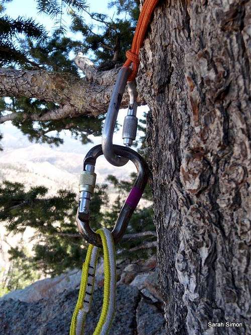 Tree anchor | 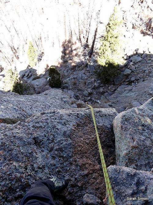 Rap looking down |
Route Information
Approach from south
Class 3+ - 4: There are at least two scrambling routes up the north side of the peak, including a rocky slope used also as a rap descent from below the summit, and a boulder-choked gully rumored to be stiff Class 3+ to Class 4.
5th Class: Numerous technical climbing routes exist on this peak, particularly on the warm southern aspect. (Which is good in the winter, of course, and not so good in the summer.) There is one gully on the western end of the southern aspect that exploits a weakness to keep the climbing blocky low 5th class. Otherwise, the routes on the popular southeastern slabs start at 5.8 YDS.
To reach the summit, expect roughly 1.5 miles roundtrip of hiking/scrambling/climbing with approximately 900 feet of elevation gain. This area was burned badly during the 2002 Hayman Fire, meaning a lack of shade but plenty of downfall and briars on the approach.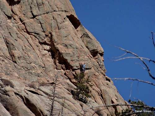 Another party | 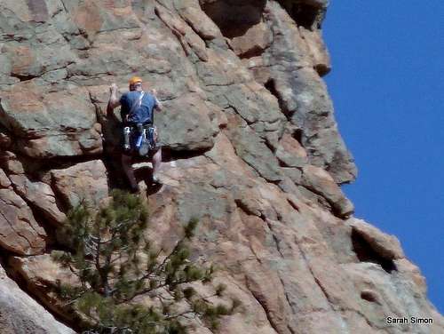 South face | 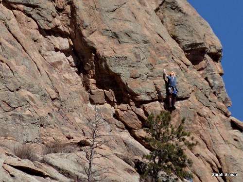 Unknown route |
Red Tape
  |
Give the land time to heal from the fire and please observe parking / driving restrictions and other use restrictions as posted by the US Forest Service. There is no fee to use this area. Please be mindful of private property in this area, particularly a ranchette to the east and northeast of Sheep Nose.
 |
Weather & Seasons
 Southern blocks
 Warm granite
 Click for weather forecast | Spring or fall would be ideal times to visit Sheep Nose. The relatively low-elevation approach through the burn scar could be dismally hot in the summer. Heavy winter or spring snows could make FS 360 briefly impassible. |  Click for weather forecast |
Camping
 Sheep Nose
 From the shouthwest
As the land recovers from the ravages of the Hayman Burn, parking in this area is limited to designated parking areas only, greatly constricting rustic camping. The Forest Service operates the seasonal Goose Creek Campgroundwhich is south of Sheep Nose off of FS 211.
The Goose Creek Campground, elevation 8,100 feet, has 10 campsites. The campground has a pit toilet and fire rings and sits in dense forest along Goose Creek. Amazingly, the campground survived scorching by the Hayman Fire. Most campgrounds in the South Platte Ranger District open Memorial Day and close Labor Day. Dial 303-275-5610 with questions about campgrounds in the South Platte Ranger District.
External Links
 On the summit
Mountain Project