
|
|
Mountain/Rock |
|---|---|
|
|
49.41761°N / 20.44054°E |
|
|
Hiking |
|
|
Spring, Summer, Fall, Winter |
|
|
2451 ft / 747 m |
|
|
Overview
|
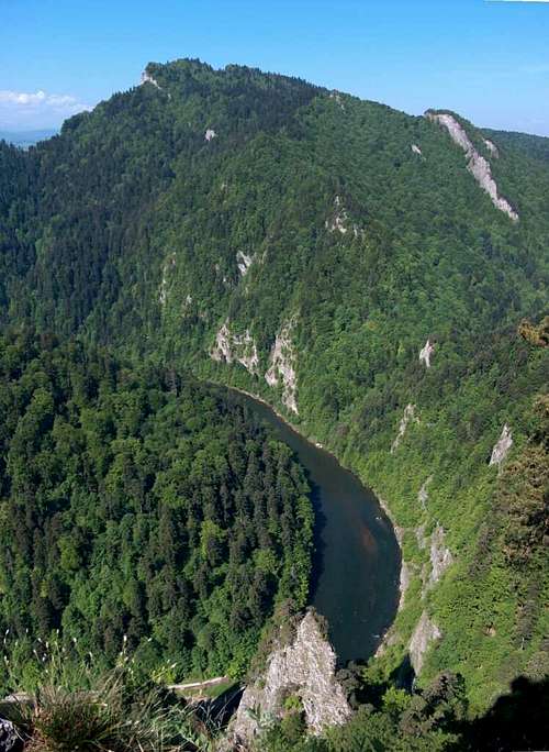
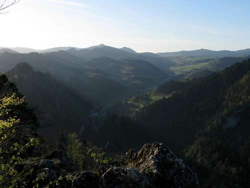
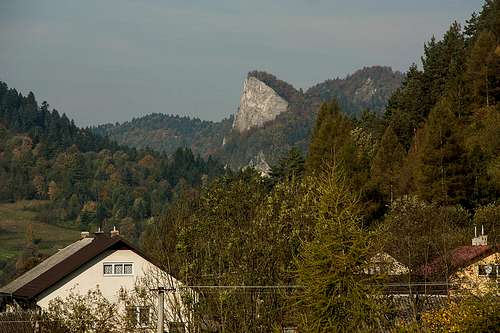
There are two outstanding mountains in the Pieniny: Trzy Korony and Sokolica. Both are located on the Polish side of the grand Dunajec Gorge. Sokolica--part of the Pieninki ridge divided from the broad massif of Trzy Korony by the valley of Pieniński Potok--is much lower and smaller than Trzy Korony, but proudly claims the title of the prettiest crag in the Pieniny. At just 747m (with 97m of prominence), the peak towers around 300m over the river not far from the lower end of the canyon. The summit gives sublime views into the canyon and towards the Tatras. Trzy Korony to the west and the highest summit in the Pieniny, Wysoka/Wysokie Skałki/Vysoké Skalky to the east can also be viewed from here. People admiring the views are protected by a guardrail, first set here at the beginning of the 20th century.
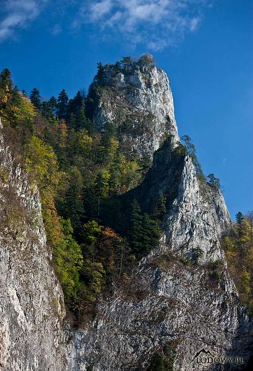
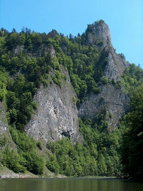
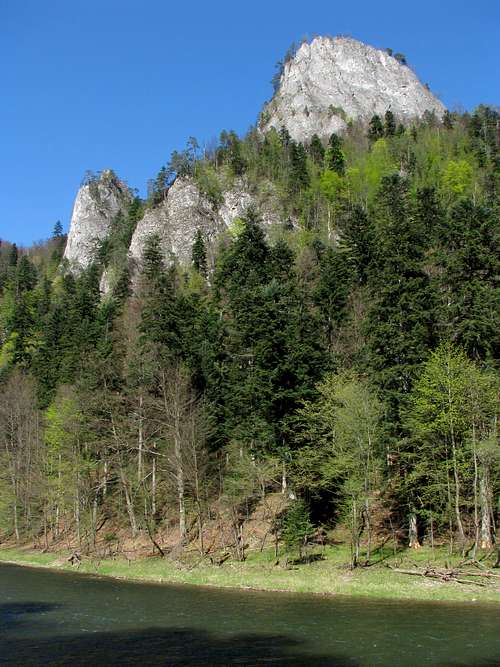
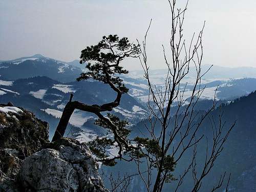
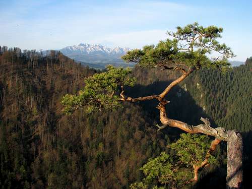
The name of the mountain is a one-word version of what means Falcons’ Rock. Whereas the north side of Sokolica is fairly steep and forested, its south face is a sheer, bare, white limestone cliff. Big falcons have stopped nesting here, but kestrels are still around. On the summit grow some ancient pine trees, estimated to be up to five hundred years old. One crooked specimen was so pretty and brave that it became a top photography model (next two photos). Unfortunately, it was broken by a helicopter during a rescue operation in September 2018.
|
Routes
|
An all-year-round key base for Sokolica is the town of Krościenko, which lies on the left bank of the Dunajec just below the lower end of its gorge. The green-stripe trail that begins in the quaint town square makes a circuit reaching Przełęcz Sosnów (Sosnów pass), from which you will get (via blue marks) to the summit of Sokolica in less than a quarter of an hour. The waymarking is excellent, so you won’t have any difficulty finding your way. As for the green trail linking Krościenko to Sosnów pass, its western branch--following the crest of the Pieninki--is more attractive, especially where it climbs Czerteż at 774m, between Burzana pass and Czertezik. Actually, that stretch--YDS Class 2, slippery when wet, partly exposed and secured with metal railing—is waymarked with blue stripes, while the green trail makes an easy, nearly horizontal traverse of Czerteż. It takes about 75 minutes to get from Krościenko’s town square to the summit of Sokolica, the longest being the variant climbing Czerteż. (Times given by signposts, maps and guidebooks are usually considerably longer.) The distance from Krościenko or Szczawnica to the summit is 3.5–4km, total elevation gain 350–400m.
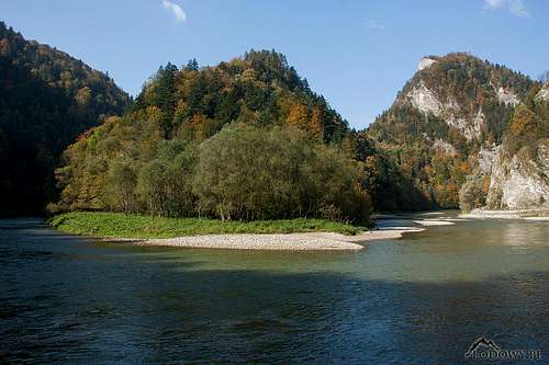
From late April to October a quite unusual variant is a hike from the resort town of Szczawnica (blue marks), which sits on the other, right bank of the Dunajec. The unusual thing about this hike is that you cross the river in a raft (for an equivalent of less than €1 per person in 2018). From the river it will take you around 40min to get to the summit. Except for the summer holiday season (July-August), this option may not be readily available on weekdays and is never available before 8am or after 7pm (in September until 6pm, October until 5pm). 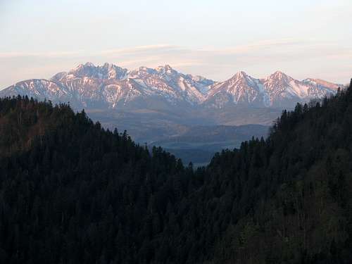 The Tatras seen from Czertezik just after dawn The Tatras seen from Czertezik just after dawnSurely Sokolica can and often is climbed along with Trzy Korony during the same day hike. The start point of such a hike can be either of the two above-mentioned towns at the lower end of the Dunajec Gorge or the village of Sromowce Niżne at the upper end of the canyon. The Slovak villages across the river offer fewer accommodation options.  |


Maps
Analogue maps- plastic 1:25,000 by WiT - all of the Pieniny
- waterproof/digital 1:25,000 by galileos.pl - Pieniny National Park
Getting There
Poland A drive from the city of Kraków is over 100km long. A journey by bus, or rather minibus, takes a little over two hours. From Zakopane you can get to Krościenko/Szczawnica by car in about 75min (if the road between Zakopane and Nowy Targ is not jammed). If you go by bus, you will have to change at Nowy Targ.
 By the road 4km N of Krościenko
Slovakia A journey from the city of Poprad to Červený Kláštor at the upper end of the Dunajec Gorge takes around an hour by car and 1hr 45min by bus.

When To Climb & Weather
During the summer months, especially July and August, the crowds are enormous. April and autumn weekdays are the best options. Autumn provides the most colourful views. There are no bears in the Pieniny, but ticks may pose some threat.
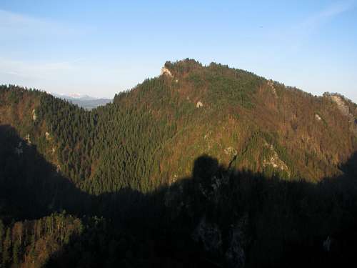
 Seen from the SE - by Tomek Lodowy
 Red Tape & Accommodation
 The ticket booth The ticket boothSokolica sits within the Pieniny National Park, from which rock climbing, bivvying and leaving the waymarked trail have been banned. Between 20 April and 31 October a 5-zloty (about €1.20, data from 2018) fee is collected for access to the last several dozen metres of the trail leading to the summit. The ticket allows you to climb both Sokolica and Trzy Korony on the same day.  NE side of Sokolica (seen from Szczawnica) - by Tomek Lodowy NE side of Sokolica (seen from Szczawnica) - by Tomek LodowyThere are plenty of accommodation options. Here are some links that may be useful while looking for a place to stay:
 |