The route is a very nice but demanding two-days alpine hike in Italy near the Swiss border, from Gressoney-La-Trinite (Aosta Valley) to Macugnaga (Piedmont). The first half of this 40-km route requires some care and experience; one section can be a problem if the weather is inferior. The second half is long but straightforward. For our small group, this was the last part of the Monte Rosa Tour travelled in September, 2019.
The report is co-authored by Max Fyodorov. The primary image and some other pictures are also made by him.
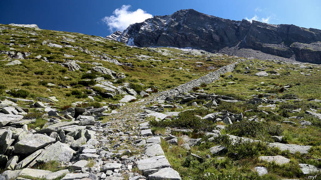
Lys Valley to Sesia Valley
The starting point of our hike was Tache, the central part of Gressoney-La-Trinite (a commune in the upper Lys valley, south of Lyskamm peaks). The summer season clearly ended: we spent the previous night in an apartment of a four-star hotel, booked almost for a song.
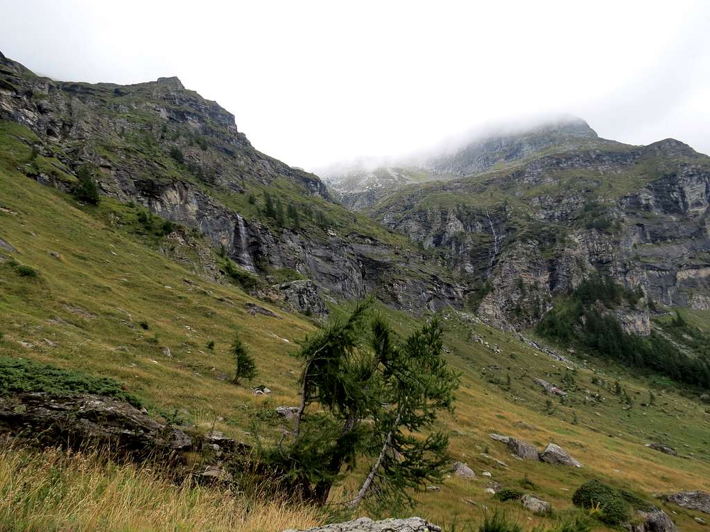
The weather in the morning was not promising but not too bad either. Our way towards the first goal—lake Gabiet (2370) we started at 8:45 with a bit of straying. We missed the approach to the bridge over the Lys river in the center of Tache and went to the next bridge 350m to the north. We crossed the bridge and went back south, crossing Ruesse creek. Soon we saw a sign “Gabiet” and followed it, walking up the trail behind some building. There are two roughly equivalent trails to the lake; the sign directed us to Trail 4, which closely follows the Ruesse creek. On the subsequent couple of forks we followed this trail. In half an hour we reached a fork at a bridge (1770; there is no bridge on the maps here!). We did not cross, proceeding up by the (orograhic) left bank of the creek. From this point there are no forks, the trail follows the creek up, sometimes crossing it or its tributaries. At 10:10 we stopped for a break (2020). Look at the trees: sometimes one doesn't need a compass to decide the NS direction:
Gabiet Lake - South Approach
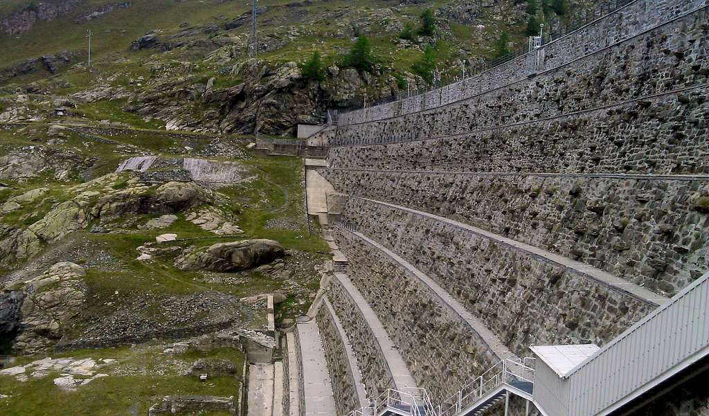
Soon after resuming the walk, we reached a steeper section, culminating with an iron staircase to the dam locking the lake (2380):
Gabiet Damb
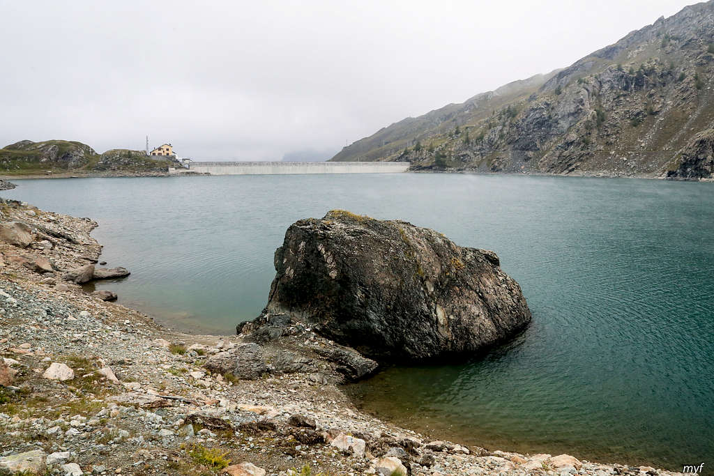
The pass across the dam was closed, so we made a short stop at the right end of the dam at 11:00 and started to skirt the lake from the right. The lake looked severe and cold:
Gabiet Lake
It took less than half an hour to reach its north shore, and we continued the traverse to the north, passing rifugio Gabiet, which is slightly below the trail. By 12:00 we finished the traverse, almost reached the cable car line, and made a break at a fork (2450). Then we took the left trail (the right one goes to Zube pass) and continued the way up, roughly parallel to the cable car line. The trail joined the road at the altitude of 2600, then left it at 2710 and joined again at 2760. It seems that the latest road construction destroyed a section of the trail which existed before; now the trail forks from the road at 2790 and goes almost strictly to the east, joining the old trail about halfway to the col. We reached d’Olen pass (2881), covered by a few sentimeters of fresh snow, at 13:35.
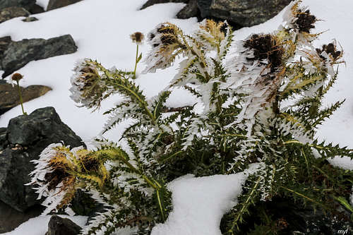
We were in thick clouds which concealed everything farther than 50 (sometimes 20) meters from our eyes. So the pictures differ from usual "summit shots":
d'Olen PassSevere BeautySurvivors
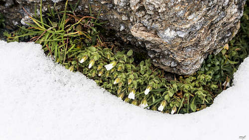
Finally we stopped taking pictures of flowers and started the walk down at 13:50. In several minutes we reached a big (4 floors!) closed rifugio Vigevano (2860). However, all its doors and windows were intact, and overall the hut did not look abandoned. After the rifugio we turned left (north) and walked by a big nearly flat stone field. Two trails cross this field, marked by occasional painted signs on the rocks. The left trail goes north-north-west to Salati pass. In spite of the nearly zero visibility, soon we found the right (in both senses) trail and followed it, crossing a creek and a cable car line. Soon after the line, we stopped for a lunch at 14:35 at the altitude 2825. The weather did not try to improve: at some moments we saw the nearest cable car mast, but that was all.
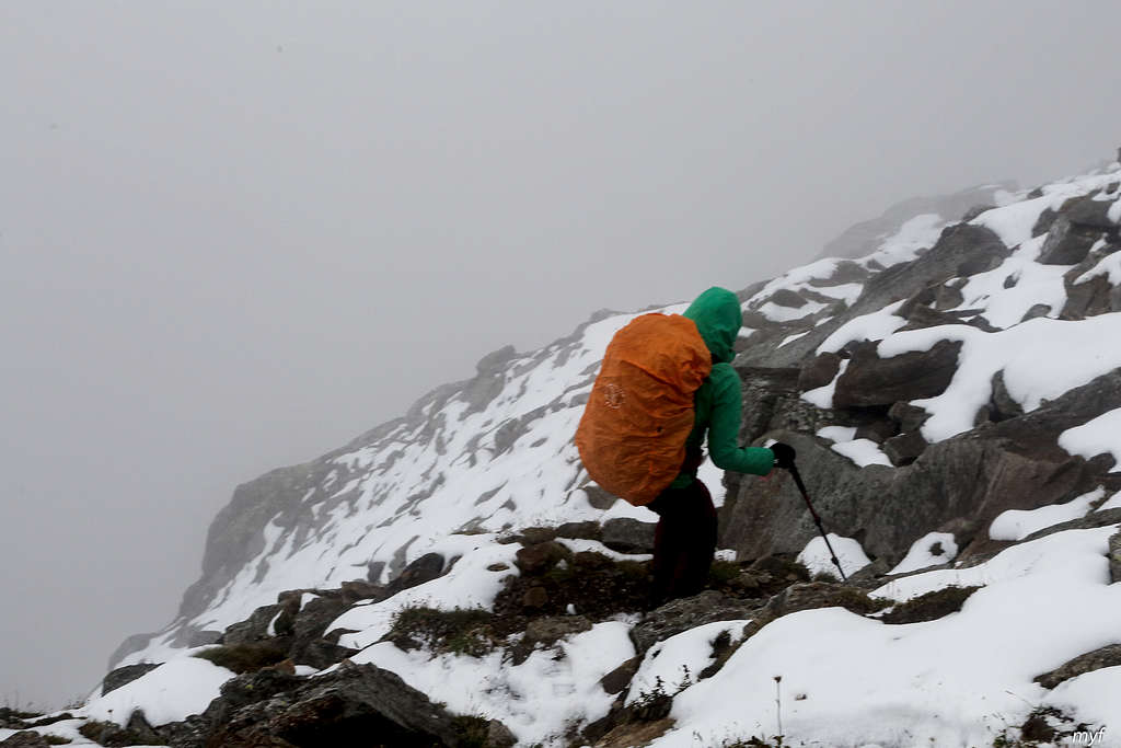
At 15:25 we resumed the movement. In a few minutes the painted marks brought us to an indistinct col (Valico Cimalegna, 2830) on the edge of the flat platform we walked by. The next step was to go down a rocky wall. OK, this is not a vertical wall. It consists of many steep drops with ledges between them. But we still could not see farther then 30m most of the time... The first steps were easy
Descent from Valico di Cimalegna
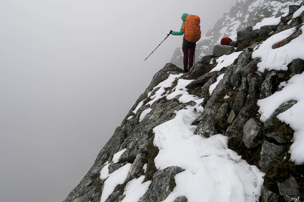
But then the steep part began:
Wall below Valico di Cimalegna
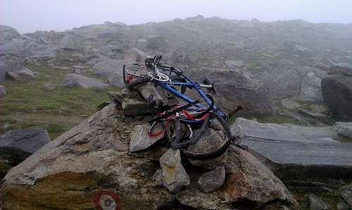
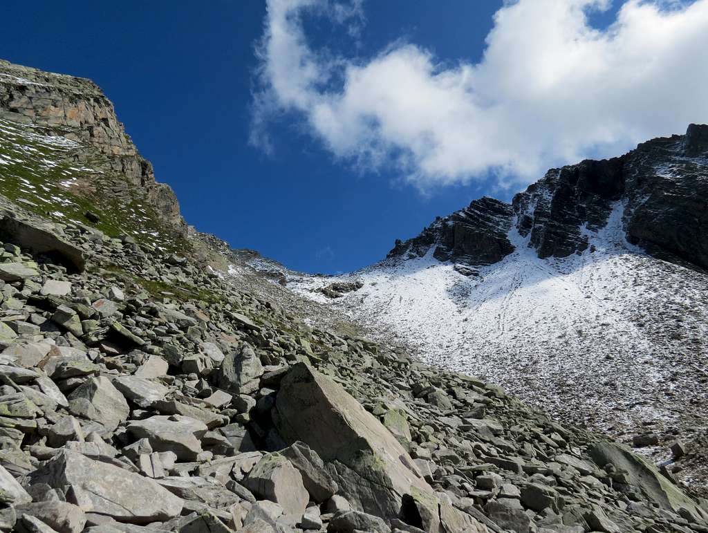
The path is winding, narrow and not equipped; there are markings at the corners of its broken line, but that is basically all. The upper part of the path was covered by snow. It took half an hour from us to drop the first hundred of meters. Since the snow obscured the path, we descended to a mark and tried to spot the next one, and again, and again. At some point we spot hare traces on the snow and realized that the animal went down the wall following the trail. Since then it became much easier to find marks; at 16:30 we reached the foot of the wall (2530). We continued north-north-east by an almost flat boulder/grass field, between the Pisse creek on the left and a small lake on the right, following an indistinct trail with occasional marks. On the way we passed a strange sign or, maybe, a monument:
Exbike
(The idea that somebody tried to descent the wall by bike sounds weird but not impossible.)
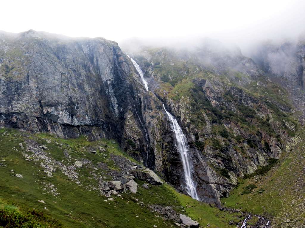
At 16:45 the trail, now more clear, turned right and soon passed ruins of some ancient buildings with stone walls and stone roofs (2475). Further, the trail made a big arc to south-east to avoid a 200-meters-high wall, which provides the base for a cascade waterfall. Near the beginning of the arc, we took left (down) on a fork (2410). At 17:15 we stopped at the altitude 2260 for a short break. After resuming the descent, we soon reached the point opposite the wall we had skirted, and clearly heard the falling water. At this moment, the cloud between us and the source of the sound suddenly dissolved and demonstrated the hidden 200-meters cascade. The picture was impressive in spite of another cloud hiding everything above the wall:
Pisse Creek - Upper Cascade
After taking modest-quality photos and videos, we continued our way and reached an almost flat area (1970) at 18:10. At 18:30 we crossed the Pisse creek by a bridge (1830) and passed the Alpe Bors place, mostly abandoned. We descended several staircases on the left bank, passed the entry to the abandoned mine, and crossed the creek back at 18:50 by a bridge (1710) near the creek’s mouth. The final part of the trail is a gentle descent among the trees by the right side of the valley of Sesia river. At 19:15 we stepped over the threshold of rifugio Pastore. The hut keeper was the first person we met since leaving Tache, and we were the only guests of this big hut that night.
The dinner was amazing. I was not surprised to find later that their restaurant is the best in the area according to tripadvisor.com.
Sesia Valley to Anza Valley
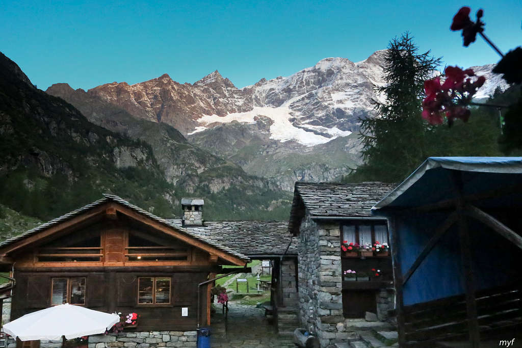
The weather had changed overnight, and the morning was clear and beautiful:
Rifugio Pastore
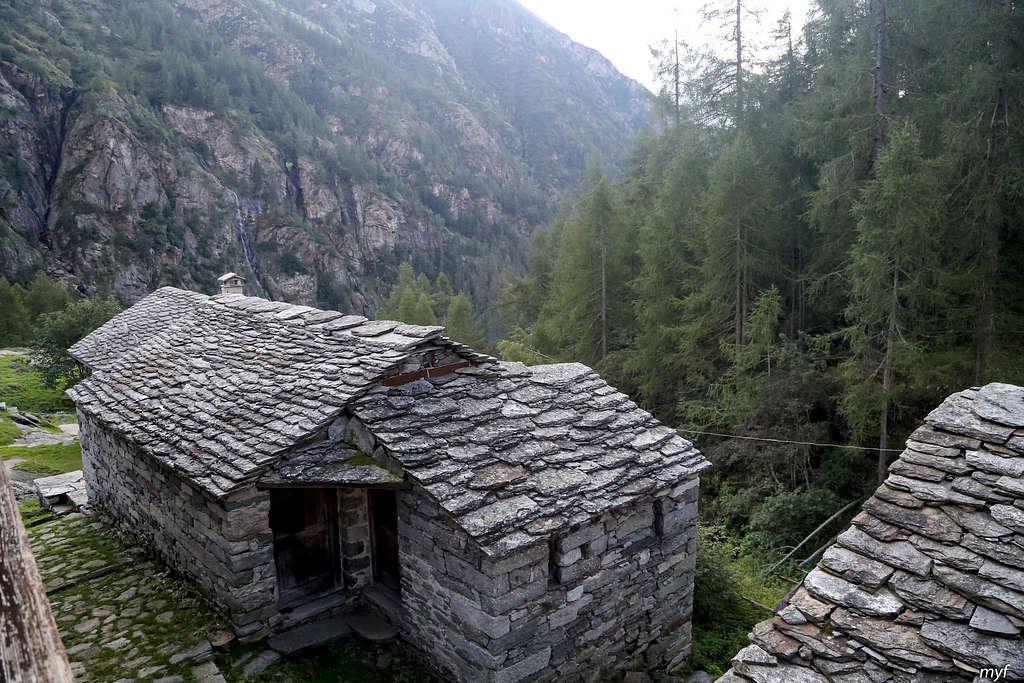
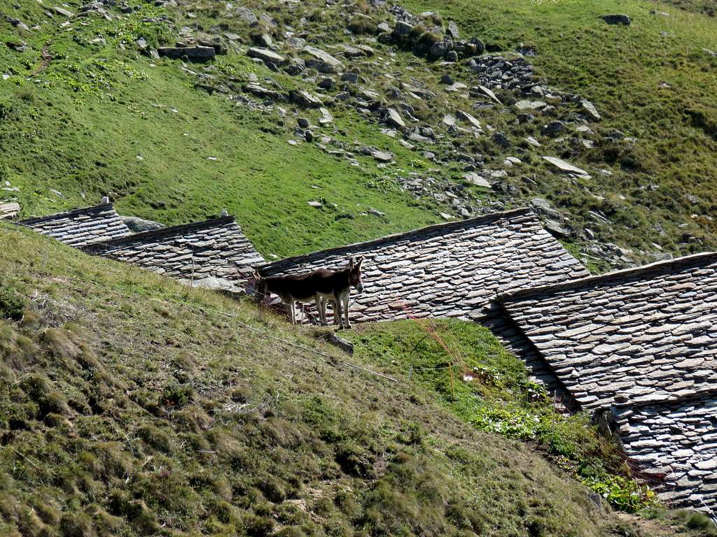
The rifugio was placed in an old settlement. Typically for this area, old buildings are made of stone completely, including roofs:
Stone Tiles
We started at 9:05 by yesterday’s trail, turned right to cross Sesia by bridge, then again turned right to cross its tributary by another bridge. After that, we dropped about 50m of elevation, met the road from the town of Alagna-Valsesia (1540), and turned left (up), crossing yet another bridge. From this point, we followed an ancient mule trail up to the col (for the first part of our way, a shortcut is available). The trail was built in Roman times and looks more like a road:
Roman Road
The weather was sunny, and it quickly became unexpectedly warm. So at 9:40 we made a break to adjust our clothes (1670). Soon after, the trail became steeper and we quickly reached the elevation 1900 before a nearly horizontal traverse to the east. A quick glance back (Corno Bianco is on the background):
Corno Stofful
During the traverse we passed a few groups of farm(?) buildings
Pushmi-Pullyu
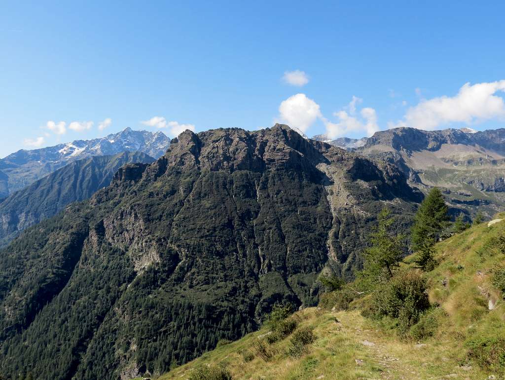
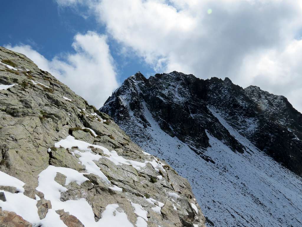
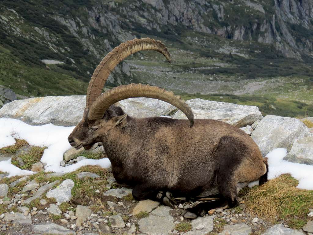
Some of them were guarded by angry chained dogs. Then the trail became steeper again; we stopped for a break at 11:20 (2220). The views from there, especially those of Monte Rosa massif (see the primary image), are definitely worth a second look. We resumed the walk at 11:40; the col was obvious, and the trail climbed the slope towards it:
Turlo Pass Approach
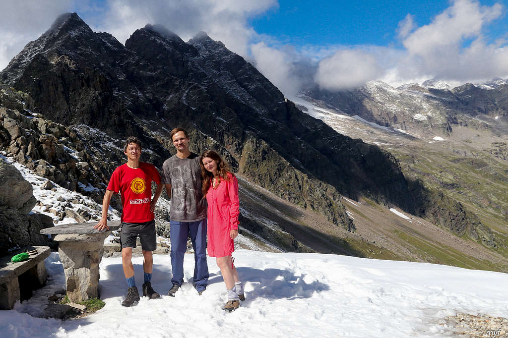
However, just before the col the trail made a sharp turn left (2710) and reached another col not visible from below. There we met the first hiker in two days. This col (2738) is small but equipped with a table, a couple of benches, and a few memorial plates dedicated to different people. The weather was excellent, and we stopped at the col at 12:50 for a 40-minutes photo session:
SE View from Turlo PassNW View from Turlo Pass
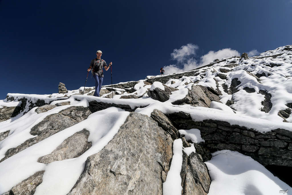
Then we began to serpentine down the snow-covered north slope:
Descending by Roman Road
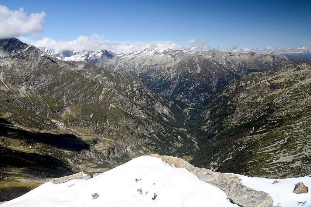
In 15 minutes, the panorama of Quarazza valley before us came into view:
Quarazza Valley from Turlo Pass
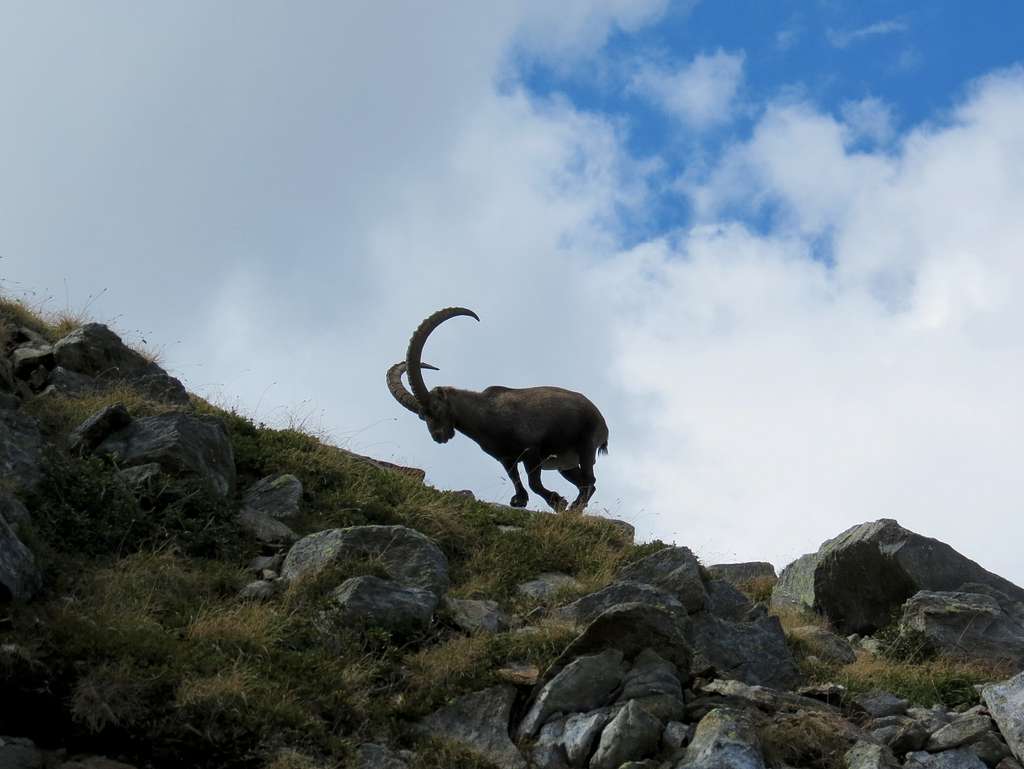
Soon after we had to share the trail with wild goats:
I Want to Rest on Your Trail
I never saw them before from a one-meter distance; luckily, this animal was in a peaceful mood, so we could safely pass, avoiding a heads-up with a guy like
I'm Ready
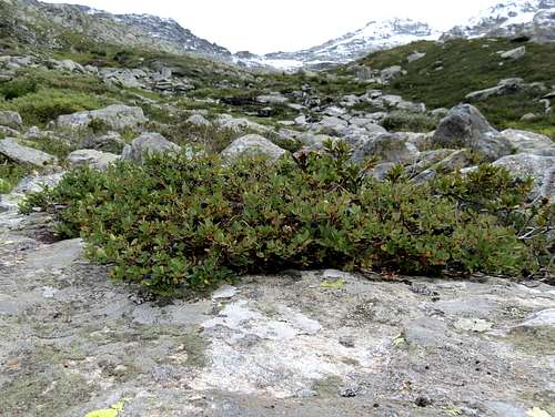
By 14:45, we were at a flat place (2075) with nice views, sun, water, and blueberries of two different species:
Bog Blueberries
So we had no option apart from stopping for a lunch. After an hour break, we continued about 1 km by a plateau and then dropped from 2000 to 1600 by a serpentine among bushes and small trees. Then we proceed 1.5 km along the Quarazza creek and crossed the bridge to the left side (1470) at 16:50. Soon we passed abandoned Crocette village; the trail turned into a road, but there is also a parallel trail closer to the creek. The creek created stone pools in its bed:
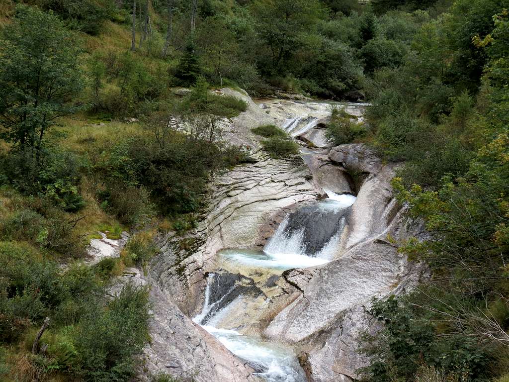
Pools
At 17:25 we reached Fate lake and stop for a break and a short swim. It should be said that Mattmark lake which we passed at the first day of our Monte Rosa tour was both nicer and more pleasant to swim in...
After the swim we skirted the lake from the left and followed the road traversing the slope of the Anza valley towards Macugnaga. We hoped to cross the river Anza by a bridge above Ronco place to reach Staffa; however, this bridge, shown by maps, no longer existed. So we went 600m up to the Opaco place, cross a bridge there and descend to Staffa by the road. Our tour ended at 18:55 in a souvenir shop near the main square of Staffa. We were just in time: they had not closed yet.
... but they're present in the gallery. Same with Chrome and FF.
--
Very nice report; I did a similar route years ago. There was a big Walser party in Rif. Col d'Olen!
Parents refers to a larger category under which an object falls. For example, theAconcagua mountain page has the 'Aconcagua Group' and the 'Seven Summits' asparents and is a parent itself to many routes, photos, and Trip Reports.


Comments
Post a Comment