|
|
Trip Report |
|---|---|
|
|
46.14430°N / 7.81637°E |
|
|
Download GPX » View Route on Map |
|
|
Sep 5, 2019 |
|
|
Hiking, Scrambling |
|
|
Fall |
Disclaimer
This was the 3rd day of the Monte Rosa Tour travelled by our small team: two rather experienced male hikers after 45 joined by a much younger female mountaineer. To hike a closed trail was not our intention; recklessness looks like a more appropriate word. However, some people may have such an intention, because this is the most beautiful part of a beautiful trail. OK, maybe they'll find this report helpful.
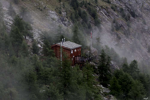
The report is co-authored by Max Fyodorov, who is also the author of almost all pictures in it, including the primary image.
Summary
Route: Grächen (1650) – traverse by Europaweg (maximum 2710) towards Europahütte (2265); 16.5 km, +1250m/-600m.
Time on the trail: 8h30m; moving: 7h50m.
Weather: partly cloudy in the morning, then overcast; since 14:30 and overnight: rain, turning into snow in higher altitudes.
At the time we passed the trail, it looked like a full-weight T4 according to Swiss grade. This level is due to severe damage made to the highest section of the trail (about 3.5 km long) by fresh rockfalls. The danger of further rockfalls is quite high, and this is a good reason to avoid the trail even if T4 is not a problem for you. If you consider this trail, think twice. Better thrice.
A Winding Way From Logging to Sheeping
When I planned the details of our Monte Rosa tour, the two days by Europaweg looked like the easiest and most straightforward part of the whole route. I checked the maps, looked at the page of Europahütte, googled Europaweg and found nothing suspicious. When we arrived at Grächen in the evening after a 25-km hike from Saas-Almagell, I looked at the page of Europahütte once more and found a fresh but rather indistinct warning: a piece of trail in “der Grosse Graben” is closed, follow the detour signs. So we decided that OK (yawning), we will follow.
...A later investigation showed that the trail was closed at least since July; a substitute route, mostly in the woods at the elevation around 1500, can be found here. What was the fresh warning about (closing the substitute?), I'm not sure. The version of Monte Rosa tour offered by outdooractive.com was updated only after the end of the season; the version at the site of Zermatt still (as of Christmas Day, 2019) assumes the closed trail.
We started as late as 9:45 and reached the south-east end of Grächen (1680) in less than 15 minutes. During this short walk we were impressed by the Swiss style of logging:
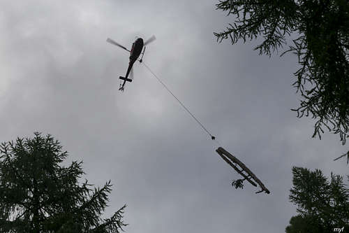
A helicopter flied back and forth, carrying logs from a nearby slope to a forest road just outside the town; reaching the road, we saw a tractor, a couple of people, and an accurate pile of logs on the roadside. After passing them, in 10 minutes we reached a dry “stone creek”: a small channel of avalanches and other fallings from upper slopes. The pass through it was closed, the signs showed up the creek. We went up to a pipe bridge (1760), crossed the dry creek and continued by a trail running very gently up along a tiny artificial channel with clay bottom and walls.
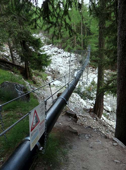
The channel is a sort of aqueduct, flowing then in the pipe across the stone creek and after it; Swiss maps show several such channels here, our channel is called Chilcheri. We passed the village of Gasenried below us on the right; in fact we were farther from it then expected but could not come closer because of a fence. We planned to catch the road at the south end of Gasenried to cross Riedbach, a big creek, by bridge (1680). Instead, we were able to catch only a higher road which ended at a small parking lot near a building over Riedbach (power station? pump station?) at the altitude of 1800. In principle, it is possible to cross Riedbach using this building and ignoring the forbidding signs, but the other bank is a cliff.
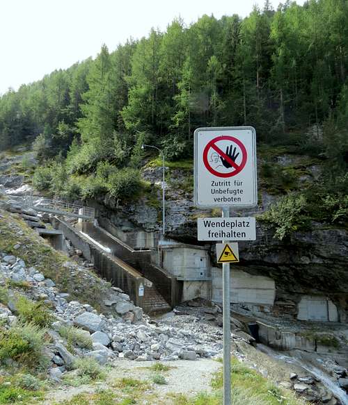
We made a stop at 10:55 at the parking lot and checked our maps. There were two bridges available: the lower one (1680) required a 1 km descent by the road, and the upper one (about 2050) was on a plateau above the steep section. Since we needed to reach 2000 m soon after crossing the creek anyway, we chose the second option. The map at outdooractive.com shows a trail going straight up from the end of the road, but the actual trail makes a couple of short winds near the creek and then goes somewhere to the north. At that moment we saw a rudimentary trail along the creek and followed it. The trail soon vanished, but still the ascent was an easy and pleasant boulder hopping. At the plateau covered by beautiful small larches we caught a trail from the left (2000).
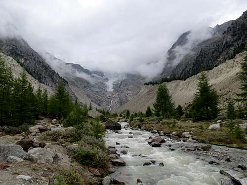
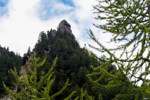
Soon we crossed the bridge (30 minutes from the parking lot), turned right on an immediate fork, turn right (down) at the next fork and arrived at the third fork (2005, 15 minutes from the bridge). Here we turned left (up): the way down would eventually bring us to the lower bridge over Riedbach. After 15 more minutes of walk, we made a break (12:05, 2090). When we resumed the movement, the trail brought us in 30 minutes to the Grathorn mountain (2322). Its top is flat, marked by a wooden cross, and located just 30m from the trail. Its shoulder, however, looks very impressive from below:
The clouds already looked worse than in the morning, but still not too menacing; we took pictures and proceeded. Surely, we did not expect this to be the last break for the day.
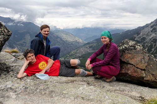
In less than half an hour we reached a Saint Bernard statue (from distance, it looks more like Buddha) on the top of a small rock; then a part of upper Riedbach valley, with a huge talus rampart parallel to the stream, came into view.
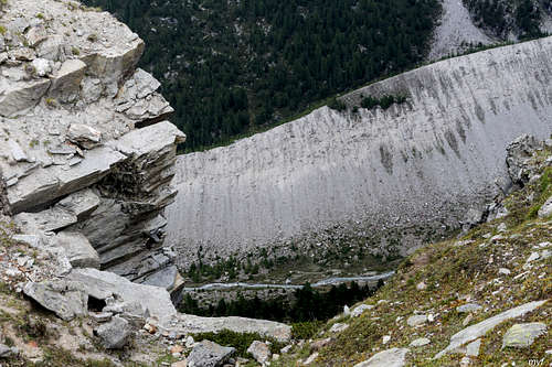
From there, we followed the ridge towards the black rock of Mittelberg:

At 13:45 we started traversing it from the right at the altitude of 2495, ignoring an indistinct side trail descending to the left. Just before 14:00 we entered a couloir and reached a fork (2570). The left trail climbed the saddle between Mittelberg and the next summit in the ridge, aiming at Bordierhütte, which is the starting point of several climbing routes. The other trail was Europaweg, and it was closed.
It was not really unexpected to see something like that on the trail continuation:
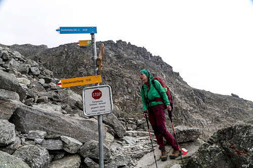
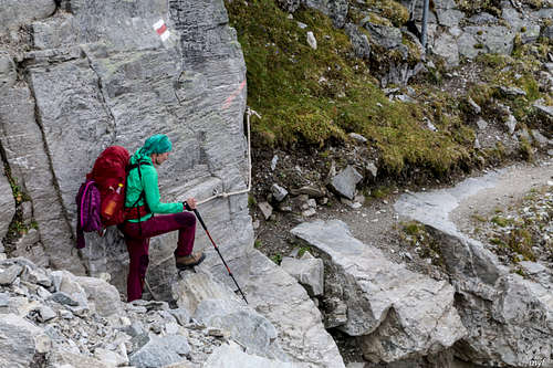
But we also expected to find a detour sign, given the number of sign poles we had passed already, without a single mention of the closed trail and available options. It quickly became clear that no detours are possible. At that moment we saw just two possibilities. The first one was to turn back, descent to the valley of Matter Vispa (or nearly to the valley) and go south to reach the town of Randa (it is possible to ascent from Randa to Europahütte in two hours, but we would need to do this in the dark). The second option was to take the risk of hiking a closed trail. We had in sight an obvious reason to close the trail: a 10-15m section of it was smashed by a recent slide of talus. The angle of the talus was not menacing, so this obstacle looked easily passable (all of us had experience of walking by scree at different angles). So we took the risk and continued by the trail. We passed the first obstacle, then turned around a bit tricky corner, thanks to an intact fixed rope:
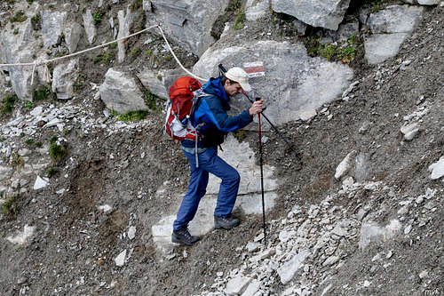
then passed an unpleasant steep clay slope:
and successfully reached the end of the couloir. At that time the skies became completely overcast. When we skirted a protruding shoulder of the ridge and entered the second couloir (2605, 14:30), light drizzle started to fall. This couloir looked worse: a big mass of rock had crashed from the cliff above us, smashing more than 100m of trail. This section at the moment was covered by a newborn scree, and everything was under a thick layer of chalky dust. The scree consisted of rocky debris of all sizes between a pebble and a car, and thus was quite unstable. Here is a glance back after finishing this first (and worst) part of the second couloir:
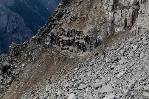
When we were still struggling through the scree, gaining some elevation to catch the next intact section of the trail, first debris began to shoot the trail behind us. From that moment, there was no possibility to turn back. We had to move forward at the maximum possible speed.
The second couloir (it seems that the name “Grosse Graben” refers solely to it) contained several more obstacles of less scale, including more fresh scree
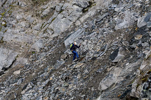
and several destroyed fixed ropes. We finished it at 15:30 (2700), when the drizzle turned into a light rain mixed with snow. From south end, the couloir looked like this:
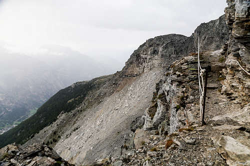
Skirting the next shoulder, we reached the topmost point (2710) of Europaweg. Can you imagine Matterhorn and Weisshorn on the next picture? They are definitely there!
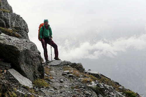
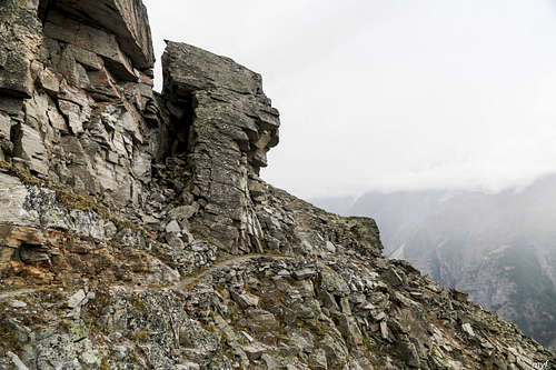
When we entered the third couloir, we heard a sound of rockfall in the second one; so we were quite lucky with the timing... The third and fourth couloirs are small, the fifth one is bigger. All of them contained further obstacles, but at least nothing was falling from above. However, look at these terribly beautiful rocks:
The most impressive obstacle after the second couloir was a broken bridge one had to reach and pass:
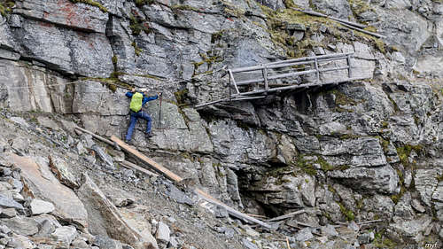
The same bridge profile view:
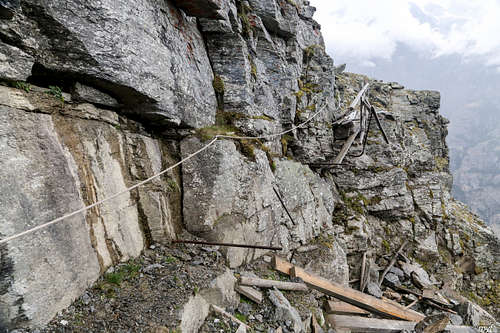
After the fifth couloir, a more straightforward and flat traversing resumed. Still, we were quite surprised to see an ancient boulder field in which some boulders had fresh cracks or were moved across the trail, opening some nasty-looking holes… At 16:30 we finally stepped on the undamaged part of the trail (2620). In the next fifteen minutes we reached the place where the trail was closed from the other side (2585); another trail forked there down to the valley. Since it continued to snow/rain, we did not stop moving. Soon we crossed Geisstriftbach creek, and the trail started to lose altitude, turning snow into rain. Skirting another shoulder by a “wall left, abyss right” section of a narrow trail, we ran into a flock of sheep, moving in our direction. It took some time and efforts to persuade them to change the direction; then we followed the flock for several hundred meters, until all sheep moved to a steep slope which replaced the precipice.
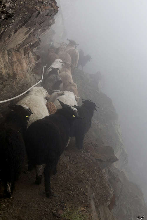
Logs in the morning, sheep in the evening… Perhaps Nature had something to say about our mental abilities. Nevertheless, at 17:45 we crossed another creek, observing a sign warning against sudden floods; then in two minutes we reached a suspension bridge (2335), about 80m long, spanning a talus field and Birchbach creek:
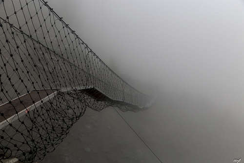
Without further adventures, we successfully arrived at Europahütte (2265) at 18:15, just fifteen minutes before the dinner. In spite of the weather, the hut was almost full.
