

Comments
No comments posted yet.
|
|
Trip Report |
|---|---|
|
|
46.01849°N / 7.74009°E |
|
|
Download GPX » View Route on Map |
|
|
Sep 6, 2019 |
|
|
Hiking |
|
|
Fall |
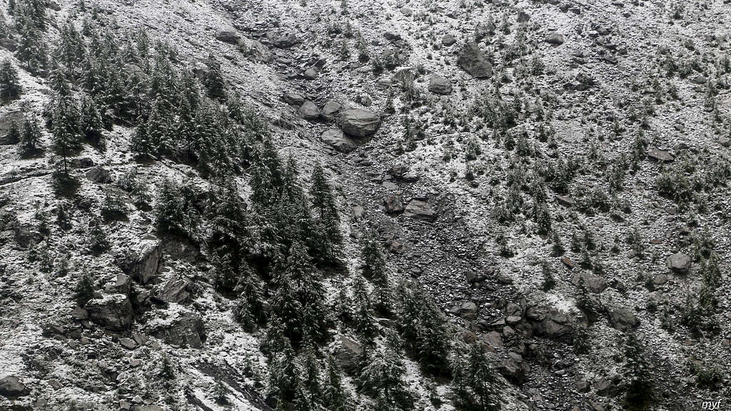
These were days four to six of the 9-day Monte Rosa Tour we hiked in September 2019 in a group of three. The weather interfered the plans of many people but created a unique charm of black-and-white landscapes with rare spots of colour.
The report is co-authored by Max Fyodorov, who is also the author of most pictures.
Route: Europahütte (2265) – traverse by Europaweg (maximum 2350) to Tuftra (2210) – Zermatt (1680); 19 km, +850m/-1450m
Time on the trail: 8h55m; moving: 6h50m, including 20m straying (+0.6km)
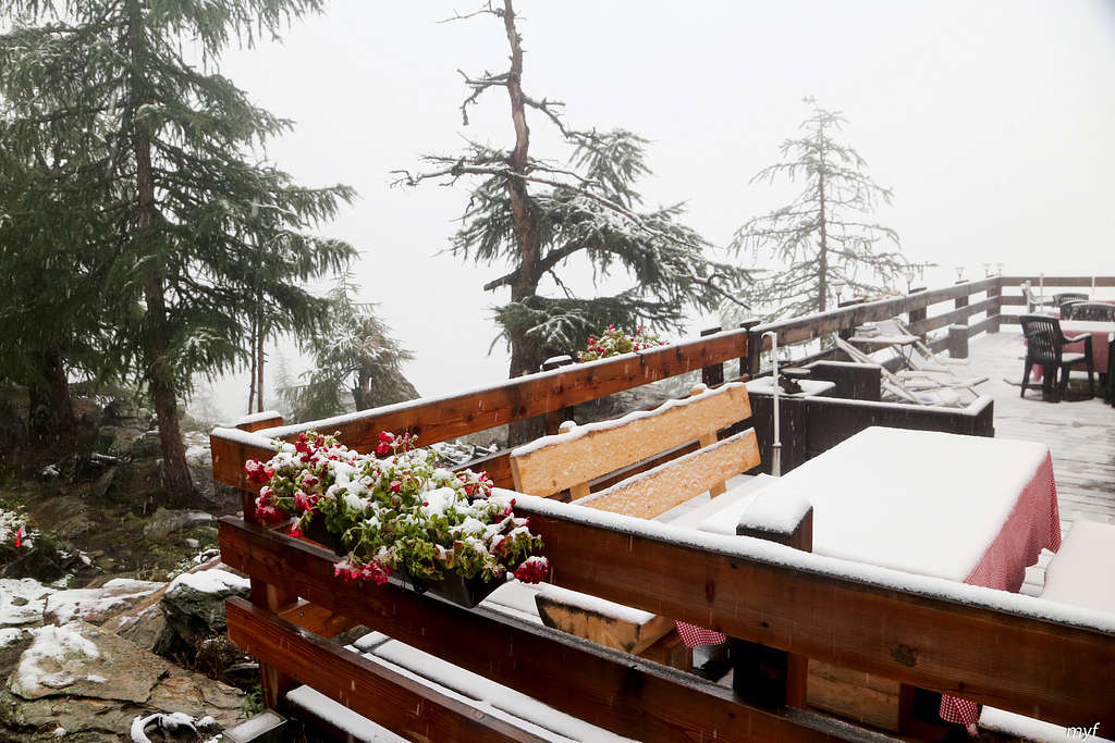
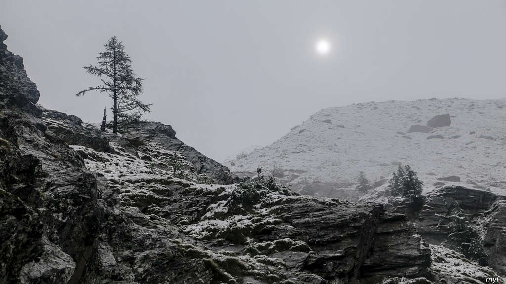
We spent the previous night at nice and hospitable Europahütte after a rather nervous day. At night the rainfall turned once more into a snowfall, so the morning met us with pictures like these:
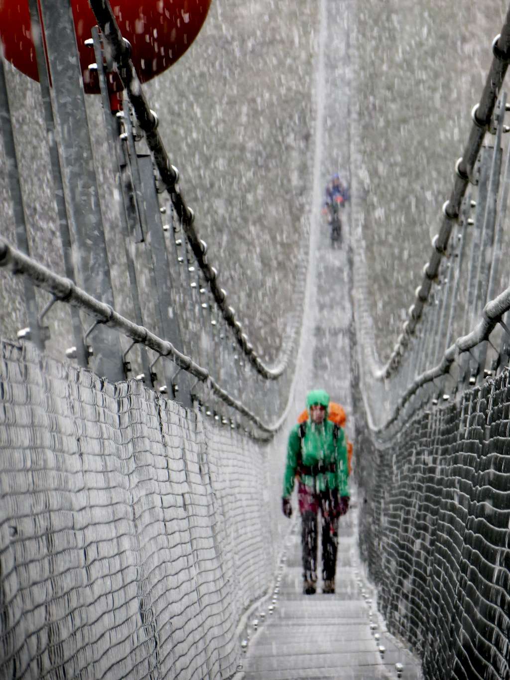
We started at 8:45; from Europahütte the Europaweg descends to the new suspension bridge, named after its main sponsor Charles Kuonen. The bridge is really impressive for both its length (494m) and height over a creek and a rockfall area (85m). Wikipedia gives the bridge a wrong altitude (2020); its north and south ends are at 2085 and 2060 respectively. It took about 20 minutes to approach the bridge and 10 minutes to pass it.
The walk over the bridge offered us surrealistic views in scales of grey: grey skies above, grey boulders below, grey bridge with a geometric grid of its grey floor, all of that through an intensive snowfall...
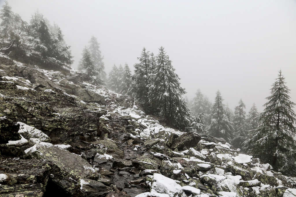
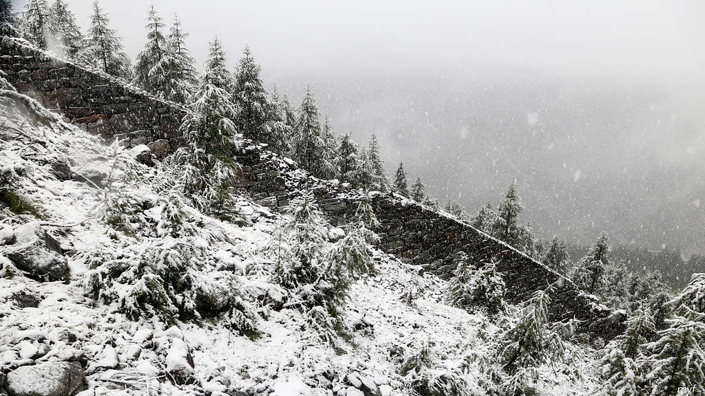
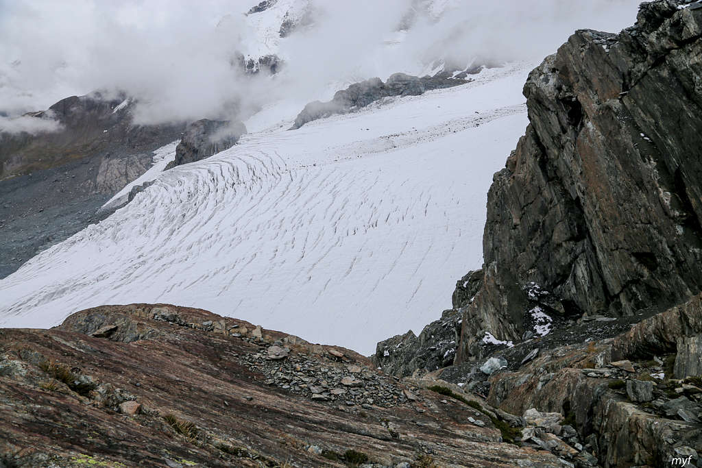
After the bridge, we gained the elevation back to 2210 and continued the traverse southwards. Beautiful and severe views continued to emerge in spite of quite limited visibility:
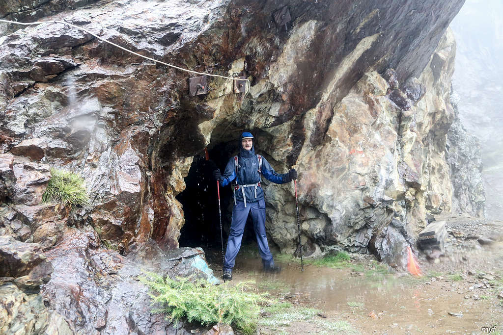
15 minutes later, the trail turned left into a 100m tunnel to avoid a protrusion that cannot be skirted:
Exiting the tunnel, we passed through a veil of water falling from above. The trail after the tunnel looked like this:
Few minutes after the tunnel, we crossed Wildibach creek by a bridge (2227) and began to traverse westwards the other slope of its gully. This section is rocky:
There are some railings and even a fence.
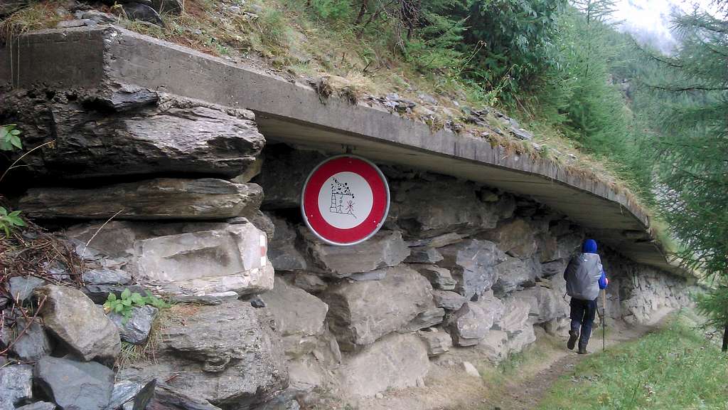
Then the trail turned south; after about 500m, it began to serpentine down. On the second wind of the trail we stopped for a break at 11:00 (2140). Resuming the walk, we descended to 2000 and entered the section covered by a sort of cornice made of thick concrete blocks, to defend against fallings from the above slope:
However, some of the blocks were broken... Passing the lowest point of the corniced section (1950), we began to gain the altitude again, ignoring all forks right and down. We soon entered the valley of Täschbach creek, traverse its north slope (maximum 2185), crossed its right subsidiary Rotbach (bridge at 2157) and entered Täschalp village at 12:30.
Going through Täschalp, we missed a direct way to the bridge over Täschbach; instead, we followed the road up the valley and approached the next bridge. This bridge was seen from a distance, as well as the trail after it, but was closed with no apparent reason. So we lost about 20 minutes straying before crossing the correct bridge. Preparing this report, I was astonished by the fact that all maps show only one bridge, namely, the one that is closed (2192), and Europaweg crosses it. The open bridge is at 2170; one should take right from the main road to reach it. After it, the trail climbs steeply up to catch Europaweg, which is ascending from the closed bridge; that section of Europaweg is blocked. The only explanation I could come with is that it was done to prevent people from reaching a closed trail up the ridge. Indeed, the way up leads to the top of the Ober Sattla mountain (2685), which offers panoramic views in all directions (in a good weather). The trail from the old bridge is now blocked, and a new trail (missing from the maps!) is open. The fork for this new trail is just 3 minutes from the point where the trail from the new bridge meets Europaweg, at the altitude of 2220. We reached this fork at 13:05 and continued to traverse the south slope of the Täschbach valley. The trail then skirted the shoulder of Sattla (2140) and turned south. Ten minutes later, we stopped for a break (13:40, 2160).
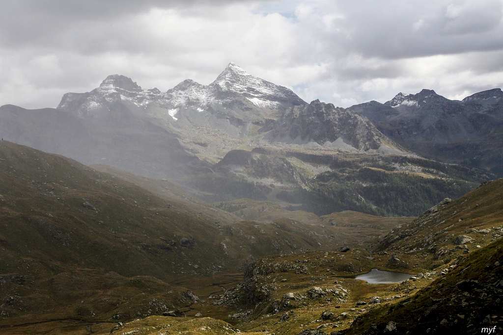
After resuming our walk, we began to gain altitude, ignoring a bike trail down at 2185 and a closed trail up to Sattla at 2245. Then we passed a kilometer-wide area with the danger of falling rocks; the area is equipped with five shelters. After that we reached the highest point of the day (2350) and soon observed another closed trail to Sattla. Then we began to descend and stopped for lunch at the next fork, just before Tuftra (2250, 15:00). The precipitation also took a break for an hour and allowed us to see the Matter river:
 Moreover, we were even allowed to watch the top of Matterhorn, which made a one-minute ghost-like appearance above the clouds:
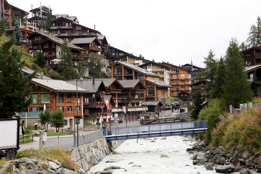
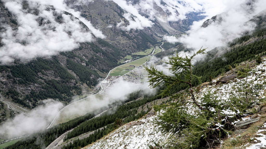
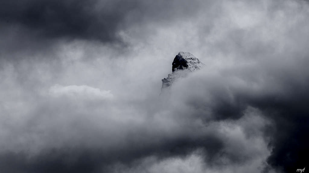 At 16:05 we resumed the way down, passing Tuftra; some drizzling resumed also. We walked slowly, ate raspberries, and reached the outskirts of Zermatt (1710) at 17:10. Zermatt is really charming from this point:
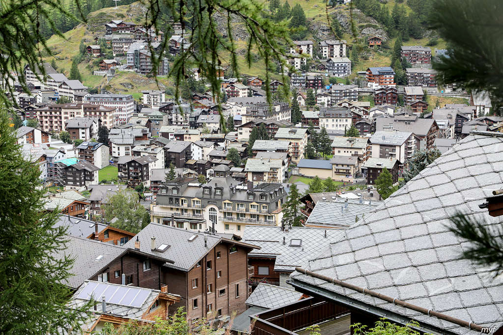 I would like to return here another day...
...After some wandering in the town, we reached our hostel (1660) at 17:40. This was an easy day, the next day had promised to be tough.
Route: Zermatt (1660) – Schwarzsee (2550) – Trockener Steg (2930) – Theodul pass (3296)/Rifugio Theodulo (3317); 16.5 km, +1900m/-250m
Time on the trail: 9h15m; moving: 7h25m
The aim of the day was the highest point of the Monte Rosa hiking: Theodul pass. The pass separates Monte Rosa massif (East) from Weisshorn-Matterhorn massif (West), and also Switzerland from Italy. We chose the route which is considered as the most beautiful (but not the shortest). A cold rain had stopped at night but the skies were overcast. We left the hostel at 9:15, went down the street to northwest and crossed Matter Vispa river by pedestrian bridge (1610):
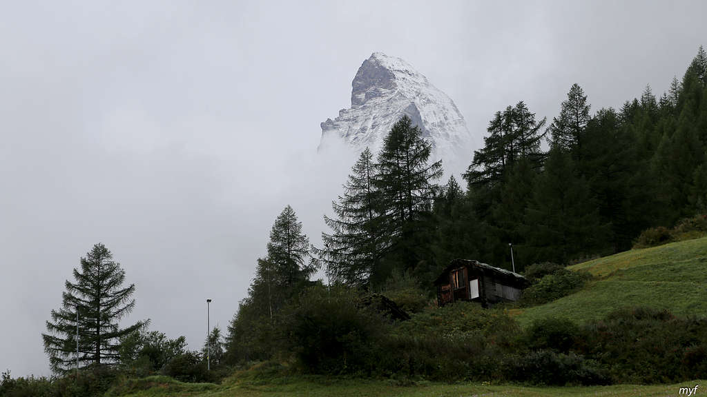
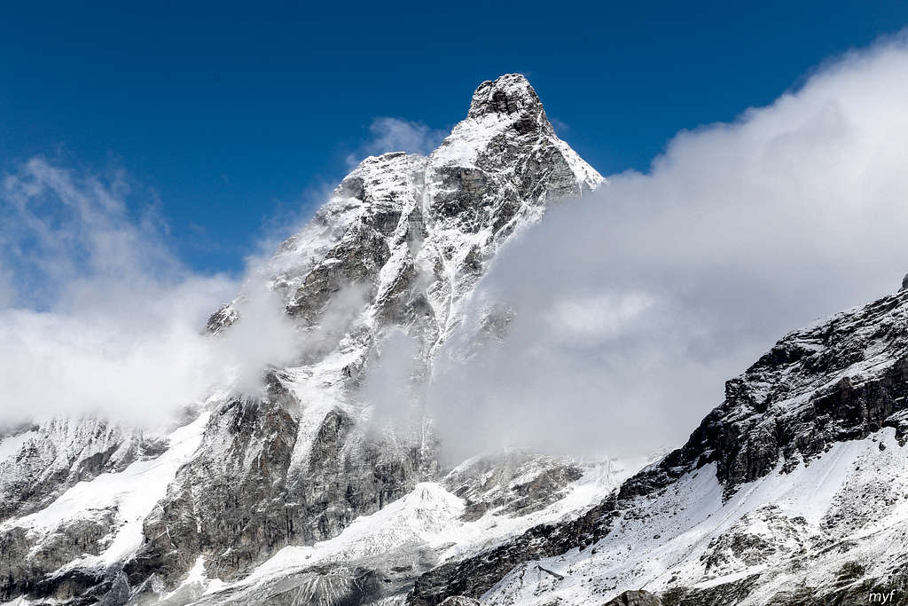
At that moment, Matterhorn showed his head, even with “shoulders”:
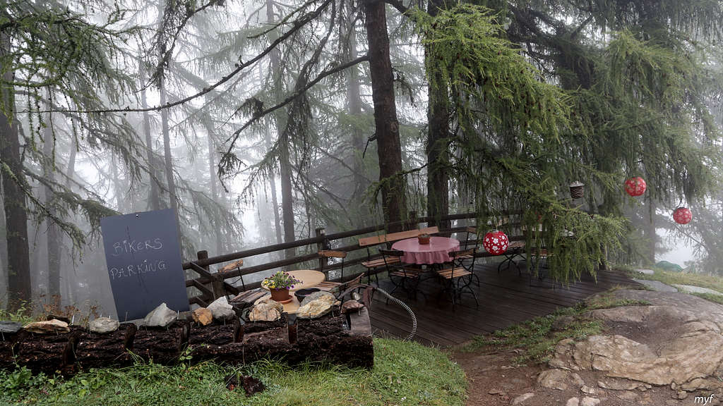
... but, as it appeared, for the last time during the day. By the way, we followed the (orographic) left bank of the river and took right to the trail climbing gently up the river and its left source, Zmuttbach. 20 minutes after the bridge we took left on a fork, following the signs to Furi, and soon crossed a bridge over Zmuttbach. On the next fork we took right (up), skirted Zum See village from the right and continued to gain elevation, following the signs to Restaurant Hermetje. We passed its creative bike parking lot:
and made the first break at 10:40 on a trail crossing above the restaurant (2060).
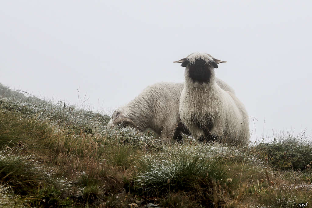
After the break we began to walk in clouds, with bad visibility; so among several trails up we chose the widest. Here and there, we saw the famous black-faced sheep, native to the surroundings of Zermatt:
After 25 minutes of walk up, we passed a skylift line. It took almost an hour more to reach our first goal, the Schwarzsee lake (2550), where we made the second break at 12:20. The lake was supposed to offer breathtaking views of Matterhorn and other mountain chains, but... not on that particular day. At the moments the cloud was lifting a bit, we were able to see at least the opposite shore, a hundred meters distant: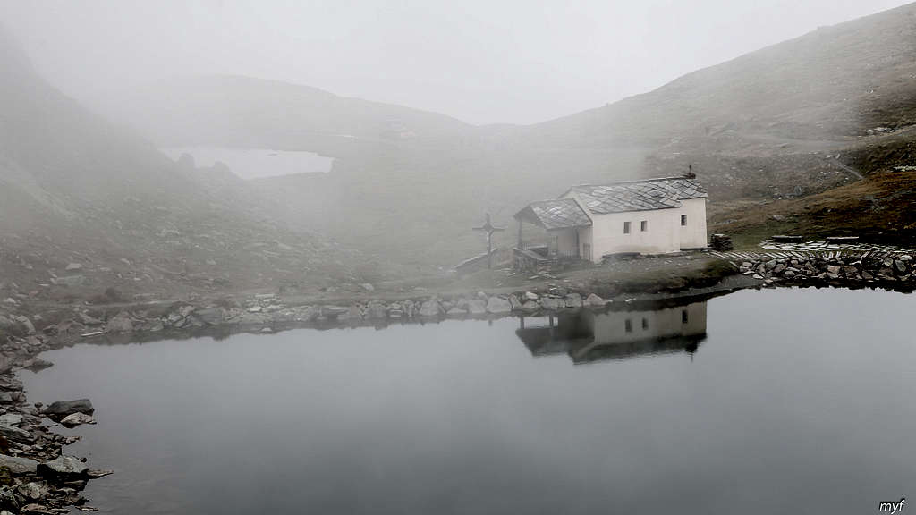 The next section of our hike was the Matterhorn Glacier Trail, skirting the outcrops of Matterhorn glacier and reaching the Trockener Steg place (2930), which is a station of several skylifts up and down. Many casual hikers take a cable car from Zermatt to Trockener Steg, walk this 6 km trail in the opposite direction, and take another cable car down from Schwarzsee. In spite of bad weather, we met more than a hundred people on this trail. It is necessary to add that during the whole 9-day route, apart from this section, we met on trails much less than a hundred people…
We continued by the trail going westwards near the south end of Schwarzsee, ascended two steeper slopes and reached the fork (2760) with the right trail going up to Hörnlihütte (3260); this hut is both a popular daily hike destination and one of the start points to climb Matterhorn. We took the left trail, facing the glacier (guess what is missing from this picture...)
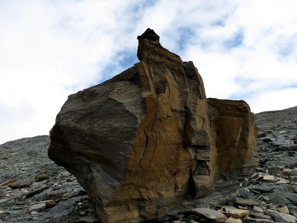
 The trail descends to the bridge over a creek flowing from the glacier (2677), crosses it and proceeds by the moraine. The retreated glacier had left a plenty of boulders for a huge open-space geological museum:
At 14:20 we stopped for a lunch on a big moraine field (2825) just opposite the hidden Matterhorn. Here is the lower part of Hörnli ridge with the Hörnli hut on top:
When we resumed the walk at 15:25, light snow began. The trail went gently up and down, passing several small lakes and surrealistic moonlike and Martian landscapes:
Finally we skirted a slightly bigger lake named Theodulgletchersee and ascended to Trockener Steg at 16:35. The weather was not encouraging, so we continued without breaks. The next section of trail followed a rocky slope, partially covered by a thin layer of fresh snow. Small lakes of triangle form fill depressions in the rock (once again, guess what is missing from the picture...):
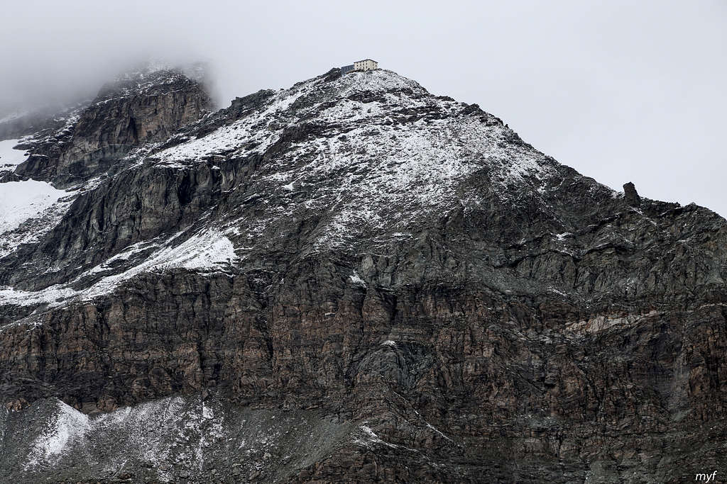
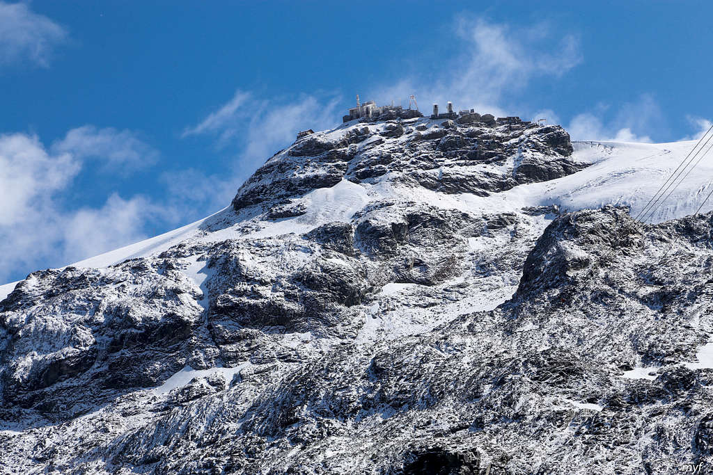
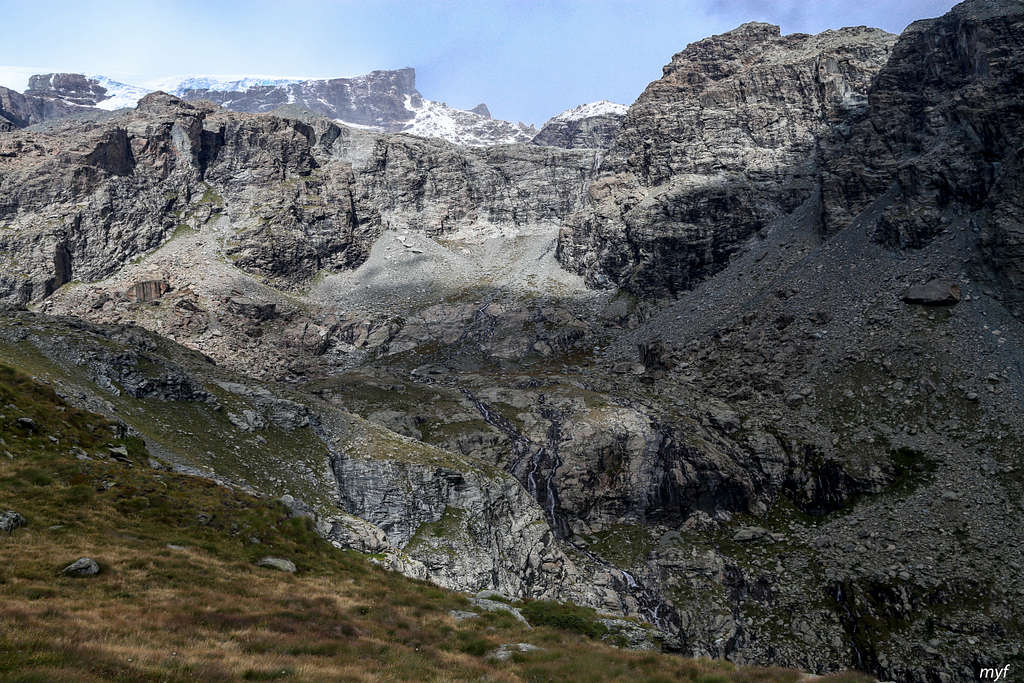
In 30 minutes we reached Gandegghütte (3030). Another day, a panorama of Breithorn might be seen on our left. However, the view of Lower Theodul glacier is also quite impressive:
Fortunately, this one was not on our way.
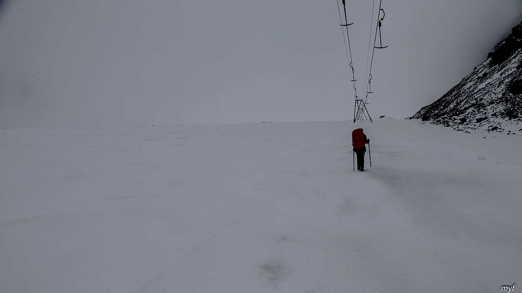
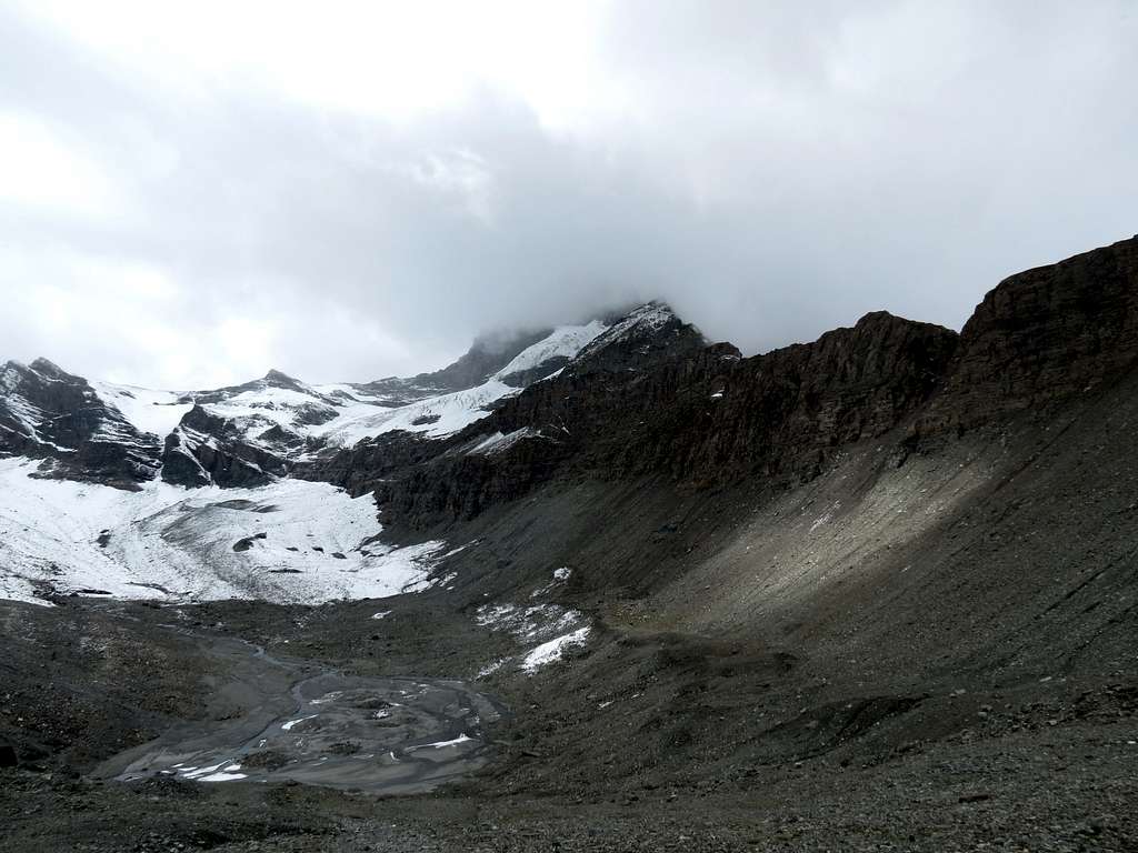
We turned southwest up a wide rocky spine. More snow lied there, so the trail, if it existed, was quickly lost. Following some rather fresh footsteps, we gained the elevation up to 3090 and descended from the rocks to the glacier at 17:30 (3070); the descent required some care. In ten minutes we caught a fresh ratrac piste, going up just under the cable line towards the Theodul pass. The winter landscape around was bleak and dismal:
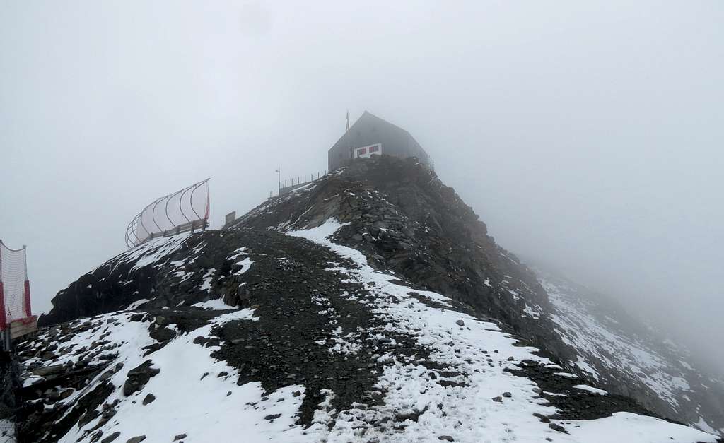
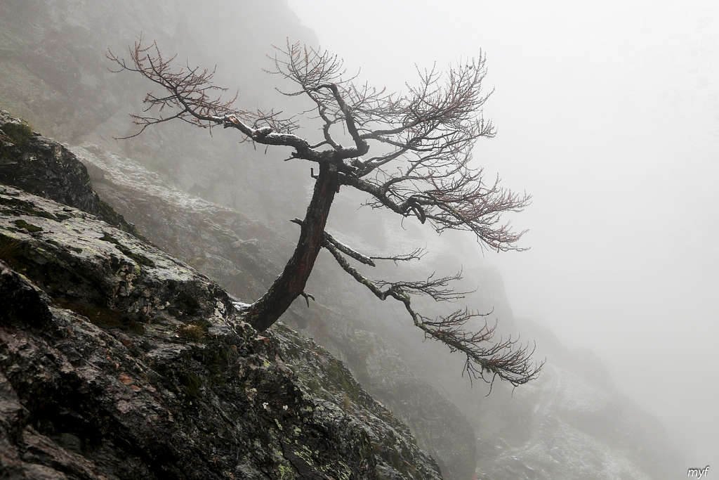
In half an hour we covered the distance to the foot of the pass (3230); fifteen more minutes we climbed its boulder slope covered with a foot of fresh snow. The pass (3296) met us with strong wind and gloomy views of the Italian side.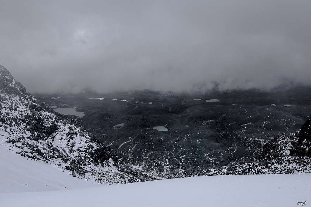
Almost all snow on the pass was blown away. The rifugio on the rock above shed a little light on the otherwise too dark scene:
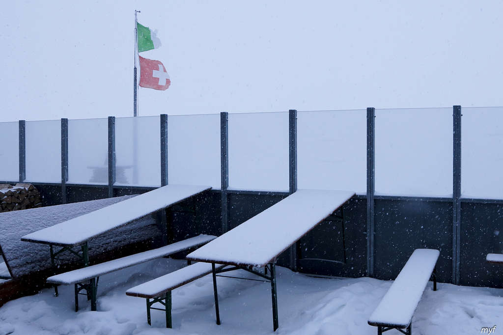
By 18:30 we were inside. We had expected this day to be harder. Surprisingly, we were the only hikers in the hut, the only people who came from Swiss side, and the only people who came afoot... (OK, we were not the only people in the hut; there were a large group of skiers and a couple of mountaineers, all arriving by cable from Italy.)
We desperately needed a good weather for tomorrow to perform our Plan A: cross the glaciated Plateau Rosa (with crampons and a rope) to di Verra valley in Italy.
Route: Rifugio Theodulo (3317) – Cime Bianche Nord Pass (2981) – Rifugio Ferraro (2072); 18 km, +300m/-1550m
Time on the trail: 8h00m; moving: 6h10m, including 40m for straying (+-120m, +1.5km)
It was snowing during the night, but the weather forecast for the first half of the day was good. We started at 07:50 towards the Monte Rosa plateau, but barely reached the Theodul pass. A blizzard ignored all forecasts and swept us back to the hut.
We waited for two hours but caught no sign of weather improving:
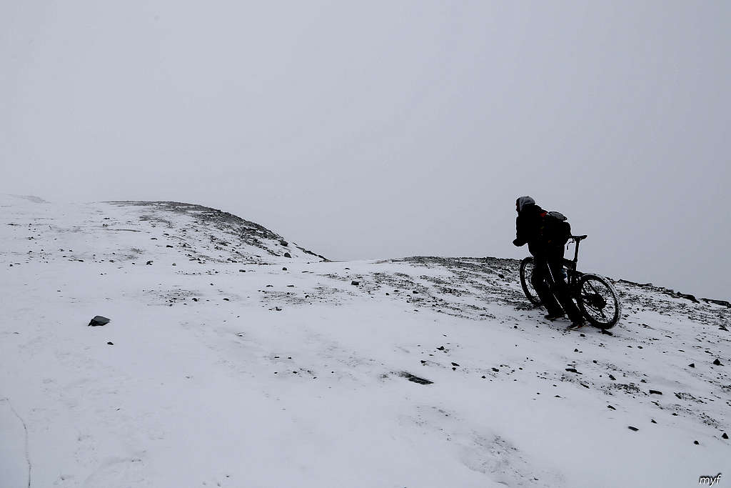
We felt somewhat disappointed, but finally adopted the plan B and started to descend into Italy at 9:55. The gravel road down to Cervinia was covered by ice and snow. Since we had crampons prepared for the glacier, we put them on, which increased our speed. There was not much traffic on the road, apart from this very determined guy:
In 30 minutes we reached Bontadini skylift station (3043) and turned left (south) at the fork after it. Soon after that the weather changed drastically: the next two photos were shot within a 15-min interval.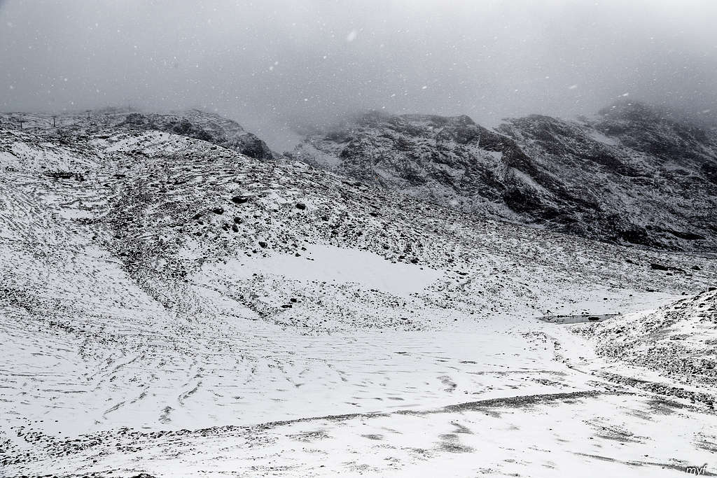
After 50 minutes of walk from the Bontadini station, we reached another station at 2810, passing Cime Bianche lakes and a couple of creeks; somewhere in the middle of this section we took the crampons off. By the time we reached the station, the weather completed its transformation into blue skies with some clouds, offering the views of the southern slopes of the Monte Rosa plateau...
and the “back” of Matterhorn:
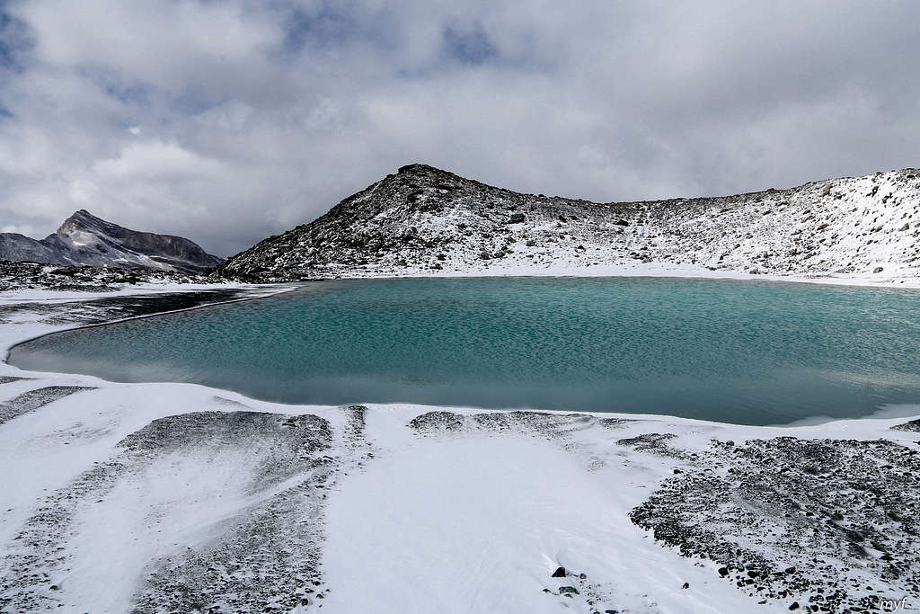
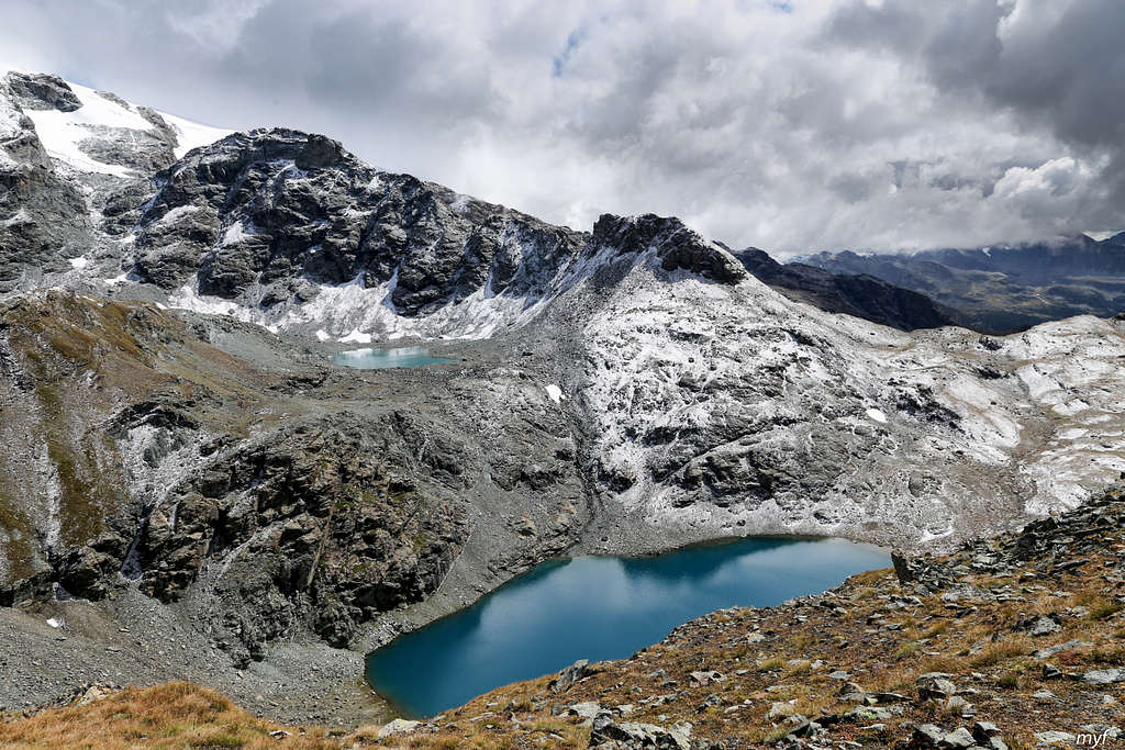
Near the station we took a break and resumed the walk at 11:35, turning left (up) on an immediate fork to ascend to the Cime Bianche North Pass (2981). The pass is actually a small plateau with a lake basin in it; the basin was dry. 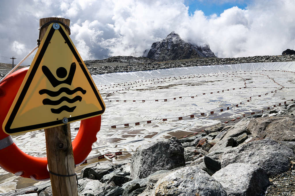 Reaching the basin at 12:20, we skirted it from the left and crossed the plateau to its boundary, which presented us with a breathtaking view of Gran Lago, surrounded by steep slopes:
The trail descended our slope in several short winds, bringing us to the bottom end of the lake (2805) at 12:50, where we stopped for a lunch. The most spectacular of nearby peaks is, probably, Bec Carre: 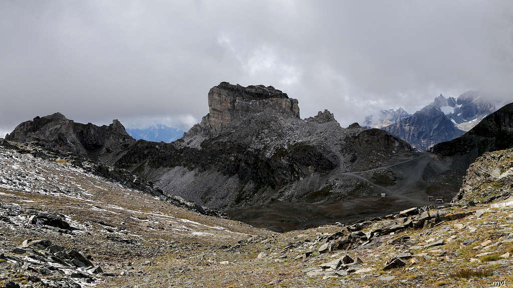 ...Somehow it reminded me of the Black Tusk in British Columbia.
At 13:55 we proceeded down the creek flowing from Gran Lago; in about 1km, the creek sharply turns right, while the trail retains its direction and soon catches another creek. A few more minutes of walk, and this creek meets a bigger creek from the left. The trail proceeds with this creek by a plateau and then turns left and down to yet another small valley. At the time, the weather began to deteriorate again:
The valley on the photo has flat bottom, covered by grass and a huge amount of cattle. We went downstream and at 15:15 stopped at a fork with a signpole (2335). After a short break, we continued by the left trail and crossed the creek. Immediately after it, there is another fork (2315). Here a procession of cows crossed our way right to left, following the creek up. It did not occur to us at the moment that cows followed a hiking trail on the right of our way and a cattle track on the left of it. Thus we proceeded forward, took a fast glance back to photo the calf lagged behind, and missed a fork.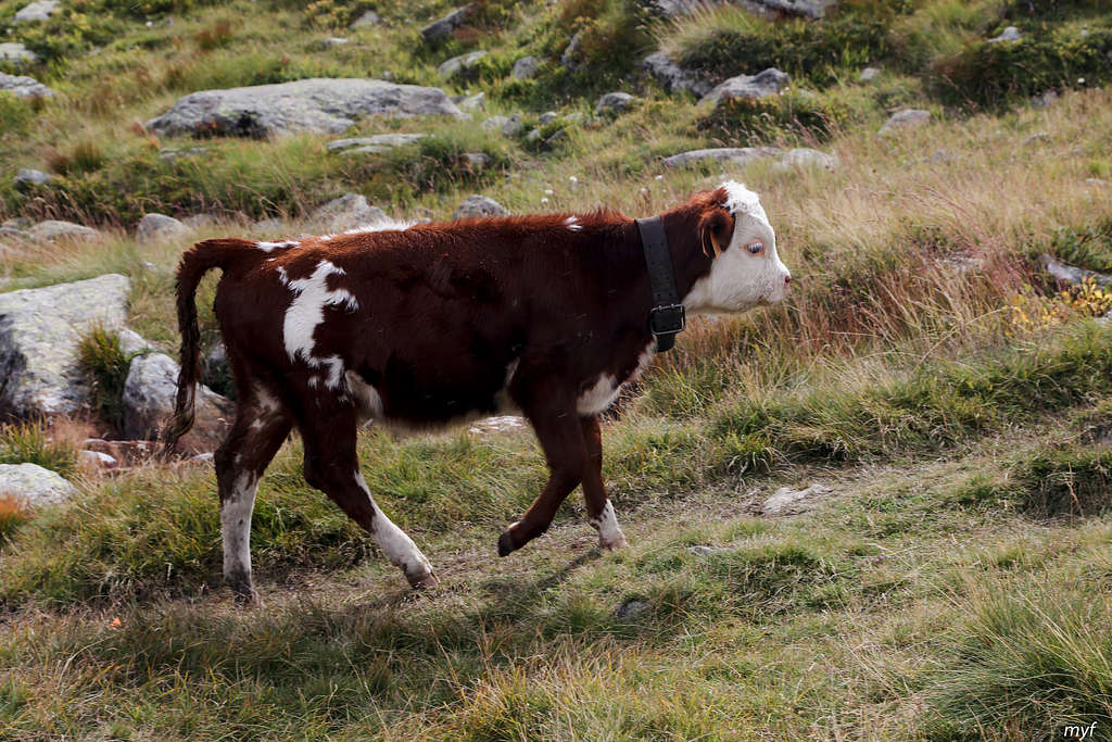 The whole act of straying along the trail aimed at bivacco Citta di Mariano cost us 40 minutes. Finally we understood that the trail goes too high, and returned. In the next 45 minutes we entered the valley of di Tzere creek, crossed it by a bridge (2170), admired the walls above the valley...
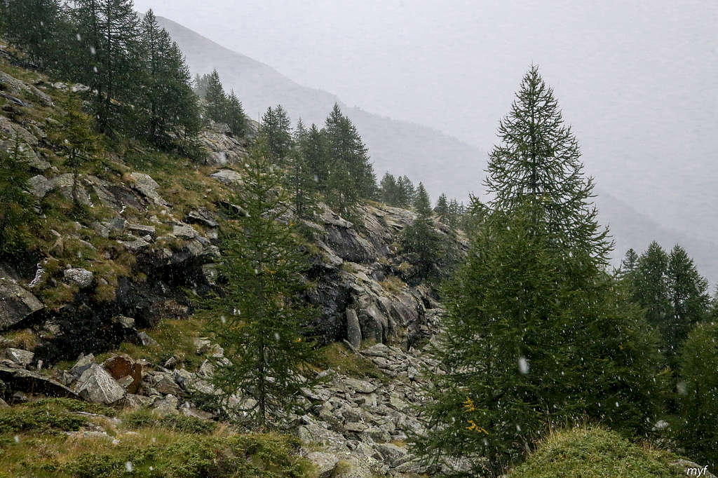
...and followed the left slope down to the waterfalls (2080; nothing spectacular this time). By the way, some precipitation began as a weird mix of snow, hail, and rain.
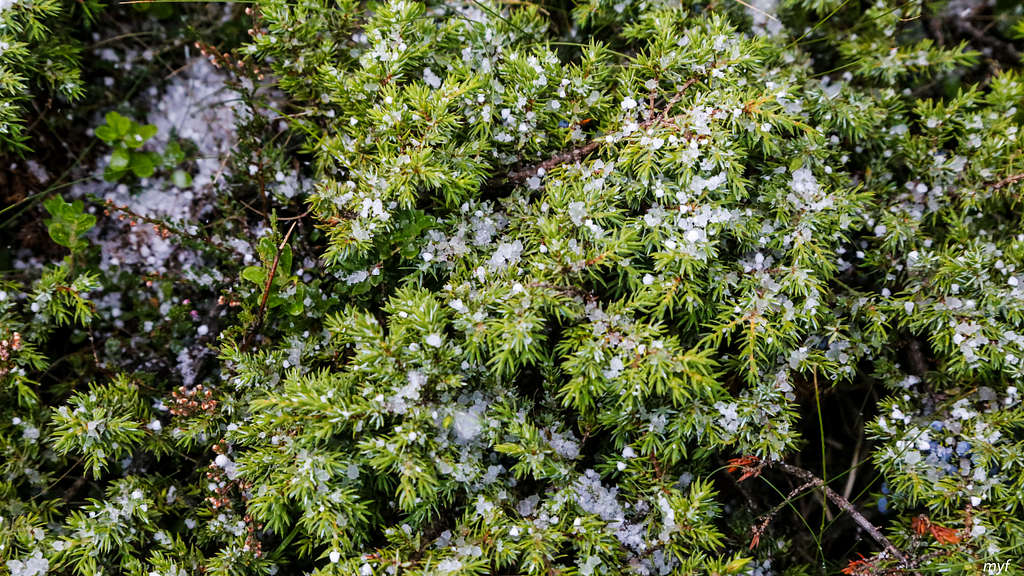
The hail provided us with some nice pictures, like this one:
After the waterfalls the trail leaves di Tzere creek and skirts a shoulder to reach the valley of di Verra creek. At 17:25 we crossed it by a bridge (2030) and followed the road to Resy, taking left at the fork in a few minutes after the bridge. At 17:55 we were at rifugio Ferraro (2072) in Resy. The precipitation stopped and mountains returned into view: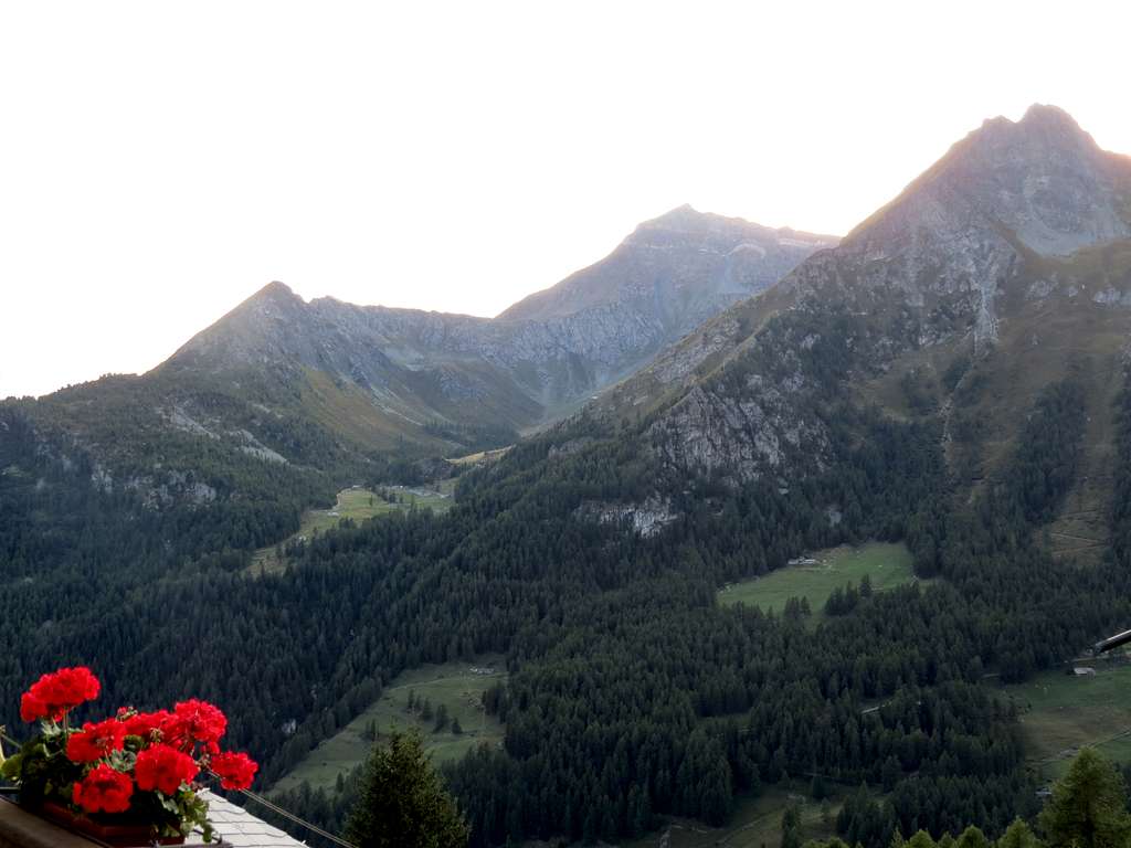 ...The hut was far from being crowded.
The guards told us that the Monte-Rosa ultra-marathon had been cancelled two days ago after the second leg: many runners had been unable to cross the Theodul pass due to weather conditions.
...The next morning was sunny and freezing, an ideal weather to start a hike.