
|
|
Route |
|---|---|
|
|
36.10318°N / 116.62403°W |
|
|
Download GPX » View Route on Map |
|
|
Class 2 |
|
|
Overview
 Sunset on Funeral Peak
The south ridge of Funeral Peak is a scenic alternative to the standard eastern ridge. The route is about half the distance, but is less commonly used due to the rougher drive involved.
Trip statistics for South Ridge from Gold Valley
Distance: 4.4 miles round-trip
Elevation Gain: 1900 feet out with another 100 feet on the return
Hiking time: 3-4 hours at a moderate pace.
Trailhead location: 36.07280° N, 116.62924° W
Getting There
 Pyramid Peak from Funeral Peak
While Greenwater Valley Road is passable by most any vehicle, the remaining drive is best undertaken with a high clearance one. The driving is not difficult at all, but there are a couple of eroded areas where the road passes through washes and high clearance is helpful. Very short portions are steep and sandy, and four wheel drive is recommended though perhaps not required for some drivers. This said I have seen two wheel drive, low clearance vehicles on roads far worse than this one, and I am sure a determined driver with little concern for their mode of transport could make it happen here. Much of the road is actually quite good, and can be driven at 20+ miles per hour with the right vehicle. Though four wheel drive is recommended, I would not hesitate to attempt it without it, just be properly cautious.
Please see the main page for driving directions to Greenwater Valley Road (also called Furnace Creek Road) from Highway 190 or Highway 178.
Turn west onto unmarked Lost Section Road from Greenwater Valley Road. This turnoff is 17.6 miles south of the northern end of Greenwater Valley Road (where you turn off the road to Dantes View) or 10.6 miles north of Highway 178. Keep track of your mileage or use a GPS, otherwise the correct turnoff may not be obvious.
Follow Lost Section Road for 2.5 miles to an intersection and turn right. The next 5.5 miles passes through a drainage area, and if four wheel drive or high clearance is necessary this is where you will use them. After 5.5 miles (8.0 miles from Greenwater Valley) bear right at an intersection and enter Gold Valley. In another 1.6 miles turn right off the main road at a faint intersection just as you pass a small hill on the right (the road here remains good, even though faint at times). Follow this track north for 1.9 miles to another intersection and bear left. One half mile later the route ends at a wash, with small amounts of rubbish scattered about from when mining was active in the area.
Route Description
 Route Map
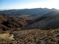 South Ridge Approach
From the trailhead drop down into the wash and follow it north to a saddle to the right of the white colored hills in the distance (do not head up the reddish hills to the right unless seeking a slightly longer outing). Shortly after leaving the trailhead you will pass some tailings and a mine shaft in the wash. Whenever the wash splits, generally keep to the left and there should not be any route finding issues. Your exact route up the last 500 feet to the saddle will vary, depending on your relative tolerance for scree, traversing, or desire to search for more solid footing. Once at the saddle, drop down slightly for a more direct route to the south ridge. Follow the obvious ridge north to the summit. Near the top travel is made a bit easier by keeping below the ridge crest on less rocky terrain.
The summit contains a register, but the benchmark has unfortunately been disturbed ($200 fine forthcoming).