
-
 4704 Hits
-
 72.08% Score
-
 2 Votes
|
|
Route |
|---|---|
|
|
51.08196°N / 115.41687°W |
|
|
Hike/Scramble |
|
|
Half a day |
|
|
Walk up |
|
|
Approach
From Canmore, Alberta take the Spray Lakes road past the dam, the Nordik Centre, through Whitemans gap and park in the Goat Creek parking lot. This is easily found and is signed. It is about a 15-20 minute drive from the centre of Canmore. From the parking walk back up the road and look for a well trodden route up to the left just past the second telephone pole. The Scrambles book mentions just past the "Bow Crow Forest" sign but it no longer exists. You will not miss the trail. It is an obvious one.
 |  |  |
Route Description
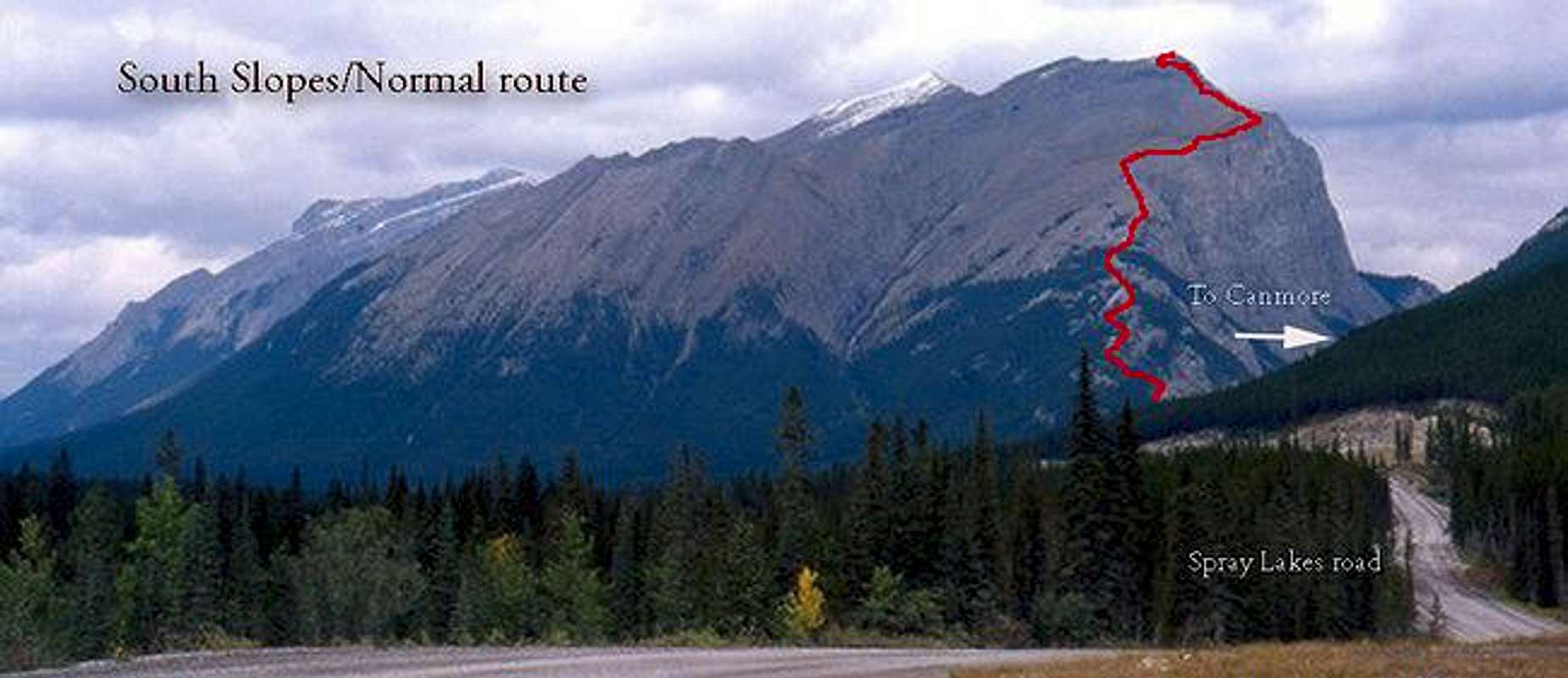
Wind your way through the obvious swichback tail through the woods. Once you break out above the tree line follow the slopes up to the ridge line. There is a well defined trail here so you cannot get lost. Follow the ridge up to the summit. Here you will have a very brief scramble to a nice flat area with a crairn on top. Excellent view of the surrounding area.
Essential Gear
Nothing more than good kiking shoes in the summer. In more wintery conditions, boots crampons and ice axe might come in handly. Dress for the mountains with warm clothes, and wind or rain shell tucked away.
Miscellaneous Info
If you have information about this route that doesn't pertain to any of the other sections, please add it here.