
|
|
Mountain/Rock |
|---|---|
|
|
48.59809°N / 113.53911°W |
|
|
Glacier |
|
|
Mountaineering |
|
|
Summer, Fall |
|
|
8792 ft / 2680 m |
|
|
Overview

View back to Triple Divide Pass from Split Mtn
The Saint Mary approach is about 15 miles to the summit and some 4,400’ vertical gain. The approach from Cut Bank ranger station is about 9.5 miles to the summit with as much as 6,200’ vertical gain depending on route.

Cross country approach from Triple Divide Pass
There is some interesting class 4 or easy class 5 scrambling from the base of the split on the summit block to reach the true summit which is on the northern portion of the split. It may be desirable to take a 50 meter rope and rappelling equipment for the retreat from the summit. If so, this can be done down the east face in a single rappel.
Guidebook: A Climber’s Guide to Glacier National Park
Trail guide: Hiking Glacier and Waterton Lakes National Parks
When to Climb:
July, August, September and into October depending on the amount of snow
Getting There
Glacier National Park is located in the NW part of the state and extends up to the Canadian border which it shares with Waterton National Park of Canada. The nearest airport is Kalispell. Amtrac stations are in Whitefish, W Glacier and E Glacier. Depending on your travel plans, it may be worthwhile to fly to Spokane, WA and pick up a rental vehicle. Some rentals there may be more user friendly on multiple state use and mileage allowances as well as price.From the Saint Mary valley, start at the Red Eagle trailhead near the park entrance at St Mary. There’s a campground at the foot of Red Eagle lake at the 7.5 mile mark and another at the head at about 8.4 miles.

Entering the split from the east
The Cut Bank trailhead is near a campground and ranger station that can be reached by traveling north from E Glacier past the Two Medicine portion of the park. From St Mary, you can follow the highway south toward Two Medicine and take the turnoff into the Cut Bank area. From the Cut Bank trailhead, you can take several routes. The one in the guide goes over Triple Divide Peak and traverses around Mt Norris. When I climbed Split Mtn, we dropped down the north side of Triple Divide pass leaving the trail and headed cross country toward the summit of Split basically joining into the St Mary approach to reach the crux near the base of the split. The trail from the Cut Bank ranger station to Triple Divide Pass is about 7.2 miles and the distance from there to the summit is probably a little over 2 additional miles.
Red Tape
Registration for day climbs in Glacier National Park is recommended, but not mandatory.National Park entrance fees apply in Glacier National Park. See Entrance Fees
Route Description
From Red Eagle Lake, hike up the trail toward Triple Divide Pass. Leave the trail near the large basin between Norris and Split mountains on your right. Scramble up the scree slopes just south of the se ridge of Split Mtn. When you reach the band of gray rock, traverse south to find breaks up through that section and continue to the summit ridge south of the summit block. Climb through the split, which runs east to west, and climb slightly down and right before heading up to reach a broad chimney about 60' up on the north section. Work your way carefully up the chimney to the summit.From Triple Divide Pass, leave the trail when it starts switchbacking to the east, away from your ideal line of travel to the summit. Head down into the large basin trying to minimize your elevation loss while enjoying a relatively level surface (I didn't want to be doing a long sidehill traverse). Climb up the broad scree slopes below the mountain to reach the cliff bands formed by the ancient reef and find breaks to climb up to the summit block a little south of the peak. Climb up into and through the split and continue as described above on the route from Red Eagle Lake
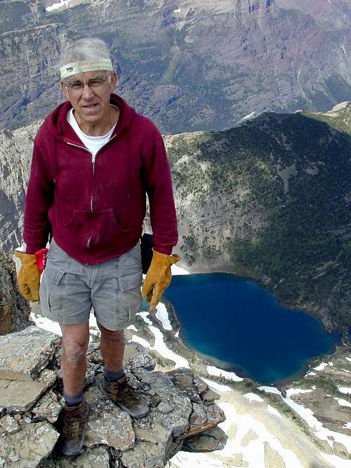
Summit photo 8/1/02
Camping
There are many camping sites available at Glacier Park; backcountry, as well as car camping. Due to the large number of grizzly and even larger number of black bears who inhabit the area, there are strict guidelines for storage of food. Most of the backcountry campgrounds have facilities for hanging your food from cables or bearproof poles, but you need adequate lines to hoist your packs, etc 15 or 20 feet off the ground. If you are seeking an “undesignated area” camping permit, the rangers may require you to use a bear barrel to protect your food. When we backpacked in to Buffalo Woman Lake, they loaned us a bear barrel since they did not think we could find adequate tree limbs for hanging our food, etc. Hanging your packs is a good idea, since I have seen damaged packs from chewing by rodents. The GNP rangers require you to view an informational video annually before you can purchase your first backcountry permit.GNP Campground Status and Infor
Backcountry Camping Info
Backcountry Camping Sites
External Links and Guidebooks
Glacier Mountaineers SocietyGuidebook: A Climber’s Guide to Glacier National Park
Trail guide: Hiking Glacier and Waterton Lakes National Parks
gimpilator - Nov 29, 2015 12:58 pm - Hasn't voted
Coordinates GlitchI just stumbled onto a strange glitch which corrupted the location of numerous pages and listed them all at the same point in southern AZ, USA. Please fix the lat/lon coordinates of this page to the following (48.598091, -113.539107) and I'll be happy to remove my "needs updates" vote. Thanks!
jimegan - Nov 29, 2015 3:51 pm - Hasn't voted
coordinatesThanks for the correction.