
|
|
Mountain/Rock |
|---|---|
|
|
38.78420°N / 107.1903°W |
|
|
Hiking |
|
|
Spring, Summer, Fall |
|
|
11814 ft / 3601 m |
|
|
Page is best viewed at monitor resolution of 1024x768
Storm Ridge Overview
I’ve always liked big photos showing loads of detail. However, submitting the images as “large” inside the text of a mountain page will interrupt the text format and can make a page annoying to read . So, I built a photo album for my Storm Ridge page with all photos submitted in “large” format showing expanded detail. Stop by and have a look, and enjoy Colorado’s spectacular West Elks Wilderness.
The following text will lean toward the difficulties of backpacking in the deep West Elks rather than the non-eventful talus slog up Storm Ridge. Climbing Storm Ridge is technically cupcake, however approaching it via the Haystack Mountain wildlife habitat is NOT very cupcake and requires thorough planning.
My name is Kane and I'm an addict...
Throughout every year, I dream about my yearly fall adventure into the mountains the first week in October. I always try talking myself into new destinations, knowing that it should be time to go somewhere else. It seems silly obsessing about the exact same spot, year after year. No matter how much I try to conjure up a new game plan, in the end I can’t resist my favorite place I know. So I pack my stuff and head to Colorado’s great West Elks Wilderness….again.
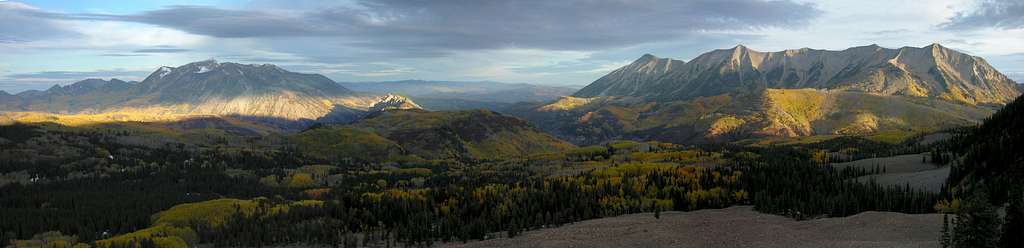
A few years ago I remember climbing East Beckwith Mountain. From that summit, I discovered Mount Gunnison. I climbed Mount Gunnison last season. Somewhere along that hike I remember spotting Mount Guero to the south. The following day I climbed Mount Guero and later, I realized why I keep coming back. In the West Elks, it’s not just about the mountain; it’s more about the encompassing area.
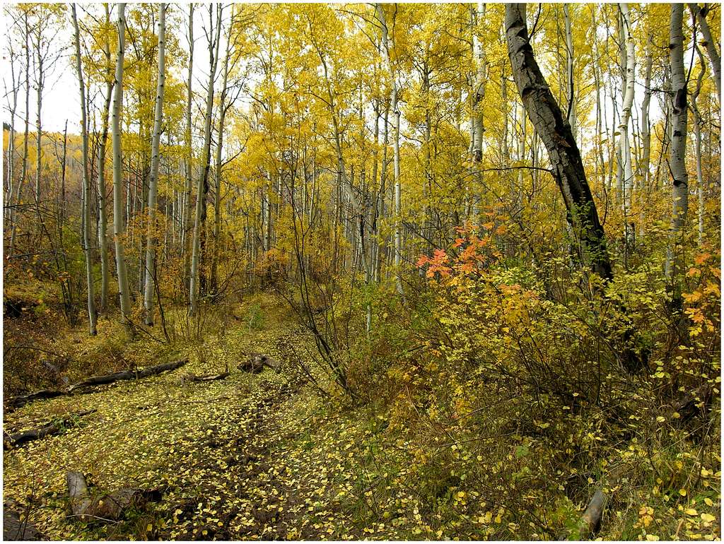
In the West Elks, one can easily be more excited about the approach, rather the climb and the view. Don’t get me wrong, the residing mountains are stunning to look at, but its obvious why this place pops with such brilliance in fall. It’s those darn aspen trees. A long time ago, I helplessly fell into a spiraling vortex of aspen addiction. Forgive me for I’m an aspen junkie, and aspens are my vice. Oh yea, the brush oak isn’t too bad to look at either. You know you’re addicted to aspens when you draw your approach in topo software and hope your proposed loop route ends up close to something nice to climb. Isn’t it usually the other way around?
That’s how I found Storm Ridge (11,811-ft). Not from a nearby summit, but rather from drawing a perfect aspen infested loop hike/route on my topo software and later realizing the route came within a few miles of a 11,811-ft perch above it all.
Storm Ridge
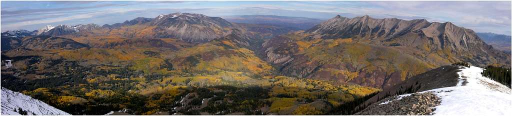
Storm Ridge is an officially named mountain just northwest of the West Elk Peak massif, and south of the Beckwith and Anthracite massifs. Storm Ridge combines with other highpoints to form a protective ring of mountains surrounding one of Colorado’s most pristine ecosystems, the Haystack Mountain wildlife habitat. The habitat is home to massive herds of large Elk which are protected by high passes, such as Minnesota Pass, Curecanti Pass, Castle Pass and Beckwith Pass and even higher mountains like The Beckwiths, The Anthracites, Mount Gunnison, Mount Guero, and Sheep Mountain. Hunting here is for the real cowboys on horseback. No roads, no trucks and no ATV’s. And backpacking here is for the adventurous.
A few things to expect while packing into this great wilderness: scintillating scenery, complete isolation, rolling non-descript terrain, an extremely confusing network of trails and mud.
I should expand a bit. Scintillating scenery goes without too much to say. In fall, I can’t imagine a better place to be than the West Elks Mountains. Complete isolation means; don’t get lost. DON’T GET LOST. The area is vast and unknown to many. It also means if you want to go find yourself spiritually, then go here. Rolling non-descript terrain means lots of convoluted and heavily treed drainages, and many open meadows that looked like the last open meadow you visited. Locating landmarks here can be challenging as well, which makes topo map interpretation difficult. Lastly, because of the lack of human impact, trails here tend to fade in and out above 8 to 9,000-ft. Adding to the difficulties, the area supports a myriad of game trails. When your trail begins to fade, it’s too easy to find another nearby trail that eventually goes the wrong way.
West Elks Overview
The West Elk Wilderness comprises a remote and mountainous area west of Gunnison Colorado. The West Elks encompasses 176,000 acres of Gunnison National Forest, making it the fifth largest wilderness in Colorado. This region resides south of Kebler Pass, which runs east from Paonia State Recreation to the tiny ski resort of Crested Butte, and south to the Curecanti National Recreation Area. The volcanic ridges and long valleys offer extensive hiking and climbing. Over 200 miles of constructed trails are available for both foot and horse travel through this rugged terrain. Elevations within the Wilderness range from 7,000 to over 13,000 feet. Because the area lacks fourteeners, centennial thirteeners and numerous alpine lakes you will get the benefit of hiking alone and away from the typical recreational visitor.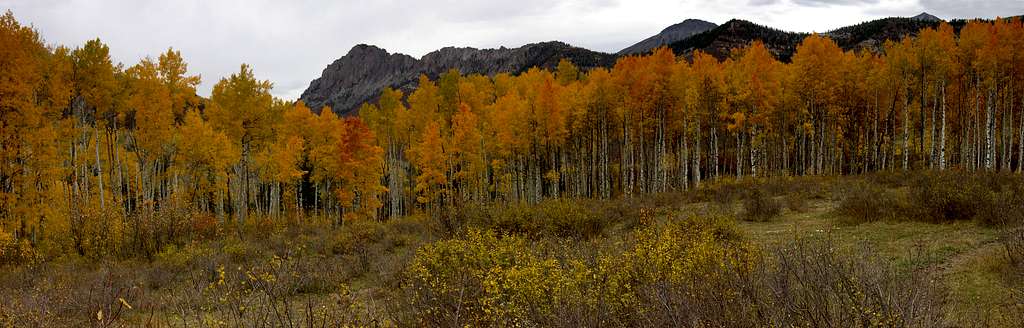
Little Robinson Trailhead
The following text is also available in the route page.From McClure Pass, drive Hwy 133 to Paonia Reservoir. Just past the reservoir, turn left on the scenic byway, Kebler Pass Road or Co12. Go approximately 2 miles and look sharp for a turnoff on the right. There is a wooden sign here marking the turn off that says “PRIVATE PROPERTY-next two miles, stay on road.” This is the Coal Creek Road. There will be no sign declaring this road to be the Coal Creek Road. Drive this scenic, one lane road 10 miles to the Robinson Creek TH. En route pass the turn-off to the Throughline TH. The road is passable for low clearance vehicles.
Red Tape
There are no fees to enter or hike this wilderness.For more information contact:
Weather
National Oceanic Atmospheric Administration (NOAA)


RyanS - Oct 18, 2006 2:15 pm - Voted 10/10
TZ linkLooks like the HP of Storm Ridge is the western summit at 11,814'. Beautiful page, Kane! All those aspen make me want to cry, I miss them so much, especially since I haven't seen a Colorado autumn since '04 :(