

|
|
Mountain/Rock |
|---|---|
|
|
38.58350°N / 106.2997°W |
|
|
13651 ft / 4161 m |
|
|
Overview
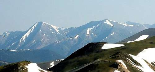
Aetna and Taylor
Taylor Mountain rises 13,651 feet above sea level in the southern Sawatch Range in central Colorado. Although it is eclipsed in height by mountains around it, Taylor Mountain is rich in mining history and is an abundant source of natural resources to this day. See Mining section, below.
Taylor Mountain also provides a place to play. Four wheelers and ATVs make use of the maze of old mining roads on the south sides of the peak. Many climbers reach its summit each year, aided no doubt by the high roads. About 45 individuals signed the summit register in 2004.
Taylor’s parent peak and closest neighbor is Mount Aetna, 1.2 miles to the west. Just across a fork of the Arkansas River to the north are the Carbonate Mountains and Tabeguache Peak. To the southwest is the prominent Mount Ouray.
 |  |  |
Mining Taylor Mountain

Taylor Gulch Mine
The Monarch Mining District, between Salida and Gunnison, on the east side of Monarch Pass, produced about $10 million of silver, gold, lead and copper between 1878 and 1910. Taylor Gulch, the 1000' deep gulch that divides Taylor Mountain and Missouri Hill, was the location of the most productive mines in the area.
Mines in the 1880's included the Zephyr, Bonnie Bell and Ben Hill, all in Taylor Gulch. Veins were 4 to 8 feet in width, and produced 1 ounce of gold per ton and 40 ounces of silver per ton. Mining at the higher altitudes, up to 12,000' elevation, was limited to the late months of summer. Today there are working limestone quarries in Taylor Gulch just above the town of Garfield.
The first ore shipped from the Monarch District came in wagon shipments to Canon City. They averaged 200 ounces of silver per ton. But most development occurred after the railroad was laid from Poncha Springs to Maysville, most of the way up the pass to the Monarch district.
The complex geology of Taylor Gulch came from folding and faulting of very diverse strata. The softer exposed sedimetary rock eroded to a deep gulch, exposing large areas of the surrounding strata. Productive mines were located in both limestone and monzonite quartz zones.
Getting There
North access:Drive 5-6 miles west on U.S. 50 from Poncha Springs. Turn north onto Chaffee County Road 240, which is well marked. Drive about 8 miles to a spot below the ghost town site of Shavano, also well marked. You will need a high clearance vehicle, but not four wheel drive, to make the last four miles of this road. Nice campsites are available along the road.
South access:
Drive west approximately 12 miles on U.S. 50 from Poncha Springs to the town of Garfield, near the base of Monarch Pass.
 |
Red Tape
Taylor Mountain is in the San Isabel National Forest. All visitors and forest users are subject to Federal Regulations. Read the rules, which address camping, vehicles, camp fires, pets, and several other issues.
Salida Ranger District
325 West Rainbow Blvd
Salida, CO 81201
719-539-3591
Much of the land on the south sides of the mountain are mining / quarry areas, but access is not restricted in any way.
Mountain Conditions; When To Climb

Taylor Summer
Taylor Mountain has a well deserved reputation for high winds, at least in the summer. Hang on to your hat! Check the National Weather Service forecast for the southern Sawatch before going, and err on the side of safely.
See also the general Forest Service guidelines for wilderness travel and peak climbing.
Almost everybody who climbs Taylor Mountain does so in the summer or early fall. Winter ascents are discouraged due to avalanche danger.