The Approach
It took me nine and a half hours to drive here from Walnut Creek, CA. There was a bit of rain on the way into the Park. The pavement turned to dirt about a mile and a half before the kilns. I wondered why the Park Service elected to stop the paving at that particular point; was it to discourage excess crowds?
I parked at the kilns and packed up to Mahogany and camped. It took me about two hours to go the 2 miles and 1,200 feet elevation gain to the campground. I could easily have driven the one mile to Thorndike Campground. The dirt road to there was good, just a bit steeper than the road into the kilns. Between Thorndike and Mahogany the road gets steeper and there are some washboard portions. I was glad I didn't try to drive to Mahogany in my Honda Fit. There was a Honda Civic up there at Mahogany so it can be done, but they must have bottomed out a few times on the way up.
At this time of the year Thorndike had no campers in it, and Mahogany was less than half full with a few quiet campers. Nice.
Morning
The rain stopped and the full moon came out that night. In the morning it was 38 degrees and the clouds had all sunk into the surrounding valleys. I ran around taking pictures and expecting that it would be a clear day for the hike up Telescope. I start hiking around 9:15 AM. Some other parties started hiking at night under the full moon and arrived on the summit at around sun-up. It must have been beautiful. I've also noticed that a number of peaks have little bivouac sites near the summit. Who is it that's doing these climbs and camping out near the top?
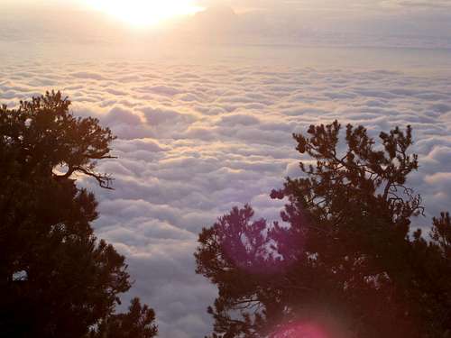
![Death Valley Morning]() Sunrise over Death Valley
Sunrise over Death ValleyThe Start
The maximum temperature recorded in Death Valley was 134 degrees in 1913. The lowest temperature was 15 degrees, also in 1913.
The interpretive sign at the start of the trail said that the Indians used to spend their summers up here gathering pinon pine nuts. Suddenly it made sense how the Indians survived in this desert - they migrated to obtain the optimal temperatures and food supply. Fits right in with the National Geographic issue for November on Migration. Indians still live in Death Valley, the Timbisha Shoshone. Nowadays they "migrate" to Lone Pine in the summer. You can read about them at Wikepedia or at timbisha.com
The other surprise on this trip was the rugged canyons. Of course everyone knows that you can see the lowest point in the Western Hemisphere from here, Badwater at 282 feet below sea level, and the highest point in the 48 states, Mt. Whitney, at 14,495 feet. But the canyons are quite impressive to see from here, too, at 11,000 feet deep from here as measured to the Valley floor! The Grand Canyon is around 6,000 feet deep, so the canyons here are almost a mile deeper than the Grand Canyon! Of course the Grand Canyon is unique in its steepness, color and different rock layers, but the canyons here are worth a mention, too.
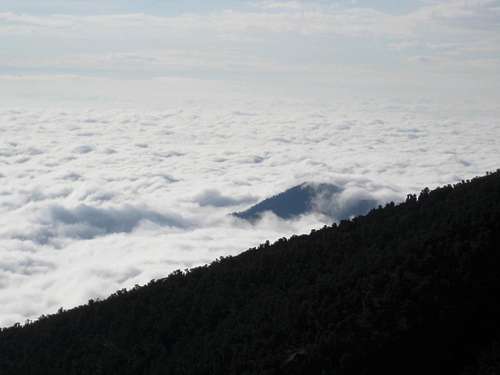
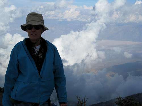
![Clouds Over Death Valley]() Death Valley. This is a desert?
Death Valley. This is a desert?The Hike Up
I was also struck by the quiet here. Not many birds or squirrels or anything making noise, other than the fighter planes from the Navy base at China Lake, of course! Where are all the animals, did they just go into hibernation?
I was also wrong in my weather forecast - the weather socked in so that there were clouds below, clouds overhead, and fog and wind at ground level. One hiker ahead of me turned back at 10,000 feet because it was socked in. I wasn't about to turn back after driving 422 miles to get here; I could at least bag the summit, even if there was no view. As it turned out, a hole in the clouds miraculously appeared and I saw Badwater from the summit. You could also see the Sierra Crest with the clouds rolling over them at times. You just never know.
The maximum temperature during the day was about 60 degrees - by and large, good temperatures for hiking. There was fresh snow on the summit.
It took me about five and a half hours to hike the seven miles to the top, going at an easy pace and stopping frequently to take pictures.
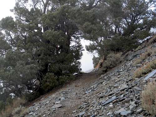
![Trees Form Tunnel]() Going towards the tunnel.
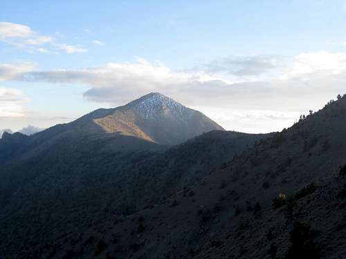
Going towards the tunnel.![Bennet Peak]() First glimpse of Bennet Peak.
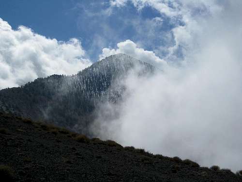
First glimpse of Bennet Peak.![Sierra Crest]() Clouds rolling over Sierra Crest.
Clouds rolling over Sierra Crest.![Telescope Peak]() Telescope Peak. Staircase to heaven.
Telescope Peak. Staircase to heaven.![Badwater]() Badwater in the distance from the Summit.
Badwater in the distance from the Summit.The Hike Down
It took me three hours and ten minutes to get down. I was surprised to see that my round trip time - about eight hours and 45 minutes - came in just under the nine hours alloted in "California Hiking" by Foghorn Outdoors press.
I got back after sunset, although there was still ample light and my ace in the hole - the full moon - was rising.
On the way back the clouds largely dissipated, too, so that it ended up being about 90% clear. All in all, the weather added variety, interest and beauty to the trip. Coulda' been worse.
![Telescope Peak]() Telescope Peak in late afternoon.
Telescope Peak in late afternoon.![Moonrise Over Death Valley]() Moonrise over Death Valley.
Moonrise over Death Valley.The End
At the University of Colorado, Boulder, when I was there in 1964 the Hiking Club used to have this greeting, they would say "Borack!" Does anyone out there in Adventure Land know what that actually means? Do they still say it???
I will assume it meant something like Aloha - hello or goodbye or both. So, Borack! to you.


Comments
Post a Comment