
-
 3780 Hits
-
 81.67% Score
-
 14 Votes
|
|
Route |
|---|---|
|
|
34.47468°N / 119.68825°W |
|
|
Hiking |
|
|
Spring, Summer, Fall, Winter |
|
|
Less than two hours |
|
|
Overview
 |  |
The Santa Ynez Mountains to the north of the city of Santa Barbara includes many trails. Some of these trails extend all the way to Camino Cielo Ridge and some extend only as far as Gibraltar Road. All of these trails are connected via a network of connector trails. The most famous of these convoluted connections is the one that connects the Rattlesnake Canyon's trail to Mission Canyon's Tunnel Trail. This trail is known simply as The Connector Trail.
Although this connector trail is only one mile in length, one needs to hike one and half of mile first to reach it. This holds true regardless of which trailhead we use as our starting point, Tunnel Trailhead in Mission Canyon or Rattlesnake Canyon trailhead.
Getting There
Rattlesnake Canyon, Santa Ynez Mountains
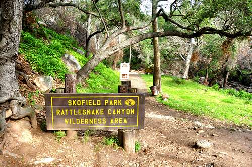
Rattlesnake Canyon Trailhead
The trailhead is just across from Skofield Park, a beautiful park with a number of famous boulders. If you are here for the canyon, take a few minutes to visit Skofield Park as well.
From US Highway 101 in Santa Barbara take the Mission Street off ramp and turn right, east, at the light. Continue on Mission street passing in front of the mission building to a stop sign at the intersection with Foothill Road. Turn right onto Foothill Road and left onto Tunnel Road. You will come to a fork. Take the right fork toward Botanic Garden. Before reaching Botanic Garden, turn right onto Las Canolas that will take you to Skofield Park and Rattlesnake Canyon Trailhead.
Route Description
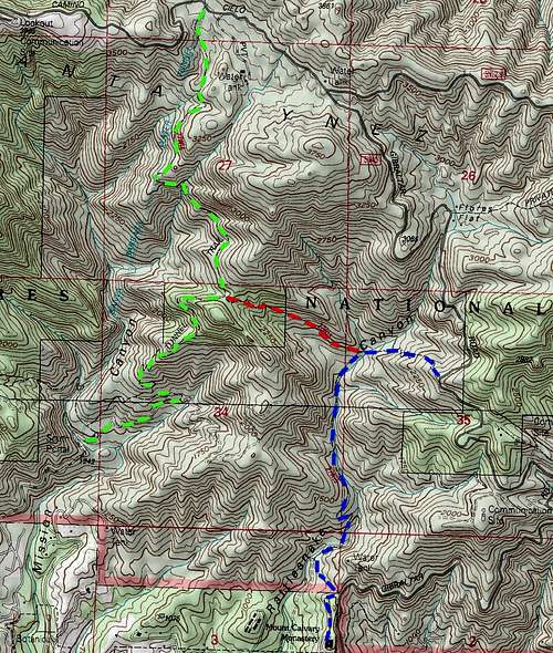
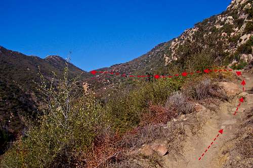
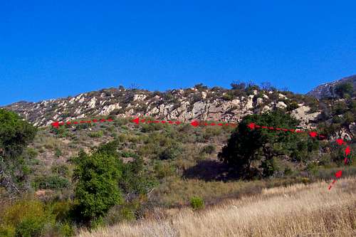
The Connector Trail shown in red
A detailed description of of the first mile and half of this can be found here. It may be useful to mention that after a heavy rain the many creek crossings of this trail become difficult. The Connector Trailhead is located about a hundred yards beyond the north end of Tin Can Meadow. There is a rusty old sign showing the way to Tunnel Trail. The trail itself follows the bottom of a prominent rock band clearly visible from the meadow. After about quarter of a mile the rock band ends and the trail heads straight for the lowest point on the horizon. Tunnel Trail is about a hundred yards down the hill from this point some some 766 feet higher than the start of the connector trail.
| Points of Interest | Coordinates | elevation | distance from trailhead |
| Trailhead | 34.46410 N 119.69257 W | 826 ft | 0 miles |
| Tin Can Meadow | 34.47468 N 119.68825 W | 1734 ft | 1.5 miles |
| Tunnel Trail Connection | 34.47828 N 119.6972 W | 2500 ft | 2.5 miles |
Essential Gear
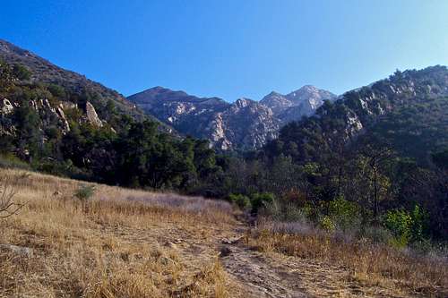 Gibraltar Rock area seen from Tin Can Meadow | 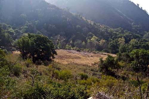 Tin Can Meadow | 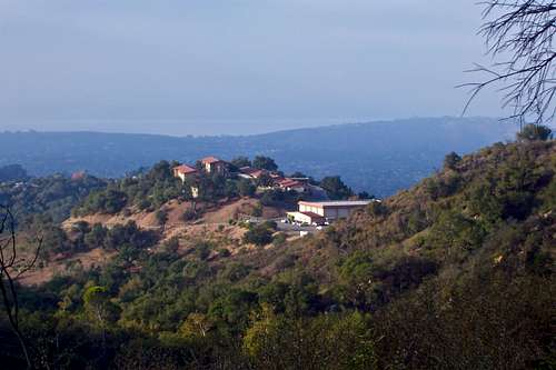 Saint Mary's Seminary |