|
|
Area/Range |
|---|---|
|
|
57.09246°N / 4.2543°W |
|
|
Hiking, Mountaineering, Trad Climbing, Ice Climbing, Skiing |
|
|
Spring, Summer, Fall, Winter |
|
|
Overview
Aka – Monadh Liath
Pronounced – Mon – a - lea
Meaning – The grey mountains
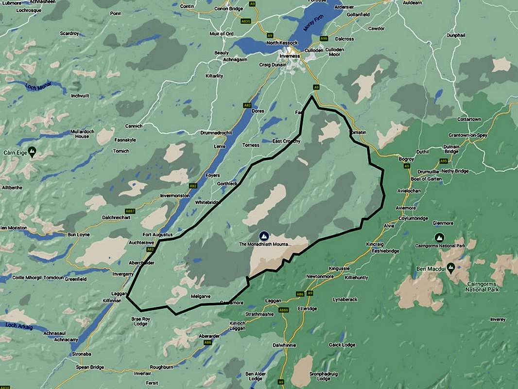
Designated as a Special Area of Conservation (SAC), the Monadhliath mountains exist as part of a large wilderness area of the Scottish central highlands. On its western boundary lies the diagonal geological slash of Loch Ness contained within the Great Glen. The Corrieyairack pass and the Spey valley are the southern limits, whilst the west and north butts up against the Cairngorms National Park (strictly speaking, the Munro summits are all within the Cairngorms National Park boundary). The western limits are outlined by the towns along the major A9 road, from Newtonmore via Aviemore, Carrbridge, Tomatin up to the land south of Loch Moy as the A9 continues on to Inverness. This encompasses an area of around 1800 square kilometers (700 square miles).
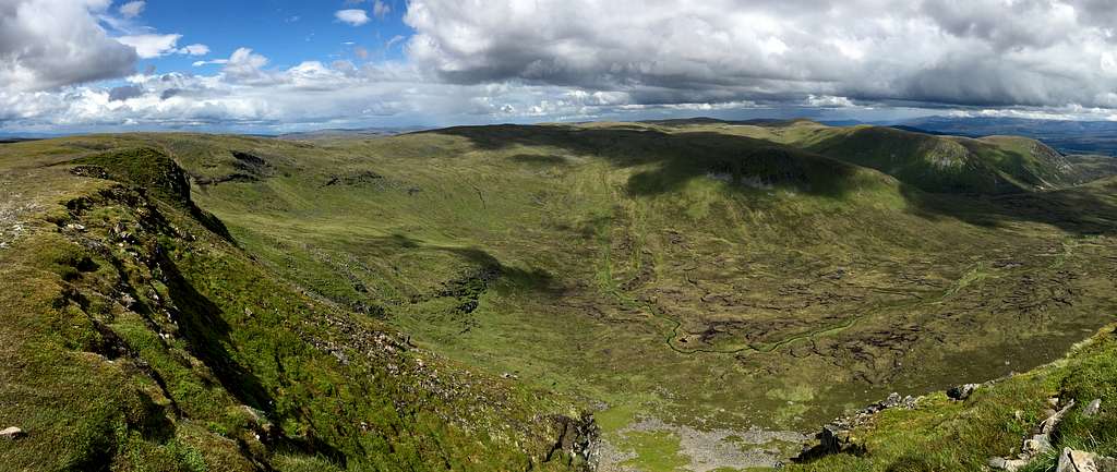
The major mountain summits themselves occupy an area to the southeast of this moorland wilderness and Peter Hodgkiss, writing in the SMC guide to “The Central Highlands” described this vast area as “featureless”.
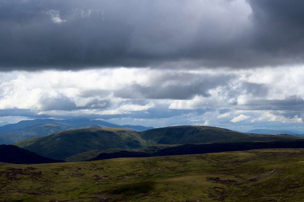
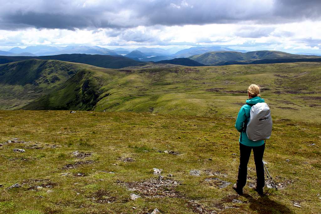
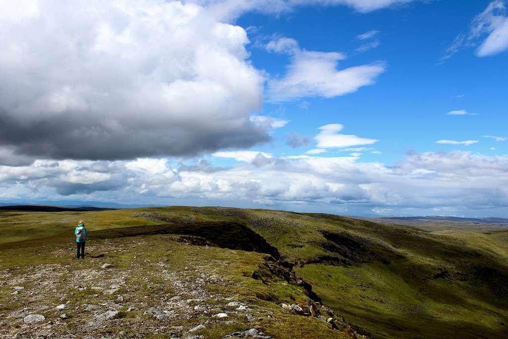
Whilst this is not the whole story, it is true that for the most part, the area consists of green, rolling moorland made up of peat bogs and carpets of moss, mostly above a height of 700m, with the occasional craggy outcrop on or near a summit. There is an interest to the mountaineer and hill walker on the aforementioned central and southern boundaries where the majority of the mountains exist, including four Munros.
As for the mountains themselves, whilst they are considered as separate mountains, it is difficult to not consider them as highpoints in one range. There is little in the way of low-lying land between the summits and most hikers will explore them by ascending multiple summits rather than single peaks.
Geology and environmental land use
The landscape of the Monadhliath mountains appears as the link between the mountains to the west and east of the central Grampian highlands.
The mountains to the west are characterized by steep and craggy, narrow ridges with deep valleys in between. Whilst to the east, the rounded, high Cairngorms plateau is punctuated by lairigs (mountain passes) and corries formed by glacial ice.
The underlying rock of the Monadhliath mountains is composed of Precambrian (Grampian group) metamorphosed sedimentary rocks that is, mainly ancient sandstone that was formed due to river activity then, changed by tectonic forces through time. This base has a wide variety of igneous rocks (such as Granite) intruded into it through natural structural faults. The ancient geological processes created heat and pressure and consequently, the sedimentary rocks have been transformed into deposits of metamorphic rocks such as Schist and Quartzite.
This land has been evolving for millions of years and although it has been repeatedly covered by icesheets through the known Ice ages, geologists agree that the freezing and melting of the climactic changes have not had that much effect on the landscape’s overall character.
There are a few corries and glacial valleys, mainly in the southeastern area, that give the hills some visual character, but nothing like to the extent there is in the nearby Cairngorms.
On the southern boundary of the range, we find the birthplace of the River Spey, one of Scotlands greatest rivers. It’s valley curves northeast into the Cairngorms National Park and passing Newtonmore and Kingussie before heading for the Moray Firth.
The other great Scottish river which rises in the Monadhliath mountains is the Findhorn River. This runs a parallel route to the Spey River on the north side of the mountains and also ends up at the Moray Firth. Both rivers are fed by countless tributaries that drain from the hills.
The landscape is mostly covered now by boggy ground at the lower levels. This can be a haven for mosses, wildflowers and heather. The higher parts of the hillsides are more exposed to the elements and have a thinner soil that is interspersed with a few crags and plenty of scattered rocks. Tough grasses cover a lot of the hillsides but small lochans or muddy swamps often form where precipitation collects.
History
Although the Monadhliath mountains have always been a wilderness, a route through them has existed for hundreds of years and the area is steeped in historical relevance.
The Corrieyairack pass was known to travelers in the 12th century being a short route through the mountains for anyone heading to the far north.
From the 15th century, a cattle drover’s route from the Isle of Skye towards Stirling was in use and James Graham, 1st Marquess of Montrose had led his men into battle along this way in 1645.
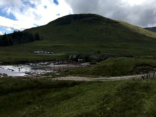
In the Summer of 1731, the English troops under the command of General Wade, completed a gravel and rock road running from the town of Dalwhinnie and the English troops barracks at Ruthven (near Kingussie) westwards, crossing the River Spey near Garvamore and over the Corrieyairack pass and down to Fort Augustus at Loch Ness.
Much of this road was constructed over the original, older route.
According to legend, it was in this area that the last wolf in Scotland was killed in 1743 and that the Jacobite leader, Charles Edward Stuart (aka Bonnie Prince Charlie) passed this way in 1745 with his fledgling army on the way to Edinburgh, England and eventual exile in France.
The modern public road that now exists down the Spey valley follows much of Wade’s original road route but motor access ends today at Garva. The bridge at Garva was constructed in 1731 and was originally called St George’s bridge by Wade although, it is usually known nowadays as Garva Bridge. It is more or less the same today as it was when Wade would have used it.
It is still possible to continue on Wade’s road to Fort Augustus on foot or by bike.
Much of the surrounding moorland has been used by farmers to graze cattle and sheep for centuries and this continues today.
The mountains in the southeast of the area form the western edge of the Cairngorms National Park and much of the rest of the land is privately owned by estates.
Consequently, the area is also used for other sports activities such as Deer stalking and Grouse shooting - hence the many modern ATV tracks encountered. Both the Spey and the Findhorn rivers are well known for the quality of their Salmon and Trout and fishing has always been popular.
The high and relatively flat moorland has always been swept by high winds from all directions. New access roads have taken away some of the feelings of remoteness the area had and also caused the creation of ranks of wind turbines as part of a very large wind energy project. A sustainable and non-polluting source of energy but an eyesore viewable from the Monadhliath summits as well as the Cairngorms. Proof perhaps, that all sources of energy come with a price.
Flora and Fauna
I have already mentioned that the area is used by hunting and fishing enthusiasts and this confirms the presence of populations of Deer, Red and Black Grouse etc.
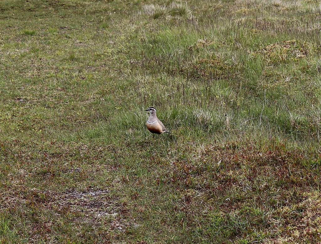
It is also possible to see a wide variety of wild birds including Golden Eagle, Peregrine Falcons, Buzzards, Merlin, Ptarmigan, Dotterel, Golden Plover and many more.
There are many mammals such as Otters, Pine Martens, Mountain Hare, Red Squirrel and possibly the rare Wild Cat.
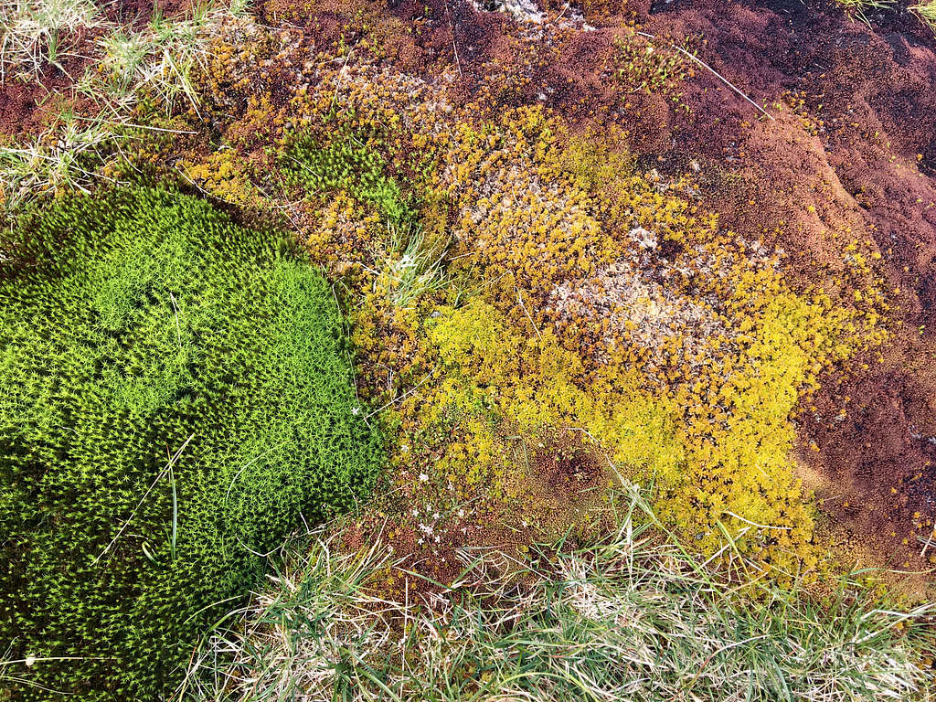
The heath land and bogs contain many specialist plants that thrive in these conditions, it is possible to see several types of Heather, Purple Saxifrage and Three leaved Rush.
The wetland bogs are populated by more specialist plants as well as carpets of moss, it is possible to see Hare’s-tail Cottongrass, Crowberry and Dwarf Birch trees if it is not too wet for their roots.
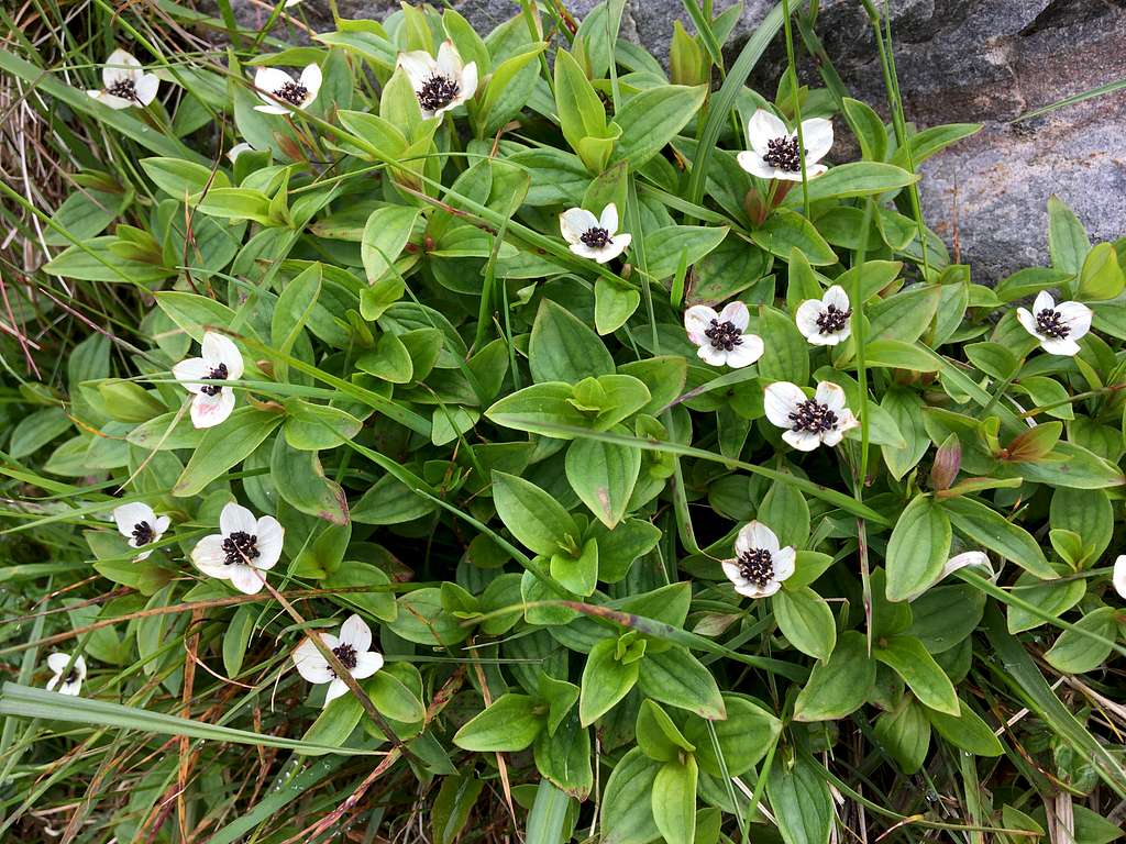
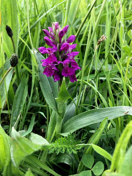
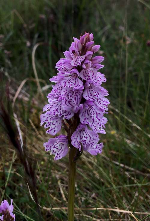
The riverbanks support a variety of wildflowers such as Dwarf Cornel or Globeflower and it is likely you will see some of the many species of wild Orchids that live in this environment.
|
|
References:
Wikipedia - Monadhliath Mountains
Charles Edward Stuart
James Graham 1st Marquess of Montrose
Military roads of Scotland
Books:
Classic Walks – Ken Wilson and Richard Gilbert
The Central Highlands - Peter Hodgkiss (SMC District guide)
Links:
Cairngorms National park - https://cairngorms.co.uk/
Heading for the Scottish hills -
https://www.outdooraccess-scotland.scot/practical-guide-all/heading-scottish-hills
National Trust for Scotland (Wildflowers)
Mountaineering
Most hillwalkers and mountaineers stick to the southeast part of the range to visit the Munros and their tops or the Corbetts. These are situated quite close together and the Munros alone can be completed in one day although, most will spend two separate days at least covering these. In fact, for Carn Sgulain although it is a Munro, it is only really the highest bump amongst the many grassy protuberances in this high moorland. It would take a rather perverse mind to plan to climb it on its own and avoid the other nearby mountains on the same day.
Hamish Brown, in his book “Hamish’s Mountain Walk” mentions that there may be some rock climbs on the crags of Carn Dearg and Peter Hodgekiss in the SMC guide, “The Central Highlands” reports a Scottish Grade 2 Winter gully climb here but otherwise these mountains don’t have sufficient steepness.
Creag Dubh (The black crag)
An exception to this rule is Creag Dubh. A low hill with a summit at 787m – 2350 ft (not high enough to be a Corbett!) but a hill that has on its lower slopes, one of Scotland's major 'roadside' rock climbing crags.
Set amongst trees, just above the A86 road, the rock is made of schist with bands of quarzite and horizontal strata forming steep routes. It has over 200 rock climbs and as far as I can tell, these are all Traditional climbing routes (not Sport climbs).
The majority of these routes are graded at Very Severe and above with E7 being at the top of the grades. Many of these routes are up to 3 pitches long, exposed and possibly with poor protection.
Approx grades. VS = 5.7 (YDS) = V+ (UIAA)
E7 = 5.13a (YDS) = IX+ (UIAA)
Consequently, Creag Dubh is not a good choice for the rock-climbing beginner!
There are also a number of high graded Winter routes if conditions are right.
For more information on Creag Dubh see the UK Climbing website.
https://www.ukclimbing.com/logbook/crags/creag_dubh_newtonmore-37/
Ski – mountaineering.
This vast area of rolling hills would be very good terrain for ski – mountaineering or touring in winter. A drawback might be the lack of permanent snow for long periods nowadays. In the past, this was not an issue and it was more the lack of easy road access in winter that caused problems. Now, with a Four-wheel drive vehicle, it should be possible to drive into the interior of the range.
Having said that, at least one epic crossing of the area was undertaken by mountaineering writer, Mike Cawthorne.
In his book, “Wilderness Dreams”, he describes a dramatic 4-day journey beginning at the summit of Slochd – a high point of the A9 road – in the northeast of the range and continuing in a southwest direction following the hills and generally, the Nairn District boundary line. Cawthorne started with a companion, they carried all the gear and supplies they needed and they used a bothy for overnight shelter on one night then, they bivouacked in the open.
The conditions were cold and the snow was good as they made their way over the rounded hills.
On the traverse, they summited one of the Munros (Carn Sgulain) and one of Carn Dearg’s tops (Carn Ban).
By Day 3, the companion had to give up the traverse due to equipment malfunction. He descended towards Garva Bridge to hitch a lift back to their car whilst Cawthorne continued alone.
He headed west, again following the District boundary and crossing over several Corbetts on his way towards the Corrieyairack Pass. By now, the weather had deteriorated into a nightmare of mist and sleet as the snow melted and he tried to find his way and descend in the darkness, only to be forced by exhaustion to bivouac again.
He completed his descent on Day 4 again in poor weather, towards Fort Augustus, walking as the snow had vanished. He eventually managed to get a lift from a farmer on a quad bike and get to Glen Buck to meet his now worried companion.
Mountains
Munros
(Scottish mountains of over 3,000 feet (914.4 m) in height, which are on the SMC official list of Munros.)
Name of Munro Height in metres Height in feet OS Map ref.
|
Càrn Dearg |
945.7 |
3,103 |
NH635023 |
|
A' Chailleach |
929.3 |
3,049 |
NH681041 |
|
Geal Chàrn |
926 |
3,038 |
NN561987 |
|
Carn Sgulain |
920.3 |
3,019 |
NH683058 |
Munro “Tops”
(Scottish peaks above 3,000 feet (914.4 m) that are not considered to be Munros due to insufficient separation from a Parent Peak (Munro)
Top name Parent Munro Height in metres Height in feet OS Map ref.
|
Càrn Bàn |
Càrn Dearg |
942.3 |
3,092 |
NH631031 |
|
Carn Dearg (SE Top) |
Carn Dearg |
923.7 |
3,031 |
NH637017 |
|
Carn Ballach |
Carn Dearg |
919.8 |
3,018 |
NH643044 |
References:
Wikipedia –
https://en.wikipedia.org/wiki/List_of_Munro_mountains#Munro_Tops_by_height
Red route: Traverse of the three Munros.
Blue route: Ascent of Geal Charn
Orange route: Route to join the previous routes together in an extended traverse of the main mountains in the range.
(Click onto full page symbol (top right hand corner) of the map to open. Zoom in or out as required.)
Carn Dearg (Red hill)
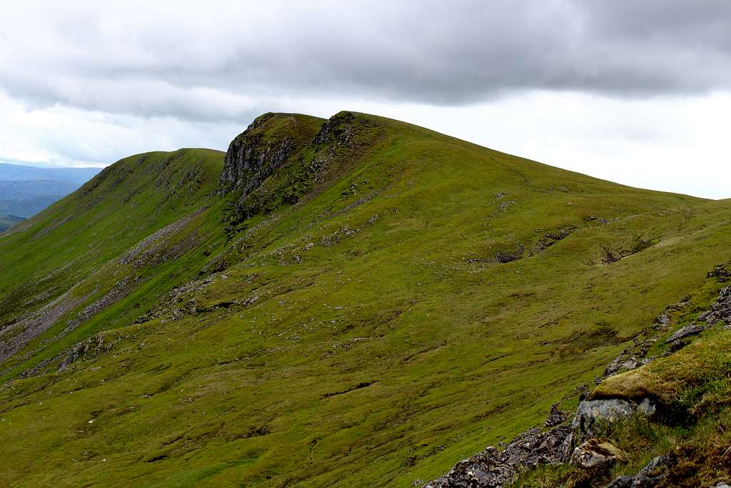
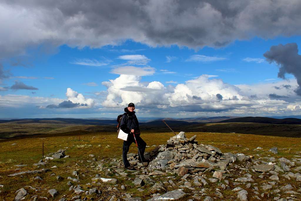
The only mountain in the range with a really steep, craggy top. The mica schist rock gives Carn Dearg its name although, it often looks more grey than red. This gives the mountain a distinct shape that makes it the most dramatic looking mountain of the range.
Positioned at the west end of the moorland plateau, it is usually ascended from Glen Banchor by following the track westwards down the glen from the car park. Then, turn right (north) before crossing the Allt Fionndrigh at the Glenballoch ruins on the track up the valley.
Follow the track high into this valley and cross the river on an old wooden footbridge to take you to the wet bealach above. Continue northwest into Gleann Ballach and from here there are different options.
It is possible to ford the Allt Ballach and climb steeply up the rocky slope to the Southeast Munro top of Carn Dearg, then head north to the main summit.
Alternatively, continue up the northeast side of Gleann Ballach, then cross the Allt Ballach and head up the grassy ramp to the bealach just north of the summit. A few minutes’ walk south along the ridge will take you to the summit.
From here, the traverse route continues north, then northeast following the boundary fenceposts which takes you over the other two of Carn Deargs Munro “tops” (Carn Ban and Carn Ballach) on the way towards Carn Sgulain
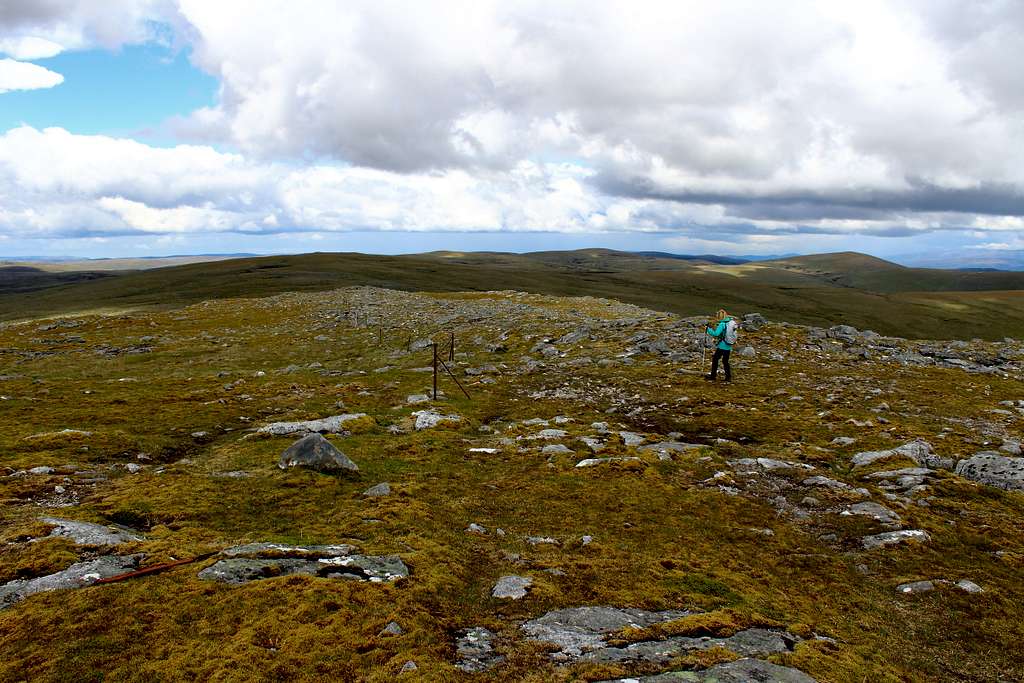
Carn Sgulain (Hill of the basket)
The summit of Carn Sgulain is a stony bump at the eastern end of the plateau like moorland that extends westwards for over 7km to Carn Dearg. If tackling it in bad weather from the west, the walker is aided in route finding by an old line of fence posts (the District boundary line) that could be a godsend in poor visibility. Having said that, the posts are becoming more intermittent as age destroys them. This part of the route is plagued by boggy peat hags that can be difficult to circumnavigate.
It is also possible to ascend the mountain from the valley by following the bank of the Allt a’ Chaorainn up to the bealach west of Am Bodach then, head southwest following the fence posts to the summit of Carn Sgulain. However, this is a boggy, rather tedious route which has little to recommend it. It makes a lot more sense to include Carn Sgulain in a traverse of one or more of the other mountains. As A’ Chailleach is its closest companion, it is also possible to ascend that first and then continue northeast to Carn Sgulain from there.
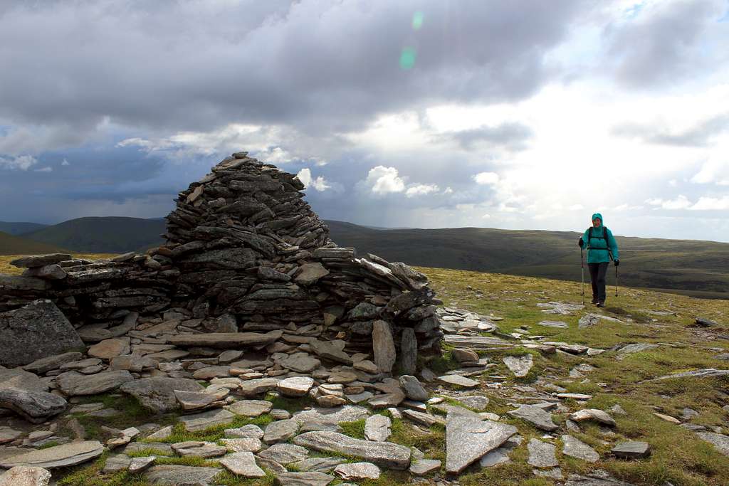
A’ Chailleach (The old woman)
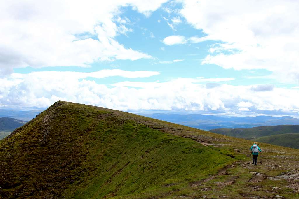
Probably the most visible mountain of the range as it stands a little separate from the plateau that links the other mountains. This curved hill has an attractive shape and a large summit cairn which can be seen from the A9 road. Its position in the range means that in any traverse, A’ Chailleach is usually either the first or last summit to be tackled.
If tackling the range from the west, this is the last summit of the day and the route actually approaches southwest from Carn Sgulain on a path through the bogs. Don’t try to cut straight across as there is a descent into the Allt Cuil na Caillich which is covered in saturated moss followed by a steep ascent on the other side to the summit.
The path descends southwards but gets lost in the wet, spongy moss and boggy ground so the walker has to find the best way towards the Allt a’ Chaorainn. On the way there is a corrugated iron hut – a possible shelter from any rain, if a little dirty! The path descends from here to the river which can be forded where possible to pick up the mettled descent track on the other side for the return to your car in Glen Banchor.

Geal Charn (White hill)
One of the many hills in Scotland named Geal Charn, this one sits very separate from the other high points of the range. The shortest ascent route begins at the end of the public road down the Spey valley at the Garva bridge – General Wade’s original construction. The bridge is crossed on foot and the route immediately turns right, following a track which after around 500m crossed the river on a metal bridge. Leave the track here and follow the river north along its bank. The path here is a bit vague but continues following the Feith Talagain on its right bank as it turns to the northwest.
This river is fed by a tributary, the Allt Coire nan Dearcag. Follow this tributary uphill on a path until it’s possible to ford the narrowing stream. The path here can be boggy but this can be alleviated by ascending slightly left onto the grass and rock ridge that rises up to the large cairn on the summit. Descend the same way.
Extended traverse
It is possible to continue northeast from the summit of Geal Charn on a grassy series of ridges, then turn east to reach the Munro top of Carn Ban to link the four Munros together in one long and lonely traverse of approximately 18 miles. However, the hiker attempting this will descend many miles from the original starting point and it would be necessary to have arranged transport back to the start point. A route perhaps, for the wilderness enthusiast!
References:
The Munros (SMC Hillwalkers guide) – Rab Anderson + Tom Prentice
https://www.walkhighlands.co.uk/
The High Mountains of Britain and Ireland – Irvine Butterfield
Corbetts
(Scottish mountains between 2,500–3,000 feet (762.0–914.4 m) in height with a prominence of over 500 feet (152.4 m)
The Corbetts in the Monadhliath mountains are scattered across the range and their ascent will take dedication to complete.
Name of Corbett Height in metres Height in feet OS Map ref.
|
Gairbeinn |
895.5 |
(2,938ft) |
NN460985 |
|
Càrn an Fhreiceadain |
878 |
2,881 |
NH725071 |
|
Meall na h-Aisre |
862 |
2,828 |
NH515000 |
|
Geal-chàrn Mòr |
824 |
2,703 |
NH836123 |
|
Càrn a' Chuilinn |
817 |
2,680 |
NH416034 |
|
Càrn Dearg (North of Gleann Eachach) |
817 |
2,680 |
NN349966 |
|
Càrn na Saobhaidhe |
811.1 |
2,661 |
NH598144 |
|
Càrn Dearg (East of Gleann Eachach) |
768 |
2,520 |
NN357948 |
References:
Wikipedia - https://en.wikipedia.org/wiki/List_of_Corbett_mountains
Maps
OS Explorer series 1:25,000 scale
OL 416 – Inverness, Loch Ness and Culloden
OL 417 – Monadliath Mountains North and Strathdean
OL 55 – Loch Laggan and Creag Meagaidh
OL 56 – Badenoch and Upper Strathspey
Getting There
By road:
Heading North:
From Glasgow, head north on the M80, then M9 to Stirling and on to Dunblane where this becomes the A9
From Edinburgh, head west on the M8, join the M9 and head northwest to Stirling and onwards to the A9.
Once on the A9, continue north through the Drumochter pass and take the exit for Newtonmore (B9150)
Heading South:
From Inverness, head south on the A9.
Take the exit for Kingussie and Newtonmore (A86)
From Newtonmore (Glen Banchor):
From Main Street, turn north onto the Old Glen Road which will take you down Glen Banchor until the public road ends at a small roadside car park.
From Newtonmore for Garva Bridge (Glen Spey):
Drive west through Newtonmore on the A86.
Continue to the hamlet of Laggan. At a sharp left bend in the road, continue straight on through the built up area and on to the farms beyond.
Continue on this road, passing the Spey resevoir on your right. You are now following the route of General Wade's original road.
Carry on past Garvamore until the public roadends at a small car park by Garva Bridge.
By rail:
There are railway stations in the small towns of Newtonmore or Kingussie. Most trains will either start or pass through Edinburgh and Glasgow from the south and Inverness from the north. These are relatively infrequent and the local timetable should be referred to.
From here you will need to arrange further transport or walk.
Red Tape
Scotland has an Outdoor Access code, see link:
https://www.outdooraccess-scotland.scot/practical-guide-all
The area is popular for Deer stalking and Grouse shooting. These activities may impact on any plans for hiking. However, it is still possible to hike during these events with a little extra effort at the planning stage.
This is a useful page on the Outdoor access – Scotland website
https://www.outdooraccess-scotland.scot/practical-guide-all/heading-scottish-hills