Packed, loaded and ready to roll.
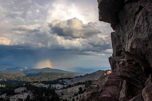
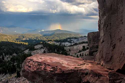
![Rainbow shower over Sifford Mtn.]() Rainbow shower over Sifford Mtn. from Mt. Helen
Rainbow shower over Sifford Mtn. from Mt. HelenFinally off to the high country! I checked around from Bishop up to Shasta to see which areas were clearest from statewide forest fire smoke. There had been a big fire on
Mount Diablo in the East Bay recently. Things were still sketchy around Yosemite and the Eastern Sierra with the Rim Fire still active. There was a fire somewhere around Shasta. Late in the season after 2 dry years fires anywhere at anytime could be expected.
I called Lassen National Park and the ranger told me what I wanted to hear. It was clear and expected to be clear for the weekend. Of course that could change in a matter of hours but it was good enough news to pack up and head across the north bay and the Sacramento River Delta. Then north up through the Sacramento Valley the northern part of California's great Central Valley. The air was typically hazy like cloudy soup sitting in the bowl created by the north Coast Range (up to 9,000') and the Northern Sierra and Cascade Ranges (up to 10,500' with Lassen Peak).
Consumer zombie robots
After about 4 hours I get to Red Bluff. This is the small town where you turn on Hwy. 36 to go east into the mountains. Needed some food, gas and a few supplies. I was directed by a local at the gas station to a place called Foodmaxx.
Didn't need much. Maybe some cheese and a few pieces of chicken etc.
Upon entering this huge behemoth of a store I was immediately overwhelmed with a sense of shoppers bewilderment. The shelves were stacked to the ceiling it seemed with bulk consumer madness. Customers appeared lost among the aisles of towering stacks of boxes of Pop Tarts, Ready Whip and cereal.
I managed to find a kid who worked there and asked him where I could find some chicken. He pointed off across the place like a stranger in a city points a few blocks away toward a store or restaurant out of sight behind masses of concrete and noise. Of course after some navigation I arrived at the bulk meat department only to quickly turn around and head for the door in mild disqust since I didn't need 10 lbs of chicken which was the smallest package available and wasn't about to look for a butcher to procure a small amount from. More than ready to leave Red Bluff by now and after finding a smaller more suitable grocery I was gladly on my way out of town.
Smokestack lightning
Driving up through the foothills I noticed some big clouds ahead. Around 3 PM I pulled off the highway on a forest road a few miles before the south entrance to Lassen National Park. The sky had been building with the heat of the afternoon into some pretty impressive thunderheads. I decided to take a nap after eating lunch on the way in. After settling in for a few moments the heavens crackled and the ground shook with a thunderous roar as a bolt of lightning struck shockingly close to the van. Than another. I was parked in a clearing surrounded by tall pines and decided it was time to get out of there.
I continued into the park to a place where it was clear of immediate threats from above. After some rest and coffee I headed off road for a few small hikes around 4 PM.
My knee had been slightly swollen for a few days but I wasn't concerned about taking a small hike up to
Diamond Peak a short distance from the road. It felt great just to get out into the fresh light and smells of high altitude terrain . It was summer warm and the sky was full of activity from clear blue to dark thunderheads and rain showers accentuated by occasional lightning and thunder.
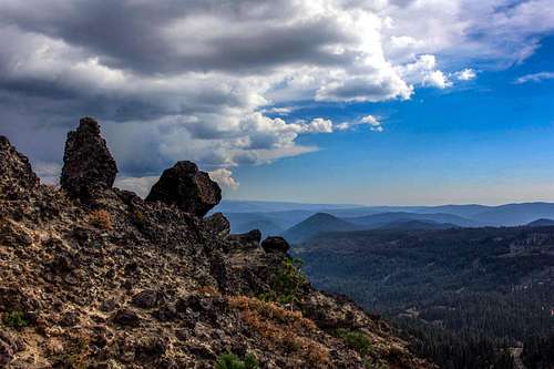
Arriving at the summit rocks of Diamond Peak I decided not to venture up onto them with my knee in a brace but it felt really good to be out there in the mountain elements again.
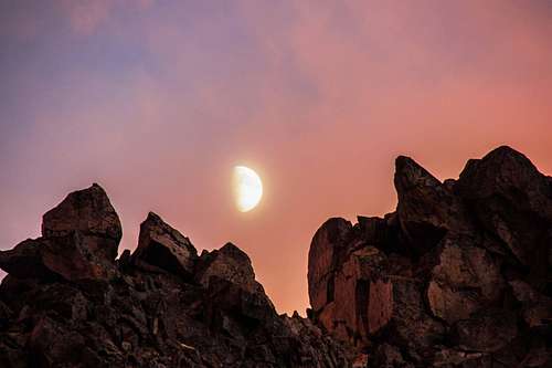
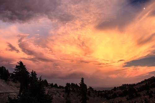
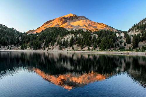
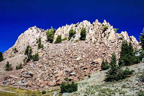
Then towards sunset I drove up to "Lassen Pass". This is the 8,512' high point on Hwy 89 in the park below Lassen Peak. Parking in the Lassen Peak parking lot I headed across the road a ways and up the north ridge of Mount Helen. This was a fun scramble up through stable blocks about a half mile to an approximate summit on a ridge line. By now it was getting on sunset and the sky was full of high drama from distant rainstorms to rainbows, blazing sunsets and a waxing moon amidst it all. After a very exhilarating evening of summer hiking I drove back to the forest road clearing to camp for the night.
![Waxing moon over Mt. Helen]() Waxing moon over Mt. Helen
Waxing moon over Mt. Helen![Fire in the sky]() Fire in the sky
Fire in the sky![Rainbow shower over Sifford Mtn.]() Rainbow shower over Sifford Mtn.
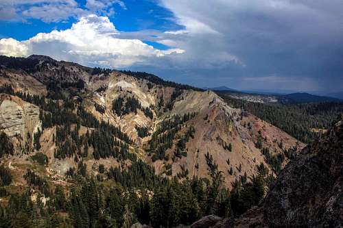
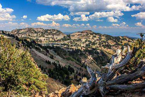
Rainbow shower over Sifford Mtn.![East from Diamond Peak]() East from Diamond peak
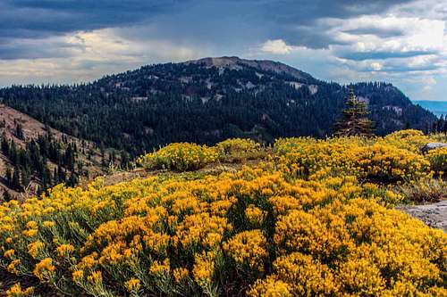
East from Diamond peak![Rabbitbrush and Mt. Conard]() Rabbit brush and Mt. Conard
Rabbit brush and Mt. Conard![South from Diamond Peak]() South from Diamond Peak
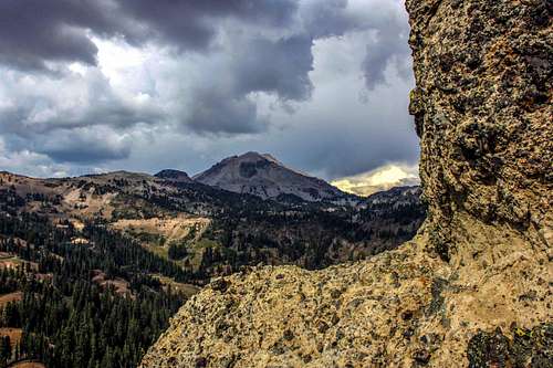
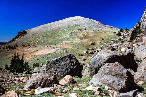
South from Diamond Peak![Lassen Peak from Diamond Peak]() Lassen Peak from Diamond Peak
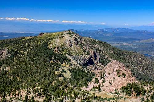
Lassen Peak from Diamond PeakPilot Pinnacle
Pilot Pinnacle was the only peak in the immediate area around Lassen Peak with the exception of Chaos Crags and Vulcans Castle on the northwest side that I hadn't climbed. It looks imposing from most sides but I figured it had a class 3 route on it somewhere. A young ranger at the headquarters confirmed the west side was class 3 and also told me the north ridge was harder with some loose rock.
I parked by the roadside below the pinnacle and started ascending the steep slope to the the saddle between Point 8,740' and
Ski Heil Peak.
I had thought I ascended this before when I did
Loomis Peak in '05 and remember it being pretty easy. But this time I started a considerable distance away from that route. Wouldn't you know it! Now I'm in steep sand and scree pissing about grumbling and looking for a way out of it all!
Not to worry. Huffing and puffing along before long I'm up scrambling over point 8,740' on the way to Pilot Pinnacle. The climb was typical class 3 as predicted with an easy summit area. The sky was still full of beautiful clouds but not as dramatic as yesterday.
The immediate drop down from Pilot Pinnacle looked real steep and covered with nasty volcanic scree so I went back over Point 8,740' again and quickly sand surfed back down the slope landing on my butt once on the way to the road. It was only 2 miles round trip but took me half a day because of all the sand/scree and class 3 negotiating along the way.
After some lunch I settled down for a while by Lake Helen to tea and a book and waited for the sunset on Lassen Peak.
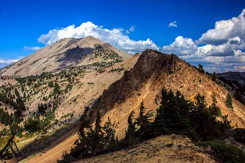
![Vulcans Castle from the south]() Vulcans Castle
Vulcans Castle![Loomis Peak and Vulcans Castle from Ski Heil Peak]() Loomis Peak and Vulcans Castle from Ski Heil
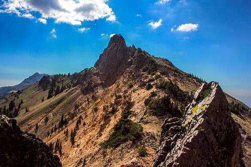
Loomis Peak and Vulcans Castle from Ski Heil![Ski Heil Peak from the northeast]() Ski Heil Peak from the northeast
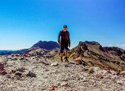
Ski Heil Peak from the northeast![On Ski Heil Peak]() On Ski Heil Peak
On Ski Heil PeakThe Lion returns with rainbows
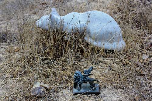
When I buried my cat Lou last Thanksgiving up on
Big Rock Ridge I put a little bronze griffin lion as a grave marker. This little object had been in our family from before I was born. The grave site was secluded off trail not far from another stone kitty that was obviously the grave stone for someone else's cat and overlooking the valley. I had come across the stone cat a few years ago and it had given me the idea to bury Lou up there in the same area about 20 feet away.
Some months after burying Lou I went up there and someone had taken the little lion!
Yesterday, Friday the 20th I took the shortcut up there again and passing the stone cat to my surprise right next to it was the lion again gazing out over the valley! Someone had returned it.
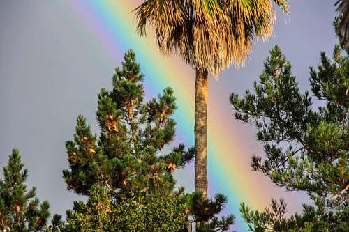
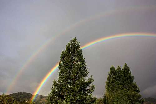
Today, Saturday a week after the trip to Lassen I woke to a fantastic double rainbow right outside off the deck only a short distance away and then it rained over half an inch this morning. The first rain we've had for 5 months.
![Rainbow through palm]() Rainbow through palm
Rainbow through palm![Double rainbow in the morning]() Double rainbow in the morning
Double rainbow in the morning![Stone cat and bronze lion]() Stone cat and bronze lion
Stone cat and bronze lion


Comments
Post a Comment