
-
 50441 Hits
-
 88.19% Score
-
 26 Votes
|
|
Area/Range |
|---|---|
|
|
44.09548°N / 121.78345°W |
|
|
Hiking, Mountaineering, Trad Climbing, Ice Climbing, Mixed, Scrambling, Skiing |
|
|
Spring, Summer, Fall, Winter |
|
|
10358 ft / 3157 m |
|
|
Overview
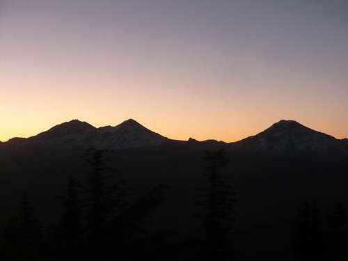
Sunrise on the Three Sisters.
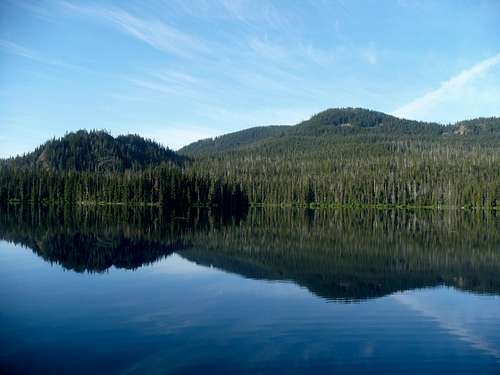
The Three Sisters Wilderness is located in Central Oregon along and around the crest of the high cascades. It is a region of unparalleled beauty in the state of Oregon, with a wide variety of mountaineering possibilities along with beautiful lakes and meadows. It is one of the more popular wildernesses in Oregon, being host to throngs of people during the peak summer months of July and August. The weather in the Three Sisters during the summer is generally mild, with sunny days and high in the 70s and 80s common for most of the season. Hikers can expect to find snow covering the higher trails up until early to mid-august.
The Three Sisters Wilderness is famous for its own brand of aggressive mosquitoes, especially in the lake and pond dotted southern half. The mosquitoes generally die down by mid-august, so be prepared for them in June and July especially. There are approximately 240 miles of trail within the wilderness, leading to mountain climbing take-off points, alpine meadows, and more than 300 lakes. The wilderness varies in elevation between 1,500 feet at the McKenzie Ranger Station to 10,358 feet at the summit of the South Sister. The Pacific Crest Trail (PCT) traverses the Wilderness for 40 miles.
History
The history of the Three Sisters is rich and varied. One of the more popularly visited sites, the Obsidian Area on the northern end of the wilderness, was used for centuries by various central Oregon indian tribes to mine the valuable rock. Samples of this particular obsidian have been found as far away as the eastern coast of the United States, suggesting that it was a lucrative trade for the natives of Oregon. Once white settlers started moving into the area, they too recognized the beauty of the Three Sisters, and as such it was declared a Primitive Area in 1937 comprising 191,000 acres, with 55,000 more acres being added in 1938. It was reclassified as a wilderness in 1957, however, the Forest Service reduced the protected area by 60,000 acres due to timber production.
With the rise of the environmental movement in the 1960's the Three Sisters were included in the National Wilderness Preservation System as part of the Wilderness Act of 1964. Afterward the French Pete Creek valley became the center of a hot debate between timber producers and conservationists, with the conservationists eventually winning back protections for the area in 1978. The last additions to the wilderness came under the Oregon Wilderness Act of 1984, bringing the total protected area to 247,102 acres.
Geology
There has been more volcanic activity in the Three Sisters Wilderness during the past few thousand years than in any part of the entire Cascade Mountain range in the Pacific Northwest. The Three Sisters, the dominate part of the Wilderness, are part of a linear series of major volcanoes rising high above the surrounding countryside. Others that are geologically related to these three mountains include Mt. Hood, Mt. Jefferson, Three Fingered Jack, Mt. Washington, Diamond Peak, Mt. Thielsen, Mt. Mazama (Crater Lake), and Mt. McLoughlin.
The high Cascades probably began to erupt about the beginning of the Pliocene epic, about five million years ago, and have continued in geologically recent time. Included in the Three Sisters Wilderness are mountains, cinder cones, lava flows, and lava-dammed lakes.
These spectacular mountains originally began merely as broad shield volcanoes built by quiet outpourings of lava, but in the final stages during the Pleistocene epic, a period beginning one million years ago, the mountains were a scene of explosive activity which built the massive peaks that are still visible today. Glacial erosion, of course, has modified all of these volcanoes. But there remain some particularly excellent examples of deeply dissected volcanoes. Included in these are the North Sister and the Husband. Less conspicuous, but still geologically interesting, are the central pipes of volcanoes also visible in the Wife and Broken Top.
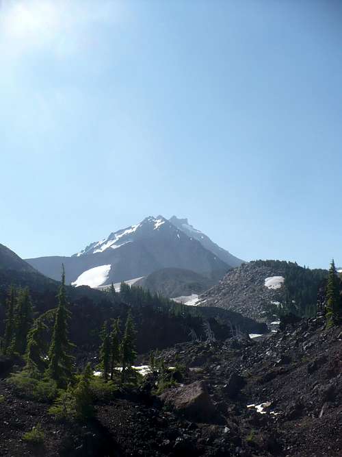
Lava flows north of the North Sister.
The South Sister was built up in three major stages with the lower portion a basaltic shield volcano which became covered by a steeper cone and topped by two recent cones – the younger of which may have been active during the present millenium. The Middle Sister also consists of older flows with the top of the mountain more recent basalt. The obsidian cliffs which are visible along the Obsidian Trail are examples of andesite and dacite flows that originated from cones from the Middle Sister.
Along the northern slopes of the North Sister are many barren basaltic flows discharged from a cluster of cinder cones, part of a succession of volcanic eruptions that may have been as recent as only one thousand years ago. These include Yapoah Crater, Four-In-One Cone, and Collier Cone. The Pacific Crest Trail passes through this area via the Oppie Dildock Pass. The Ahalapaim Cinder field was formed by outpouring from Collier.
One of the flows from Collier Cone spread westward 13 miles, damming Linton Creek to form Linton Lake in the Three Sisters Wilderness. It also formed small Spring Lake. At McKenzie Pass the expanses of recent lava are counted among the most impressive fields seen in the United States, with flows originating from Yapoah Crater and Four-In-One Cone within the Three Sisters Wilderness and Belknap Craters in the Mt. Washington Wilderness.
At about the same time as these flows, there were basaltic eruptions from the Le Conte Crater on the southern base of the South Sister, noted as one of the most beautifully preserved craters in the Wilderness. It consists of an extensive sheet of almost barren obsidian at Rock Mesa just east of the PCT.
Other intersting geologic features within the Wilderness include Sims and Condon Buttes. Flows from Sims Butte covered the valley of Lost Creek. Water originating within the Wilderness disappeared between this blanket of lava before reappearing in a series of larger springs further down the valley.
Broken Top Mountain is the best example in the Pacific Northwest of the effects of advanced glaciation. It is not, as many think, an example of an exploded crater such as Newberry Crater or Crater Lake. Thus, these are mountains which tell a geologic story of different ages, ranging from advanced effects of glaciation (North Sister and Broken Top) to the South Sister which shows only light glacial erosion. Bachelor Butte, outside of the Wilderness, is an almost perfect cone, showing virtually no glacial action at all.
The Newberry Flow, which blocked the drainage between Broken Top and South Sister, was responsible for the formation of Green Lakes, one of the most popular attractions on the east side of the Wilderness.
Flora
In the lower elevations of the Three Sisters Wilderness visitors will find western white pine, Englemann spruce, western hemlock, white fir, and western redcedar. Nature is dynamic, and as such one will find that many of the white pines have been killed by infestations of mountain pine beetle. At higher elevations one will find mountain hemlock, alpine fir, lodgepole pine, and white-bark pine.
High mountain meadows are a hallmark of the Wilderness – in these one will find lupine, red Indian Paintbrush, heather, arnica, larkspur, bluebells, wild sunflower, columbine, alpine dandelion and many more species of beautiful flowers.
Fauna
Within the wilderness is a variety of wildlife. Columbia blacktailed deer, Roosevelt elk, and black bear are common. Blacktailed and mule deer intermingle during the summer months, especially near the crest of the Cascades. When fall snows come, the deer and elk move out of the area to lower elevations; the mule deer migrate in an easterly direction into central Oregon, and the blacktails and Roosevelt elk move westward toward the Willamette Valley. Cougar may be seen occasionally. Smaller fur-bearing animals such as mink, marten, weasel, raccoon, bobcat and coyote also make the Wilderness their home. Blue and ruffed grouse are the principle game birds and are found primarily in the timbered areas.
Hunting is permitted within the wilderness. The regular deer season extends for about three weeks in October and the elk season for about two weeks in November.
Regions
There are 5 different regions in the Three Sisters, each with special attributes that can be explored.
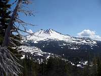
North Sister from Scott Meadow on the PCT.
Northern PCT Region
This region extends north from the boundary of Obsidian to Highway 242 for 12 miles along the PCT and includes extensive lava flows, beautiful meadows and spectacular views of the North Sister and Collier Glacier. Oppie Dilldock Pass, Collier Cone, Yapoah Crater, Black Crater and other cinder cones are located in this area. The main trails to access this region are the PCT, Scott Trail #3531, Millican Crater Trail #4066 and Scott Pass Trail #4068.
South Sister over Husband Lake.
Central PCT Region
This region is located south of the Obsidian Area and west of the crest, extending for 12 miles down to Horse Lake and Horse Mountain. In this section there are many alpine meadows and a number of lakes, as well as The Husband, Sphinx Butte, The Wife and routes up the Middle and South Sisters. The main trails to access this region are the PCT, Foley Ridge Trail #3511, and the Louise Creek Trail #3520.
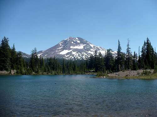
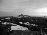
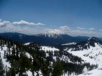
Packsaddle Mountain over Mink Lake.
Southern PCT Region
This region is located near Highway 46 and runs along the PCT from the southern boundary of the wilderness to near Horse Lake, a distance of 16 miles. This region has dense forests and more lakes than any other part of the wilderness, and as such is a home for thousands of mosquitoes. Mountains in this area include the South Sister, Red Hill, Packsaddle Mountain, Irish Mountain and Williamson Mountain. The main trails that access this area are the Six Lakes Trail #3597, Lucky Lake Trail and Winopee Lake Trail.

Western Part of the Three Sisters Wilderness from Horsepasture Mountain.
French Pete Creek/Western Region
This region contains vast amounts of uncrowded old-growth forests, mountains and ridges. If you are looking to not see anybody for days, this is the place to do it. Trails extend for miles and miles without running into landmarks, such as the Horse Creek Trail #3514, which goes for 13 miles from the trailhead until it hits Horse Lake. The mountains in this region include Olallie Mountain, Substitute Point, Rebel Rock and Pyramid Mountain. The main trails to access this region are the French Pete Creek Trail #3311, the Olallie Trail #3529, Rebel Trail #3323 and Crossing Way Trail #3307.
South Sister over Wickiup Plain and the Rock Mesa Obsidian Flow.
Broken Top/Green Lakes Region
This region includes lava flows, meadows, the extremely popular Green Lakes, the South Sister and Broken Top. It is north of Highway 46 and can be accessed by Forest Road 16 as well. It is very popular with mountain climbers as well as backpackers and campers. Other mountains in the area include Ball Butte, Broken Hand and Tam McArthur Rim. The main trails to access this region are the Green Lakes Trail #4070, Park Meadow Trail #4075 and the Broken Top Trail #4010.
Special Areas
Middle Sister from the upper Obsidian Area, Arrowhead Lake.
Obsidian Limited Entry Area
The Obsidian Area is one of the finest bits of scenery in all of Oregon, perhaps the Pacific Northwest. It is located on the western side of the crest near the North and Middle Sisters, and extends for about 3 miles along the PCT from near Obsidian Falls to the Obsidian Trail #3528. The area is best known for the black rock which it gets its name from – there are mounds and mounds of it lying around. There is a special permit required to enter this region on day hikes or overnighters – the permit must be reserved in advance from either the McKenzie Ranger Station or the Sisters Ranger Station and can be picked up or e-mailed to you. There is a limit of 40 people per day, and permits fill up quickly in the peak summer months.
Pacific Crest Trail near Minnie Scott Spring
Pacific Crest National Scenic Trail
The Pacific Crest National Scenic Trail extends from the southern boundary of the Three Sisters Wilderness about 40 miles to the north end at Highway 242. Along the way it encounters the best the wilderness has to offer, from beautiful mountain lakes in the southern part, to lava flows in the central and northern sections and to high alpine meadows once near the giant volcanoes themselves. It is also the main thoroughfare for the entire western side of the wilderness, as every trail eventually meets up with it.
Mountaineering
The Three Sisters Wilderness holds many of the most popular major peaks in Oregon for mountain climbing. They can be divided in terms of their access routes, which are either on the northern end (Highway 242), western end (Forest Road 19), eastern end (Forest Road 15 and 16) or southern end (Highway 46). The following mountains listed are not exhaustive, but represent most of the climbed peaks in the wilderness.
Northern End:
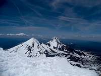
Middle and North Sisters from the summit of the South Sister.
North Sister (10,085 ft)
Middle Sister (10,047 ft)
Little Brother (7,810 ft)
The Husband from the Obsidian area.
The Husband (7,524 ft)
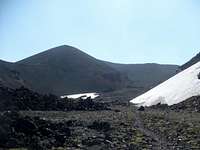
Collier Cone from Opie Dilldock Pass.
Collier Cone (7,534 ft)
Black Crater (7,251 ft)
Yapoah Crater (6,737 ft)
Four-In-One Cone (6,258 ft)
Condon Butte (5,901 ft)
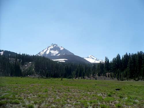
South Sister from Foley Ridge.
Huckleberry Butte (5,849 ft)
Sims Butte (5,648 ft)
Western End:
Substitute Point (6,344 ft)
Proxy Point (6,205 ft)
Olallie Mountain (5,700 ft)
Chucksney Mountain (5,760 ft)*
Horsepasture Mountain (5,660 ft)*
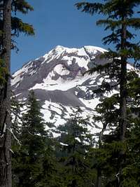
Broken Top from the West.
Pyramid Mountain (5,602 ft)
Rebel Rock (5,583 ft)
O'Leary Mountain (5,530 ft)*
Lowder Mountain (5,170 ft)
Tipsoo Butte (5,134 ft)
Eastern End:
South Sister (10,358 ft)
North Sister (10,085 ft)
Middle Sister (10,047 ft)
Broken Hand (8,000 ft)
Tam McArthur Rim (7,730 ft)
Bachelor Butte from the north.
Millican Crater (6,442 ft)
Southern End:
South Sister (10,358 ft)
Broken Top (9,175 ft)
Bachelor Butte (9,065 ft)*
Ball Butte (8,091 ft)
The Wife (7,054 ft)
Koosah Mountain (6,520 ft)
Sphinx Butte (6,455 ft)
Burnt Top (6,323 ft)
Red Hill (6,245 ft)
Horse Mountain (6,224 ft)
Irish Mountain (5,803 ft)
Packsaddle Mountain (5,144 ft)
Mountains marked with an asterisk* are not technically in the Three Sisters Wilderness, but are close enough to the border to warrant attention. Each of the Three Sisters volcanoes have multiple access points due to their size and the number of routes on each of them.
Camping
The Three Sisters Wilderness is extremely camper friendly and a backpacker's heaven. Not only are there vast amounts of trail to be explored, but nearly every lake has established campsites. The obsidian area itself has more than 60 established campsites waiting to be found. There are wonderful campsites located in the Chambers Lakes Area between the South and Middle Sisters as well. Be cautious trying to camp in the Mathieu Lakes area or the Green Lakes area though – the spots fill up very quickly and the opportunities for solitude in those areas is practically nil.
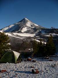
Campsite at the Chambers Lakes.
Getting There
Access for regions of the Three Sisters Wilderness
Northern PCT Region: Highway 242 provides access west from Sisters or east from McKenzie Bridge.
Central PCT Region: Take Highway 126 from Eugene and turn right onto Foley Ridge Road #2643 (about ¼ mile east of McKenzie Ranger Station) and follow the signage to either the Foley Ridge Trail or Louise Creek Trail. PCT is accessed via Highway 242.
Southern PCT Region: Take Highway 46 west from Bend; the trails are right off the highway.
French Pete Creek/Western Region: Take Forest Road 19 from Highway 126 (about 4 miles west of McKenzie Bridge, 5 miles east of Blue River) and follow it up to reach various trailheads.
Broken Top/Green Lakes Region: Take Highway 46 west from Bend to reach the Green Lakes Trail, take Forest Road 16 from Sisters to access the others.
Red Tape
There are a number of regulations within the Three Sisters Wilderness to make the experience suitable for current and future generations. Wilderness permits are required in every part of the wilderness and are available for free at every trailhead; the fine for not having one is $200. Campfires are not allowed within 100 feet of water or trail everywhere, and they are not allowed at all in the Husband/Eileen Lake and Obsidian areas. Northwest Forest Passes are not needed anywhere on the western side in the Willamette National Forest, but they are needed at most trailheads in the Deschutes National Forest on the eastern side of the crest. The Obsidian Limited Entry Area requires a special permit; see more above. There is a limit of 12 people per party, no exceptions. Stock are allowed in the wilderness, as are dogs. Proxy Falls on Highway 242 requires a $5 day pass for use, but no wilderness permit.
External Links/Contact Info
Willamette National Forest
McKenzie River Ranger District
57600 McKenzie Highway
McKenzie Bridge, OR 97413
541-822-3381
FAX 541-822-7254
Middle Fork Ranger District
46375 Highway 58
Westfir, OR 97492
541-782-2283
FAX 541-782-5306
Deschutes National Forest
Bend-Fort Rock Ranger District
1230 NE 3rd St., Suite A-262
Bend, OR 97701
541-383-4000
Sisters Ranger District
P.O. Box 249
Sisters, OR 97759
(541) 549-7700
Location - Pine St & Hwy. 20