The Argument
Titcomb Basin: It’s probably one of the top 10 must-see alpine destinations in the United States. The fact that climbers from around the world seek it out suggests it is among the must-see alpine destinations on the entire planet.
When climbers or backpackers decide it’s time to experience the Wind River Range, they invariably consider Titcomb Basin or the Cirque of the Towers as a first destination. If you see a picture of the Wind River Range in a calendar or on a postcard or in some travel guide, there’s a good chance it’s of one of those two settings.
As a result, and even despite an approach that is 12 miles by the shortest route, Titcomb Basin is an exceedingly popular place July through Labor Day. Very distinctly, I recall reading a guidebook description saying that at times, there have been about 75 camps in Titcomb Basin alone (not sure of that meant 75 tents or 75 actual camps, but still).
For someone enamored of solitude in the mountains and driven to find it, that bit about the crowds was enough to change my mind about Titcomb Basin and the Cirque of the Towers for more than 10 years. Those places could wait. And if I never got to them at all, well, no big deal-- there are many other amazing locations in the mountains of the western United States.
But summer 2013 had me looking at an extra week alone after the family went home, and I got to thinking it was maybe time to go see Titcomb Basin and climb something out there.
The main reasons:
How could I forever skip seeing what is supposed to be one of the most breathtaking alpine settings to be found?
Hadn’t I learned my lesson from avoiding the Tetons backcountry for several years for similar reasons and then finding myself stunned when I finally got into it?
Didn’t I think that even if there were a lot of other people out there, I could still find a secluded campsite somewhere out there and avoid others for the most part with early starts?
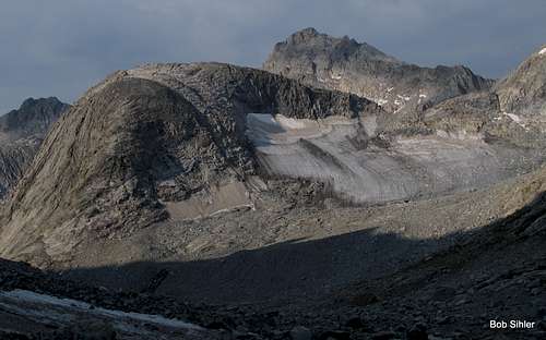
Didn’t I want to stand atop one of the highest peaks in Wyoming and look down on the largest glaciers in the U.S. Rockies? Although I had once hiked the Glacier Trail to its end at the foot of the Dinwoody Glaciers, I wanted to know what it was like to be above the glaciers out there.
Also, for the past four summers, I’d gotten together with Tim to climb some Wyoming Peaks. And it just so happened that he wanted to head back into the Titcomb and Indian Basin areas at the same time to climb a few peaks on his list.
On Monday, August 19, I set off at about 7 A.M. from Elkhart Park, cursing the smoky haze I could see over the crest of the range in the distance and thinking about how if not for the fact that Tim was already out there and waiting for me, I would have bailed on the trip and headed south down the range in hopes of finding clearer air.
About 4 ½ hours later, I reached Island Lake, planning to have a short rest and then hike the additional mile to the Titcomb/Indian trail junction and find a campsite nearby, but then I realized that the figure approaching me was Tim, who had already found a good and pretty secluded site by Island Lake. After greetings and a quick discussion about the merits of moving the campsite, we decided to stay put.
My goals for the trip:
Fremont Peak-- for the stature of the peak and the glacier views.
Ellingwood Peak-- for the fun and because it was a primary goal for Tim.
Indian Pass and Knife Point Mountain for the glacier views.
Bonney Pass and maybe Miriam Peak or Dinwoody Peak, again for the glacier views and also for the views of Gannett Peak; or maybe Mount Sacagawea.
What I wound up doing, in order:
Fremont Peak
Ellingwood Peak
Elephant Head
Bonney Pass, Miriam Peak, Bobs Towers, and Dinwoody Peak, plus a side trip to Twins Glacier.
One regret:
Not climbing Knife Point Mountain. I had enough food to stay another night but just didn't feel like it. I could have climbed the peak the morning I hiked out, but I didn't feel like a 20+ mile day with a long, boring hike complete with heavy pack to end it. Now I ponder whether I should have climbed the damn thing and then hiked out, or just spent another night, instead of being a big baby about it.
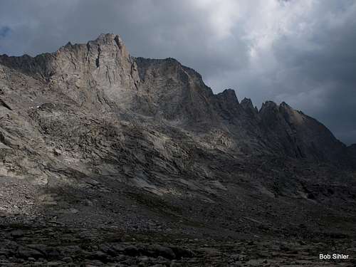
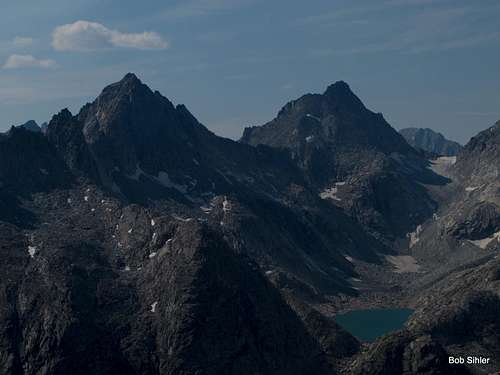
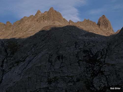
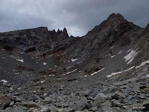
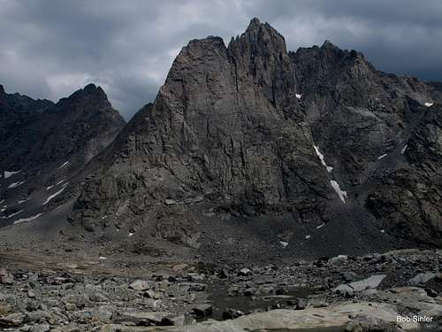
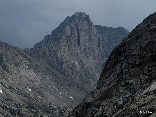
![Knife Point Mountain and Harrower Glacier]() Knife Point Mountain
Knife Point MountainThe rest of this trip report is a photo trip report with some commentary.
August 19
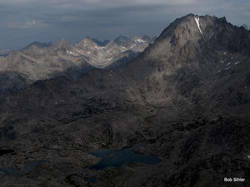
At 2:00, or maybe it was 3, I left camp to climb Fremont Peak via Indian Basin. Not difficult, the route was still tiring, especially after the long hike in to camp. But I got what I wanted-- solitary and breathtaking views of the big glaciers.
![Fremont Peak from SW Buttress Approach]() Fremont seen during descent from SW Buttress back into Indian Basin
Fremont seen during descent from SW Buttress back into Indian BasinOther people seen that day: three, all of them climbers I passed on the trail between camp and the trail junction for Titcomb and Indian Basins. Other people seen between the junction and returning to camp: zero. Nice.
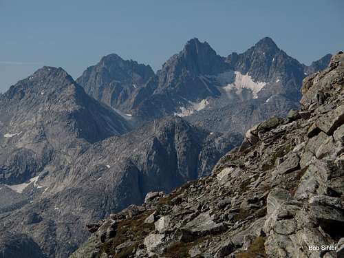
![Henderson Peak, American Legion Peak, and Summer Ice Lake]() Seen from the SW buttress of Fremont Peak
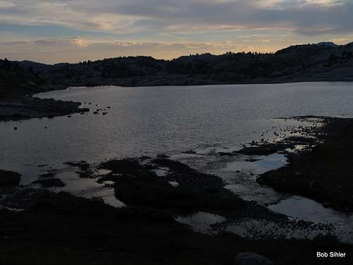
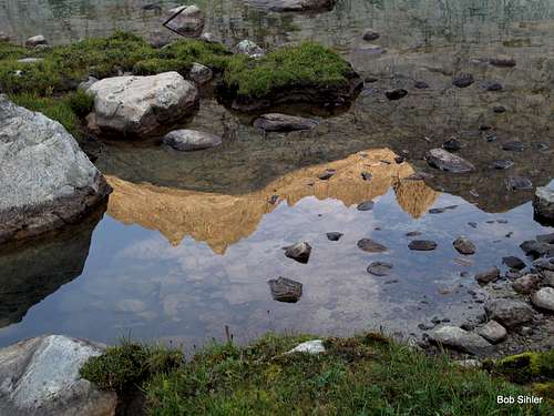
Seen from the SW buttress of Fremont Peak![Lake 10,467 at Sunset]() A pretty sunset I caught on the way back to camp
A pretty sunset I caught on the way back to camp
August 20
Tim and I set out for the main objective of his trip to the Winds that summer-- Ellingwood Peak by its southwest ridge (still waiting for that page, Tim!), which goes at Class 3 or 4 depending on the source. (I'd say Class 3 since the fun Class 4 stuff I intentionally sought out was avoidable without too much effort. One note, though-- finding the Class 3 route may now be a little harder since I, appalled at finding so many cairns on such a remote peak, knocked apart almost every one of them until I went off on my own, more exposed and more challenging way. In my opinion, if you need a bunch of cairns to help you climb a wilderness peak, you shouldn't be in the wilderness and should stick to other things instead.)
Although a Winds and Wyoming 13er and thus on some peakbagging lists, Ellingwood is not one of the giants of the Titcomb Basin area and is not among the ones most frequently climbed, but it is one of the prettiest and is also home to a spectacular technical route-- the north arete-- which goes at 5.6 or 5.7 (sources differ).
Also, Ellingwood is not in Titcomb Basin proper and is not visible from the basin itself, but it has spectacular views of the peaks of Titcomb Basin.
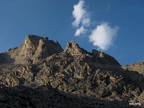
![Ellingwood Peak from Indian Basin]() Ellingwood
Ellingwood![Summit View from Ellingwood Peak]() From Ellingwood
From EllingwoodFollowing Ellingwood, I wanted to climb Elephant Head, also called Cairn Peak, by its Class 4 southeast ridge, a short but fun climb resulting in stunning views of, yes, the peaks of Titcomb Basin. Tim, nursing a foot injury that had plagued him for most of the summer, headed back while I climbed. In the still-dark hours of the next morning, Tim began the long trek out, but I was in it for at least another night.
![Elephant Head and an Unnamed Lake in Indian Basin]() Elephant Head
Elephant Head![The Heart of the Winds from Elephant Head]() The peaks of Titcomb Basin seen from Elephant Head
The peaks of Titcomb Basin seen from Elephant HeadOther people seen that day, not including Tim: maybe three or four, all at camps between ours and Ellingwood. This is not counting the jackasses camped near us who made a lot of fun and noise tossing large rocks into Island Lake for much of the afternoon. I’m not too sure they qualified as people and not pests such as the mosquitoes that found us late that day as well.
August 21
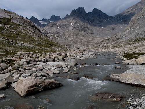
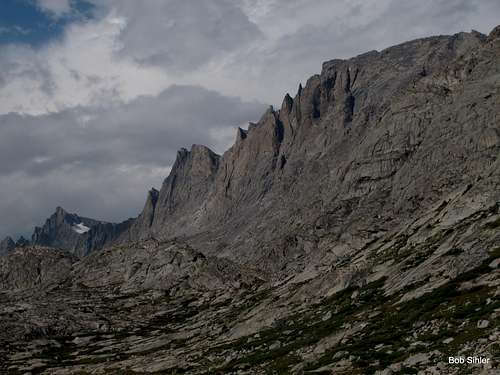
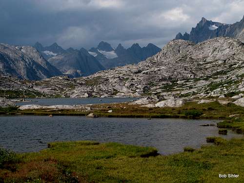
At last, it was time for the real Titcomb Basin.
Throughout the night, there had been thunderstorms and rain. At dawn, or what passed for it, an almost-universal gray overcast did not promise great climbing. As I hiked up Titcomb Basin, there were moments of golden summer mountain glory, but the overarching story remained the gray ceiling and the promise of rain. Fortunately, the overcast was never so low as to behead the peaks, so even though conditions perhaps were not going to allow stunning pictures, they at least were going to allow me to enjoy the sights, or at least for a while.
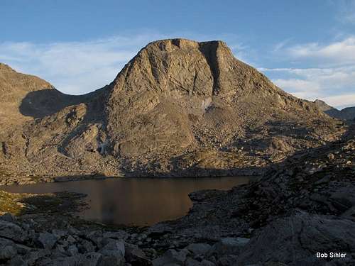
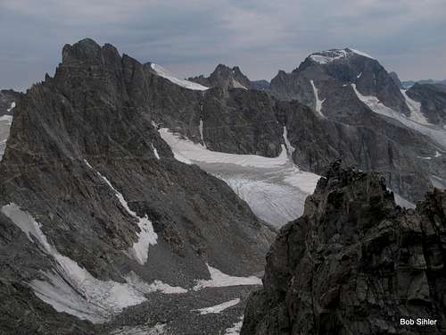
![Lower Titcomb Lake]() Titcomb Lake
Titcomb Lake![Titcomb Needles and Great Needle]() Needles
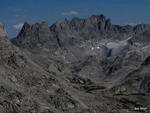
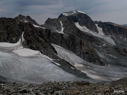
NeedlesFor a bare minimum on the day considering the weather, I set hiking to Bonney Pass as a goal so that I could see the big glaciers again and enjoy that sense of seeing the “other side,” which in this case would include great views of Gannett Peak, the highpoint of both the range and Wyoming. In fact, there is no higher peak in the Rockies, U.S. or Canadian, north of Gannett.
![Gannett Peak from Bonney Pass]() From Bonney Pass
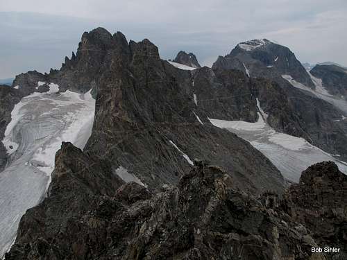
From Bonney PassOn either side of Bonney Pass are, respectively, Miriam Peak and Dinwoody Peak, the former rated Class 4 (but just for the summit block) and the latter likely to be no harder than Class 2, making it not too exciting but suitable for a quick climb and quicker descent with weather being an issue.
Since the weather was still gloomy but still holding by the time I reached the pass, I decided to try Miriam first. After getting up it quickly and with no troubles (and seriously questioning the Class 4 rating when I felt it was really more like an impressively exposed Class 3), I began eyeing nearby Bobs Towers and debating whether I should try them. From where I was, the highest of them looked Class 5 and harder than I cared to try alone and unroped, but I couldn’t resist the idea of Bob climbing Bobs Towers, so I headed over on what turned out to be a fun ridge traverse.
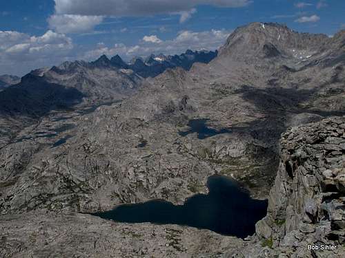
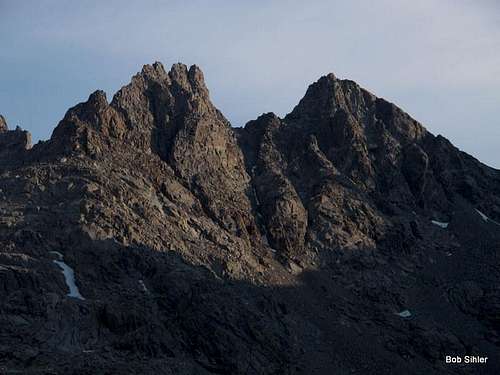
![Bobs Towers and Miriam Peak]() Bobs Towers and Miriam Peak seen from Titcomb Basin
Bobs Towers and Miriam Peak seen from Titcomb Basin![Woodrow Wilson and Gannett from Miriam]() Mount Woodrow Wilson and Gannett Peak from Miriam Peak
Mount Woodrow Wilson and Gannett Peak from Miriam Peak![Mount Woodrow Wilson and Gannett Peak from Bobs Towers Highpoint]()
And from Bobs Towers
The highpoint was indeed Class 5 and is detailed on the page for the peaks, but I made it up and down alive and then headed back past Miriam to Bonney Pass, where I rested for about 15 minutes and had a snack before turning for Dinwoody Peak, which ended up being quick and easy but had spectacular views to compensate.
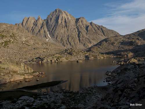
![Dinwoody Peak and Spearhead Pinnacle from Titcomb Basin]() Dinwoody Peak (left)
Dinwoody Peak (left)Back at Bonney Pass afterward, there for the third time that day, I would have liked to have hung out and relaxed in the grand setting, but the sky and rumbles of thunder were telling me to go:
So I went.
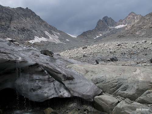
But then, as is so often the case in the mountains, the weather improved, and I started thinking about what looked like a fairly easy cross-country trek to Twins Glacier, nestled in a basin beneath American Legion Peak, Winifred Peak, and Twin Peaks. Considering that I was there and the opportunity existed and I didn’t know when the opportunity would be present again, I made my way over to the glacier. And I’m glad I did.
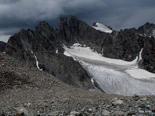
![Henderson Peak and Twins Glacier]() Seen from Upper Titcomb Basin on the way to Bonney Pass
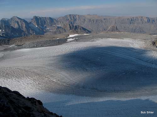
Seen from Upper Titcomb Basin on the way to Bonney PassPoor Twins Glacier. Maps show it being much larger than it really is; over the past few decades, it has seen substantial melting. This is a glacier without long left; although I’m no glaciologist, based on maps and the state I found it in, I give it a couple decades until it becomes a “permanent snowfield.”
![Mount Helen from Twins Glacier]() Views from the glacier
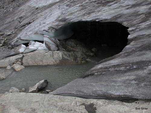
Views from the glacierAt the edge of the glacier, I found, among all the other sights, a cool “cave” with glacial meltwater dripping down its upper lip. Reveling in the feeling of the alpine wild, I stood beneath one of those drips and drank down the water. Despite the siltiness, there was something immensely satisfying about drinking that frigid water.
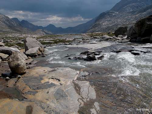
Then I followed the glacial stream along a waterfall and back down into Titcomb Basin. With the sun still high and warm, I shed the boots, socks, and shirt for a bit and waded in the milky waters and basked on a granite slab beside them. Something about doing that makes me feel so much a part of the mountains, a part of the wilderness.
Not long after resuming the return journey, the storms that had been menacing me from a distance all day finally became a reality. As I reached Upper Titcomb Lake, the rain began in earnest and stayed with me past the lower lake. Despite lasting only about an hour, the storm did its job in making things cold and wet, so the return of the sun felt glorious as I took some of my final glimpses of this true gem of an alpine setting from the shores of the last, or first, of the three major lakes of Titcomb Basin.
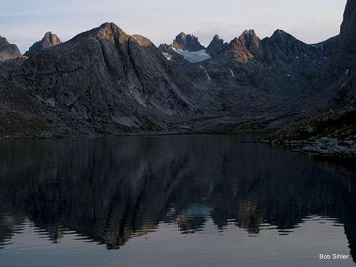
![Helen, Sacagawea, and Fremont After the Storm]() After the storm
After the stormOther people seen this day: around 10, and all on the way back. Not bad for one of the most-prized backcountry spots in the country.
August 22
As stated way back, I had more than enough provisions-wise to stay another night and do some more peaks, or I could have climbed in the morning and then packed out, making a very long, tiring day.
But maybe it was the right call to head out. By lunchtime, I was back in Pinedale and strong thunderstorms with pounding rain were slamming the town and all over the mountains. And it was that way on and off the rest of the day. It was good to have windows and doors to hide behind.
The Verdict
It was more than worth the effort and the minimal crowding. Titcomb Basin and its environs are not places to miss if one is a true lover of mountains, and I would be happy to go back. Next summer, I may have to finally make my way to the Cirque of the Towers.


Comments
Post a Comment