
|
|
Mountain/Rock |
|---|---|
|
|
35.71922°N / 118.56113°W |
|
|
KERN |
|
|
Hiking, Mountaineering |
|
|
Spring, Summer, Fall |
|
|
6838 ft / 2084 m |
|
|
Overview

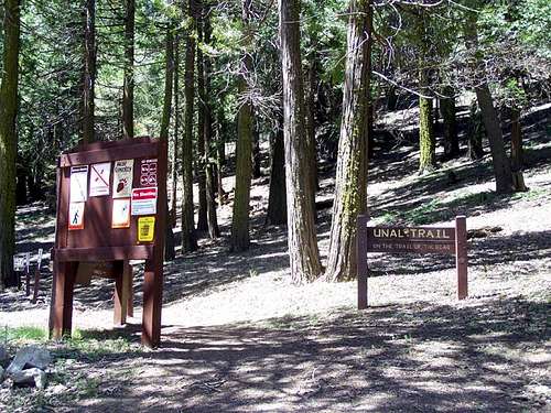
I took this photo of the trailhead on May 16th, 2009.
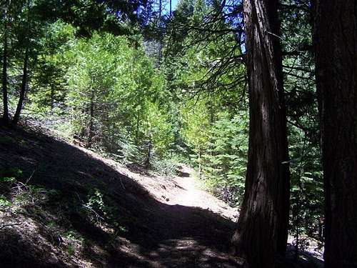
The Unal Trail is well maintained. 05-16-2009.
The Unal Trail (Trail of the Bear) is located right next to Summit station across the street from the Greenhorn Summit sand shed. This is a great place to picnic after your hike, and there is some interesting information regarding the history of the Greenhorn Summit on a signboard next to the sand shed.
This location is warm in the summer, but covered in snow in the winter. The Alta Sierra ski resort at Shirley Meadows is 3 miles to the South. This is the launching site for a variety of sports including mountain biking, hiking, snow shoeing, cross country skiing, and snowmobiling.
If you parked in front of summit station then you will see the trailhead to maintained Unal trail (31E58). The trail is listed at around 3 miles, and has little elevation change (700 ft). The trail also has an interactive brochure written from the viewpoint of the Tubatulabal tribe. There are large signboards at the trailhead that provide information as well as maps, and the brochure for the interactive hike. Unless it is precious to you please put the brochure back at the end of the hike for the next group.
There are numbered posts that correspond to the section in the brochure that you are supposed to read. Some of the posts are missing, but you can tell where to stop if you pay attention to the map in the brochure. The trail is very well maintained, and it makes a loop. Once you get to the top there is a chair that identifies your location as the summit of Unal Peak (6838'). You may be interested in doing the Alta Sierra Figure 8 Loop Hike.
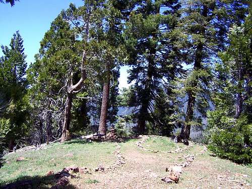
This is the chair area which author Ruby Jenkins identified as Unal Peak (6838'). There is no register here, and this is not the top of the mountain, but who am I to argue? I actually hiked the 288' and .6 miles South up the ridge to the top (7126'), but there is no register there either. Since the Forest Service has an awesome trail, and Ruby Jenkins called it then it is good enough for me to call 6838 Unal Peak, and to let it go at that. The view is much better there too, and there is a chair after all.....
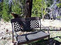
I took this photo of the chair on Unal Peak on November 18th, 2007.

This is what the road looks like if you continue climbing up from the chair area. 05-16-2009.
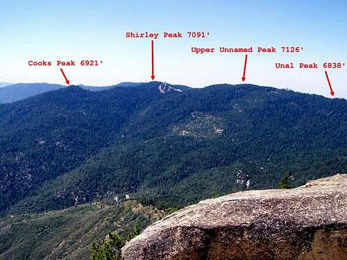
I took this photo of the Alta Sierra section of the Greenhorn summit from Black Mountain Point on August 9th, 2009.
Getting There
From Wofford Heights take SR 155, 7.7 miles to Greenhorn Summit.
~I-5 North to Bakersfield, exit 178 east. Go to Lake Isabella and exit on SR155, follow signs to Wofford Heights.
~From Ridgecrest, Hwy 14 to 178 west, follow signs to Kernville, then go west on 155 to Wofford Heights.
~From 99 southbound, take 155 east to Greenhorn Summit, turn left on 24S15.
~It is also possible to take Rancheria Road from Highway 178 in Rio Bravo near Bakersfield though it is a dirt road for much of the way.
From the sand shed on the Greenhorn Summit take Rancheria Rd. South for .1 miles and park in front of the Summit Station where you will be able to see the trailhead Southwest of you. Google Map.
I took this photo of the trailhead on May 16th, 2009.
Red Tape
This is not a wilderness area, so permits are not required.
Greenhorn Ranger District
4875 Ponderosa Drive
P.O. Box 3810
Lake Isabella, CA 93240
(760) 379-5646
Tule River Ranger District
32588 Highway 190
Springville, CA 93265
(559) 539-2607
Camping
Evans Flat, Alder Creek, Rancheria Rd. & Cedar Creek.
Camping & other lodging is also available in nearby Lake Isabella, Kernville, and Wofford Heights.
External Links
Weather from the National Weather Service
Webcams
Lake Isabella Online
Seasons & Conditions
Season: The normal route is snow covered during winter, so access is normally limited to May through October.