Scott Wesemann
Offline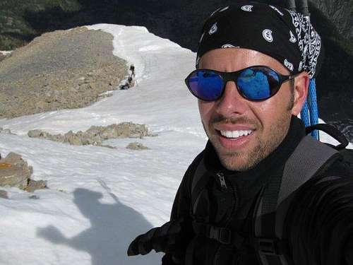
| Gender/Age | Male, 51 years old |
|---|---|
| Location | American Fork, Utah, United States |
| Power | 76 |
| Vote Weight | 75.23% |
| Occupation | Telecommunications |
| Website | http://scottwesemann.blogspot.com/ |
A Little About Me
Summit junkie!
| Partner Details: | For climbing, mountaineering, peak-bagging, trail running and ultra distances |
|---|
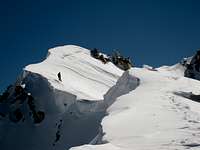
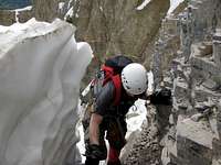
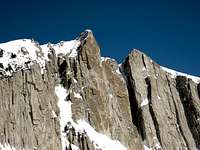
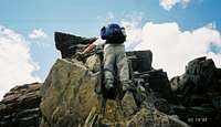
My Images


My Areas & Ranges (1)
- Ibex Utah Western Desert Ranges
My Trip Reports (21)
- A cliffhanger on Borah Borah Peak
- A fantastic day on Dromedary Mt. Dromedary
- A lot of white on Little Black Little Black Mountain
- A Sierra Appetizer Boundary Peak (Nevada)
- Bryce Canyon Trail Link-Up Bryce Canyon National Park
- Catching some winter air on Aire Mount Aire
- Climbing Notch Peak and exploring the west desert of Utah Notch Peak
- Gettin' dirty in The Grunge Couloir North Timpanogos
- Getting blown away on Elbert Mount Elbert
- I'll take solitude for $1000 Alex Ibapah Peak (UT)
- Kings in a day Kings Peak
- Lone Peak: Where it all started. Lone Peak
- Mount Sherman Mount Sherman
- Mount Van Hot! Mount Van Cott
- Pfeifferhorn: A Wasatch classic Pfeifferhorn
- South Thunder Mountain South Thunder Mountain
- Spring climb on Red Baldy Red Baldy
- Surmounting the weather on Whitney Mount Whitney
- West Gunsight West Gunsight (a.k.a. Dome) Peak
- White Baldy Trip report White Baldy
- Wind River Bliss Gannett Peak
My Albums (3)
- Lone Peak winter 2009 Lone Peak
- Lost Camera Broads Fork Twin Peaks
- Wasatch Peak jumping Wasatch Range (Central)
Climber's Logs I've Signed (125)
Areas & Ranges (1)
- Zion National Park U.S. National Parks
Mountains & Rocks (114)
- Kings Peak Kings-Emmons Ridge
- Mount Bross Colorado 14ers
- Mount Cameron Colorado 14ers
- Mount Lincoln Colorado 14ers
- Mount Democrat Colorado 14ers
- Mt. Timpanogos (UT) Wasatch Range (South)
- Mount Belknap Tushar Mountains
- Delano Peak (UT) Utah County Highpoints
- Millvue Peak Wasatch Range (Central)
- Gannett Peak U.S. State Highpoints
- Sawtell Peak Snake River Plain
- Lone Peak Wasatch Alpine Ridge
- Henrys Fork Peak High Uintas Wilderness
- Flat Top Mountain (UT) Ultra-prominence Peaks of the 48 States
- James Peak (UT) Bear River Range
- Bald Mountain Western Uinta / Lakes Roadless Area
- Angels Landing Zion National Park
- Lucky Peak Boise Mountains
- Kyhv Peak (formerly Squaw Mountain/Squaw Peak) Wasatch Range (South)
- Box Elder South Peaks Wasatch Range (South)
- Dude Benchmark Wasatch Range (North)
- Meridian Peak 5978 Wasatch Range (North)
- Francis Peak 9540 Wasatch Range (North)
- Willard Peak Utah County Highpoints
- Ben Lomond Wasatch Range (North)
- Box Elder Peak Wasatch Range (South)
- Wasatch BM High Uintas Wilderness
- Tokewanna Peak High Uintas Wilderness
- The Butterfield Peaks Utah Western Desert Ranges
- Mount Wire (Big Beacon) Wasatch Range (North)
- South Kings Peak Kings-Emmons Ridge
- Gilbert Peak High Uintas Wilderness
- View Benchmark (UT) Wasatch Range (Central)
- American Fork Twin Peaks Utah County Highpoints
- Sugarloaf Peak Wasatch Alpine Ridge
- Mount Superior & Monte Cristo Wasatch Cottonwood Ridge
- Malan's Peak and Basin Wasatch Range (North)
- Little Black Mountain Wasatch Range (North)
- Lake Mountain Peak (UT) Utah Western Desert Ranges
- Saddleback Mountain Bear River Range
- Grandeur Peak Wasatch Range (Central)
- Centerville Peak 8,904 Wasatch Range (North)
- Mount Olympus Wasatch Range (Central)
- Desolation Peak Wasatch Range (Central)
- Scott Hill Wasatch Range (Central)
- Mount Majestic (Clayton Peak) Wasatch Cottonwood Ridge
- Pfeifferhorn Wasatch Alpine Ridge
- Peak 10,420 Wasatch Range (Central)
- Bountiful Peak Wasatch Range (North)
- Mount Van Cott Wasatch Range (North)
- South Mountain (UT) Utah Western Desert Ranges
- Mount Wolverine & Mount Tuscarora Wasatch Cottonwood Ridge
- West Mountain Utah 2,000 ft Prominence Peaks
- Little Pfeifferhorn Wasatch Range (Central)
- North Timpanogos Mt. Timpanogos (UT)
- Thayne Peak Wasatch Range (Central)
- Little Mountain, UT. Wasatch Range (North)
- Topliff Hill (UT) Utah Western Desert Ranges
- Red Top Mountain Wasatch Range (Central)
- Obelisk (Hogum Divide) Wasatch Range (Central)
- Bighorn Peak (Upper Bells Peak) Wasatch Alpine Ridge
- Big Baldy (Timpanogos) Wasatch Range (South)
- Upwop Peak, UT. Wasatch Range (Central)
- Ibapah Peak (UT) Utah County Highpoints
- Circle All Peak Wasatch Range (Central)
- Silver Peak, UT. Wasatch Range (Central)
- Honeycomb Cliffs Wasatch Cottonwood Ridge
- Little Water Peak Wasatch Range (Central)
- Broads Fork Twin Peaks Wasatch Cottonwood Ridge
- Frary Peak (Antelope Island) Utah Western Desert Ranges
- Reynolds Peak Wasatch Range (Central)
- Chipman Peak Wasatch Alpine Ridge
- Mahogany Mountain (UT) Wasatch Range (South)
- Dale Peak, UT. Wasatch Range (North)
- Perkins Peak Wasatch Range (North)
- Turtlehead Peak Spring Mountains
- Tri-County Peak Wasatch Range (Central)
- Provo Peak Wasatch Range (South)
- Devil's Castle Wasatch Alpine Ridge
- Mount Nebo Utah County Highpoints
- Boundary Peak (Nevada) Nevada County Highpoints
- Mount Whitney California County Highpoints
- Patsy Marley Wasatch Range (Central)
- Crystal Peak Utah: Some "Unknown Classics"
- Notch Peak Utah Western Desert Ranges
- Borah Peak Idaho County Highpoints
- Mount Aire Wasatch Range (Central)
- North Thunder Mountain Wasatch Alpine Ridge
- South Thunder Mountain Wasatch Alpine Ridge
- Fish Lake Hightop Utah County Highpoints
- The Gate Buttress - Five Fingers Area Little Cottonwood Canyon
- Mt. Dromedary Wasatch Cottonwood Ridge
- Mount Rainier Cascade Volcanoes
- White Baldy Wasatch Alpine Ridge
- Ensign Peak Wasatch Range (North)
- Mount Millicent Wasatch Cottonwood Ridge
- Kessler Peak Wasatch Cottonwood Ridge
- Hidden Peak (Utah) Little Cottonwood Canyon
- Mount Bierstadt Colorado 14ers
- Quandary Peak Colorado 14ers
- Mount Sherman Colorado 14ers
- Gobblers Knob Wasatch Range (Central)
- Mount Raymond Wasatch Range (Central)
- Sunrise Peak Wasatch Cottonwood Ridge
- Storm Mountain Wasatch Cottonwood Ridge
- Mount Baldy (UT) Wasatch Alpine Ridge
- Pikes Peak Colorado 14ers
- Deseret Peak Utah County Highpoints
- Gunsight Peak High Uintas Wilderness
- Humphreys Peak U.S. State Highpoints
- Huron Peak Colorado 14ers
- Mount Hood Cascade Volcanoes
- Grays Peak Colorado 14ers
- Mount Evans Colorado 14ers
Routes (9)
- Rim to Rim (R2R) Hike Grand Canyon National Park
- Grunge Couloir North Timpanogos
- Everest Ridge Mt. Timpanogos (UT)
- South Ridge of Mt. Superior Mount Superior & Monte Cristo
- Cold Fusion Couloir North Timpanogos
- Tanners Gulch Mt. Dromedary
- Beatout - Pfeifferhorn to Bells Canyon Pfeifferhorn
- Southwest (Chicken-Out) Ridge Borah Peak
- Coalpit Gulch North Thunder Mountain
Canyons (1)
- Virgin River Narrows Zion National Park
My Lists
Content loading here...
Messages I Posted/ Editable Objects
Reviews I Posted/Reviews Posted to my Gear
Objects Others Have Attached to My Objects
Content loading here...
Photos Others Have Attached to My Objects
Content loading here...