
-
 17329 Hits
-
 74.01% Score
-
 4 Votes
|
|
Route |
|---|---|
|
|
67.96742°N / 18.59985°E |
|
|
Hiking |
|
|
Summer |
|
|
A long day |
|
|
F |
|
|
Getting There
From Nikkaluokta you hike 19km to the Kebnekaise mountain lodge up at 770m. The mountain lodge offers many facilities. You can have a nice dinner there (although rather small portions!) and the brekfast buffet is really great. The lodge even hosts a small shop where you can buy food for your hike and a nice Kebnekaise-t-shirt after you've summited. If you prefer to camp there are many nice spots where you can put up your tent. Fresh water you can get from the lodge.
Route Description


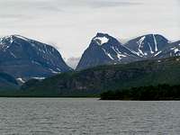
You start from the Kebnekaise mountain lodge head westbound towards Tuolpagorni which rises majestically in the background. The route is marked with red dots and the trail turns to the right of Tualpagorni into the valley Kitteldalen, following the river Kittelbäcken. You follow the river until the end of the valley up at the small lake Kittelsjön (1.198m) At the end of the valley, beside the little lake, there are several nice flat areas with grass where it is possible to camp. There are lot’s fresh water available.
The route continues up through the steep flank to the saddle between Tualpagorni and Vierramvare and further up the southern flank to the top of Vierramvare (1.711m), which is like an ocean of stones.
After the Vierramvare summit you have to descent for 200m to the bottom of Kaffedalen, the valley below. Here it is also possible to set up a tent but Kaffedalen is not as friendly and inviting as the lower Kitteldalen. The valley is covered with stones and does not offer too many spots suitable to erect a tent.
The Western route continues up the SW-flank of Kebnekaise (see lower picture to the left) and passes two wooden shelters at around 1.900m.
It is also here where the Eastern route connects.
After another steep section the landscape gets flat and the glaciated summit of Kebnekaise's south-summit can be seen.
The summit push over the glacier is short and can be made from different sides. Descent over the same route.
Essential Gear

Sturdy hiking boots and a couple of poles. Warm clothing and rain gear. Depending on the snow/ice conditions on the summitglacier, crampons can be useful. Perhaps a short rope to protect inexperienced hikers at the summit, as it is rather steep on both sides. Fatal accidents has occurred.
This summer (June 2010) a man fell 400m to his death from the south summit.
Suggestions

The entire western route is quite an strenuous undertaking and requires around 10-12 hours of hiking. The altitude meters to be gained are at least around 1.700m (as you need to descent/ascent Vierramvare).
One suggestion is to bring a tent and spend a night in Kitteldalen.
No crowds as down at the mountain lodge and if you are lucky you might meet some genuine Swedish reindeers in the late evening/early morning.