
-
 2156 Hits
-
 83.69% Score
-
 17 Votes
|
|
Mountain/Rock |
|---|---|
|
|
45.93377°N / 10.56757°E |
|
|
Trentino |
|
|
Hiking, Mountaineering, Scrambling, Skiing |
|
|
Spring, Summer, Fall, Winter |
|
|
6768 ft / 2063 m |
|
|
Overview
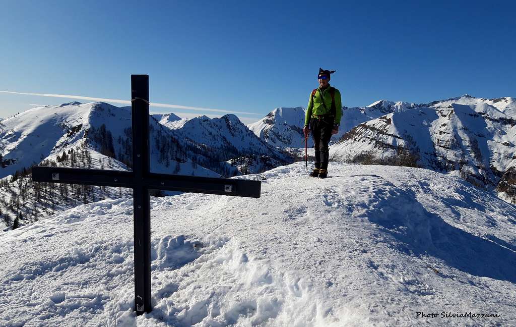
Cima Pissola 2063 m
Cima Pìssola 2063 m is a minor peak belonging to the Adamello group and located at the South-Eastern end of the group. The mountain shows steep wooded and partly rocky sides and is located precisely NE of the Bocca di Pissola, a large saddle located on the short ridge between Cima Pìssola and Cima Marese.
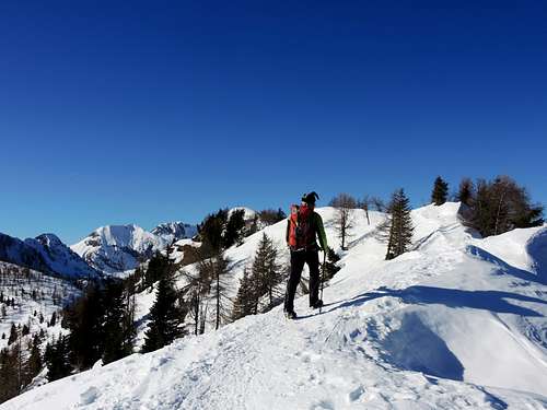
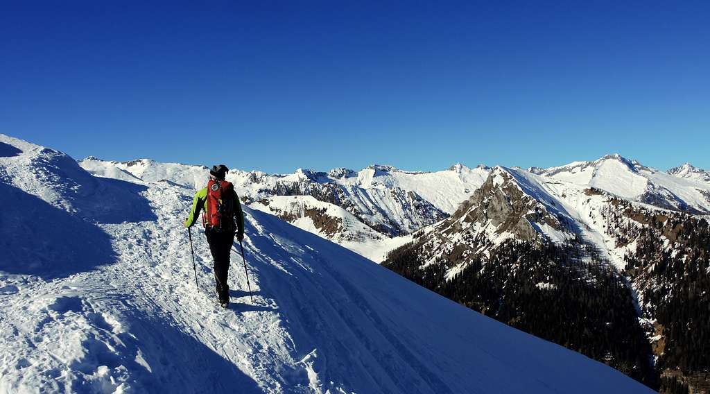
Cima Pìssola offers a pleasant route, safe even in winter with snow, easily identifiable and without particular technical difficulties. It's satisfying for the panorama that can be enjoyed from the top: Adamello, Carè Alto, Brenta Dolomites and Ledro Alps, as well as the Monte Baldo chain. These characteristics make the ascent to Cima Pìssola the ideal terrain for ski mountaineering and winter climbing of moderate commitment, in addition to the far better known route of the Valle del Chiese.
Cima Pissola was occupied by the Italian troops at the beginning of WWI and is still rich in war remains today. The excursion leads to move in a high mountain environment and to discover numerous traces of walkways, shacks, observatories, trenches, artillery posts.
The area has been affected in recent years by a project for the enhancement and restoration of military works promoted by the municipality of Castel Condino.
Getting There
The starting point are the grasslands in the locality of Boniprati 1166 m. From the village of Pieve di Bono, just south of Tione, on the Caffaro state road, drive up to Prezzo and then to Boniprati (wide parking lot near the Hotel Boniprati).
Normal route from Boniprati
Cima Pissola Normal Route report
Summit altitude: 2063 m
Difficulty: EE
Difference in level: 900 m from Boniprati
Starting point: Altopiano di Boniprati 1166 m
An interesting and panoramic route, above all in Winter and early Spring
Route report
From the parking lot in Boniprati we start heading left (East) along the road behind the Boniprati restaurant, then we pass on the left of a farm, continuing until an aqueduct construction. Skirt it to the left, then climb up directly and steeply up the wood, following some sparse red marks and reaching a large meadow with a alm, the Baita al Cioc at about 1395 m.
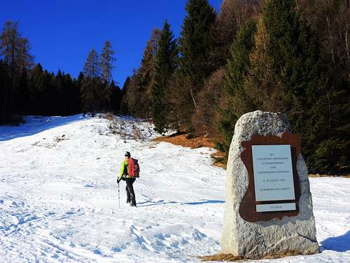
From the hut continue to the left on an obvious track for a few tens of meters, then go directly up the slope in the woods on the right. You exit by crossing a road on open ground nearby a granite stone dedicated to the "Garibaldini Volunteers". Now continue uphill above the memorial stone without obligatory itinerary climbing the slope between scattered larches.
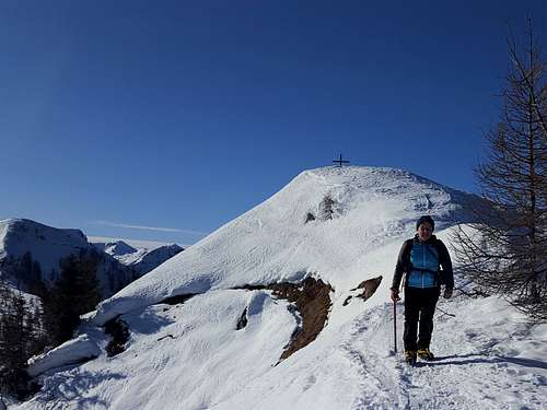
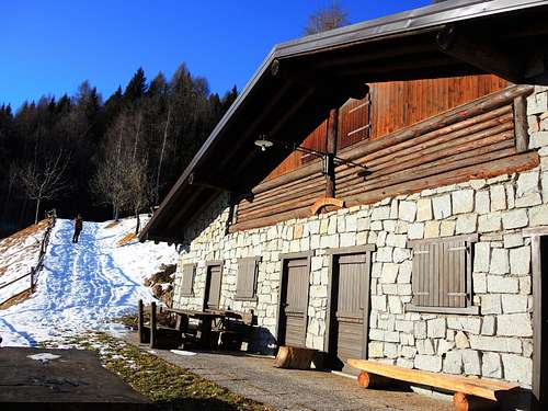
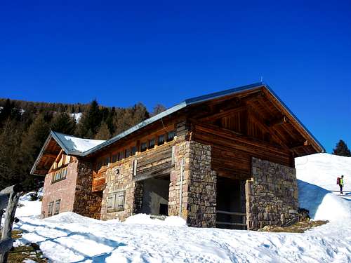
The slope leads directly to the beautiful building of Malga Tablè 1641 m. From the alm there are two possibilities: continue uphill directly behind the shelter, following a large natural corridor that opens into the sparse wood and leads straight onto the fore-summit at about 1885 m.
Alternatively take the track on the left of the alm (signpost Malga Bissolo) and leave it after about 400 meters, rising directly above the road following a slope with majestic larches and joining the previous route just below the fore-summit.
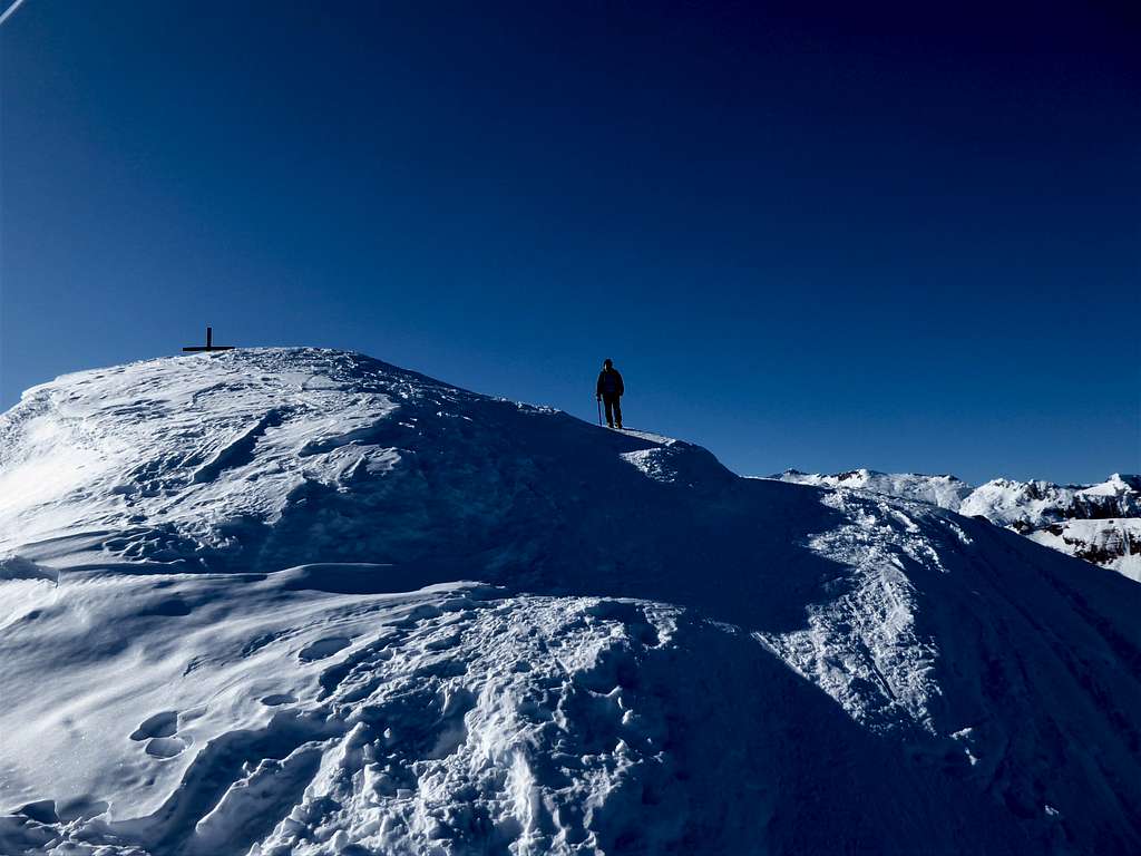
Here it starts a fine ridge up to the top. Follow this funny ridge somewhere airy up to the visible summit of Cima Pissola 2063 m.
Descent: reversing the same route
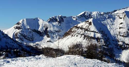
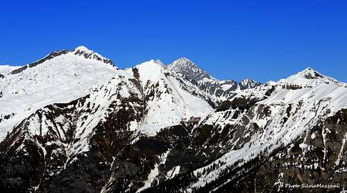
Summit views
Red Tape
No fees no permits needed and no particular restriction in climbing and hiking.
When to Climb
All year round.
Snowshoeing and ski-mountaineering: from December to March/April
Hiking: from May to November
Winter and early Spring ascents require specific equipment such as: skis, snowshoes, ice axe and crampons.
Accomodation
Valle del Chiese offers different kinds of accomodation
Meteo
Guidebooks and maps

"Adamello" volume I by Pericle Sacchi, Guida dei Monti d’Italia CAI – Touring Club