Synopsis
PJ and I took advantage of a decent snow year to get a June ski descent (not bad for the Land of Manana) of our favorite local peak,
Lake Fork Peak (12881'). We did an early morning 2 hour drive from Los Alamos, NM to the Williams Lake trailhead near Taos Ski Valley and started hiking around 6:30am. Our total elevation climbed was just over 3000' with an estimated roundtrip mileage of about 6 miles and a car-to-car time of about 6 hours.
Trailhead information
To get to the Williams Lake trailhead parking area, take NM State Route 150 to the Taos Ski Valley parking area. From the NE corner of the parking area, find and take Twining Rd (dirt road) for about 2 miles to the hikers' parking lot which will be on the right side of the road after some switchbacks. This dirt road gets fairly steep, but normal passenger cars will be OK as long as the road is snow/ice free. From the parking lot, follow a well-beaten path heading S from the SW corner of the parking lot. Shortly you will pass the Bavarian Restaurant (good German beers/grub although they are generally closed from early April through late May) and come to the bottom of a ski lift. In early/mid spring, this is generally where you can start skinning. Head up the slope (past the lodge) and turn left at a small shack called Black Diamond Espresso (too bad it's only open when the lifts are running). This is the start of the Williams Lake Trail.
Approach and climb
Being this late in the spring, we had to hike about 3/4 mile to just before the Wheeler Peak Wilderness boundary sign before we could put our skis on. Even after that, there were places where we had to dismount and do the ski-carry:
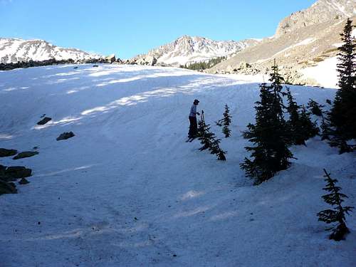
![PJ humping it]() PJ and the ski carry.
PJ and the ski carry.
Upon reaching the rise just north of Williams Lake, we headed SE into the trees and shortly came out into the clearing:
![Scott taking a break]() Scott breaking out of the trees.
Scott breaking out of the trees.
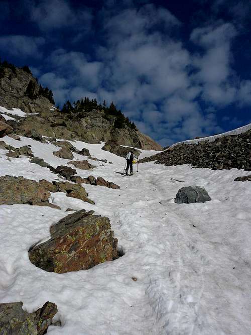
Earlier in the spring, this entire clearing is completely covered by snow, and you can skin in any direction you want. Today, there were big piles of talus showing, and we actually had to scramble over some sections of talus, and it took some effort to find the skinnable line:
![Scott finding a skinnable line]() Scott skinning amidst talus.
Scott skinning amidst talus.
We chose to skin up the side drainage just to the NE of Lake Fork Peak:
![PJ skinning]() PJ skinning toward the NE face of Lake Fork (with Wheeler Peak in the background).
PJ skinning toward the NE face of Lake Fork (with Wheeler Peak in the background).
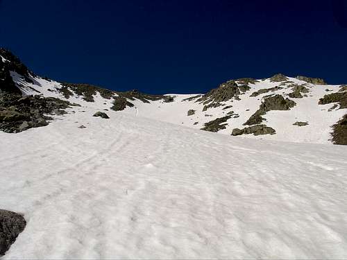
In a short while, we went around the corner and started heading SW up Lake Fork's NE face:
![Scott skinning]() Scott skinning up the lower parts of Lake Fork's NE face.
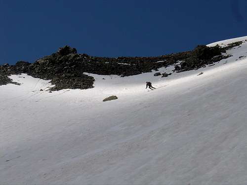
Scott skinning up the lower parts of Lake Fork's NE face.![NE face of Lake Fork]() Looking up Lake Fork's NE face.
Looking up Lake Fork's NE face.![PJ snowclimbing]() PJ booting up Lake Fork's NE face.
PJ booting up Lake Fork's NE face.![PJ near the summit]() PJ just below the summit. We would later ski down the slope directly behind him.
PJ just below the summit. We would later ski down the slope directly behind him.
We reached the summit about 3 hours after we started hiking, and we were rewarded with amazing views on a gorgeous day.
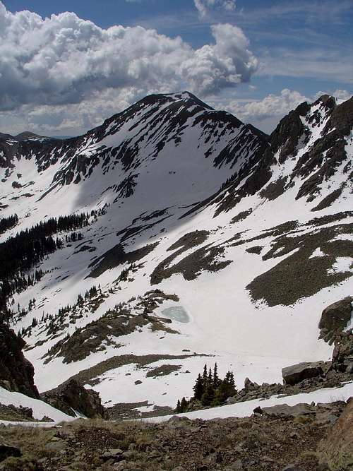
![Vallecito Mountain]() Vallecito Mountain to the SW.
Vallecito Mountain to the SW.![Wheeler Peak from Lake Fork Peak]() Wheeler Peak to the NE.
Wheeler Peak to the NE.![Scott on the summit of Lake Fork Peak]() Scott on the summit with UN 12819 behind to the SE.
Scott on the summit with UN 12819 behind to the SE.![PJ summit pose]() PJ on the summit.
PJ on the summit.Time to ski!
After about 15 minutes on the summit, we clicked in for perfect soft spring snow.
![Scott dropping in]() Scott dropping in.
Scott dropping in.
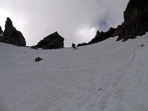
There was a narrow strip of snow high on the NE face that gave us a continuous descent:
![Scott finding the continuous snow]() Scott finding the line.
Scott finding the line.![PJ dropping in]() PJ dropping in.
PJ dropping in.![PJ ripping it up]() PJ in the middle of the NE face.
PJ in the middle of the NE face.![Scott at the bottom of Lake Fork s NE face]() Scott near the bottom of the NE face.
Scott near the bottom of the NE face.
The snow was so good we decided to boot up one of the short (~400' vertical) north facing chutes off the east ridge of Lake Fork Peak:
![Scott ready to bootpack]() Scott getting ready to boot up.
Scott getting ready to boot up.![PJ nearing the top of the bonus chute]() PJ nearing the top of the chute.
PJ nearing the top of the chute.
It was a pleasant snow climb and we reached the notch. It was about 10:40am.
![UN 12819 from east ridge of Lake Fork Peak]() UN 12819 from the notch at the top of the chute.
UN 12819 from the notch at the top of the chute.![PJ caught on camera]() PJ snacking at the notch.
PJ snacking at the notch.
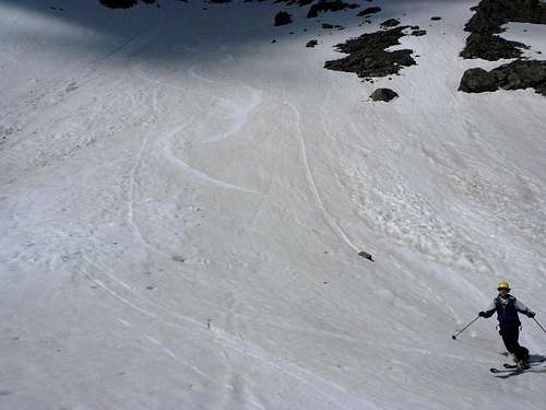
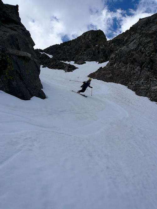
After a short break, we skied the chute in prime conditions.
![Scott skiing]() Scott skiing the chute.
Scott skiing the chute.![Scott in a N facing chute]() More Scott.
More Scott.![PJ in a fun chute]() PJ in the chute.
PJ in the chute.![PJ in a fun chute]() More PJ.
More PJ.
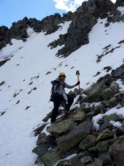
Then we had to find our way through the talus again:
![PJ threading the needle]() PJ in the snow-talus maze.
PJ in the snow-talus maze.
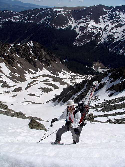
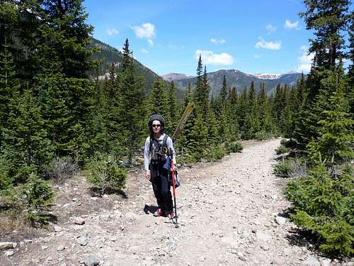
We managed to ski all the way down to near the wilderness boundary sign, where we put the skis back onto the packs for the short hike out.
![PJ getting ready for the hike out]() PJ strapping his skis onto his pack.
PJ strapping his skis onto his pack.![Scott on the hike out]() Scott on the hike out with his convertible bonnet.
Scott on the hike out with his convertible bonnet.
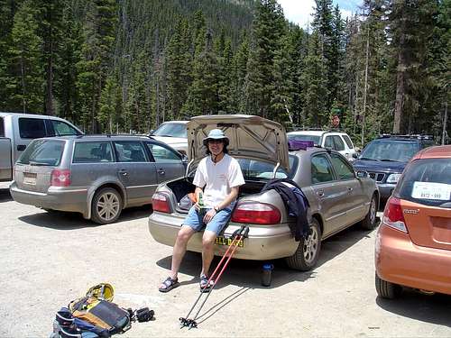
We got back to the car around 12:30pm to cold beer. Another awesome day in the backcountry.
Useful links
Northern New Mexico Avalanche Exchange
Taos Ski Valley
Lists of John
Comments
No comments posted yet.