Stats
What: One day ski trip to the summit of Gunsight Peak (13263')
Where: Uinta Mountains, Utah, 2.15 miles NE of Kings Peak
Length: 23.5 miles round trip
Total elevation gain: 4,531'
Start elevation: 8972'
Start location: Henrys Fork winter parking
Date: April 4, 2011
Round trip time: 14 hours 25 min, 5:35am to 8pm
Time to summit: 9 hours 15 min
Participants: me
![Gilbert and Gunsight]() Route to Gunsight Peak as seen from the north ridge of Mount Powell
Route to Gunsight Peak as seen from the north ridge of Mount Powell![Gilbert and Gunsight]() As seen from Kings Peak
As seen from Kings PeakPrequel
After a successful winter ski ascent of
Gilbert Peak on March 10, 2011, I wanted to get Gunsight Peak in the winter as well. Gunsight would be harder as it was an additional 2 miles RT above treeline. The problem was there wasn't much winter left and the weather wasn't cooperating. The only day that looked at all feasible was the very last day of winter, March 19. The forecast called for sun with a high in the low 30's, but 55 mph wind gusts. Given that I'd be above treeline for 9 miles, I was pretty sure I would not make it if the forecast held true. However, the worst case I envisioned was going to treeline, getting in some good practice for the next week's trip to Kings Peak, and then turning around.
The night before the winds were strong enough to shake the car as I was trying to sleep in it. The next morning was unusually warm, 28F, so it didn't feel that bad skiing in the trees. But when I hit an open meadow at 10400' the wind came directly at me and I thought my glasses were going to freeze to my face. It was truly miserable crossing that and there was no question I'd be turning around at real treeline.
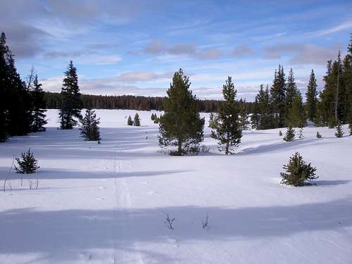
![Windy meadow]() Looking back across the meadow
Looking back across the meadow
I skied another mile through trees and then it opened up and again was miserable. I made it to the top of a steep pitch, taking shelter in a small clump of trees at 11100' and surveyed the scene. Huge plumes were blowing off of the ridge ahead and some times it was completely obscured. In less than a minute, my ski tracks behind me had vanished. There was no question that I was turning around. I hung out for 15 minutes and had a nice snack, dreading my initial descent across an open slope. The wind was now in the strong enough to blow you over range and it was difficult to ski back to the trees, bracing myself during gusts. Once in the trees, it was pleasant as it had warmed considerably. When crossing the meadow, the wind was now at my back. I made it to the car in a few hours thinking, "next year".
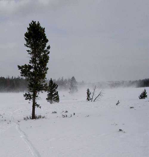
![The final mile]() Almost back to car and very pleasant
Almost back to car and very pleasant
And hopefully next year I will be back in the true winter, but skiing conditions that high up are usually good until mid May so winter or not I was up for another go this year.
To go or not to go
It was hard to find a good day. The forecast was for snowing or blowing or both. Finally, a sunny day was predicted with winds in the 15 mph range. Sounds perfect, but there was a slight problem in that heavy snow was predicted immediately preceding this perfect day which could make travel to the trailhead difficult and trailbreaking tough.
The forecast went back and forth as to how much snow was due and when I went to bed the night before I was to leave, things looked good. At lower elevations only about 3" was predicted and it didn't matter how much was predicted at high elevations since it would all blow away anyway.
I woke the next morning to discover it had snowed more than expected, about 8" with more on the way, and decided to bail. But by early afternoon no additional snow had materialized so I reconsidered. I prepared my food and gathered everything I would need to camp out in subzero temps followed by a dawn to dusk ski trip. It was time to go and it was snowing hard again. Grrr! I had to drive 150 miles to my destination and I didn't think it was a good idea to do that alone in a snowstorm, especially when I wasn't sure if the last 20 miles of dirt road would be plowed on a Sunday. But the car was packed. I went.
Getting there
The falling snow was a localized event and ended soon after leaving Salt Lake City. The roads were much better than anticipated. The scenery was beautiful with the brilliant fresh white snow dotted with little black newborn baby cow specks lying next to their mothers. As I was whizzing by at 75 mph, I was startled to see 4 deer grazing right at the edge of the shoulder and wondered if they were the same 4 deer doing the same thing the last time I drove by. I crested a hill at mile marker 21 in Wyoming to see a long line of windmills gleaming white with sunshine silhouetted against a dark cloudy sky. I cruised to a stop at the Maverick in Mountain View, a small town of 1200 people, where I like to top off the car before leaving the last remnant of civilization.
The women's bathroom has an interesting sign on the door inside. It says "DO NOT turn the lock, only push in or YOU WILL BE LOCKED IN". I worry every time I use it but have not been locked in yet.
A few more miles of driving brought me to the dirt road. It didn't look so bad. There were even bare spots. It looked like it had only snowed a few inches. It turned out to be fine and when the snow got deeper it was obvious that it had been freshly plowed.
There
Now my main concern was how cold it would get overnight. It was still light out and the temperature had already dropped to 11F. When I had skied to Kings Peak, nine days previous, it had also been cold. I had told myself on that trip that I would be happy if the temp was above 0 in the morning. When the car said 1F I thought "oh boy I got my wish". But within a few seconds it had dropped to 0. But on this night I suspected it would be even colder and if it was as warm as 0, I would be genuinely ecstatic. During the night I had to position myself so that only my nose was sticking out of my sleeping bag. For Kings, I hadn't had to do that. When I got up at 4:15am the car reported -3F. I could live with that.
It takes me a long time to eat, but I crammed in as much as possible, knowing it would be difficult to eat once I got going. Food in outside coat pockets freezes and food in inside coat pockets is hard to get at without unzipping and removing mittens.
The trip
My skis were on and I was ready to roll at 5:35am about an hour before it would be light. It felt much colder than it did for Kings. My neoprene overboots were a godsend. I had 3 layers on my legs, 4 on my core, two hats, a neck gaiter, a nose gaiter, and hand warmers.
The first 3 miles is almost flat along unplowed dirt roads. I started out on snowed/blown over ski/snowmobile tracks that worked great for awhile, but I soon discovered that the new snow was less deep above the tracks then in them as the trough had partially filled with blown in snow.
After 2.8 miles I turned left on the Hole-in-Rock road and skied a short distance to Joulious creek. Off went the down vest, but I was sticking with everything else. On went the kicker skins and I ascended a steep hill on the west side of the creek. The next mile was a ski bushwhack through pretty dense trees. After the grade subsided I made my way down to the creek bed which is a cross country skiers dream. It rises steadily at a gentle grade for the next 3 miles. It is generally wide and straight with no major snags. It is mostly frozen over but there's always room to ski beside any open water.
![The creek bed]() The creek bed
The creek bed
Although the previous few sentences make it sound lovely, the disadvantage of skiing in a creek bed is that it's extra specially cold down there. Cold air sinks and you are going to be in the lowest spot around. The sun hits the trees above, but where you are it's still dark.
Earlier in the winter I had experimented to see what foods could be eaten straight from the freezer. Today I brought along some precooked bacon which when frozen, doesn't even taste cold. That was gone quickly and I wished I had planned better and brought some other taste fine frozen foods like nuts and pretzels, but I could tough it out until it warmed up.
About 9am I reached the big meadow at 10400' and I was finally in the sun. Trailbreaking hadn't been bad, but when you are the only one doing it, even not bad gets tiresome after awhile. I took shelter in the last set of trees and took a break, anticipating shedding layers left and right once I started going. But the wind picked up and the sky was quickly transitioning from bright blue to dark gray.
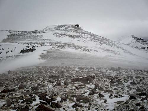
After the meadow there is a mile of trees, another meadow, and then the broad ridge leading to Gilbert and Gunsight. Initially there are a few clumps of trees here and there to hide behind, but by 11300' the trees are gone and there are no terrain features to break the wind. It is a barren expanse the rest of the way. I took another break at 11am, just shy of 11300', knowing it would be my last chance. I had 3.8 miles left and a little over 2000' to climb.
![Last of the trees]() The second meadow and the start of the ridge to Gilbert and Gunsight. I turned around at the start of this meadow last time.
The second meadow and the start of the ridge to Gilbert and Gunsight. I turned around at the start of this meadow last time.
The ridge becomes almost a plateau, rising gently from north to south. There are very steep drop offs to the east and west. At its widest, it is almost 1.5 miles across, totally barren, not even a big rock to break things up. Finally, after mile 8.8 at about 11900', the tip of Gilbert comes into view. But, I wasn't going to Gilbert and it would be awhile before I'd be able to see Gunsight.
![Featureless]() Barren
Barren![Tip of Gilbert]() Finally Gilbert comes into view.
Finally Gilbert comes into view.
At 12600' there is an 80' steep rocky step. As I approached it, mostly snow transitioned to mostly rocks. I kept my skis on as long as possible, gingerly stepping on tops of rocks. I gave up after awhile and strapped them to my pack. The rocky step was the only annoying footing of the trip. The rocks are big and the snow between them is either rock hard slick or does not support your weight making it easy to sink in and bang up your shins between the rocks.
At the top of the step at mile 10, both Gilbert and Gunsight are in view. Gilbert looked so close, only .6 miles away and an easy 700' up. Gunsight was 1.6 miles away and the weather in that direction looked bad. It was tempting to switch targets, but I'd already been on 3 ski trips to Gilbert, but had never been to Gunsight this time of year.
![Gilbert Peak]() Gilbert looking close Gilbert looking close | ![Gunsight, W Gunsight, Kings, and Henrys Fork Peaks]() Gunsight at left, not so close Gunsight at left, not so close |
I had to walk on rock for awhile and wondered if I should have left my skis below the step, but I came to a large snow patch and was glad I had them. The snow patch wasn't nearly as big as I would have liked and at the end of it the skis came off again. It looked mostly rocky the rest of the way and any snow patches didn't look big enough to be worthwhile to ski on. I carefully considered where to stash my skis. I didn't want them to blow away or to be covered up.
![Buried skis and poles]() Buried skis on previous trip
Buried skis on previous trip
On my previous trip to Gilbert I had found my stashed skis covered with snow except for their tips. Without a GPS it would have been like looking for a needle in a haystack as every rock looks like every other rock. Even with a GPS it could have been tough because I've seen them be off by 50' and looking for buried skis in a circle with a 50' radius with a howling wind would be grim indeed. I considered myself lucky. Footprints get filled in fast so there is no following your physical tracks back.
I stashed them next to the biggest rock I could find which would hopefully block them from blowing away. But big is relative and this rock was only sticking up about 8" and I was worried about what would happen if the wind changed direction. The other time I had consciously placed them in a depression to keep them from blowing away and here there was no depression, but nevertheless I worried they'd be buried.
![Gunsight Peak]() Gilbert/Gunsight saddle with Gunsight beyond
Gilbert/Gunsight saddle with Gunsight beyond
I still had 1.1 miles to walk to the summit. I was struck by how brown it looked in the wind tunnel of a saddle between Gilbert and Gunsight. Brown was bad. Brown meant windy. Not windy enough to blow you over, but windy enough that when you put your foot down it doesn't always land where you think it will.
![Gilbert Creek Basin]() Gilbert Creek Basin
Gilbert Creek Basin
From the saddle there is a nice view of Gilbert Creek Basin, with the seldom climbed Cleve Benchmark at the far end of the trees. Even though it was cloudy with snow blowing around like crazy and other peaks obscured, I was always blessed with good visibility wherever I happened to be at the time I was there.
![The route to Gunsight Peak]() Looking back from 13100'
Looking back from 13100'
It was still really windy past the pass but not quite as bad and I knew I was going to make it. I wanted to summit by 3pm in order to make it back to the car before dark and made it there by 2:50, 9 hours and 15 minutes after starting. From the summit there wasn't a lot to see. I had hoped to get some nice pictures of Kings Peak and the Kings-Emmons ridge, but it was completely socked in. I had to settle for a picture looking down at Gunsight Pass with West Gunsight Peak obscured behind it.
![Gunsight Pass]() Looking down at Gunsight Pass
Looking down at Gunsight Pass
My sister says I worry too much and today was no exception. My mind was on my skis the whole time. I wanted to get back to them ASAP so I didn't linger. I was starving by now, but it was too windy to stop. It was relatively warm, probably around 25-30F, but with the wind, my hands were freezing even with hand warmers. I carefully followed my GPS track back and found the skis with no problem. Yipee! Still starving I made my way to the top of the rocky step where I took the skis off again and wind or no wind I had to take a break. It had been over 5 hours since my last one. I couldn't take cold hands anymore so I broke out a second set of hand warmers for my mittens and having 2 handwarmers per mitten was divine. The only other time I've ever used 2 handwarmers had been on a calm day when the temperature was -22F. I felt much better after eating and life was rosy once again.
![Sunshine returns]() Looking north and ahead
Looking north and ahead![Looking back]() Looking south and behind
Looking south and behind
Things brightened considerably once I was down to treeline. To the north where I was headed the sky was mostly blue. Behind me it was still an ominous shade of gray.
![Almost done]() Still a mile to go
Still a mile to go
I made it to the car just before dark. There was a note tucked in the driver's side window. I thought uh-oh, what did I do wrong now, did someone not like where I had parked? But again my sister is right and I worry too much. The note started out "Hey there, Don't see too many cars parked here. I was wondering if you are some of those crazy animals that do Kings in the spring?" etc. etc. etc. It was a very nice note and was a very nice way to end the day.
Trip topo
![Gunsight trip topo]() Topo map of trip
Topo map of trip


Comments
Post a Comment